
Church and Mt Lassen, 2007
Palo Cedro’s story
133 years in pictures
Census counts: 1,247 in 2000, 2,931 in 2020. The archive holds 6 old photos and papers going back to 2007 and 3 maps from 1901 on.
- 1893Palo Cedro is settled
Each edition grades its towns against each other only.
A town of 3,685, settled in 1893.
Palo Cedro grades B− overall, 225th of 841 graded towns in California, with clear strengths and some subjects that lag. It is healthier than 86% of U.S. towns and its public schools beat 77% of California towns on state tests and graduation. On the other side, FEMA rates its natural-hazard risk higher than 91% of U.S. communities, with inland flooding at the top. Palo Cedro’s July high is 99°F, above both the California town median (89°F) and the median of U.S. towns (85°F). Homes are expensive, about $550K for a typical one and 7.6 times the Redding metro’s $73K median household income.
Where Palo Cedro beats most towns, and one thing worth knowing.
1,269 counted in 2010 and 2,931 in 2020.
U.S. Census 2010 & 2020 counts
Each subject compared with towns across the country (schools within California), ordered by how far Palo Cedro is from typical.
How TownRatings grades towns →
Census counts: 1,247 in 2000, 2,931 in 2020. The archive holds 6 old photos and papers going back to 2007 and 3 maps from 1901 on.
Palo Cedro is unincorporated, so Shasta County and regional agencies provide most services.
EPA SDWIS (Oct 9, 2026) · HIFLD + EIA-861 2025 · Census 2020 ZCTAs · NCES 2024–25 · registration: vote.gov, updated Nov 18, 2024.
Ordered by what stands out in Palo Cedro.
Palo Cedro has hotter summers than nearly all U.S. towns, has home values still below their peak and owes part of its health edge to its incomes.
Against the 5,731 U.S. towns with household incomes like Palo Cedro’s, it is healthier than 69%, a smaller edge than it has nationally: part of it comes with its incomes.
17% of Palo Cedro adults get no exercise outside work. Palo Cedro beats the California average on 15 of 32 CDC measures and trails it on 5. 26% of Palo Cedro adults have obesity.
| Palo Cedro | California towns | U.S. towns | |
|---|---|---|---|
| Get no exercise (CDC PLACES) | 17% | 24% | 25% |
| Obesity (CDC PLACES) | 26% | 29% | 35% |
| Food insecurity (CDC PLACES) | 7.9% | 16% | 14% |
| Feel lonely (CDC PLACES) | 32% | 36% | 33% |
| What stands out | Palo Cedro | CA |
|---|---|---|
| Fewer uninsured adults | 4.4% | 10.6% |
| Fewer adults facing food insecurity | 7.9% | 17.9% |
| More adults who have had cancer | 11.7% | 6.4% |
CDC PLACES 2025 · modeled estimates for adults · CMS · HRSA
Its public schools are run by the Shasta Union High school district. Three of its 4 schools are below, each with why it’s listed. The largest public high school is Foothill High, with 1,487 students.
| School | Level | Students | Letter |
|---|---|---|---|
| Junction ElementaryLargest public elementary schoolGrades K–8 | Grades K–8 | 416 | A− |
| Foothill HighLargest public high schoolGrades 9–12 | Grades 9–12 | 1,487 | A− |
| Chrysalis CharterTop results in townGrades K–8 | Grades K–8 | 226 | A− |
NCES · EDFacts · graded within CA on state tests and graduation
FEMA National Risk Index · OpenFEMA
Adults 18 to 34 are 12% of residents (24% statewide); children under 18 are 31% of residents (22% statewide). 41% of adults 25 and older hold a bachelor’s degree or more in Palo Cedro.
| Palo Cedro | California towns | U.S. towns | |
|---|---|---|---|
| Bachelor’s degree or more, 25+ | 41% | 29% | 29% |
| Aged 65 or older | 22% | 16% | 18% |
| Median age | 41.6 years | 39 years | 40.5 years |
54% women, 46% men
That’s an even split within the survey’s margin of ±3.9 points. Across California, 50.1% of residents are women.
| Palo Cedro | CA | U.S. | |
|---|---|---|---|
| Under 10 | 15.4% | 11.4% | 11.6% |
| 10 to 17 | 15.9% | 10.5% | 10.3% |
| 18 to 24 | 4.3% | 9.1% | 9.1% |
| 25 to 34 | 7.7% | 14.8% | 13.7% |
| 35 to 44 | 11.5% | 13.9% | 13.2% |
| 45 to 54 | 13.2% | 12.5% | 12.2% |
| 55 to 64 | 10.2% | 12.1% | 12.7% |
| 65 to 74 | 11.7% | 9.2% | 10.2% |
| 75 and older | 10% | 6.5% | 7% |
| No diploma | 3.5% | 15.3% | 10.4% |
| High school | 15.2% | 20.5% | 26% |
| Some college | 27% | 19.3% | 19.1% |
| Associate’s | 13.7% | 7.9% | 8.8% |
| Bachelor’s | 27% | 22.7% | 21.6% |
| Graduate | 13.5% | 14.4% | 14.1% |
U.S. Census Bureau · ACS 2020-2024 5-year estimates · in a town of 3,700, single groups can be off by several points
The typical value, about $551K, is 8% below its July 2022 peak. At about $551K, home values are down 2% in five years, against a rise of 13% across California.
The median rent in Palo Cedro is $1,375 a month. The typical Palo Cedro home is worth about $551,000, down 1.4% in a year, 28% below the California typical home.
Census ACS, 2020–24 · Zillow Home Value Index · Redfin Data Center
July afternoons average 98.7°, hotter than in 99% of U.S. towns; January nights average 38.8°.
Palo Cedro has mild winters and hot summers. Palo Cedro’s January low is 39°F. Snow is almost unheard of.
NOAA U.S. Climate Normals, 1991–2020
Jobs based here grew from 594 in 2013 to 791.
Most working residents leave Palo Cedro for work: only 7% work in town. Jobs based in Palo Cedro grew to 791 in 2023, 197 more than in 2013. The top destinations are Redding (50%), Anderson (3%) and Chico (2%).
| Palo Cedro | California towns | U.S. towns | |
|---|---|---|---|
| Average trip to work | 33 minutes | 28 minutes | 25 minutes |
| Median household income | $120,000 | $95,000 | $80,000 |
| Below the poverty line | 6.6% | 10% | 9.6% |
Census LEHD 2023 · ACS
| Palo Cedro | California towns | U.S. towns | |
|---|---|---|---|
| Conserved land | 0.4% | 4.3% | 4.3% |
| Miles of trail per square mile | 0.4 miles per square mile | 1.0 | 0.4 |
Trails & parks © OpenStreetMap contributors · Conserved land: USGS PAD-US
Museums, parks, gardens and other places to visit around Palo Cedro. Close and well known come first.
 35 mi National ParkLassen Volcanic National Park505K visitors a year
 40 mi MountainLassen Peak
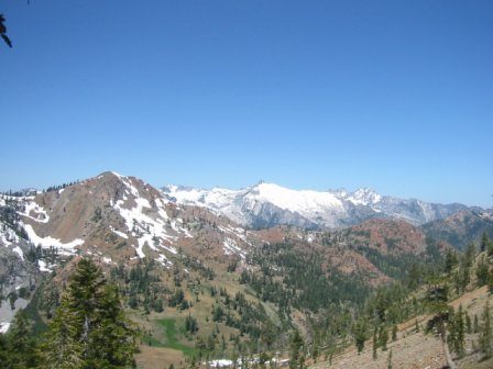 38 mi National forestShasta–Trinity National Forest
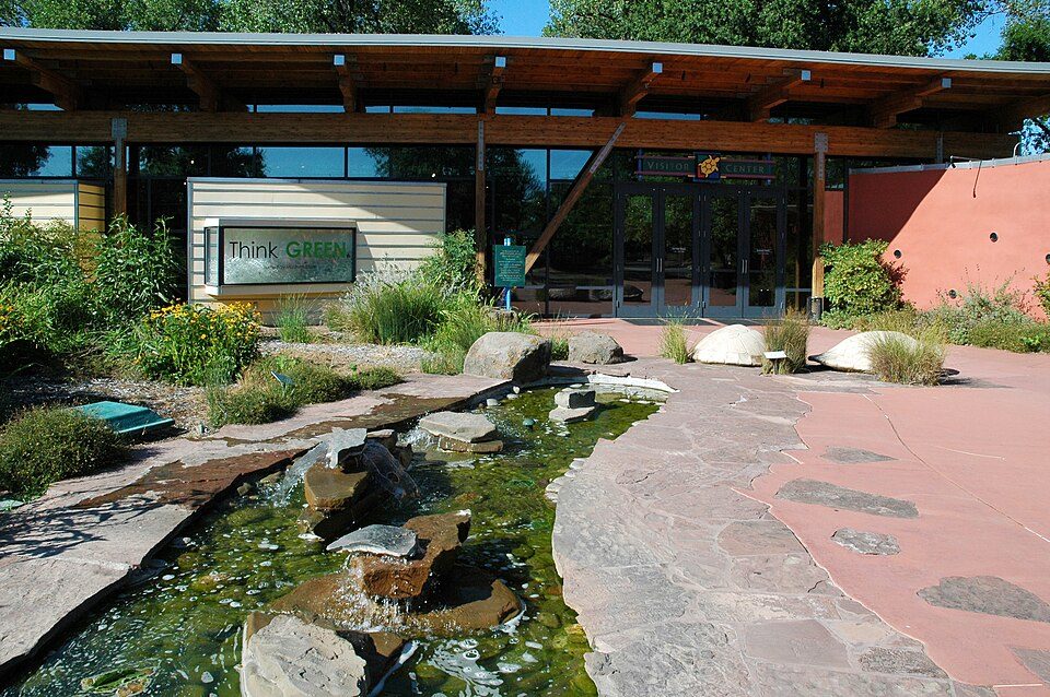 7 mi MuseumTurtle Bay Exploration Park
 7 mi TheatreCascade Theatre
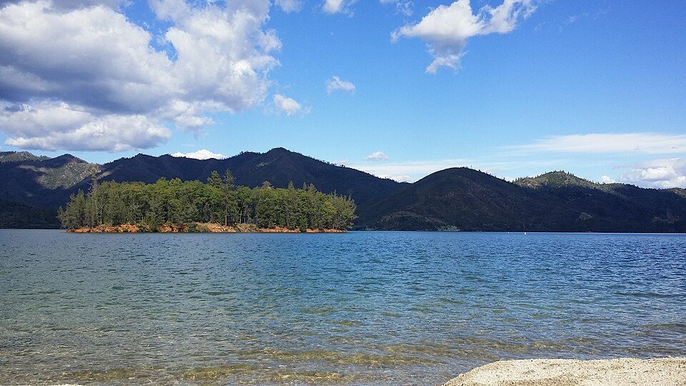 13 mi National Recreation AreaWhiskeytown-Shasta-Trinity National Recreation Area764K visitors a year
Lassen Volcanic National Park: en:User:Mav, CC BY-SA 3.0 · Lassen Peak: Frank Schulenburg, CC BY-SA 4.0 · Shasta–Trinity National Forest: Unknown, CC BY-SA 3.0 · Turtle Bay Exploration Park: DimiTalen, CC BY-SA 3.0 · Cascade Theatre: Publichall, CC BY-SA 3.0 · Whiskeytown-Shasta-Trinity National Recreation Area: RoyalMayfair, CC BY-SA 4.0
3 within 15 miles of the center of Palo Cedro
About 3 of every 100 Palo Cedro residents are enrolled in college, against 8 across California.
Place in California, United States
Palo Cedro (Spanish for "Cedar Wood") is a census-designated place (CDP) in Shasta County, California, United States. It is 8 miles (13 km) east of Redding. Its population is 2,931 as of the 2020 census, up from 1,269 from the 2010 census. Originally, indigenous Native Americans lived in Northern California, including what is now Shasta County, prior to European American settlement. European American exploration of inland California started in 1769 and continued on into the 19th century. Cow Creek, a Sacramento River tributary that runs south through Palo Cedro, was a conduit for entrance into the Sacramento Valley by Hudson Bay Fur Company trappers including Alexander McLeod (1829) and Joh…
From Wikipedia, licensed CC BY-SA 4.0 · facts via Wikidata (CC0)
2 towns share a border with Palo Cedro.
| Town | CA rank | Overall | Cost | Safety | Schools | Health |
|---|---|---|---|---|---|---|
| Palo Cedro | #225 | B− | D | — | A− | A |
| Bella Vista | #531 | C− | D | — | B+ | B |
| Millville | — | — | — | — | — | — |
Palo Cedro and Bella Vista report no FBI crime data of their own. Millville isn’t graded (fewer than 1,000 residents, or not enough data). Compare Palo Cedro with a neighbor →
Short answers, built from the data on this page.
Palo Cedro grades B− overall, better than 47% of U.S. towns and #225 of 841 in California. It grades A for health and A− for schools. Hazard risk is its weak spot, with a D.
Yes. Cost of living, which also weighs rents, property taxes and how many households pay 30% or more of their income for housing, grades D.


