114 years in pictures
Census counts: 2,868 in 2000, 5,945 in 2020. The archive holds 6 old photos and papers going back to 1999 and 3 maps from 1953 on.
- 1912Oakhurst is settled
Each edition grades its towns against each other only.

A town of 6,091, settled in 1912.
Oakhurst grades D− overall, 755th of 841 graded towns in California. What it does well: it has 21 miles of trail and 33% conserved land. 33% of the land in Oakhurst is conserved, against 4.2% in California’s towns and 4.3% across U.S. towns. FEMA rates its natural-hazard risk higher than 97% of U.S. communities, with inland flooding at the top.
2,829 counted in 2010 and 5,945 in 2020.
U.S. Census 2010 & 2020 counts
Each subject compared with towns across the country (schools within California), ordered by how far Oakhurst is from typical.
How TownRatings grades towns →
Census counts: 2,868 in 2000, 5,945 in 2020. The archive holds 6 old photos and papers going back to 1999 and 3 maps from 1953 on.
Oakhurst is unincorporated, so Madera County and regional agencies provide most services.
EPA SDWIS (Oct 9, 2026) · HIFLD + EIA-861 2025 · Census 2020 ZCTAs · NCES 2024–25 · registration: vote.gov, updated Nov 18, 2024.
Ordered by what stands out in Oakhurst.
Oakhurst is a second-home town and keeps more of its land conserved than most of California, but it is a long drive from an emergency room.
52% of Oakhurst’s expected losses from natural hazards come from inland flooding, followed by wildfires at 44%. 11 flood insurance claims have been paid here since 1982. Federal aid has come to Oakhurst households in 2 declared disasters; the latest was in 2023.
FEMA disaster declarations and aid · FEMA flood insurance claims · FEMA National Risk Index · OpenFEMA
Two of its 9 schools are shown below, with the reason for each. The largest public high school is Yosemite High, with 542 students. The 6 public schools in Oakhurst teach 1,403 students between them.
| School | Level | Students | Letter |
|---|---|---|---|
| Oakhurst ElementaryLargest public elementary schoolGrades K–5 | Grades K–5 | 333 | C+ |
| Yosemite HighLargest public high schoolGrades 9–12 | Grades 9–12 | 542 | A |
NCES · EDFacts · graded within CA on state tests
Its 6,973 conserved acres are a larger share of the town than in 93% of California towns.
Oakhurst’s trail network density stands at 0.6 miles per square mile, where California’s towns sit at 1.0 and U.S. towns at 0.4. Parks and preserves here: 2, covering 7 acres.
| Biggest places to walk | Trails | Acres |
|---|---|---|
| 1. Oakhurst Community Park | 0.2 mi | 5 |
| 2. Fresno Flats Historic Village and Park | — | 2 |
Trails & parks © OpenStreetMap contributors · Conserved land: USGS PAD-US
The rent at the middle of the market for Oakhurst comes to $1,728 a month. Among households here, 83% own their home. Homes in Oakhurst sold for 95.4% of their list price on average.
| Oakhurst | California towns | U.S. towns | |
|---|---|---|---|
| Households that own their home | 83% | 64% | 73% |
| Median rent | $1,728 a month | $1,898 a month | $1,185 a month |
Census ACS, 2020–24 · Zillow Home Value Index · Redfin Data Center
July afternoons average 94.9°, hotter than in 96% of U.S. towns; January nights average 34.1°.
About 3 inches of snow falls in a winter. In Oakhurst, the midsummer high is 95°F.
| Oakhurst | California towns | U.S. towns | |
|---|---|---|---|
| July high | 95°F | 89°F | 85°F |
| January low | 34°F | 41°F | 22°F |
NOAA U.S. Climate Normals, 1991–2020
The average commute for its 1,982 working residents takes 20.4 minutes, against 28.7 across California. Jobs based here grew from 2,136 in 2013 to 2,887.
For working residents in Oakhurst, the share who work locally is 28%. Employers in Oakhurst added 751 jobs between 2013 and 2023, to 2,887. The town’s mean commuting time comes in at 20 minutes. The top destinations are Fresno (9%), Mariposa (3%) and Madera (3%).
| Oakhurst | California towns | U.S. towns | |
|---|---|---|---|
| Working residents who work in town | 28% | 6.6% | 8% |
| Average trip to work | 20 minutes | 28 minutes | 25 minutes |
| Below the poverty line | 5.5% | 10% | 9.6% |
| Median household income | $82,000 | $95,000 | $80,000 |
Census LEHD 2023 · ACS
The nearest emergency room, John C Fremont Healthcare District, is 22.2 miles away in a straight line.
In Oakhurst, 32% of adults have obesity. Against the California average, Oakhurst comes out ahead on 10 CDC measures out of 32, and behind on 9. 16% of adults in Oakhurst report frequent physical distress; 14% binge drink.
| Oakhurst | California towns | U.S. towns | |
|---|---|---|---|
| High blood pressure (CDC PLACES) | 39% | 31% | 35% |
| Frequent physical distress (CDC PLACES) | 16% | 14% | 14% |
| Binge drink (CDC PLACES) | 14% | 16% | 16% |
| Yearly checkup (CDC PLACES) | 76% | 72% | 79% |
| What stands out | Oakhurst | CA |
|---|---|---|
| Fewer uninsured adults | 6.8% | 10.6% |
| Fewer adults facing housing insecurity | 10.3% | 14.9% |
| More adults who have had cancer | 11.6% | 6.4% |
CDC PLACES 2025 · modeled estimates for adults · CMS · HRSA
Museums, parks, gardens and other places to visit around Oakhurst. Close and well known come first.
Big draw11 mi National ParkYosemite National Park4.3M visitors a year
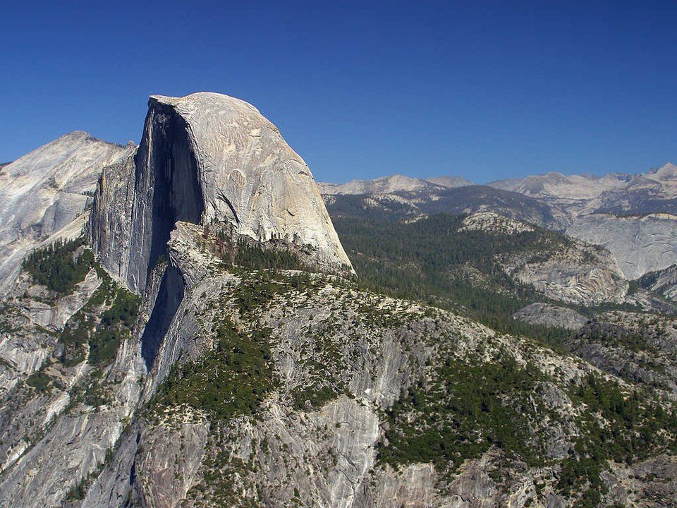
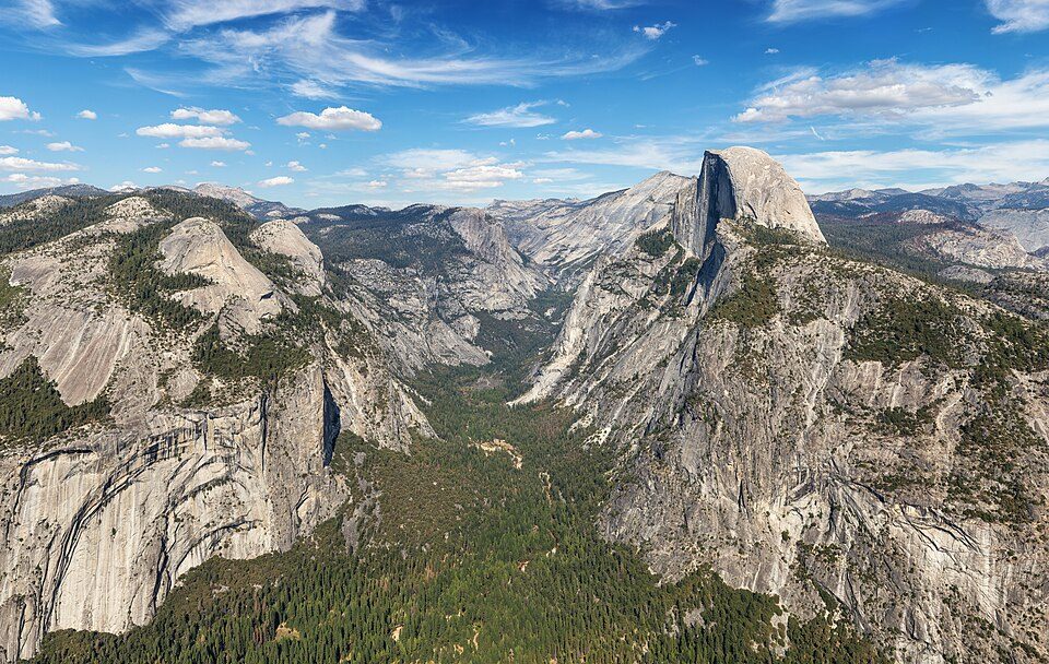
Big draw28 mi MountainHalf Dome
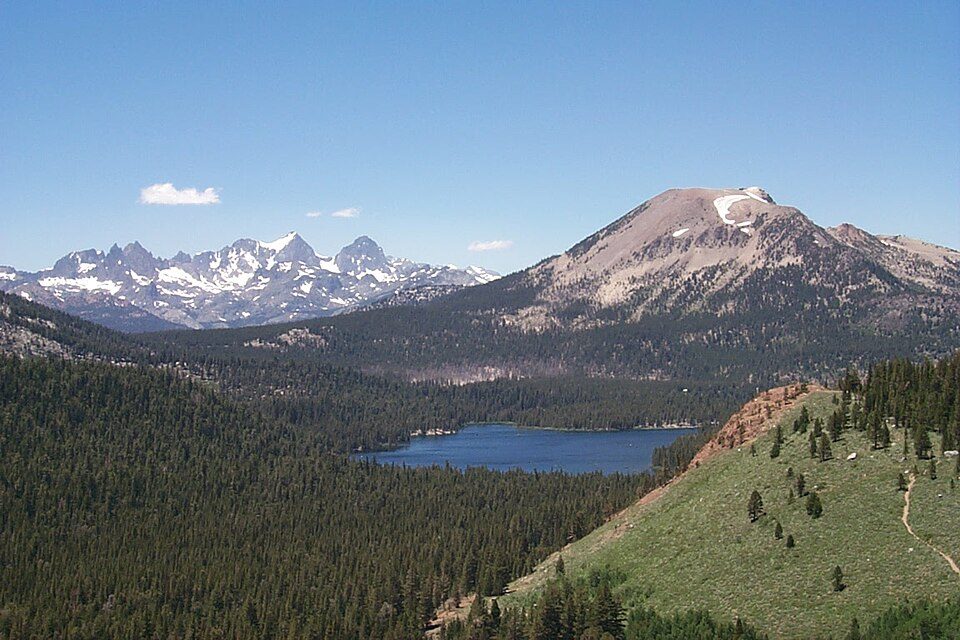
40 mi Ski areaMammoth Mountain153 runs · 2,962 ft vertical
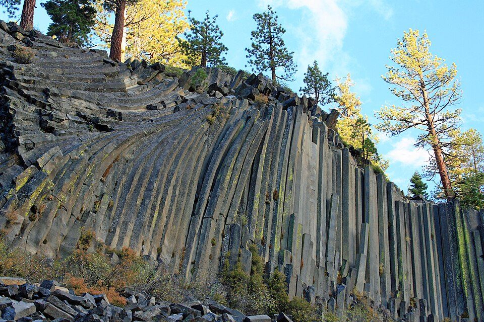
34 mi National MonumentDevils Postpile National Monument100K visitors a year
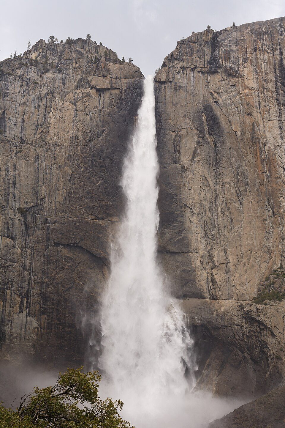
29 mi WaterfallYosemite Falls
8 mi Scenic railwayYosemite Mountain Sugar Pine RailroadYosemite National Park: Thomas Wolf, www.foto-tw.de, CC BY-SA 3.0 · Half Dome: Jon Sullivan, Public domain · Mammoth Mountain: Hike395 (talk · contribs), CC BY 3.0 · Devils Postpile National Monument: Frank Kovalchek from Anchorage, Alaska, USA, CC BY 2.0 · Yosemite Falls: King of Hearts, CC BY-SA 4.0 · Yosemite Mountain Sugar Pine Railroad: Bobtalbot61, CC BY-SA 3.0
None within 15 miles of Oakhurst; the nearest are
About 11 of every 100 Oakhurst residents are enrolled in college, against 8 across California.
Census-designated place in California, United States
Oakhurst (formerly Fresno Flats) is a census-designated place (CDP) in Madera County, California, United States. It lies in the Sierra Nevada foothills about 14 miles (23 km) south of the southern entrance to Yosemite National Park, at the junction of Highway 41 and Highway 49. Oakhurst is at the southern edge of California’s Gold Country and had a population of 5,945 at the 2020 United States census. Founded in 1858 as Fresno Flats, the community developed first as a cattle stop and later as a logging center before becoming a gateway for Yosemite-bound travel. The surrounding region had long been a gathering place for the Miwok, Yokuts, and Mono peoples and was the site of early conflicts …
From Wikipedia, licensed CC BY-SA 4.0 · facts via Wikidata (CC0)
One town shares a border with Oakhurst.
Oakhurst reports no FBI crime data of its own. Bass Lake isn’t graded (fewer than 1,000 residents, or not enough data). Compare Oakhurst with a neighbor →
Short answers, built from the data on this page.
Oakhurst grades D− overall, better than 3% of U.S. towns and #755 of 841 in California. It grades B− for health and C for schools. Hazard risk is its weak spot, with a D−.
Yes. That is 5.8 years of the area's median household income ($74,468 across the Fresno, CA metro area). Cost of living, which also weighs rents, property taxes and how many households pay 30% or more of their income for housing, grades D.