Monterey dates to 1770, and 11% of its homes were built before 1940
More historic than 90% of U.S. towns · #6 of 847 in California. What drives it
12 places in town are on the National Register, among them 4 National Historic Landmarks and a historic district with 17 buildings. Below: 23 old photos and papers, maps from 1885 on, and the census since 1850.
Founding year: Wikidata. First post office: 1849.The full story ↓
History grade
What drives Monterey’s History grade
On its age, its old homes and the National Register, Monterey is more historic than 90% of U.S. towns, #6 of 847 in California. All 3 inputs are above most U.S. towns; its age ranks highest and its share of homes from before 1940 lowest.
A
HistoryA character grade: shown, never part of Monterey’s overall grade.
Few California towns list much on the Register (a typical California town has 0.0 per 10,000 residents, the U.S. 2.4), so Monterey’s 9.8 sits above most of its state (91% of California towns have fewer) while its 29 historic buildings outnumber those of 81% of U.S. towns.
How sure. Graded on any two of the three inputs instead, the letter would range from A− to A+. The pre-1940 share (±2.2 points) is firm at this size. Two sources give 1770.
Founding year: Wikidata (other dates in Quick answers). Homes: Census ACS 2020–24. National Register: National Park Service, May 2026 list; each listing counted once (boundary changes and added documentation belong to their listing), and a historic district counts its contributing buildings. How TownRatings grades history →
What stands out about Monterey’s past
Read from the archive, the National Register and the record. The page puts what stands out first.
Nothing in the archives for these yearsWeddings on Main Street, storms, parades, school pictures, the old store. If it’s in your family album, it belongs here.
Long before the arrival of Spanish explorers, the Rumsen Ohlone tribe, one of seven linguistically distinct Ohlone groups in California, inhabited the area now known as Monterey. Ohlone villages in the area included Ichxenta (Point Lobos), Calendaruc, Wacharon (Moss Landing), and Rumsien (Carmel-by-the-Sea), among others. They subsisted by hunting, fishing and gathering food on and around the biologically rich Monterey Peninsula.
Passages that mention Monterey, cut from the printed page as they were published.
Historic landmarks of Monterey, California1917Read the page →
Read the text
Amongthe most sacred objects of veneration in the town of Old Monterey is the Church of San Carlos de Monterey. The present buildingwas erected at the Presidio in 1794, and was called the Royal Chapel because it was the place of worship for the governors of California who were the representatives of the King of Spain. At the time of the secularization of Mission Carmel in 1834, the church at Monterey became the parish church, Padre Jose Real being then in charge, and holding services occasionally at Carmel. In 1858, the transept was added and main altar erected.
Text read by machine from the scan; it may contain errors.
Scans and text from the Internet Archive. Books published in 1930 or earlier, which are in the public domain.
Timeline
Monterey, 1770 to 1960
Woven from the archive, old maps, post office records, the National Register and the people born here.
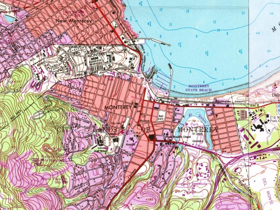
Every edition of the U.S. Geological Survey’s map of Monterey. Tap a year, or press play to watch the town change.
1913Monterey sheet · 1:62,500
U.S. Geological Survey historical topographic maps (public domain), via Esri’s collection of the scans. The red ring marks the center of Monterey.
Every building
Monterey, building by building, 1885–1912
Fire insurance maps drew every building, what it was made of and what it was used for, so insurers could price the risk of fire. Pick a year, then a sheet.
Lost post offices, old corners, places now gone and burying grounds
Monterey’s post office has been open since 1849. Two other post offices opened and closed inside today’s town.
Monterey
1849–today
Del Monte
1882–1952
Presidio Of Monterey
1915–1919
18401930today
Hamlets and corners on the map
Cannery RowDel MonteNew Monterey
Gone or out of use
Casa de CastrobuildingCasa JimenobuildingDel Monte Polo FieldlocaleEl CuartellocaleFort HalleckmilitaryHartnell HousebuildingPresidio de Montereymilitary
3cemeteries and burying grounds inside Monterey
El EncinalSaint JohnsSan Carlos
US Post Offices dataset (Blevins & Helbock, CC0). Places and cemeteries from the USGS Geographic Names Information System (2021).
Help out
Finish Monterey’s story
Most archives stop around 1920. The photos from after that are in family albums, not libraries.
Decades since 1900 with photos
00s10s20s30s40s50s60s70s80s90s
1 of 10 decades. The empty ones are waiting for someone’s album.
In 1770, according to Wikidata. Monterey’s post office opened in 1849, and the census of 1850 counted 1,092 people here.
How does Monterey rank for history?
Monterey is more historic than 90% of U.S. towns, #6 of 847 in California. The History grade combines the town’s founding era, the share of homes built before 1940 and its National Register listings. It’s a character grade, so it isn’t part of the overall grade. How it works.
What is on the National Register in Monterey?
12 listings, 4 of them National Historic Landmarks: 11 buildings, among them the Larkin House (a National Historic Landmark since 1960), and 1 historic district, the Monterey Old Town Historic District, with 17 contributing buildings. 29 historic buildings in all.
How old are the homes in Monterey?
11% of Monterey’s homes were built before 1940 (Census estimate, ±2.2 points), against a typical 3.4% for a California town; the median home was built in 1971.
Founding dates: Wikidata, Wikipedia, the U.S. post office records of Blevins & Helbock (CC0) and the Census. Homes by year built: Census ACS 2020–24. National Register of Historic Places: National Park Service (list of May 22, 2026). Old photos, postcards and papers: Wikimedia Commons, the Library of Congress and other public archives, credited on each item’s page. Maps: U.S. Geological Survey historical topographic maps (via Esri) and Sanborn fire-insurance maps (Library of Congress). History text and census tables: Wikipedia (CC BY-SA 4.0). Places that used to be: USGS Geographic Names Information System (2021).
From Wikimedia Commons (20), the Library of Congress (3), Wikidata (1), the National Register of Historic Places (12), Wikipedia, Wikidata and Wikipedia for famous people, U.S. Geological Survey historical maps, U.S. Census counts (via Wikipedia), the US Post Offices dataset (Blevins & Helbock), the USGS Geographic Names Information System, Sanborn fire insurance maps (Library of Congress) and old county and town histories (Internet Archive). Archive images are copied here with their credits and licenses, shown on each photo’s page. Refreshed monthly.


 ★ Landmark
 ★ Landmark
 ★ Landmark
 ★ Landmark


 1827
 1828
 1847
 1847
 1847
 1847
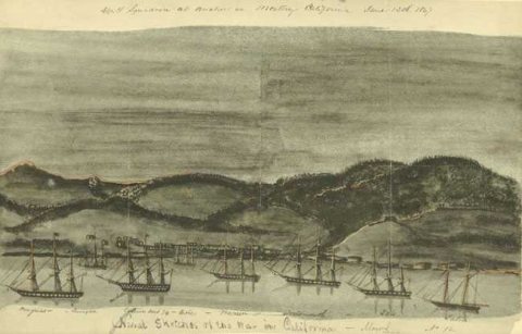 1847
 1849
 1854
 1875
 c. 1876
 1877
 c. 1877
 1887
 1890
 1890
 1898
 c. 1900
 c. 1900
 c. 1900
 1902
 1902
 1903