La Selva BeachCA
A town in California, home to 2,302 people.
Is La Selva Beach a good place to live?
The best of La Selva Beach’s subject grades are an A− for incomes and an A+ for the outdoors; the weakest is a D− for cost of living. La Selva Beach’s rent at the middle of the market is $3,379 a month, above both California’s towns ($1,896 a month) and U.S. towns ($1,185 a month). On cost of living, just 102 of California’s 1,058 towns do worse. FEMA rates its natural-hazard risk higher than 90% of U.S. communities, with drought at the top. La Selva Beach’s trail density is 2.3 miles per square mile, against 1.0 in California’s towns and 0.4 across U.S. towns. Only 78 of California’s 1,064 towns score higher on the outdoors. Manresa State Beach, at 141 acres with 2.6 miles of trail, is the biggest park or preserve. La Selva Beach has fewer than 2,500 residents, so it gets subject grades but no overall grade.
What makes La Selva Beach stand out
Where La Selva Beach beats most towns, and one thing worth knowing.
La Selva Beach has shrunk 11% from 2010 to 2020
2,843 counted in 2010 and 2,531 in 2020.
U.S. Census 2010 & 2020 counts
How La Selva Beach grades
Each subject compared with towns across the country (schools within California), ordered by how far La Selva Beach is from typical.
How TownRatings grades towns →
Levi's Stadium and 70 more within 40 miles
Museums, parks, gardens and other places to visit around La Selva Beach. Close and well known come first.
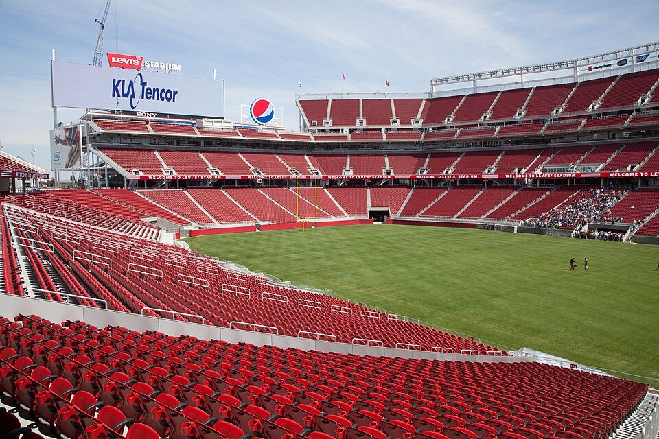 Big draw34 mi Stadium & arenaLevi's Stadium
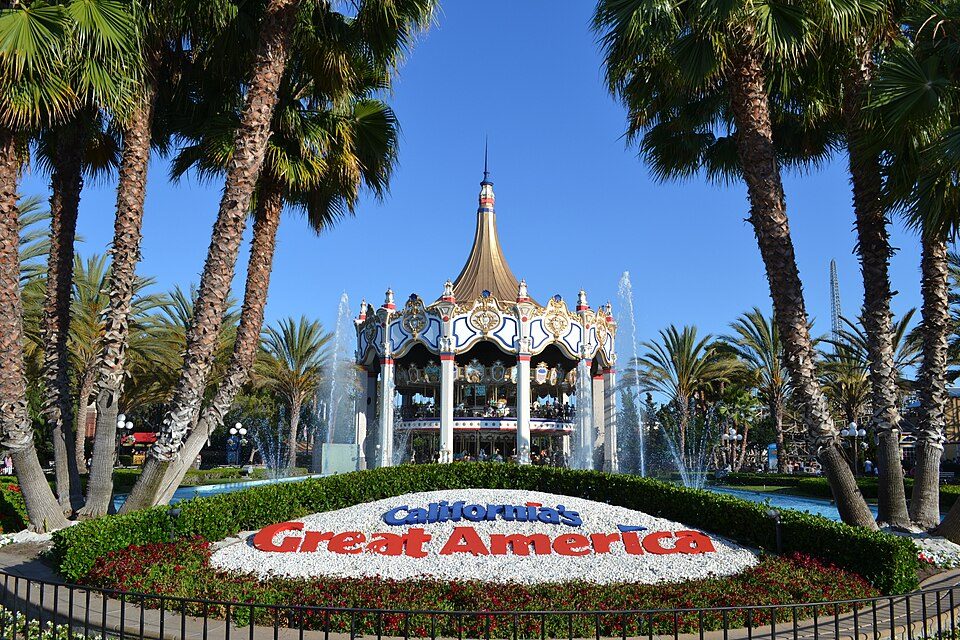 Big draw33 mi Theme parkCalifornia's Great America
 22 mi Zoo & aquariumMonterey Bay Aquarium
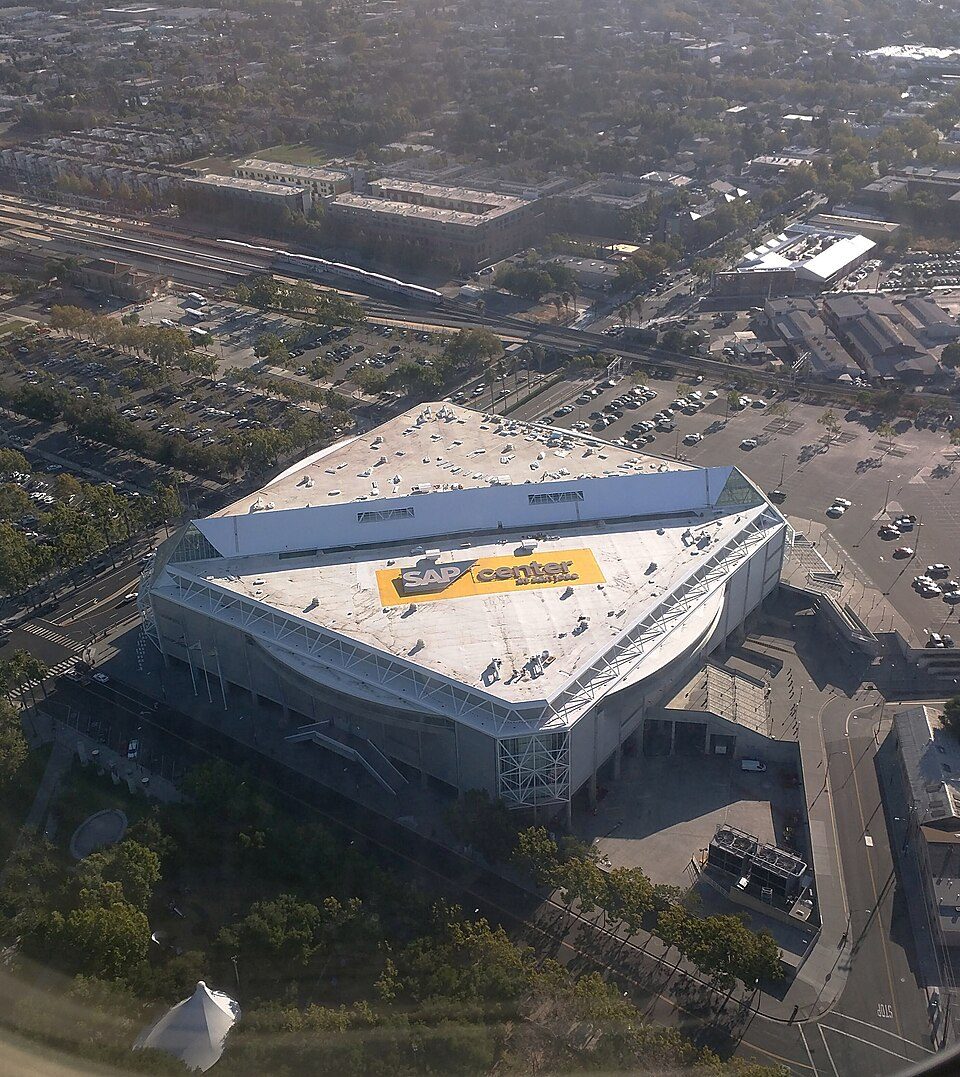 28 mi Stadium & arenaSAP Center
 23 mi MuseumMonterey Museum of Art
 10 mi Theme parkSanta Cruz Beach Boardwalk
Photo credits
Levi's Stadium: Matthew Roth, CC BY-SA 2.0 · California's Great America: Oleg Alexandrov, CC BY-SA 4.0 · Monterey Bay Aquarium: Meij.kobayashi, Public domain · SAP Center: Dicklyon, CC BY-SA 4.0 · Monterey Museum of Art: Sgerbic, CC BY-SA 4.0 · Santa Cruz Beach Boardwalk: Josta Photo, CC BY 2.0


Moving to La Selva Beach: who provides what
La Selva Beach is unincorporated, so Santa Cruz County and regional agencies provide most services.
EPA SDWIS (Oct 9, 2026) · HIFLD + EIA-861 2025 · Census 2020 ZCTAs · NCES 2024–25 · registration: vote.gov, updated Nov 18, 2024.
The data
Ordered by what stands out in La Selva Beach.
Very high risk in La Selva Beach, with drought at the top
Federal aid has come to La Selva Beach households in 2 declared disasters; the latest was in 2023. FEMA puts 39% of the town’s expected hazard losses down to drought, and 31% to earthquakes.
FEMA disaster declarations and aid · FEMA National Risk Index · OpenFEMA
On state tests, La Selva Beach’s schools trail 67% of California districts
The Pajaro Valley Unified school district runs its public schools. One of its 2 schools is below, with the reason it’s listed. Enrollment at La Selva Beach’s public school: 112 students.
| School | Level | Students | Letter |
|---|---|---|---|
| Renaissance High ContinuationLargest public high schoolGrades 9–12 | Grades 9–12 | 112 | – |
NCES · EDFacts · graded within CA on state tests and graduation
With 0.4 jobs for every working resident, most of La Selva Beach’s workers commute out
Half the trips to work are shorter than 23 miles. La Selva Beach’s typical household income comes in at $161,000. Only 1% of working residents stay in La Selva Beach for work; the rest commute out. Jobs locally fell by 128 from 2013 to 2023, to 323.
| La Selva Beach | California towns | U.S. towns | |
|---|---|---|---|
| Median household income | $161,000 | $95,000 | $80,000 |
| Working residents who work in town | 1.3% | 6.6% | 8% |
| Average trip to work | 26 minutes | 28 minutes | 25 minutes |
Where working residents work
Census LEHD 2023 · ACS
La Selva Beach keeps 17.8% of its land conserved
Trails run 12 miles in 4 parks and preserves. Parks and preserves in La Selva Beach: 4, covering 146 acres.
| Biggest places to walk | Trails | Acres |
|---|---|---|
| 1. Manresa State Beach | 2.6 mi | 141 |
| 2. Place De Mer Park | — | 3 |
| 3. Manresa State Beach - Soquel Creek Water District | — | 1 |
Trails & parks © OpenStreetMap contributors · Conserved land: USGS PAD-US
Expect mild winters and pleasant summers in La Selva Beach
In La Selva Beach, the midsummer high is 71°F.
Typical low → high °F
NOAA U.S. Climate Normals, 1991–2020
Residents of La Selva Beach are healthier than 64% of U.S. towns
For adults in La Selva Beach, the share who report frequent physical distress is 15%. Of 32 CDC measures, La Selva Beach beats the California average on 10 and trails it on 7. Among adults locally, 38% have high blood pressure and 32% sleep under 7 hours.
| La Selva Beach | California towns | U.S. towns | |
|---|---|---|---|
| Obesity (CDC PLACES) | 26% | 29% | 35% |
| High blood pressure (CDC PLACES) | 38% | 31% | 35% |
| Sleep under 7 hours (CDC PLACES) | 32% | 35% | 36% |
| Yearly checkup (CDC PLACES) | 76% | 72% | 79% |
| What stands out | La Selva Beach | CA |
|---|---|---|
| Fewer adults facing housing insecurity | 9.5% | 14.9% |
| Fewer uninsured adults | 6.9% | 10.6% |
| More adults who have had cancer | 11.3% | 6.4% |
CDC PLACES 2025 · modeled estimates for adults · CMS · HRSA
A home in La Selva Beach sells for about $2.1M at the median
La Selva Beach: 78% of households own their home.
Census ACS, 2020–24 · Zillow Home Value Index · Redfin Data Center
Everything we know about La Selva Beach
Colleges nearby
3 within 15 miles of the center of La Selva Beach
About 8 of every 100 La Selva Beach residents are enrolled in college, about the same as California.
99% of working residents leave La Selva Beach for work
Where La Selva Beach’s working residents go each day. Line width shows the share.
Census LEHD 2023
About La Selva Beach
Census-designated place in California, United States
La Selva Beach (La Selva, Spanish for "The Forest") is a census-designated place (CDP) in Santa Cruz County, California, United States. La Selva Beach sits at an elevation of 151 feet (46 m). The 2020 United States census reported La Selva Beach's population was 2,531. La Selva Beach is one of the several small communities located in and around Aptos. It neighbors Seascape to the north, Corralitos to the east, and Watsonville to the south. When founded, the small beach community was surrounded by dense conifer woods.
From Wikipedia, licensed CC BY-SA 4.0 · facts via Wikidata (CC0)
- Area
- 5.3 sq mi
- Elevation
- 151 ft
La Selva Beach’s neighbors
2 towns share a border with La Selva Beach.
| Town | CA rank | Overall | Cost | Safety | Schools | Health |
|---|---|---|---|---|---|---|
| La Selva Beach | — | — | D− | — | C | B |
| Rio del Mar | #326 | C+ | D− | — | C | A |
| Aptos Hills-Larkin Valley | — | — | D− | — | C | A− |
La Selva Beach and Aptos Hills-Larkin Valley have fewer than 2,500 residents, so they get subject grades but no overall grade. La Selva Beach, Rio del Mar and Aptos Hills-Larkin Valley report no FBI crime data of their own. Compare La Selva Beach with a neighbor →
Questions about La Selva Beach
Short answers, built from the data on this page.
Is La Selva Beach, CA expensive?
Yes. The typical home is worth about $1,326,000, 74% above the California typical home. Cost of living, which also weighs rents, property taxes and how many households pay 30% or more of their income for housing, grades D−.