More historic than 20% of U.S. towns · #462 of 847 in California. What drives it
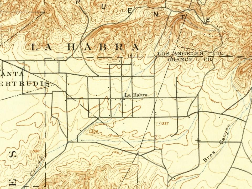
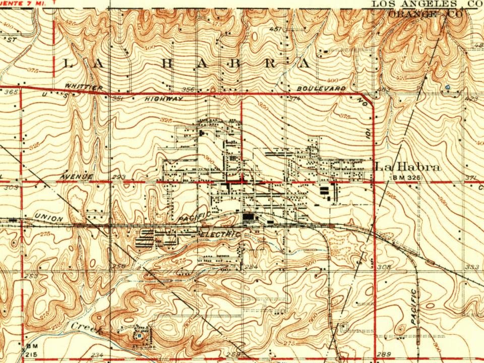
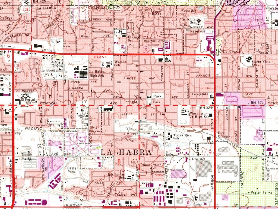
Most of La Habra was built recently: 3% of its homes predate 1940 and the median home dates from 1968. Below: 1 old photo or paper, maps from 1896 on, and the census since 1930.
Founding year: the first La Habra post office (Blevins & Helbock, CC0).The full story ↓
History grade
What drives La Habra’s History grade
On its age, its old homes and the National Register, La Habra is more historic than 20% of U.S. towns, #462 of 847 in California. Its age holds the grade up; its share of homes from before 1940 pulls it down.
C−
HistoryA character grade: shown, never part of La Habra’s overall grade.
Few California towns list much on the Register (a typical California town has 0.0 per 10,000 residents, the U.S. 2.4), so La Habra’s 0.0 sits below most of its state (31% of California towns have fewer) while its 0 listings outnumber those of 23% of U.S. towns.
How sure. Graded on any two of the three inputs instead, the letter would still be C−. The pre-1940 share (±0.8 points) is firm at this size. The founding year is the first post office, not a stated founding date.
Founding year: the first post office (other dates in Quick answers). Homes: Census ACS 2020–24. National Register: National Park Service, May 2026 list; each listing counted once (boundary changes and added documentation belong to their listing), and a historic district counts its contributing buildings. How TownRatings grades history →
What stands out about La Habra’s past
Read from the archive, the National Register and the record. The page puts what stands out first.
The name referred to the "Pass Through the Hills," the natural pass through the hills to the north first discovered and used by Spanish explorers of the Portola expedition on July 30, 1769.
In 1839, when the area was part of Alta California, vast herds of cattle and horses grazed over the hills and valleys of Southern California. Mariano Reyes Roldan was granted 6,698 acres (27 km2) in that year and named his land Rancho Cañada de La Habra. In the 1860s, Abel Stearns purchased Rancho La Habra.
La Habra was founded in 1896. The first post office in the town was established in 1898 in a corner of Coy's Store at Central (now La Habra Boulevard) and Euclid Street.
"Then I remember what the Good Book says — that it was the fool who said in his heart, 'There is no God.' " La Habra is the name of a rancho and settlement near the extreme northwest corner of Orange County. The town is one of the stations of the Pacific Electric Railway from Los Angeles to Riverside through the La Habra \'alley and the Santa Ana Canyon. This valley contains some excellent land and, with its close connection with the Los Angeles markets, has a bright future before it.
Text read by machine from the scan; it may contain errors.
History of Orange County, California1921 · page 1229Read the page →
Read the text
the peace in Mercer County. When he came West, his destination was Whittier, and there he paid the record price up to that time for ten acres of citrus fruit. In 1911 he sold his Whittier holdings and bought seventeen acres of year-old Eureka lemons at La Habra. He is a member of the La Habra Valley Water Company, and is vicepresident of the La Habra Citrus Association. He is also president of the First National Bank of La Habra, which is operated in connection with the Federal Reserve.
Text read by machine from the scan; it may contain errors.
Scans and text from the Internet Archive. Books published in 1930 or earlier, which are in the public domain.
Timeline
La Habra, 1895 to 1996
Woven from the archive, old maps, post office records, the National Register and the people born here.
Nothing in the archives for these yearsWeddings on Main Street, storms, parades, school pictures, the old store. If it’s in your family album, it belongs here.
The La Habra post office opened in 1895, the earliest record of the town by name (U.S. post office records).
How does La Habra rank for history?
La Habra is more historic than 20% of U.S. towns, #462 of 847 in California. The History grade combines the town’s founding era, the share of homes built before 1940 and its National Register listings. It’s a character grade, so it isn’t part of the overall grade. How it works.
How old are the homes in La Habra?
3% of La Habra’s homes were built before 1940 (Census estimate), against a typical 3.4% for a California town; the median home was built in 1968.
Founding dates: Wikidata, Wikipedia, the U.S. post office records of Blevins & Helbock (CC0) and the Census. Homes by year built: Census ACS 2020–24. National Register of Historic Places: National Park Service (list of May 22, 2026). Old photos, postcards and papers: Wikimedia Commons, the Library of Congress and other public archives, credited on each item’s page. Maps: U.S. Geological Survey historical topographic maps (via Esri) and Sanborn fire-insurance maps (Library of Congress). History text and census tables: Wikipedia (CC BY-SA 4.0). Places that used to be: USGS Geographic Names Information System (2021).
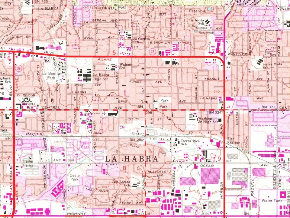
From Wikimedia Commons (13), Wikipedia, Wikidata and Wikipedia for famous people, U.S. Geological Survey historical maps, U.S. Census counts (via Wikipedia), the US Post Offices dataset (Blevins & Helbock), the USGS Geographic Names Information System, Sanborn fire insurance maps (Library of Congress) and old county and town histories (Internet Archive). Archive images are copied here with their credits and licenses, shown on each photo’s page. Refreshed monthly.






 2026
 2026
 2026
 2026
 2021
 2018
 2016
 2010
 2009
 2007
 2007
 2006
