Fullerton dates to 1887, and 23 of its places are on the National Register
More historic than 50% of U.S. towns · #155 of 847 in California. What drives it
Most of Fullerton was built recently: 5% of its homes predate 1940 and the median home dates from 1969. 23 places in town are on the National Register, among them four historic districts with 13 buildings between them. Below: 3 old photos and papers, maps from 1890 on, and the census since 1910.
Founding year: Wikidata; Wikipedia’s history section gives the same year. First post office: 1888.The full story ↓
History grade
What drives Fullerton’s History grade
On its age, its old homes and the National Register, Fullerton is more historic than 50% of U.S. towns, #155 of 847 in California. Its National Register listings hold the grade up; its share of homes from before 1940 pulls it down.
B−
HistoryA character grade: shown, never part of Fullerton’s overall grade.
Among the 400 U.S. cities of 100,000 or more, Fullerton ranks #242 on History.
Few California towns list much on the Register (a typical California town has 0.0 per 10,000 residents, the U.S. 2.4), so Fullerton’s 2.6 sits above most of its state (83% of California towns have fewer) while its 37 historic buildings outnumber those of 83% of U.S. towns.
How sure. Graded on any two of the three inputs instead, the letter would range from C− to B. The pre-1940 share (±0.8 points) is firm at this size. Two sources give 1887.
Founding year: Wikidata (other dates in Quick answers). Homes: Census ACS 2020–24. National Register: National Park Service, May 2026 list; each listing counted once (boundary changes and added documentation belong to their listing), and a historic district counts its contributing buildings. How TownRatings grades history →
What stands out about Fullerton’s past
Read from the archive, the National Register and the record. The page puts what stands out first.
Evidence of prehistoric animal habitation, such as saber-toothed cats and mammoths, is present in Ralph B. Clark Regional Park in the northwest of the city.
The area of the city was a part of the homelands of the Tongva for thousands of years. There was a large village in the area along the Santa Ana River that has since been identified as the Hutuknga. The village was one of the largest throughout all of Tovaangar, or the Tongva world. It was connected by marriage ties to other villages in the area, including Genga. Acorns and seeds from grasses and sages were regularly cultivated. Trade connections were established with villages on the coast and those further inland.
Passages that mention Fullerton, cut from the printed page as they were published.
History of Orange County, California1921 · page 581Read the page →
Read the text
Fullerton did not receive any natural benefits from the boom, for before the advent of the railroad, it was all over. The first train to reach the town was in the fall of 1888, and the first building of any importance to be erected was the St. George Hotel, named for George Amerige, costing over $50,000, which was wrecked in 1918 to make room for a modern business block, erected by Geo. H. .Amerige. The Wilshire Block at the corner of Spadra and Commonwealth avenue was also built in 1888, and it is still standing. The first bank to be established was the First National Bank and Fullerton Savings Bank, affiliated, which came into existence largely through the
Text read by machine from the scan; it may contain errors.
History of Orange County, California1921 · page 270Read the page →
Read the text
When the town of Fullerton was started, in 1887, he located there and started the first store, with Mr. Howell as a partner for one year, under the firm name of Howell & Ford. Later he bought his partner out and continued the business alone. During this time he had purchased twenty acres of land on West Commonwealth Avenue, from the Pacific Land and Improvement Company, and also set out several orange and walnut groves in the Fullerton district on shares for this company.
Text read by machine from the scan; it may contain errors.
Scans and text from the Internet Archive. Books published in 1930 or earlier, which are in the public domain.
Timeline
Fullerton, 1887 to 1971
Woven from the archive, old maps, post office records, the National Register and the people born here.
Nothing in the archives for these yearsWeddings on Main Street, storms, parades, school pictures, the old store. If it’s in your family album, it belongs here.
Fire insurance maps drew every building, what it was made of and what it was used for, so insurers could price the risk of fire. Pick a year, then a sheet.
1890Sheet 1 of 1
Edition
Sheets
BrickWoodStone
Sanborn Map Company, via the Library of Congress. Editions published in 1930 or earlier, which are in the public domain.
Then & now
Stand where they stood
No then-and-now pairs yet. Take a photo from the same spot as an old one and they appear here side by side.
Retake this view07111-Fullerton-1906-A Flowing Welk near Fullerton, Cal.-Brück & Sohn Kunstverlag, 1906
Find the spot, match the angle, and add your photo. It becomes the first then-and-now pair on Fullerton’s page.
In 1887, according to Wikidata and Wikipedia’s history of the town. Fullerton’s post office opened in 1888, and the census of 1910 counted 1,725 people here.
How does Fullerton rank for history?
Fullerton is more historic than 50% of U.S. towns, #155 of 847 in California. The History grade combines the town’s founding era, the share of homes built before 1940 and its National Register listings. It’s a character grade, so it isn’t part of the overall grade. How it works.
What is on the National Register in Fullerton?
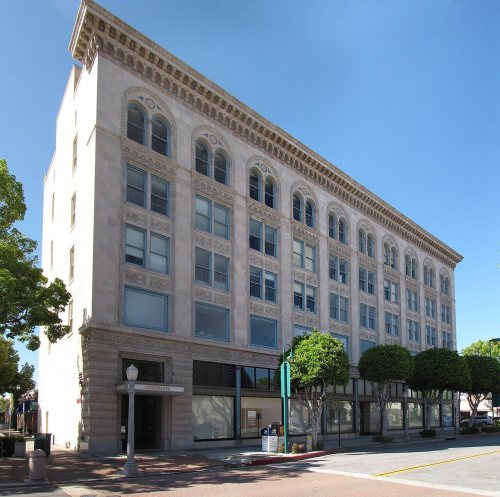
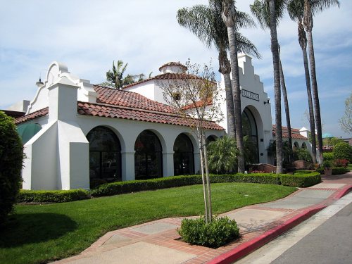
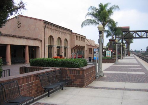
23 listings: 19 buildings, among them the Dr. George C. Clark House (listed 1976, the first), and 4 historic districts with 13 contributing buildings. 37 historic buildings in all.
How old are the homes in Fullerton?
5% of Fullerton’s homes were built before 1940 (Census estimate), against a typical 3.4% for a California town; the median home was built in 1969.
Founding dates: Wikidata, Wikipedia, the U.S. post office records of Blevins & Helbock (CC0) and the Census. Homes by year built: Census ACS 2020–24. National Register of Historic Places: National Park Service (list of May 22, 2026). Old photos, postcards and papers: Wikimedia Commons, the Library of Congress and other public archives, credited on each item’s page. Maps: U.S. Geological Survey historical topographic maps (via Esri) and Sanborn fire-insurance maps (Library of Congress). History text and census tables: Wikipedia (CC BY-SA 4.0). Places that used to be: USGS Geographic Names Information System (2021).
From Wikimedia Commons (3), Wikidata (2), the National Register of Historic Places (23), Wikipedia, Wikidata and Wikipedia for famous people, U.S. Geological Survey historical maps, U.S. Census counts (via Wikipedia), the US Post Offices dataset (Blevins & Helbock), the USGS Geographic Names Information System, Sanborn fire insurance maps (Library of Congress) and old county and town histories (Internet Archive). Archive images are copied here with their credits and licenses, shown on each photo’s page. Refreshed monthly.




 c. 1910


