
EMD 7001 WB at Floriston July94, 2007
Floriston’s story
135 years in pictures
The archive holds 6 old photos and papers going back to 2007 and 3 maps from 1955 on.
- 1891Floriston is settled
Each edition grades its towns against each other only.

Today 26 people live in this town, first settled in 1891.
Floriston’s midpoint age is 76.6 years, above both California’s towns (39 years) and U.S. towns (40.5 years). No town among the 848 in California we compare has a higher owner-occupancy rate than Floriston. 42% of the land in Floriston is conserved, where California’s towns sit at 4.3% and U.S. towns at 4.3%. The biggest park or preserve is Truckee River Wildlife Area Canyon Unit, at 82 acres. Floriston has fewer than 1,000 residents, too few for fair grades; the figures below are still real.
In a town this size, neighbors are the best guide. Ask them anything.
The archive holds 6 old photos and papers going back to 2007 and 3 maps from 1955 on.
Museums, parks, gardens and other places to visit around Floriston. Close and well known come first.
 Big draw21 mi LakeLake Tahoe
 14 mi LakeDonner Lake
 19 mi Ski areaPalisades Tahoe Olympic Valley122 runs · 2,542 ft vertical
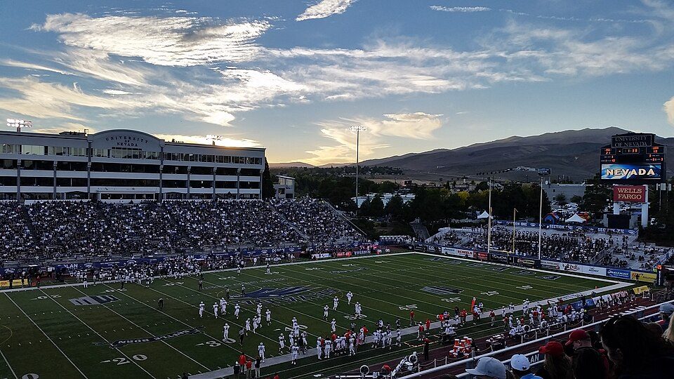 15 mi Stadium & arenaMackay Stadium
 9 mi Ski areaMount Rose Ski Tahoe57 runs · 1,625 ft vertical
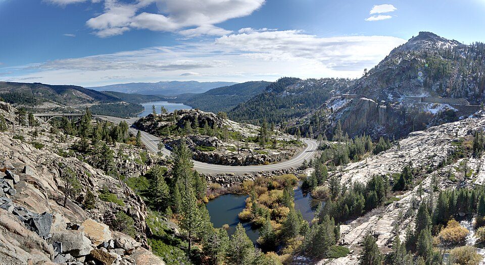 13 mi State parkDonner Memorial State Park
Lake Tahoe: Lara Farhadi, CC BY 2.0 · Donner Lake: J.smith, CC BY-SA 3.0 · Palisades Tahoe Olympic Valley: Jonnyboyca at English Wikipedia, Public domain · Mackay Stadium: Lanski, CC BY-SA 4.0 · Mount Rose Ski Tahoe: Beesmill, CC BY-SA 4.0 · Donner Memorial State Park: Joe Parks from Berkeley, CA, CC BY 2.0
Floriston is unincorporated, so Nevada County and regional agencies provide most services.
EPA SDWIS (Oct 9, 2026) · HIFLD + EIA-861 2025 · Census 2020 ZCTAs · NCES 2024–25 · registration: vote.gov, updated Nov 18, 2024.
Ordered by what stands out in Floriston.
Expected losses in Floriston break down as 50% from wildfires and 28% from inland flooding. Compared with 99% of U.S. communities, expected storm and flood damage in the town is higher.
FEMA National Risk Index · OpenFEMA
There are 3.0 miles of trail across 1 park or preserve. Floriston’s density of trails is put at 3.3 miles per square mile.
| Biggest places to walk | Trails | Acres |
|---|---|---|
| 1. Truckee River Wildlife Area Canyon Unit | 0.7 mi | 82 |
Trails & parks © OpenStreetMap contributors · Conserved land: USGS PAD-US
The town’s typical July afternoon high works out to 81°F.
NOAA U.S. Climate Normals, 1991–2020
In Floriston, 69% of adults had a checkup this year. On the CDC’s 32 measures, Floriston is ahead of California on 1 and behind on 7.
| Floriston | Typical California town | Typical U.S. town | |
|---|---|---|---|
| Binge drink (CDC PLACES) | 21% | 16% | 16% |
| Yearly checkup (CDC PLACES) | 69% | 72% | 79% |
| Smoke cigarettes (CDC PLACES) | 17% | 11% | 14% |
| Frequent mental distress (CDC PLACES) | 19% | 17% | 17% |
| What stands out | Floriston | CA |
|---|---|---|
| More adults screened for colon cancer | 63.1% | 57.5% |
| More smokers | 17.2% | 10.9% |
CDC PLACES 2025 · modeled estimates for adults · CMS · HRSA
1 within 15 miles of the center of Floriston
About 0 of every 100 Floriston residents are enrolled in college, against 8 across California.
Census-designated place in California, United States
Floriston is an unincorporated community and census-designated place in Nevada County, California. It is situated at an elevation of 5,400 ft (1,600 m) above sea level. Floriston is located on the Truckee River, 10 miles (16.1 km) east-northeast of Truckee. Formerly an important railroad stop and mill town, Floriston survives to this day as a small residential community. The population was 80 at the 2020 census.
From Wikipedia, licensed CC BY-SA 4.0 · facts via Wikidata (CC0)
Short answers, built from the data on this page.
Floriston has fewer than 1,000 residents, too few for fair grades; the figures below are still real.


