
US101CotatiGradeEdit2667, 2007
Cotati’s story
132 years in pictures
Census counts: 1,852 in 1960, 7,584 in 2020. The archive holds 3 old photos and papers going back to 2007 and 6 maps from 1916 on.
- 1894Cotati is settled
Each edition grades its towns against each other only.

FEMA rates its natural-hazard risk higher than 94% of U.S. communities, with inland flooding at the top. Overall it grades B−, ranked 233rd of 841 in California. It is healthier than 84% of U.S. towns and the median household earns $111K. Its weakest subject is cost of living: homes are expensive, about $724K for a typical one and 6.9 times the Santa Rosa metro’s $105K median household income. Cotati’s concentration of trails is 1.7 miles per square mile, above both the California town median (1.0) and the median of U.S. towns (0.4). Cotati is more walkable than 87% of U.S. towns.
Where Cotati beats most towns, and one thing worth knowing.
Each subject compared with towns across the country (schools within California), ordered by how far Cotati is from typical.
Its grades run from A for walkability (better than 87% of comparable towns) to D− for hazard risk (better than 4%), so the B− overall blends very different results.
How TownRatings grades towns →
Census counts: 1,852 in 1960, 7,584 in 2020. The archive holds 3 old photos and papers going back to 2007 and 6 maps from 1916 on.
Museums, parks, gardens and other places to visit around Cotati. Close and well known come first.
 Big draw38 mi MuseumAlcatraz Federal Penitentiary
 Big draw40 mi LandmarkLombard Street
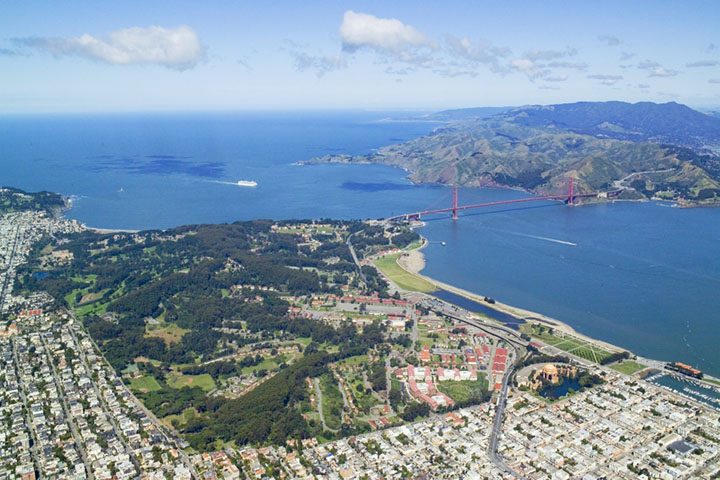 Big draw39 mi GardenPresidio of San Francisco
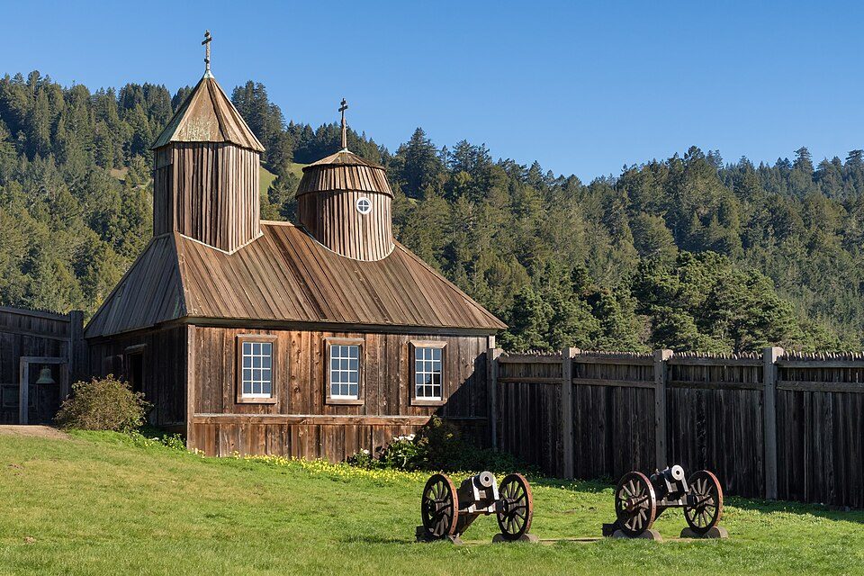 32 mi Ancient siteFort Ross
 30 mi National MonumentMuir Woods National Monument757K visitors a year
 29 mi MountainMount Tamalpais
Alcatraz Federal Penitentiary: druchoy, CC BY-SA 2.0 · Lombard Street: The original uploader was Y6y6y6 at English Wikipedia., Public domain · Presidio of San Francisco: Robert Campbell, CC BY-SA 3.0 · Fort Ross: Frank Schulenburg, CC BY-SA 4.0 · Muir Woods National Monument: Unknown, CC BY-SA 3.0 · Mount Tamalpais: Originally uploaded by Nelso (Transferred by DimiTalen), CC BY-SA 3.0
Who provides power, water and the rest in Cotati, and how to reach them.
EPA SDWIS (Oct 9, 2026) · HIFLD + EIA-861 2025 · Census 2020 ZCTAs · NCES 2024–25 · registration: vote.gov, updated Nov 18, 2024.
Ordered by what stands out in Cotati.
| Biggest places to walk | Trails | Acres |
|---|---|---|
| 1. Pocket Park and Food Forest | 0.3 mi | 3 |
| 2. Helen Putnam Park | 0.2 mi | 8 |
| 3. Cator Field | 0.1 mi | 4 |
Trails & parks © OpenStreetMap contributors · Conserved land: USGS PAD-US
Its one school is below. Public schools: the Cotati-Rohnert Park Unified school district. Enrollment at the town’s public school: 428 students.
| School | Level | Students | Letter |
|---|---|---|---|
| Thomas Page AcademyLargest public elementary schoolGrades K–8 | Grades K–8 | 428 | – |
NCES · EDFacts · graded within CA on state tests and graduation
Households in Cotati have drawn federal disaster aid in 3 declared disasters, most recently in 2020. 53% of the town’s expected losses from natural hazards come from inland flooding, followed by earthquakes at 44%. Paid flood insurance claims locally since 1993: 2.
FEMA disaster declarations and aid · FEMA flood insurance claims · FEMA National Risk Index · OpenFEMA
Its widest gap with California is no health insurance: 6.5% of those 18–64 have no health insurance, against 10.6% statewide.
In Cotati, 25% of adults have been diagnosed with depression. The share of adults in Cotati who have obesity is 26%, against 29% in California’s towns and 35% across U.S. towns. On the CDC’s 32 measures, Cotati is ahead of California on 14 and behind on 2.
| Cotati | California towns | U.S. towns | |
|---|---|---|---|
| Yearly checkup (CDC PLACES) | 71% | 72% | 79% |
| Obesity (CDC PLACES) | 26% | 29% | 35% |
| High blood pressure (CDC PLACES) | 28% | 31% | 35% |
| Diabetes (CDC PLACES) | 9% | 12% | 12% |
| What stands out | Cotati | CA |
|---|---|---|
| Fewer uninsured adults | 6.5% | 10.6% |
| Fewer adults facing food insecurity | 11.4% | 17.9% |
| More adults with depression | 25% | 20.1% |
CDC PLACES 2025 · modeled estimates for adults · CMS · HRSA
NOAA U.S. Climate Normals, 1991–2020
Commuting out is the norm in Cotati: 4% of working residents work locally. The average trip to work for Cotati comes to 29 minutes. Half commute less than 11 miles. The top destinations are Santa Rosa (17%), Petaluma (13%) and Rohnert Park (9%).
| Cotati | California towns | U.S. towns | |
|---|---|---|---|
| Median household income | $111,000 | $95,000 | $80,000 |
| Work from home | 15% | 14% | 11% |
| Average trip to work | 29 minutes | 28 minutes | 25 minutes |
| Working residents who work in town | 4.5% | 6.6% | 8% |
Census LEHD 2023 · ACS
Cotati has lost 3.4% of its people since 2020, down to 7,347 in the Census Bureau’s 2025 estimate. Children under 18 are 16% of residents (22% statewide). The share of adults 25 and older in Cotati who hold a bachelor’s degree or more: 38%.
| Cotati | California towns | U.S. towns | |
|---|---|---|---|
| Under 18 | 16% | 22% | 22% |
| Bachelor’s degree or more, 25+ | 38% | 29% | 29% |
| Median age | 38.5 years | 39.1 years | 40.5 years |
| Aged 65 or older | 16% | 16% | 18% |
53% women, 47% men
That’s an even split within the survey’s margin of ±3.6 points. Across California, 50.1% of residents are women.
| Cotati | CA | U.S. | |
|---|---|---|---|
| Under 10 | 10.3% | 11.4% | 11.6% |
| 10 to 17 | 5.9% | 10.5% | 10.3% |
| 18 to 24 | 8.9% | 9.1% | 9.1% |
| 25 to 34 | 17.4% | 14.8% | 13.7% |
| 35 to 44 | 17.5% | 13.9% | 13.2% |
| 45 to 54 | 11.4% | 12.5% | 12.2% |
| 55 to 64 | 12.5% | 12.1% | 12.7% |
| 65 to 74 | 8.6% | 9.2% | 10.2% |
| 75 and older | 7.4% | 6.5% | 7% |
| No diploma | 2.4% | 15.3% | 10.4% |
| High school | 14.7% | 20.5% | 26% |
| Some college | 34.1% | 19.3% | 19.1% |
| Associate’s | 11.1% | 7.9% | 8.8% |
| Bachelor’s | 26.5% | 22.7% | 21.6% |
| Graduate | 11.1% | 14.4% | 14.1% |
Census population estimates, 2025 · U.S. Census Bureau · ACS 2020-2024 5-year estimates
Cotati’s median rent is $2,056 a month. Homes sold in Cotati spent a median 15 days on the market. 59% of households are owner-occupiers locally.
| Cotati | California towns | U.S. towns | |
|---|---|---|---|
| Median rent | $2,056 a month | $1,895 a month | $1,185 a month |
| Households that own their home | 59% | 64% | 73% |
Census ACS, 2020–24 · Zillow Home Value Index · Redfin Data Center
The violent crime rate in Cotati is 1.4 per 1,000 residents. Within California, it does better than nearly four in five towns.
| Cotati | California towns | U.S. towns | |
|---|---|---|---|
| Violent crimes per 1,000 (2025) | 1.4 per 1,000 residents | 2.9 | 1.6 |
| Property crimes per 1,000 (2025) | 11.7 per 1,000 residents | 13.4 | 9.9 |
FBI crime data, 2025 · crimes reported to police
2 within 15 miles of the center of Cotati
About 8 of every 100 Cotati residents are enrolled in college, about the same as California.
City in California, United States
Cotati (, ; Miwok: Kota’ti) is a city in Sonoma County, California, United States, located approximately 45 mi (70 km) north of San Francisco in the 101 corridor between Rohnert Park and Petaluma. Cotati's population as of the 2020 Census was 7,584, making it the least populous incorporated community in Sonoma County. Like the rest of Sonoma County, Cotati is included in both the San Francisco Bay Area and the North Coast. Located in the Sonoma Coast AVA, Cotati can also be considered part of Wine Country. E & J Gallo Winery operates a 400-acre (160 ha) vineyard called Two Rock Vineyard in the hills west of town. Cotati's hexagonal downtown plaza, one of only two hexagonal town layouts in t…
From Wikipedia, licensed CC BY-SA 4.0 · facts via Wikidata (CC0)
One town shares a border with Cotati.
| Town | CA rank | Overall | Cost | Safety | Schools | Health |
|---|---|---|---|---|---|---|
| Cotati | #233 | B− | D− | B− | B− | A− |
| Rohnert Park | #378 | C | D− | C+ | B− | A− |
Short answers, built from the data on this page.
Cotati grades B− overall, better than 46% of U.S. towns and #233 of 841 in California. It grades A− for health, B− for safety and B− for schools. Hazard risk is its weak spot, with a D−.
Within California, it does better than 79% of towns.
Yes. Cost of living, which also weighs rents, property taxes and how many households pay 30% or more of their income for housing, grades D−.


