Guest, Sign inJoin

Post to Chula Vista

We’ll email a one-tap link to publish your post. No password, and nothing is public until you click it.
Already a member? Sign in
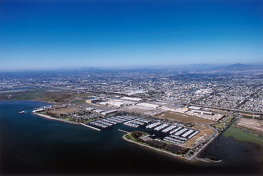
ChulaVista BayfrontPhoto: Port of San Diego · CC BY 2.0
AOutdoors
Outdoors in Chula Vista

Chula Vista has 107 miles of mapped trails, 2.2 for every square mile of land

19% of Chula Vista’s land is conserved, about 5,984 acres. 94% of residents live within a half mile of a park. The biggest trail networks: San Diego National Wildlife Refuge (3.2 mi), Sweetwater Park (1.3 mi), Montevalle (1 mi).

Ahead of 90% of U.S. towns · #181 of 847 in California. What drives it

Conserved land
19%
5,984 acres · of 49.8 sq mi of land
Trails
107 mi
2.2 per sq mi of land
Park land
2,759 ac
10.0 acres per 1,000 residents
Near a park
94%
of residents within ½ mile
Bike routes
134 mi
113 mi lanes · 8.4 mi paths
Highest peak
659 ft
Rock Mountain
Lakes & rivers
4
1 beach · 1 boat launch

What kind of outdoors town is Chula Vista?

Read from the map. The page puts what stands out first.

Outdoors grade

How much outdoors does Chula Vista have?

On conserved land, trails, park land and how close residents live to a park, Chula Vista is ahead of 90% of U.S. towns, #181 of 847 in California. Trail miles hold the grade up; park acres per resident pull it down.

A
OutdoorsA character grade: shown, never part of Chula Vista’s overall grade.
All U.S. towns we grade (21,298)Ahead of 90%
LessMore
California towns of 2,500+ (847)Ahead of 79%

Among the 400 U.S. cities of 100,000 or more, Chula Vista ranks #79 on Outdoors.

How sure. Graded on any three of the four inputs instead, the letter would range from A− to A+. Trails and many small parks come from OpenStreetMap, mapped by volunteers, so coverage varies from town to town; the half mile is a straight line from each census block, so a river or highway in the way isn’t counted against it.

PAD-US, OpenStreetMap (© OpenStreetMap contributors), Census 2025 Gazetteer and 2020 blocks; details in Sources below. How TownRatings grades the outdoors →

The map

Conserved land, trails & bike routes

Tap a number to zoom to a park. Tap a layer to hide it.

12345678
Easements protect land from building but are usually private.© OpenStreetMap contributors · USGS PAD-US
Places to walk

Pick a walk

The longest trail network is San Diego National Wildlife Refuge, with 3.2 miles. Directions go to the nearest trailhead or public parking.

San Diego National Wildlife Refuge

Managed by United States Fish and Wildlife Service
439 acres3.2 mi of trail
Vista Lago
Dog rules not recorded
Directionsto the parking lotWebsite ↗

Sweetwater Park

Managed by Chula Vista
37 acres1.3 mi of trail
Dog rules not recorded
Directionsto the parking lotWebsite ↗

Montevalle

Park
24 acres1 mi of trail
Dog rules not recorded
Directionsto the parking lot

San Diego Bay National Wildlife Refuge

Managed by United States Fish and Wildlife Service
338 acres0.9 mi of trail
Dog rules not recorded
Directionsto the parking lot

Rohr Park

Park
59 acres0.9 mi of trail
Sweetwater Park Trail
Dog rules not recorded
Directionsto the parking lot

Salt Creek

Park
14 acres0.8 mi of trail
Dog rules not recorded
Directionsto the parking lot

Voyager Park

Park
10 acres0.7 mi of trail
Dog rules not recorded
Directionsto the parking lot

Chula Vista Community Park

Park
19 acres0.6 mi of trail
Dog rules not recorded
Directionsto the parking lot
All 71 parks & preserves
San Diego National Wildlife Refuge439 acres · 3.2 mi of trail · United States Fish and Wildlife Service
Directions
Sweetwater Park37 acres · 1.3 mi of trail · Chula Vista
Directions
Montevalle24 acres · 1 mi of trail
Directions
San Diego Bay National Wildlife Refuge338 acres · 0.9 mi of trail · United States Fish and Wildlife Service
Directions
Rohr Park59 acres · 0.9 mi of trail
Directions
Salt Creek14 acres · 0.8 mi of trail
Directions
Voyager Park10 acres · 0.7 mi of trail
Directions
Chula Vista Community Park19 acres · 0.6 mi of trail
Directions
Sunset View Park10 acres · 0.6 mi of trail
Directions
Scobee Park8 acres · 0.6 mi of trail
Directions
Mount San Miguel Park20 acres · 0.4 mi of trail
Directions
Sweetwater County Park18 acres · 0.4 mi of trail
Directions
Mountain Hawk13 acres · 0.4 mi of trail
Directions
Veterans Park10 acres · 0.4 mi of trail · City of Imperial Beach
Directions
Memorial Park8 acres · 0.4 mi of trail
Directions
Cottonwood Park7 acres · 0.4 mi of trail
Directions
Santa Cora Park6 acres · 0.4 mi of trail
Directions
Bonita Long Canyon Park11 acres · 0.3 mi of trail
Directions
Mackenzie Creek Park5 acres · 0.3 mi of trail
Directions
Horizon Park5 acres · 0.3 mi of trail
Directions
Lauderbach Park4 acres · 0.3 mi of trail
Directions
Friendship Park4 acres · 0.3 mi of trail
Directions
el Rancho del Rey Park3 acres · 0.3 mi of trail
Stylus Park2 acres · 0.3 mi of trail
Directions
Rienstra Sports Complex15 acres · 0.2 mi of trail
Directions
SDG&E East10 acres · 0.2 mi of trail
Directions
Tiffany Park5 acres · 0.2 mi of trail
Directions
Otay Park5 acres · 0.2 mi of trail
Directions
Harvest Park5 acres · 0.2 mi of trail
Directions
Harborside Park4 acres · 0.2 mi of trail
Sunbow Park4 acres · 0.2 mi of trail
Strata Park2 acres · 0.2 mi of trail
Directions
Orion Park2 acres · 0.2 mi of trail
Directions
Halecrest Park2 acres · 0.2 mi of trail
Directions
Metro Park2 acres · 0.2 mi of trail
Directions
Circle Park1 acres · 0.2 mi of trail
Kumeyaay Park13 acres · 0.1 mi of trail · City of Chula Vista
Directions
Terra Nova Park9 acres · 0.1 mi of trail
Directions
Independence Park5 acres · 0.1 mi of trail
Millenia Park4 acres · 0.1 mi of trail
Augusta Park3 acres · 0.1 mi of trail
Loma Verde Park3 acres · 0.1 mi of trail
Directions
Countryside Park1 acres · 0.1 mi of trail
Mulberry Park1 acres · 0.1 mi of trail
Greg Rogers Park38 acres
Directions
San Diego Gas and Electric Park20 acres
Eucalyptus Park20 acres
Directions
Heritage Park11 acres
Directions
Chula Vista Bayside Park11 acres · Port of San Diego
Directions
Hilltop Park10 acres
Directions
Chula Vista Bayfront Park10 acres · Port of San Diego
Directions
SDG&E West10 acres
Directions
All Seasons Park7 acres
Directions
Chula Vista Marina View Park6 acres · Port of San Diego
Directions
Explorer Park6 acres
Los Ninos Park5 acres · City of Chula Vista
Directions
Valle Lindo Park4 acres
Directions
Sunridge Park4 acres
Marisol Park4 acres
Palomar Park3 acres
Directions
Dolphin Beach Club3 acres
Oak Crest Park2 acres
Directions
Paseo del Ray Park2 acres
Breezewood Park2 acres
Bay Boulevard Park2 acres
Directions
Norman Park2 acres
Directions
Jacaranda Park1 acres
Wisteria Park1 acres
Directions
Orchard Park1 acres
Summerland Park1 acres
Saint Claire Park1 acres
Who protects it

5,984 conserved acres

19% of Chula Vista’s land. Who manages Chula Vista’s conserved land, from the USGS Protected Areas Database. Approximate, because parcels can overlap.

Town or city3,047 ac
U.S. Fish and Wildlife Service1,510 ac
Other or Unknown Local Government1,180 ac
County995 ac
Regional Water Districts459 ac
Regional agency88 ac
Land trusts & nonprofits59 ac
Local Recreation Area · 1,967 acUnknown Easement · 1,560 acNational Wildlife Refuge · 1,510 acLocal Conservation Area · 1,038 acLocal Park · 916 ac
Good to know

Conserved doesn’t always mean open to visitors. 851 acres are conservation easements, usually private land. The walks above are places people visit.

The biggest protected parcels
Parcel (PAD-US)Managed byAcresPublic access
City of Chula Vista Open Space
Local Recreation Area
Town or city1,580Open
Otay Ranch Preserve
Local Conservation Area
County973Closed
San Diego National Wildlife Refuge
National Wildlife Refuge
U.S. Fish and Wildlife Service895Restricted
San Diego Bay National Wildlife Refuge
National Wildlife Refuge
U.S. Fish and Wildlife Service615Open
Otay Valley Regional Park
Local Park
County233Open
Mount Miguel Open Space
Local Recreation Area
Regional Water Districts230Closed
Rolling Hills Ranch
Local Other or Unknown
Town or city220Closed
Chula Vista Municipal Golf Course
Local Recreation Area
Town or city128Restricted
Lower Otay Lakes
Local Other or Unknown
Town or city88Open
Chula Vista Wildlife Reserve
Local Conservation Area
Regional agency64Open

5 smaller protected places aren’t shown.

Things to do

140 places to go in Chula Vista

Beaches, playgrounds, peaks, falls and more. Pick a kind.

Public pools in Chula Vista
Big Bird's Beach
Directions
Cookie's Monster Pool
Directions
Elmo's Silly Sand Slides
Directions
Ernie's and Bert's Tunnels
Directions
Floaties Swim School
Directions
Rolling Hills Ranch Community Pool
Directions
Snuffy's Spaguetti Slides
Directions
The Count's Splash Castle
Directions
Trails & water

9 named trails and 4 lakes & rivers

Named trails
Open to bikes · 13.9 miHorses · 7.9 miUnpaved · 47.1 mi
Sweetwater Park Trail2.8 mi
Rice Canyon Trail1.8 mi
Vista Lago1.5 mi
Centennial Trail1.4 mi
Snake Trail1.2 mi
SDG&E Utility Access Path0.8 mi
Gotham Canyon Trail0.3 mi
Rice Canyon Loop0.3 mi
Pot Canyon Trail0.1 mi
Lakes & rivers tap for directions
Biking & sports

134 miles of bike routes

Bike lanes are often missing from the map in smaller towns, so that number is likely low.

113 mi
painted or protected bike lanes
8.4 mi
off-road bike paths
12 mi
shoulders & shared lanes
Sweetwater Bike RouteBike route
1.4 mi
Courts & fields
107Tennis
102Basketball
58Baseball
18Soccer
16Pickleball
7Football
7Skate park
7Beach volleyball

Includes school and college facilities, which aren’t always open to the public.

When to get out

The best walking months in Chula Vista: April to August

NOAA’s 1991–2020 normals for the town and the daylight at its latitude. Outlined months have long days, highs of 59 to 86 °F and little rain for the place.

JanFebMarAprMayJunJulAugSepOctNovDec
Daylight (h)10.211.011.912.913.814.314.113.312.311.310.410.0
High (°F)696869717276808382787368
Rain (in)2.02.21.60.70.20.10.00.00.10.40.91.7

July is the driest month (under 0.1 in) and August the warmest (highs of 83 °F). 2.2 inches fall in February, the wettest month. The climate in Chula Vista →

Next door

Chula Vista and its neighbors

Chula Vista has the second most mapped trails of the 4 towns around it. Tap a town to see its outdoors.

TownConserved
of land
Trail mi
per sq mi
Park acres
per 1,000
Near a park
½ mile
Outdoors
Chula Vista19%2.21094%A
Bonita14%1.43099%A+
National City4%0.6391%B
San Diego26%2.22897%A+

The four inputs of the Outdoors grade, from the engine; shares are of land, not water.

Questions about parks and trails in Chula Vista

Where can I hike in Chula Vista?

The longest trail networks: San Diego National Wildlife Refuge, 3.2 miles; Sweetwater Park, 1.3 miles; Montevalle, 1 miles; San Diego Bay National Wildlife Refuge, 0.9 miles. Each one is on the map above, with directions to the nearest trailhead or parking.

How much of Chula Vista is conserved land?

19% of its land, against a typical 4% for a California town and 4% nationally (PAD-US). Conserved doesn’t always mean open to visitors: easements are usually private land.

Are dogs allowed on Chula Vista’s trails?

San Diego National Wildlife Refuge and Sweetwater Park don’t have dog rules recorded on the map; check the signs at the trailhead.

Where can I bike in Chula Vista?

134 miles of bike routes are on the map: 113 of painted or protected lanes, 8.4 of off-road paths and 12 of shoulders and shared lanes. Named routes: Sweetwater Bike Route.

Is there public land near Chula Vista?

50,987 acres of parks and open public land lie inside Chula Vista or within 10 miles of it (PAD-US), 2,817 of them inside the city line.

How much outdoors does Chula Vista have?

Ahead of 90% of U.S. towns on the Outdoors grade, #181 of 847 in California. The grade combines the share of land that is conserved, miles of mapped trail per square mile of land, park acres per 1,000 residents and the share of residents within a half mile of a park. It’s a character grade, so it isn’t part of the overall grade. How it works.

Trail talk

Conditions, parking and favorite walks from Chula Vista neighbors.
Town Square →
Share a tip
Sources

Where this page comes from

Conserved and public land: USGS Protected Areas Database of the United States (PAD-US), service updated July 2026. Parks, trails, playgrounds, beaches and other places: OpenStreetMap (© OpenStreetMap contributors, ODbL), map data as of 2026-10-28. Land and water area: Census 2025 Gazetteer. Residents near a park: 2020 Census blocks. National Register: National Park Service. How TownRatings grades the outdoors →