61 years in pictures
Census counts: 1,309 in 1970, 14,973 in 2020. The archive holds 19 old photos and papers going back to 2010 and 2 maps from 1943 on.
- 1965California City is settled
Each edition grades its towns against each other only.

California City grades D− overall, in the bottom 2% of U.S. towns, mostly because of incomes and health. The median household income is $60K, and 23% of residents live below the poverty line. Residents are less healthy than 92% of U.S. towns on CDC estimates. One bright spot: it has 243 miles of trail. California City’s average trip to work is 43 minutes, against 28 minutes in California State’s towns and 25 minutes across U.S. towns. Only 34 of California State’s 1,063 towns score lower on history. California City's civic life (library use, community groups, volunteering) trails 90% of U.S. towns.
Where California City beats most towns, and one thing worth knowing.
Where California City’s working residents go each day. Line width shows the share.
Census LEHD 2023
Each subject compared with towns across the country (schools within California State), ordered by how far California City is from typical.
How TownRatings grades towns →
Census counts: 1,309 in 1970, 14,973 in 2020. The archive holds 19 old photos and papers going back to 2010 and 2 maps from 1943 on.
Who provides power, water and the rest in California City, and how to reach them.
EPA SDWIS (Oct 9, 2026) · HIFLD + EIA-861 2025 · Census 2020 ZCTAs · NCES 2024–25 · registration: vote.gov, updated Nov 18, 2024.
Ordered by what stands out in California City.
California City has more 90° days than nearly all U.S. towns, but it is a long drive from an emergency room and has poverty well above the California State rate.
The typical value, about $271K, is 7% below its December 2024 peak. The median property tax bill is $2,027, against $5,124 across California State, another input to its cost-of-living grade.
The typical California City home is worth about $271,000, down 3% in a year, 64% below the California State typical home. 55% of households own their home in California City.
| California City | California State towns | U.S. towns | |
|---|---|---|---|
| Households that own their home | 55% | 64% | 73% |
| Median rent | $1,300 a month | $1,898 a month | $1,185 a month |
Census ACS, 2020–24 · Zillow Home Value Index · Redfin Data Center
Its public schools are run by the Mojave Unified school district. Two of its 4 schools are below, each with why it’s listed. The largest public high school is California City High, with 604 students.
| School | Level | Students | Letter |
|---|---|---|---|
| Robert P. Ulrich ElementaryLargest public elementary schoolGrades K–2 | Grades K–2 | 503 | – |
| California City HighLargest public high schoolGrades 9–12 | Grades 9–12 | 604 | – |
NCES · EDFacts · graded within CA on state tests and graduation
The nearest emergency room, Adventist Health Tehachapi Valley, is 35.3 miles away in a straight line.
31% of California City adults worry about having enough food. California City beats the California State average on 1 of 32 CDC measures and trails it on 23. 22% of California City adults report frequent mental distress.
| California City | California State towns | U.S. towns | |
|---|---|---|---|
| Food insecurity (CDC PLACES) | 31% | 16% | 14% |
| Frequent mental distress (CDC PLACES) | 22% | 17% | 17% |
| Fair or poor health (CDC PLACES) | 31% | 22% | 19% |
| Get no exercise (CDC PLACES) | 33% | 24% | 25% |
| What stands out | California City | CA |
|---|---|---|
| Fewer adults who have had cancer | 5.5% | 6.4% |
| More adults facing a utility shut-off | 15.2% | 7.3% |
CDC PLACES 2025 · modeled estimates for adults · CMS · HRSA
The trail density in California City is 1.2 miles per square mile. The biggest park or preserve is Desert Tortoise Preserve, at 684 acres.
| California City | California State towns | U.S. towns | |
|---|---|---|---|
| Miles of trail per square mile | 1.2 miles per square mile | 1.0 | 0.4 |
| Conserved land | 4.4% | 4.2% | 4.3% |
| Biggest places to walk | Trails | Acres |
|---|---|---|
| 1. Desert Tortoise Preserve | 0.6 mi | 684 |
| 2. Silver Saddle Ranch and Club | 0.4 mi | 28 |
| 3. Central Park | 0.3 mi | 34 |
Trails & parks © OpenStreetMap contributors · Conserved land: USGS PAD-US
California City’s violent crime rate is 5.3 per 1,000 residents.
| California City | California State towns | U.S. towns | |
|---|---|---|---|
| Violent crimes per 1,000 (2025) | 5.3 per 1,000 residents | 2.9 | 1.6 |
| Property crimes per 1,000 (2025) | 14 per 1,000 residents | 13.3 | 9.9 |
FBI crime data, 2025 · crimes reported to police
Expected storm and flood damage is higher than in 87% of U.S. communities.
FEMA National Risk Index · OpenFEMA
The average commute for its 3,772 working residents takes 43.3 minutes, against 28.7 across California State.
Most working residents leave California City for work: only 14% work in town. Jobs based in California City grew to 1,457 in 2023, 98 more than in 2013. The top destinations are Lancaster (9%), Los Angeles (7%) and Mojave (7%).
| California City | California State towns | U.S. towns | |
|---|---|---|---|
| Median household income | $60,000 | $95,000 | $80,000 |
| Working residents who work in town | 14% | 6.6% | 8% |
| Work from home | 11% | 14% | 11% |
Census LEHD 2023 · ACS
The Randsburg weather station, 20 miles away, records that about 106 days a year reach 90°, more than in 96% of U.S. towns. July afternoons average 100.2°, hotter than in 99% of U.S. towns; January nights average 34.6°.
California City has mild winters and scorching summers, with very little rain. About 2 inches of snow falls in a winter.
| California City | California State towns | U.S. towns | |
|---|---|---|---|
| July high | 100°F | 89°F | 85°F |
| January low | 35°F | 41°F | 22°F |
NOAA U.S. Climate Normals, 1991–2020
Museums, parks, gardens and other places to visit around California City. Close and well known come first.
11 mi LandmarkBalls 8
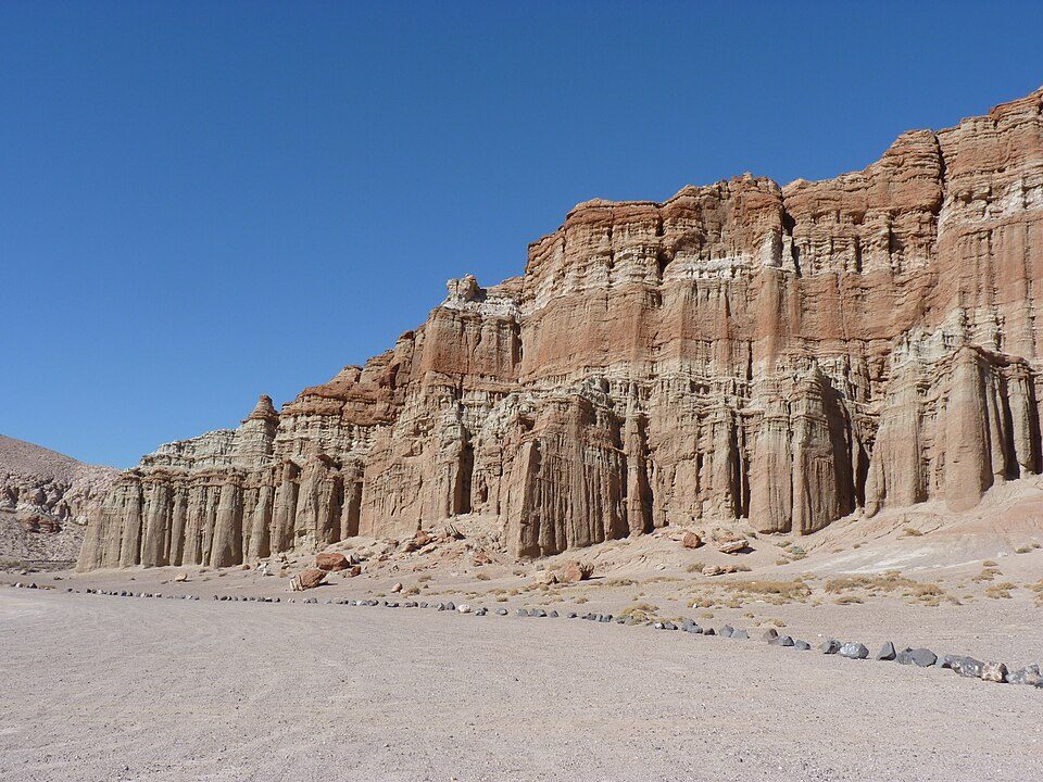
17 mi State parkRed Rock Canyon State Park17 mi MuseumAir Force Flight Test Museum
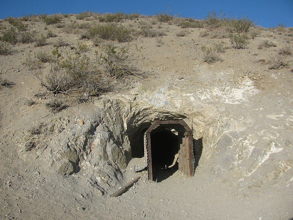
18 mi Park & preserveBurro Schmidt Tunnel
39 mi National MonumentCésar E. Chávez National Monument31K visitors a year
40 mi MuseumJoe Davies Heritage AirparkBalls 8: NASA/Tony Landis, Public domain · Red Rock Canyon State Park: Jean trans h+, CC BY-SA 4.0 · Burro Schmidt Tunnel: Kurtis2014, CC BY-SA 3.0 · César E. Chávez National Monument: Bobak Ha'Eri, CC BY 3.0 · Joe Davies Heritage Airpark: Alan Wilson from Stilton, Peterborough, Cambs, UK, CC BY-SA 2.0
None within 15 miles of California City; the nearest are
About 7 of every 100 California City residents are enrolled in college, about the same as California State.
City in California, United States
California City is a city located in northern Antelope Valley in Kern County, California, United States. It is 100 miles (160 km) north of the city of Los Angeles, and the population was 14,973 at the 2020 census. Covering 203.63 square miles (527.4 km2), California City has the third-largest land area of any city in the state of California (behind San Diego and Los Angeles), and is the largest city in California, by land area, that is not a county seat. It is the 43rd-largest city in the United States by land area. Despite its massive size, a large portion of the city remains unfinished, with a grid of paved roads that have no houses and have yet to be completed. Many of the city's residen…
From Wikipedia, licensed CC BY-SA 4.0 · facts via Wikidata (CC0)
Short answers, built from the data on this page.
California City grades D− overall, in the bottom 2% of U.S. towns. It grades D for health, C− for safety and C− for schools. Jobs & income is its weak spot, with a D−.
Yes. That is 3.9 years of the area's median household income ($70,210 across the Bakersfield-Delano, CA metro area). Cost of living, which also weighs rents, property taxes and how many households pay 30% or more of their income for housing, grades C−.