Half of South Tucson’s homes were built after 1967
More historic than 21% of U.S. towns · #59 of 140 in Arizona. What drives it
Most of South Tucson was built recently: 6% of its homes predate 1940 and the median home dates from 1967. Below: 2 old photos and papers, maps from 1948 on, and the census since 1940.
On its age, its old homes and the National Register, South Tucson is more historic than 21% of U.S. towns, #59 of 140 in Arizona. Its share of homes from before 1940 holds the grade up; its National Register listings pull it down.
C−
HistoryA character grade: shown, never part of South Tucson’s overall grade.
Few Arizona towns list much on the Register (a typical Arizona town has 0.1 per 10,000 residents, the U.S. 2.4), so South Tucson’s 0.0 sits below most of its state (29% of Arizona towns have fewer) while its 0 listings outnumber those of 23% of U.S. towns.
How sure. Graded on two of the three inputs, so a change in either one moves the letter more than it would with three. The pre-1940 share is a Census survey estimate (±4.9 points).
Founding year: our sources. Homes: Census ACS 2020–24. National Register: National Park Service, May 2026 list; each listing counted once (boundary changes and added documentation belong to their listing), and a historic district counts its contributing buildings. How TownRatings grades history →
What stands out about South Tucson’s past
Read from the archive, the National Register and the record. The page puts what stands out first.
In 1936, Tucson officials took steps to expand Tucson's boundaries by moving to annex the unincorporated area along south Sixth Avenue from 25th Street south to the Veterans Hospital, which was south of Tucson city limits. Area auto court and other property owners on south Sixth Avenue objected, as they did not want to pay the higher business taxes imposed by Tucson or be subject to Tucson's building codes. As a recourse to prevent the annexation, south Sixth Avenue property owners submitted a petition to the Pima County Board of Supervisors asking for an incorporation election. On August 10, 1936, South Tucson residents voted 52 to 35 in favor of incorporation. In response, Tucson continued to require Tucson Water customers in South Tucson to obtain building permits from Tucson, or their water would be shut off. The South Tucson City Council responded by imposing a $500 annual franchis…
Nothing in the archives for these yearsWeddings on Main Street, storms, parades, school pictures, the old store. If it’s in your family album, it belongs here.
Old hamlets and crossroads still carry their names on the map.
Hamlets and corners on the map
Arizona Trailer Court
Gone or out of use
Pima County General Hospitalhospital
Places and cemeteries from the USGS Geographic Names Information System (2021).
Questions about South Tucson’s history
How does South Tucson rank for history?
South Tucson is more historic than 21% of U.S. towns, #59 of 140 in Arizona. The History grade combines the town’s founding era, the share of homes built before 1940 and its National Register listings. It’s a character grade, so it isn’t part of the overall grade. How it works.
How old are the homes in South Tucson?
6% of South Tucson’s homes were built before 1940 (Census estimate, ±4.9 points), against a typical 0.4% for an Arizona town; the median home was built in 1967.
Founding dates: Wikidata, Wikipedia, the U.S. post office records of Blevins & Helbock (CC0) and the Census. Homes by year built: Census ACS 2020–24. National Register of Historic Places: National Park Service (list of May 22, 2026). Old photos, postcards and papers: Wikimedia Commons, the Library of Congress and other public archives, credited on each item’s page. Maps: U.S. Geological Survey historical topographic maps (via Esri) and Sanborn fire-insurance maps (Library of Congress). History text and census tables: Wikipedia (CC BY-SA 4.0). Places that used to be: USGS Geographic Names Information System (2021).
From Wikimedia Commons (5), the Library of Congress (1), Wikipedia, U.S. Geological Survey historical maps, U.S. Census counts (via Wikipedia) and the USGS Geographic Names Information System. Archive images are copied here with their credits and licenses, shown on each photo’s page. Refreshed monthly.


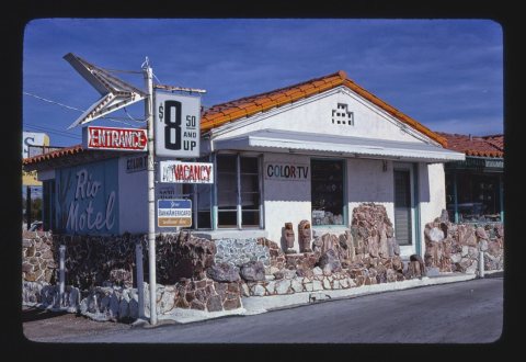 1979
 2018
 2017
 2009
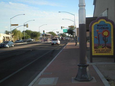 2009


