Guest, Sign inJoin

Post to Mesa

We’ll email a one-tap link to publish your post. No password, and nothing is public until you click it.
Already a member? Sign in
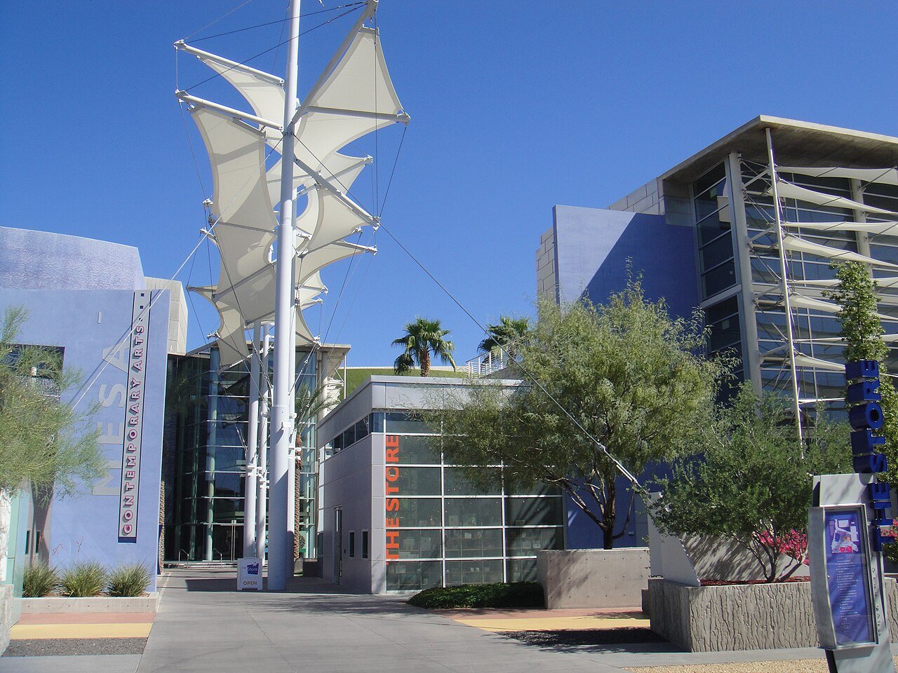
Mesa Arts Center - West - 2009-09-16Photo: Cygnusloop99 · CC BY-SA 3.0
B+Outdoors
Outdoors in Mesa

6% of Mesa’s land is conserved, and 98% of residents live within a half mile of a park

The biggest trail networks: Temple Square (2.8 mi), Eastmark Great Park (2.1 mi), Desert Trails Park (1.8 mi). 91 miles of mapped trail cross Mesa, 0.6 per square mile of land. 6% of Mesa’s land is conserved, about 5,803 acres.

Ahead of 73% of U.S. towns · #56 of 140 in Arizona. What drives it

Conserved land
6%
5,803 acres · of 142.0 sq mi of land
Trails
91 mi
0.6 per sq mi of land
Park land
3,876 ac
7.6 acres per 1,000 residents
Near a park
98%
of residents within ½ mile
Bike routes
416 mi
382 mi lanes · 29 mi paths
Highest peak
2,080 ft
Whisper Mountain
Lakes & rivers
15
1 beach · 1 boat launch

What kind of outdoors town is Mesa?

Read from the map. The page puts what stands out first.

Outdoors grade

How much outdoors does Mesa have?

On conserved land, trails, park land and how close residents live to a park, Mesa is ahead of 73% of U.S. towns, #56 of 140 in Arizona. The share of residents near a park holds the grade up; park acres per resident pull it down.

B+
OutdoorsA character grade: shown, never part of Mesa’s overall grade.
All U.S. towns we grade (21,298)Ahead of 73%
LessMore
Arizona towns of 2,500+ (140)Ahead of 60%

Among the 400 U.S. cities of 100,000 or more, Mesa ranks #249 on Outdoors.

Arizona towns conserve more land than most (a typical one, 14%; the U.S., 4%), so Mesa’s 6% is ahead of 34% of Arizona towns, while its trails per square mile lead 29% of them.

Park acres per resident are where Mesa trails most U.S. towns: 7.6 per 1,000 against 12.6 typical, since 513,656 people share 3,876 acres.

How sure. Graded on any three of the four inputs instead, the letter would range from B to A−. Trails and many small parks come from OpenStreetMap, mapped by volunteers, so coverage varies from town to town; the half mile is a straight line from each census block, so a river or highway in the way isn’t counted against it.

PAD-US, OpenStreetMap (© OpenStreetMap contributors), Census 2025 Gazetteer and 2020 blocks; details in Sources below. How TownRatings grades the outdoors →

The map

Conserved land, trails & bike routes

Tap a number to zoom to a park. Tap a layer to hide it.

12345678
Easements protect land from building but are usually private.© OpenStreetMap contributors · USGS PAD-US
Places to walk

Pick a walk

The longest trail network is Temple Square, with 2.8 miles. Directions go to the nearest trailhead or public parking.

Temple Square

Park
16 acres2.8 mi of trail
Dog rules not recorded
Directionsto the parking lot

Eastmark Great Park

Park
34 acres2.1 mi of trail
Dog rules not recorded
Directionsto the parking lot

Desert Trails Park

Managed by City of Mesa
42 acres1.8 mi of trail
Dog rules not recorded
Directionsto the parking lot

Desert Arroyo Park

Park
61 acres1.2 mi of trail
Explorers PathExploerers PathBotanical WalkDesert Arroyo Connector Path+1
Dog rules not recorded
Directionsto the parking lot

Park of the Canals, Brinton Desert Botanical Garden

Managed by City of Mesa
31 acres1.2 mi of trail
Compass CourseNorth Consolidated Canal
Dog rules not recorded
Directionsto the parking lot

Eagles Park

Managed by City of Mesa
26 acres1 mi of trail
Dog rules not recorded
Directionsto the parking lot

Red Mountain Park

Managed by City of Mesa
321 acres0.8 mi of trail
Dog rules not recorded
Directionsto the parking lot
All 205 parks & preserves
Temple Square16 acres · 2.8 mi of trail
Directions
Eastmark Great Park34 acres · 2.1 mi of trail
Directions
Desert Trails Park42 acres · 1.8 mi of trail · City of Mesa
Directions
Riverview Park22 acres · 1.3 mi of trail
Directions
Desert Arroyo Park61 acres · 1.2 mi of trail
Directions
Park of the Canals, Brinton Desert Botanical Garden31 acres · 1.2 mi of trail · City of Mesa
Directions
Eagles Park26 acres · 1 mi of trail · City of Mesa
Directions
Red Mountain Park321 acres · 0.8 mi of trail · City of Mesa
Directions
Pioneer Park16 acres · 0.8 mi of trail
Directions
Reed Park16 acres · 0.8 mi of trail · City of Mesa
Directions
Dobson Ranch Park10 acres · 0.6 mi of trail
Directions
Rotary Park7 acres · 0.5 mi of trail
Directions
Mountain View Park15 acres · 0.4 mi of trail
Directions
Summit Park11 acres · 0.4 mi of trail
Augusta Ranch Park11 acres · 0.3 mi of trail · City of Mesa
Rancho Del Mar Park10 acres · 0.3 mi of trail
Directions
Skyline Park34 acres · 0.2 mi of trail · City of Mesa
Directions
Kensington Groves Park21 acres · 0.2 mi of trail
Carriage Lane Park17 acres · 0.2 mi of trail · City of Mesa
Directions
Marlborough Mesa Park7 acres · 0.2 mi of trail · City of Mesa
McDowell Trailhead Lehi loop4 acres · 0.2 mi of trail · City of Mesa
Directions
PolyTech Park 13 acres · 0.2 mi of trail
Directions
Christopher J. Brady Park47 acres · 0.1 mi of trail · City of Mesa
Directions
Fitch Park40 acres · 0.1 mi of trail
Directions
Countryside Park28 acres · 0.1 mi of trail · City of Mesa
Directions
Falcon Hill Park22 acres · 0.1 mi of trail · City of Mesa
Harmony Park19 acres · 0.1 mi of trail
Directions
Palo Verde Park18 acres · 0.1 mi of trail
Directions
Los Alamos Park18 acres · 0.1 mi of trail
Directions
Jefferson Park16 acres · 0.1 mi of trail · City of Mesa
Kingsborough Park13 acres · 0.1 mi of trail
Ensenada Park11 acres · 0.1 mi of trail
Silvergate Park9 acres · 0.1 mi of trail
Chelsea Park5 acres · 0.1 mi of trail
Candlelight Park4 acres · 0.1 mi of trail · City of Mesa
Trovita Commons3 acres · 0.1 mi of trail
Stapley Park3 acres · 0.1 mi of trail
Directions
Kelstern Garden2 acres · 0.1 mi of trail
City View Park1 acres · 0.1 mi of trail
Planck Park1 acres · 0.1 mi of trail
Tupelo Park1 acres · 0.1 mi of trail
Tungsten Park1 acres · 0.1 mi of trail
PolyTech Park 21 acres · 0.1 mi of trail
Directions
Sossaman Air Park1 acres · 0.1 mi of trail
Directions
Sunset Park1 acres · 0.1 mi of trail
Gene Autrey Park46 acres
Directions
Quail Run Park30 acres · City of Mesa
Directions
Kleinman Park29 acres
Directions
Lehi Sports Park22 acres · City of Mesa
Greenfield Park21 acres · City of Mesa
Directions
Sherwood Park20 acres · City of Mesa
Directions
Heritage Park19 acres
Directions
Fiesta Sports Park16 acres · City of Mesa
Directions
Emerald Park16 acres
Directions
Signal Butte Park15 acres
LDS Church Ballfields14 acres · Church of Jesus Christ LDS Corp
Trailhead Parke12 acres
Boulder Mountain Parke11 acres
Directions
Holmes Park11 acres
Directions
Usery Mountain Regional Park10 acres
Sonoran Heights Parke10 acres
Directions
Owners Club Park10 acres
Valencia Park10 acres
Directions
Whitman Park9 acres · City of Mesa
Directions
Granite Reef Park9 acres
Morrison Ranch Park9 acres
Golden Hills Park8 acres · City of Mesa
Alta Mesa Park8 acres · City of Mesa
Directions
104th Place Park8 acres · City of Mesa
Woodglen Park7 acres
Directions
Brown Road Park7 acres
Directions
Meadowgreen Park7 acres
Red Rock Park7 acres
Inspirian Peak Park7 acres
Directions
Hermosa Vista Park6 acres · City of Mesa
Sheepherders Park6 acres · City of Mesa
Directions
Lompoc Park6 acres · City of Mesa
Falcon Field Park6 acres
Directions
Basin 8066 acres · City of Mesa
Evergreen Park6 acres · City of Mesa
Directions
Enid Park5 acres · City of Mesa
Princess Park5 acres
Sun Circle Basin5 acres
Chapparal Park5 acres · City of Mesa
Escobedo Park4 acres · City of Mesa
Directions
Northpointe Community Park4 acres
Directions
Acacia Retention Basin4 acres
Harriet Tubman Parke4 acres
Dana Ranch4 acres
Aripine Park4 acres · City of Mesa
Ranch West Park4 acres
Directions
Basin 8054 acres · City of Mesa
Directions
Desert Foothills Parke4 acres
Harmony Basin4 acres
Vista Monterey Park4 acres
Greenbelt Basin4 acres
Directions
East Harmony Dog Park3 acres
Meadowvale Water Retention Basin3 acres
Pace East II Park3 acres
Navarro Park3 acres · City of Mesa
City of Mesa Basin 1133 acres · City of Mesa
Emerald Acres Subdivision Number Two Mini Park3 acres
Directions
Figueroa Green3 acres
Cardon Park3 acres
Lunar Green Park3 acres
Eclipse Garden3 acres
Stapley Gardens Mini Park3 acres · City of Mesa
Davis Park3 acres
Rendezvous Park2 acres
Directions
Porter Park2 acres
Directions
Saranac Park2 acres · City of Mesa
Laguna Park2 acres
Basin 8092 acres · City of Mesa
Lindner Park2 acres · City of Mesa
Sonoran Hills Tennis Club2 acres
Directions
Trovita Norte Park2 acres
Galaxy Point2 acres
Morrison Ranch Park - South2 acres
Binary Park2 acres
Neutron Point2 acres
Lawson Park2 acres
Benton Park2 acres
Acceleration Park2 acres
Directions
Sagebrush Park1 acres
Beverly Park1 acres · City of Mesa
Neptune Commons1 acres
Mulberry Park1 acres
Rayvine Point1 acres
Kashiwagi Park1 acres
Easton Green1 acres
Tahoe Park1 acres
Milagro Park1 acres · City of Mesa
Palladium Park1 acres
Relativity Point1 acres
Kingsgate Park1 acres
Lomita Park1 acres · City of Mesa
Washington Park1 acres · City of Mesa
Directions
Concorde Point South1 acres
Parc Joule1 acres
Lumiere Garden1 acres
Concorde Point North1 acres
Sunset Mesa Subdivision Mini Park1 acres
Directions
Lincoln Square1 acres
Solstice Park1 acres
Country Manor Subdivision Mini Park1 acres
Oakwood Estates Subdivision Mini Park1 acres
Locke Park1 acres
Sonic Square1 acres
Morrison Ranch Park - North1 acres
The Square Park1 acres
Mesa Villas Water Retention Basin1 acres
Directions
Cambrium Court South1 acres
Sunspot Point1 acres
Wavelength Park1 acres
Venturi Green1 acres
Kinetic Point1 acres
Radiant Grove1 acres
Plaza at Mesa City Center1 acres · City of Mesa
Directions
Anitole Park1 acres
Copernicus Court1 acres
Trillium Park1 acres
Torino Park1 acres
Stearn Garden1 acres
Cambrium Court North1 acres
Corbin Point1 acres
Zenith Square1 acres
Pequeno Park1 acres
Directions
Gilbert Estates Phase Two Mini Park1 acres
Moonbeam Court1 acres
Strobe Green1 acres
Thistle Park1 acres
Astral Heights North1 acres
Octagon Commons1 acres
Zodiac Point1 acres
Directions
Old West Valley Subdivision Mini Park1 acres
Curie Court North1 acres
Directions
Thatcher Place1 acres
Thunderbolt Park1 acres
Electron Green1 acres
Gamma Green1 acres
Rotor Park1 acres
Directions
Satellite Point1 acres
Tamery Court1 acres
Tarragon Square1 acres
Astral Heights South1 acres
Val Vista Greens Park1 acres
Rocket Park1 acres
Sable Gardens1 acres
Val Vista Greens Community Park1 acres
Aileron Square1 acres
Theorem Place North1 acres
Directions
Selenium Park North1 acres
Directions
Tillman Park1 acres
Red Mountain Ranch Community Park1 acres
Dahlia Point Playground1 acres
Powell Estates Subdivision Mini Park1 acres
Directions
Tiburon Park1 acres
Curie Court South1 acres
Directions
Gateway Park1 acres
Directions
Pleasant Shadows Subdivision Mini Park1 acres
Alexander Park1 acres
Triumph Park1 acres
Tesla Park1 acres
Titan Park1 acres
Mesa Meadows Subdivision Water Retention Basin1 acres
Who protects it

5,803 conserved acres

6% of Mesa’s land. Who manages Mesa’s conserved land, from the USGS Protected Areas Database. Approximate, because parcels can overlap.

Town or city2,693 ac
State Department of Land2,323 ac
Bureau of Land Management647 ac
Bureau of Reclamation142 ac
Regional agency67 ac
State fish & wildlife10 ac
U.S. Forest Service1 ac
State Resource Management Area · 2,323 acLocal Park · 2,236 acNational Public Lands · 647 acLocal Recreation Area · 524 acFederal Other or Unknown · 142 ac
Good to know

Conserved doesn’t always mean open to visitors. Public access isn’t recorded for 1 of 277 parcels. The walks above are places people visit.

The biggest protected parcels
Parcel (PAD-US)Managed byAcresPublic access
State Trust Land
State Resource Management Area
State Department of Land2,323Restricted
Red Mountain District Park
Local Park
Town or city843Open
Lower Sonoran Field Office
National Public Lands
Bureau of Land Management647Open
Dobson Ranch Golf Course
Local Recreation Area
Town or city145Open
Usbr
Federal Other or Unknown
Bureau of Reclamation142Unknown
Usery Mountain Regional Park
Local Park
Regional agency67Open
Desert Arroyo Park
Local Park
Town or city58Open
Gene Autry Park
Local Park
Town or city46Open
Hohokam Park
Local Park
Town or city42Open
Desert Trails Park
Local Park
Town or city41Open

5 smaller protected places aren’t shown.

Things to do

328 places to go in Mesa

Beaches, playgrounds, peaks, falls and more. Pick a kind.

Playgrounds in Mesa
Beverly Park Playground
Directions
Candlelight Park PlaygroundIn Candlelight Park
Directions
Carriage Lane PlaygroundIn Carriage Lane Park
Directions
Children's Center Playground
Directions
Countryside Park PlaygroundIn Countryside Park
Directions
Eastmark Orange MonsterIn Eastmark Great Park
Directions
Emerald Park PlaygroundIn Emerald Park
Directions
Emerald Park PlaygroundIn Emerald Park
Directions
19 more playgrounds
Ensenada PlaygroundIn Ensenada Park
Directions
Escobedo Park PlaygroundIn Escobedo Park
Directions
Evergreen Park PlaygroundIn Evergreen Park
Directions
Freedom Park Playground
Directions
Grades 1-6 Playground
Directions
Greenfield Park PlaygroundIn Greenfield Park
Directions
Indian Compound PlaygroundIn Park of the Canals, Brinton Desert Botanical Garden
Directions
Jungle GymIn Morrison Ranch Park
Directions
Kindergarden Playground
Directions
McDonald's PlayPlace
Directions
Mini City
Directions
Morrison Ranch Community Playground
Directions
Morrison Ranch Playground
Directions
Sherwood Park PlaygroundIn Sherwood Park
Directions
Sherwood Park PlaygroundIn Sherwood Park
Directions
Small child playgroundIn Morrison Ranch Park
Directions
Washington Park PlaygroundIn Washington Park
Directions
Whitman Park PlaygroundIn Whitman Park
Directions
Whitman Park PlaygroundIn Whitman Park
Directions

273 playgrounds are on OpenStreetMap in all; the list shows named ones from the first 30.

Trails & water

20 named trails and 15 lakes & rivers

Named trails
Open to bikes · 31.3 miHorses · 10.2 miUnpaved · 25.2 mi
Upper Hawes9.7 mi
Consoliated Canal Path2.6 mi
Maricopa Trail2.5 mi
Lehi Trail1.4 mi
North Consolidated Canal1.2 mi
Fence Line Trail (Easy)1.1 mi
Power Rd Trail (Easy)1.0 mi
Hawes Loop Trail1.0 mi
Explorers Path0.6 mi
South 202nd Place0.5 mi
10 more trails
Eastern Canal Trail
0.4 mi
Red Mountain
0.3 mi
Exploerers Path
0.3 mi
Hawes Trail
0.3 mi
Compass Course
0.2 mi
Botanical Walk
0.2 mi
Desert Pass Trail
0.2 mi
Ensenada Park Path 4
0.1 mi
Desert Arroyo Connector Path
0.1 mi
Explorerers Path
0.1 mi
Lakes & rivers tap for directions
Biking & sports

416 miles of bike routes

Bike lanes are often missing from the map in smaller towns, so that number is likely low.

382 mi
painted or protected bike lanes
29 mi
off-road bike paths
4.7 mi
shoulders & shared lanes
Eastern Canal PathBike route
2.8 mi
Sun Circle TrailBike route
2.5 mi
Courts & fields
376Basketball
285Tennis
223Pickleball
123Baseball
85Soccer
51Equestrian
38Beach volleyball
32Volleyball

Includes school and college facilities, which aren’t always open to the public.

History along the way

31 places on the National Register

The country’s official list of places worth saving (National Park Service). The map also marks 17 historic points from OpenStreetMap: plaques, memorials and old buildings.

History →
Park of the CanalsDistrict · listed 1975
About it
Robert Scott HouseBuilding · listed 1982
About it
Alhambra HotelBuilding · listed 1991
About it
Strauch HouseBuilding · listed 1991
About it
Mesa Woman's ClubBuilding · listed 1991
About it
Spangler-Wilbur HouseBuilding · listed 1993
About it
Ammo Bunker (S-1007)Structure · listed 1995
About it
Ammo Bunker (S-1008)Structure · listed 1995
About it
Demountable HangarStructure · listed 1995
About it
Civil Engineering Maintenance ShopBuilding · listed 1995
About it
FlagpoleObject · listed 1995
About it
Housing Storage Supply WarehouseBuilding · listed 1995
About it

19 more on the History page.

When to get out

April is the best month for walking in Mesa

NOAA’s 1991–2020 normals for the town and the daylight at its latitude. Outlined months have long days, highs of 59 to 86 °F and little rain for the place.

JanFebMarAprMayJunJulAugSepOctNovDec
Daylight (h)10.210.911.913.013.914.414.213.412.311.310.49.9
High (°F)6871788594104106104100897666
Rain (in)1.01.21.00.30.20.00.91.00.70.60.60.9

June is the driest month (under 0.1 in) and July the warmest (highs of 106 °F). 1.2 inches fall in February, the wettest month. Summer highs reach 106 °F, too hot for the outline. The climate in Mesa →

Next door

Mesa and its neighbors

Mesa has the second most mapped trails of the 6 towns around it. Tap a town to see its outdoors.

TownConserved
of land
Trail mi
per sq mi
Park acres
per 1,000
Near a park
½ mile
Outdoors
Mesa6%0.6898%B+
Gilbert4%0.91299%+A−
Tempe5%1.0998%A−
Chandler4%0.91099%+A−
Apache Junction65%2.2351%B+
Queen Creek18%0.91393%A

The four inputs of the Outdoors grade, from the engine; shares are of land, not water.

Questions about parks and trails in Mesa

Where can I hike in Mesa?

The longest trail networks: Temple Square, 2.8 miles; Eastmark Great Park, 2.1 miles; Desert Trails Park, 1.8 miles; Riverview Park, 1.3 miles. Each one is on the map above, with directions to the nearest trailhead or parking.

How much of Mesa is conserved land?

6% of its land, against a typical 14% for an Arizona town and 4% nationally (PAD-US). Conserved doesn’t always mean open to visitors: easements are usually private land.

Are dogs allowed on Mesa’s trails?

Temple Square and Eastmark Great Park don’t have dog rules recorded on the map; check the signs at the trailhead.

Where can I bike in Mesa?

416 miles of bike routes are on the map: 382 of painted or protected lanes, 29 of off-road paths and 4.7 of shoulders and shared lanes. Named routes: Eastern Canal Path and Sun Circle Trail.

Is there public land near Mesa?

93,402 acres of parks and open public land lie inside Mesa or within 10 miles of it (PAD-US), 4,508 of them inside the city line.

How much outdoors does Mesa have?

Ahead of 73% of U.S. towns on the Outdoors grade, #56 of 140 in Arizona. The grade combines the share of land that is conserved, miles of mapped trail per square mile of land, park acres per 1,000 residents and the share of residents within a half mile of a park. It’s a character grade, so it isn’t part of the overall grade. How it works.

Trail talk

Conditions, parking and favorite walks from Mesa neighbors.

Town Square →
Share a tip
Sources

Where this page comes from

Conserved and public land: USGS Protected Areas Database of the United States (PAD-US), service updated July 2026. Parks, trails, playgrounds, beaches and other places: OpenStreetMap (© OpenStreetMap contributors, ODbL), map data as of 2026-10-28. Land and water area: Census 2025 Gazetteer. Residents near a park: 2020 Census blocks. National Register: National Park Service. How TownRatings grades the outdoors →