Guest, Sign inJoin

Post to Gilbert

We’ll email a one-tap link to publish your post. No password, and nothing is public until you click it.
Already a member? Sign in
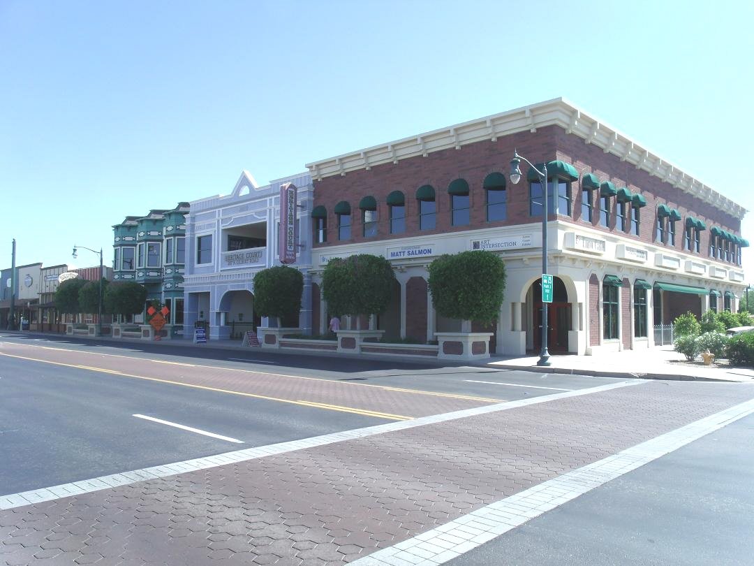
Gilbert-Gilbert Heritage District as viewed from Gilbert Rd.Photo: Tony the Marine · CC BY-SA 3.0
A−Outdoors
Outdoors in Gilbert

Virtually every resident lives within a half mile of a park in Gilbert

Virtually every resident lives within a half mile of a park. 62 miles of mapped trail cross Gilbert, 0.9 per square mile of land. The biggest trail networks: Riparian Preserve at Water Ranch (3.2 mi), Desert Sky Park (2.2 mi), Crossroads Park (1.3 mi).

Ahead of 78% of U.S. towns · #45 of 140 in Arizona. What drives it

Conserved land
4%
1,525 acres · of 68.8 sq mi of land
Trails
62 mi
0.9 per sq mi of land
Park land
3,283 ac
12 acres per 1,000 residents
Near a park
99%+
of residents within ½ mile
Bike routes
332 mi
326 mi lanes · 6.1 mi paths
Lakes & rivers
17
2 boat launches

What kind of outdoors town is Gilbert?

Read from the map. The page puts what stands out first.

Outdoors grade

How much outdoors does Gilbert have?

On conserved land, trails, park land and how close residents live to a park, Gilbert is ahead of 78% of U.S. towns, #45 of 140 in Arizona. All four inputs are above most U.S. towns; the share of residents near a park ranks highest, park acres per resident lowest.

A−
OutdoorsA character grade: shown, never part of Gilbert’s overall grade.
All U.S. towns we grade (21,298)Ahead of 78%
LessMore
Arizona towns of 2,500+ (140)Ahead of 68%

Among the 400 U.S. cities of 100,000 or more, Gilbert ranks #214 on Outdoors.

Arizona towns conserve more land than most (a typical one, 14%; the U.S., 4%), so Gilbert’s 4% is ahead of 23% of Arizona towns, while its trails per square mile lead 42% of them.

How sure. Graded on any three of the four inputs instead, the letter would range from B to A. Trails and many small parks come from OpenStreetMap, mapped by volunteers, so coverage varies from town to town; the half mile is a straight line from each census block, so a river or highway in the way isn’t counted against it.

PAD-US, OpenStreetMap (© OpenStreetMap contributors), Census 2025 Gazetteer and 2020 blocks; details in Sources below. How TownRatings grades the outdoors →

The map

Conserved land, trails & bike routes

Tap a number to zoom to a park. Tap a layer to hide it.

12345678
Easements protect land from building but are usually private.© OpenStreetMap contributors · USGS PAD-US
Places to walk

Pick a walk

The longest trail network is Riparian Preserve at Water Ranch, with 3.2 miles. Directions go to the nearest trailhead or public parking.

Riparian Preserve at Water Ranch

Park
118 acres3.2 mi of trail
Tiger Moth TerritoryCattail CrawlRattlesnake Ridge TrailSandpiper Escape+1
Dog rules not recorded
Directionsto the parking lotWebsite ↗

Desert Sky Park

Managed by Town of Gilbert
149 acres2.2 mi of trail
Dog rules not recorded
Directionsto the parking lotWebsite ↗

Crossroads Park

Managed by Town of Gilbert
62 acres1.3 mi of trail
Dogs allowed
Directionsto the parking lotWebsite ↗

McQueen Park

Managed by Town of Gilbert
45 acres1 mi of trail
Sun Circle Trail
Dog rules not recorded
Directionsto the parking lotWebsite ↗

Gilbert Regional Park

Managed by Town of Gilbert
275 acres0.9 mi of trail
Dog rules not recorded
Directionsto the parking lotWebsite ↗

Freestone Park

Managed by Town of Gilbert
66 acres0.8 mi of trail
Dog rules not recorded
Directionsto the parking lot

Zanjero Park

Park
17 acres0.8 mi of trail
Dog rules not recorded
No trailhead mapped yet

Spectrum Park

Park
9 acres0.8 mi of trail
Dog rules not recorded
Directionsto the parking lot
All 101 parks & preserves
Riparian Preserve at Water Ranch118 acres · 3.2 mi of trail
Directions
Desert Sky Park149 acres · 2.2 mi of trail · Town of Gilbert
Directions
Crossroads Park62 acres · 1.3 mi of trail · Town of Gilbert
Directions
McQueen Park45 acres · 1 mi of trail · Town of Gilbert
Directions
Gilbert Regional Park275 acres · 0.9 mi of trail · Town of Gilbert
Directions
Freestone Park66 acres · 0.8 mi of trail · Town of Gilbert
Directions
Zanjero Park17 acres · 0.8 mi of trail
Spectrum Park9 acres · 0.8 mi of trail
Directions
Eastern Canal Trail31 acres · 0.6 mi of trail
Directions
Adora Trails Park11 acres · 0.6 mi of trail
Directions
Stratland Estates Park5 acres · 0.6 mi of trail
Discovery Park51 acres · 0.5 mi of trail · Town of Gilbert
Directions
Tern Park5 acres · 0.5 mi of trail
The Barn & Trail Side Community Park10 acres · 0.3 mi of trail
Directions
Ranch del Verde Park7 acres · 0.3 mi of trail
Cheyenne Park7 acres · 0.3 mi of trail
Penrose Park5 acres · 0.3 mi of trail
Splashpad Park4 acres · 0.3 mi of trail · Coronado Ranch HOA
The Groves Park3 acres · 0.3 mi of trail
Pirate Park3 acres · 0.3 mi of trail
Bridgeport Park2 acres · 0.3 mi of trail
Vermont Park2 acres · 0.3 mi of trail
Park Village Park9 acres · 0.2 mi of trail
Marlene Park9 acres · 0.2 mi of trail
Page Park5 acres · 0.2 mi of trail · Town of Gilbert
Directions
Circle G Park5 acres · 0.2 mi of trail
Directions
The Arbors Park3 acres · 0.2 mi of trail
Directions
Green Park3 acres · 0.2 mi of trail · Coronado Ranch HOA
Directions
Derringer Park3 acres · 0.2 mi of trail
Village III Park2 acres · 0.2 mi of trail
Riparian Preserve at Neely Ranch73 acres · 0.1 mi of trail
Directions
Evans Ranch Community Park5 acres · 0.1 mi of trail
Carol Rae Park5 acres · 0.1 mi of trail
Towne Meadows HOA Park5 acres · 0.1 mi of trail
Mirador Estates - Playground Equipment4 acres · 0.1 mi of trail
Gopher Park4 acres · 0.1 mi of trail · Coronado Ranch HOA
Directions
Oak Tree Park3 acres · 0.1 mi of trail
Melody Ranch Park2 acres · 0.1 mi of trail
Veterans Park2 acres · 0.1 mi of trail · Town of Gilbert
Directions
Vista Allegre Park2 acres · 0.1 mi of trail
Directions
Baranca Park2 acres · 0.1 mi of trail · Coronado Ranch HOA
Brittlebush Park1 acres · 0.1 mi of trail
Wateka Park1 acres · 0.1 mi of trail · Coronado Ranch HOA
Warbler Park1 acres · 0.1 mi of trail
Villa Madeira Park1 acres · 0.1 mi of trail
Fruitvale Park1 acres · 0.1 mi of trail
Gilbert Rodeo Park (Closed)45 acres
The Ranch Community Park21 acres
Calestenics Park Fitness21 acres
Cosmo Dog Park16 acres · Town of Gilbert
Directions
Amber Park16 acres
Shiloh Park15 acres
Nichols Park15 acres
The Islands Park14 acres
Linda Park12 acres
Lakeside Park10 acres
Ashland Ranch Neighborhood Park8 acres
Ashland Ranch Park South7 acres
Neely Ranch Park6 acres
Val Vista Lakes Rose Garden6 acres
Directions
Appaloosa Park6 acres
Sunview Park5 acres
Springtree Neighborhood Park5 acres
Lindsay Estate Park4 acres
Constellation Park4 acres
Annecy Park4 acres
Directions
Calistoga Park4 acres
Play Park4 acres
Directions
Finley Farms South Tot Lot Park3 acres
Sagebrush Park3 acres
Vaughn Avenue Basin Park3 acres
Directions
Baars Court3 acres
Kensington Estates Park3 acres
Annecy Park E3 acres
Cat F Park2 acres
John Allen Park2 acres
Directions
Bob & Sheilah Wagner Park2 acres
Mirador Estates - Gazebo Area2 acres
Circle Park2 acres
Stratford Neighborhood Park2 acres · Stratford
Windmill Park2 acres
Rancho del Verde Park2 acres
Magpie Park2 acres
Directions
Stuart Ave Park1 acres
Kimball Park1 acres · Coronado Ranch HOA
Spinnaker Bay Park1 acres
Patterson Point Park1 acres
Soccer Park1 acres · Coronado Ranch HOA
Banning Park1 acres
Apartment Park1 acres
Water Tower Plaza1 acres
Directions
Stratford West Park1 acres · Stratford
Mira Vista Place Park1 acres
Fencepost Lane Playground1 acres
Stratford East Park1 acres · Stratford
Nash Park1 acres
Little Park1 acres
Joshua Tree Park1 acres · Coronado Ranch HOA
Thornton Park1 acres · Coronado Ranch HOA
Mirador Estates - Connector1 acres
Church green belt/park1 acres
Who protects it

1,525 conserved acres

4% of Gilbert’s land. Who manages Gilbert’s conserved land, from the USGS Protected Areas Database. Approximate, because parcels can overlap.

Town or city1,488 ac
County33 ac
State Department of Land4 ac
Local Park · 1,205 acLocal Recreation Area · 169 acLocal Resource Management Area · 147 acState Resource Management Area · 4 ac
The biggest protected parcels
Parcel (PAD-US)Managed byAcresPublic access
Gilbert Regional Park
Local Park
Town or city444Open
Rittenhouse Basin
Local Park
Town or city218Open
South Area Water Recharge Site
Local Resource Management Area
Town or city147Open
Riparian Preserve @ Water Ranch
Local Park
Town or city118Open
Riparian Preserve @ Neely Ranch
Local Park
Town or city73Open
Freestone Park
Local Park
Town or city65Open
Gilbert Soccer Complex
Local Recreation Area
Town or city64Open
Crossroads Park
Local Park
Town or city52Open
Folley Park
Local Park
Town or city52Open
Discovery District Park
Local Park
Town or city48Open

5 smaller protected places aren’t shown.

Things to do

336 places to go in Gilbert

Beaches, playgrounds, peaks, falls and more. Pick a kind.

Playgrounds in Gilbert
Blue Park
Directions
Gilbert Youth Soccer Complex
Directions
Kindergarten playground
Directions
Mira Vista Park PlaygroundIn Mira Vista Place Park
Directions
Monkey Bars
Directions
Red Park
Directions
Splash PladIn Splashpad Park
Directions
Vineyards Park PlaygroundIn Play Park
Directions

290 playgrounds are on OpenStreetMap in all; the list shows named ones from the first 30.

Trails & water

8 named trails and 17 lakes & rivers

Named trails
Open to bikes · 14.6 miHorses · 8.2 miUnpaved · 20.6 mi
Sun Circle Trail0.4 mi
Tiger Moth Territory0.2 mi
Cattail Crawl0.2 mi
Rattlesnake Ridge Trail0.2 mi
Sandpiper Escape0.1 mi
Desert Willow Walk0.1 mi
Whispering Wind0.1 mi
Jackrabbit Jaunt0.1 mi
Lakes & rivers tap for directions
Biking & sports

332 miles of bike routes

Bike lanes are often missing from the map in smaller towns, so that number is likely low.

326 mi
painted or protected bike lanes
6.1 mi
off-road bike paths
0.2 mi
shoulders & shared lanes
Sun Circle TrailBike route
0.4 mi
Courts & fields
211Basketball
120Tennis
86Baseball
61Soccer
41Beach volleyball
34Pickleball
24Volleyball
24Football

Includes school and college facilities, which aren’t always open to the public.

History along the way

1 place on the National Register

The country’s official list of places worth saving (National Park Service). The map also marks 4 historic points from OpenStreetMap: plaques, memorials and old buildings.

History →
Gilbert Elementary SchoolBuilding · listed 1980
About it
When to get out

April is the best month for walking in Gilbert

NOAA’s 1991–2020 normals for the town and the daylight at its latitude. Outlined months have long days, highs of 59 to 86 °F and little rain for the place.

JanFebMarAprMayJunJulAugSepOctNovDec
Daylight (h)10.210.911.913.013.914.314.113.412.311.310.410.0
High (°F)6771788594104106104100897666
Rain (in)1.01.10.90.30.10.00.91.10.70.50.60.9

June is the driest month (under 0.1 in) and July the warmest (highs of 106 °F). 1.1 inches fall in February, the wettest month. Summer highs reach 106 °F, too hot for the outline. The climate in Gilbert →

Next door

Gilbert and its neighbors

Gilbert has the second most mapped trails of the 4 towns around it. Tap a town to see its outdoors.

TownConserved
of land
Trail mi
per sq mi
Park acres
per 1,000
Near a park
½ mile
Outdoors
Gilbert4%0.91299%+A−
Chandler4%0.91099%+A−
Mesa6%0.6898%B+
Queen Creek18%0.91393%A

The four inputs of the Outdoors grade, from the engine; shares are of land, not water.

Questions about parks and trails in Gilbert

Where can I hike in Gilbert?

The longest trail networks: Riparian Preserve at Water Ranch, 3.2 miles; Desert Sky Park, 2.2 miles; Crossroads Park, 1.3 miles; McQueen Park, 1 miles. Each one is on the map above, with directions to the nearest trailhead or parking.

How much of Gilbert is conserved land?

4% of its land, against a typical 14% for an Arizona town and 4% nationally (PAD-US). Conserved doesn’t always mean open to visitors: easements are usually private land.

Are dogs allowed on Gilbert’s trails?

OpenStreetMap records dogs as welcome at Crossroads Park. For the rest, check the signs at the trailhead.

Where can I bike in Gilbert?

332 miles of bike routes are on the map: 326 of painted or protected lanes, 6.1 of off-road paths and 0.2 of shoulders and shared lanes. Named routes: Sun Circle Trail.

Is there public land near Gilbert?

39,806 acres of parks and open public land lie inside Gilbert or within 10 miles of it (PAD-US), 3,283 of them inside the town line.

How much outdoors does Gilbert have?

Ahead of 78% of U.S. towns on the Outdoors grade, #45 of 140 in Arizona. The grade combines the share of land that is conserved, miles of mapped trail per square mile of land, park acres per 1,000 residents and the share of residents within a half mile of a park. It’s a character grade, so it isn’t part of the overall grade. How it works.

Trail talk

Conditions, parking and favorite walks from Gilbert neighbors.

Town Square →
Share a tip
Sources

Where this page comes from

Conserved and public land: USGS Protected Areas Database of the United States (PAD-US), service updated July 2026. Parks, trails, playgrounds, beaches and other places: OpenStreetMap (© OpenStreetMap contributors, ODbL), map data as of 2026-10-28. Land and water area: Census 2025 Gazetteer. Residents near a park: 2020 Census blocks. National Register: National Park Service. How TownRatings grades the outdoors →