
Tate's Hell State Forest
Tate's Hell State Forest is 212,645 acres (860 km2) of land in Franklin and Liberty counties in Florida.

A park & preserve, 10 mi northwest of Carrabelle
Carrabelle is the nearest base
Carrabelle is 10 miles southeast, with 6 places to stay. Where to stay ↓
Best months: Jan, Feb, Mar, Apr, Oct, Nov and Dec
January, February, March, April, October, November and December are the mild months, with highs of 63–81°. When to go ↓
Established in 1994
Tate's Hell State Forest dates from 1994. About ↓
Written from NOAA 1991–2020 normals, Overture places to stay, Census town figures, Wikidata and Wikipedia.
Weather, month by month
Typical highs and lows in Carrabelle. Green months are the mild ones.
Tate's Hell State Forest
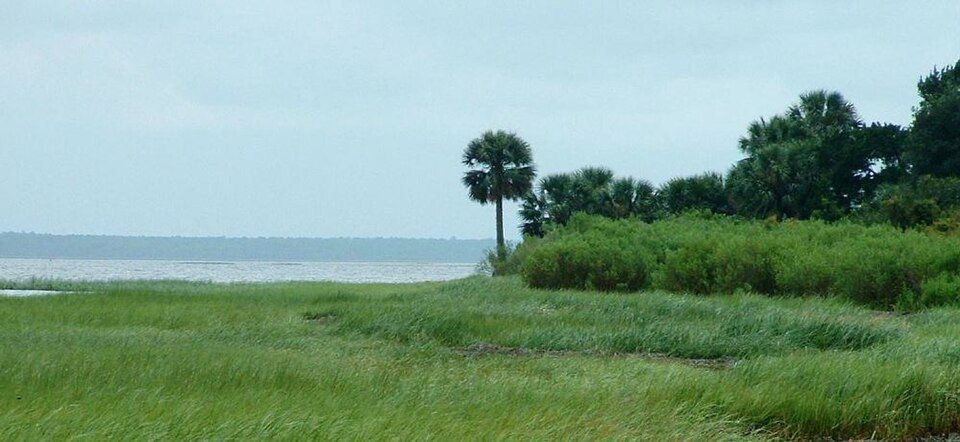
Tate's Hell State Forest is 212,645 acres (860 km2) of land in Franklin and Liberty counties in Florida. The forest is located near Carrabelle off US 98 along the Gulf coast and on St. James Island. At one time, Tate's Hell supported at least 12 major habitats including: wet flatwoods, wet prairie, seepage slope, baygall, floodplain forest, floodplain swamp, basin swamp, upland hardwood forest, sandhill, pine ridges, dense titi swamp thickets and scrub. Tate's Hell State Forest is an important hydrologic area and includes a section of the New River (Florida Panhandle). The forest's watershed provides fresh water into the Apalachicola Bay, the Carrabelle River and the Ochlockonee River.
- Type
- Park & preserve
- Established
- 1994
- Area
- 332 square miles
- Wikipedia readers
- 6.2K a year
Where to stay near Tate's Hell State Forest
The closest towns with hotels, motels or campgrounds are Carrabelle (6) and Apalachicola (13).
Carrabelle
The closest town with somewhere to stay.
2,572 people · 34% vacation homes
10 mi southeast of Tate's Hell State Forest
St. George Island
1,133 people · 31% vacation homes
19 mi south of Tate's Hell State Forest
Compare 7 towns
| Town | From Tate's Hell State Forest | Drive | Places to stay | People | Typical home |
|---|---|---|---|---|---|
| Carrabelle 34% vacation homes | 10 mi southeast | 15 min | 6 1 hotel · 1 motel · 1 inn or B&B · 3 RV parks | 2,572 | $218K |
| Apalachicola | 17 mi southwest | 25 min | 13 5 hotels · 1 motel · 3 inns & B&Bs · 4 lodges & cabins | 2,473 | $288K |
| St. George Island 31% vacation homes | 19 mi south | 30 min | 10 7 hotels · 1 inn or B&B · 2 lodges & cabins | 1,133 | $693K |
| Eastpoint | 12 mi south | 15 min | 2 1 motel · 1 RV park | 3,163 | $201K |
| Port St. Joe | 30 mi west | 45 min | 11 7 hotels · 1 inn or B&B · 1 lodge or cabins · 2 RV parks | 3,995 | $353K |
| Wewahitchka | 26 mi northwest | 40 min | 3 2 campgrounds · 1 RV park | 2,213 | $186K |
| Panacea 32% vacation homes | 27 mi east | 40 min | 3 1 motel · 2 RV parks | 894 | $106K |
Getting there
Nearest airports with airline service
Also near Tate's Hell State Forest
Other well-known places within 67 miles. Numbered ones are on the map above.
 47 mi Stadium & arenaDoak Campbell Stadium
 124 mi National forestApalachicola National Forest
 44 mi Park & preserveSt. Marks National Wildlife Refuge
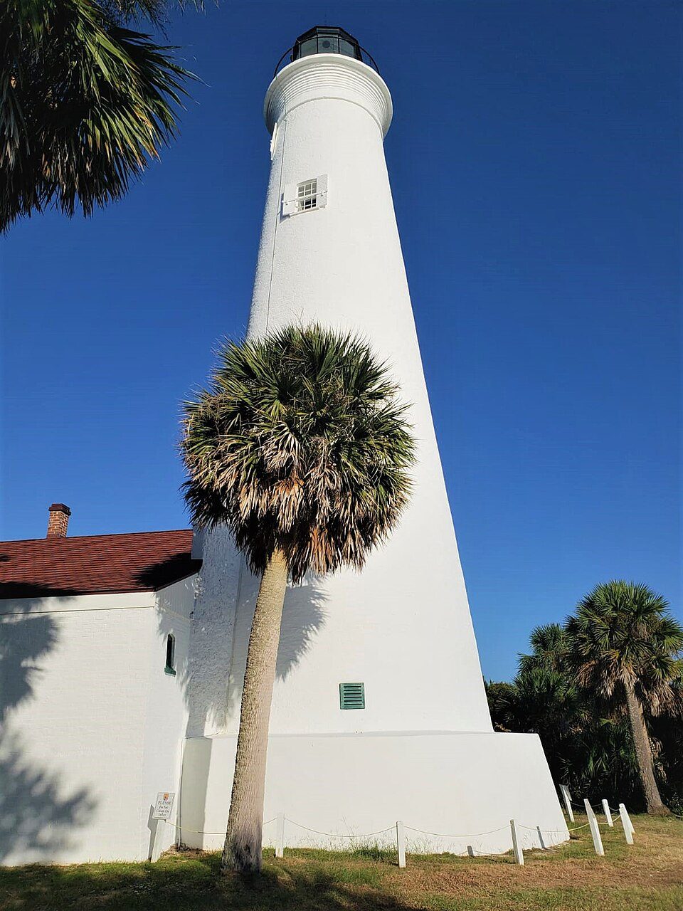 40 mi LighthouseSt. Marks Light
 66 mi CaveFlorida Caverns State Park55 mi Ancient sitePage-Ladson prehistory site
 44 mi MuseumTallahassee Museum
 210 mi MuseumCamp Gordon Johnston Museum
Photo credits
Doak Campbell Stadium: Mlsquad, CC BY-SA 4.0 · Apalachicola National Forest: Sallicio, Public domain · St. Marks National Wildlife Refuge: Tim Ross, Public domain · St. Marks Light: MaheshGonela, CC BY-SA 4.0 · Florida Caverns State Park: Tim Ross, Public domain · Tallahassee Museum: Tim Ross, Public domain · Camp Gordon Johnston Museum: PRpeep, CC BY-SA 4.0


Visiting Tate's Hell State Forest
What town is Tate's Hell State Forest near?
Carrabelle, FL, about 10 miles southeast.
When is the best time to visit Tate's Hell State Forest?
January, February, March, April, October, November and December, with highs of 63–81°.
What is the closest airport to Tate's Hell State Forest?
Tallahassee (TLH), about 44 miles away. The nearest big hub is Pensacola (PNS), about 146 miles.
Where should I stay near Tate's Hell State Forest?
Carrabelle (10 mi, 6 places to stay), Apalachicola (17 mi, 13 places to stay) and St. George Island (19 mi, 10 places to stay).
Tips from people in Carrabelle
No tips yet. Ask, or answer, in Carrabelle’s Town Square.
Sources: National Park Service · ski areas © OpenSkiMap / OpenStreetMap contributors · Wikidata · Wikipedia readership · NOAA climate normals · U.S. Census.