
Apalachicola National Forest
The Apalachicola National Forest is the largest U.S. National Forest in the state of Florida. It lies 15 mi southwest of Fort Braden. Its history begins in 1936.

A national forest, 15 mi southwest of Fort Braden
Plan where you’ll sleep
The nearest town with many places to stay is Midway, 22 miles northeast. Where to stay ↓
Summers are hot
June, July and August highs run 91–92°, and about 79 days a year reach 90°. When to go ↓
Best months: Jan, Feb, Mar, Apr, Oct, Nov and Dec
January, February, March, April, October, November and December are the mild months, with highs of 64–81°. When to go ↓
Established in 1936
Apalachicola National Forest dates from 1936. About ↓
Written from NOAA 1991–2020 normals, Overture places to stay, Census town figures, Wikidata and Wikipedia.
Choosing a month
A visit to Apalachicola National Forest can follow the seasons below.
Apalachicola National Forest
The Apalachicola National Forest is the largest U.S. National Forest in the state of Florida. It encompasses 635,019 acres (992.217 sq mi; 2,569.83 km2) of which 576,374 acres are under National Forest System management. It is the only national forest located in the Florida Panhandle. The National Forest provides water and land-based outdoors activities such as off-road biking, hiking, swimming, boating, hunting, fishing, horse-back riding, and off-road ATV usage.
- Type
- National forest
- Established
- 1936
- Area
- 879 square miles
- Elevation
- 98 ft
- Wikipedia readers
- 10K a year
Lodging near Apalachicola National Forest
Nearest for a night are Tallahassee (91) and Quincy (13).
Tallahassee
The closest town with somewhere to stay.
204,902 people
29 mi northeast of Apalachicola National Forest
Compare 8 towns
| Town | From Apalachicola National Forest | Drive | Places to stay | People | Typical home | Safety |
|---|---|---|---|---|---|---|
| Tallahassee | 29 mi northeast | 45 min | 91 76 hotels · 5 motels · 2 inns & B&Bs · 6 lodges & cabins · 2 campgrounds | 204,902 | $294K | D |
| Quincy | 23 mi north | 35 min | 13 6 hotels · 2 motels · 3 inns & B&Bs · 2 lodges & cabins | 8,162 | $126K | — |
| Midway | 22 mi northeast | 35 min | 6 6 hotels | 3,482 | $227K | — |
| Fort Braden | 15 mi northeast | 20 min | 2 1 lodge or cabins · 1 campground | 917 | $164K | — |
| Carrabelle 34% vacation homes | 26 mi south | 40 min | 6 1 hotel · 1 motel · 1 inn or B&B · 3 RV parks | 2,572 | $218K | — |
| Panacea 32% vacation homes | 22 mi southeast | 35 min | 3 1 motel · 2 RV parks | 894 | $106K | — |
| Bristol | 23 mi northwest | 35 min | 3 1 motel · 1 campground · 1 RV park | 936 | $119K | — |
| Blountstown | 27 mi northwest | 40 min | 4 3 motels · 1 lodge or cabins | 2,272 | $159K | — |
Getting there
Nearest airports with airline service
Places to add to Apalachicola National Forest
These lie within 53 miles as the crow flies.
 126 mi Stadium & arenaDoak Campbell Stadium
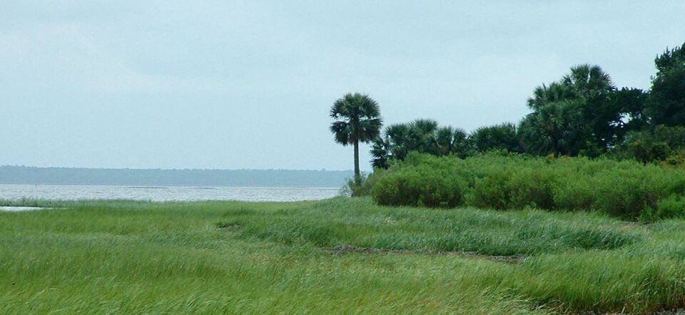 32 mi Park & preserveSt. Marks National Wildlife Refuge
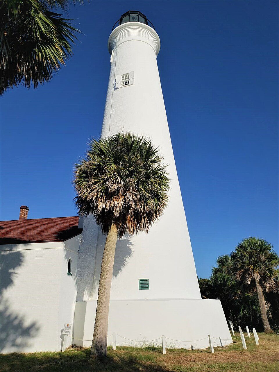 31 mi LighthouseSt. Marks Light
 224 mi Park & preserveTate's Hell State Forest
 52 mi CaveFlorida Caverns State Park
 323 mi MuseumTallahassee Museum
 52 mi MuseumPebble Hill Plantation
 426 mi MuseumCarnegie Library at FAMU
Photo credits
Doak Campbell Stadium: Mlsquad, CC BY-SA 4.0 · St. Marks National Wildlife Refuge: Tim Ross, Public domain · St. Marks Light: MaheshGonela, CC BY-SA 4.0 · Tate's Hell State Forest: The Bushranger, CC BY-SA 4.0 · Florida Caverns State Park: Tim Ross, Public domain · Tallahassee Museum: Tim Ross, Public domain · Pebble Hill Plantation: Bubba73, CC BY-SA 3.0 · Carnegie Library at FAMU: Tim Ross, Public domain


Quick answers on Apalachicola National Forest
What town is Apalachicola National Forest near?
Fort Braden, FL, about 15 miles northeast.
When is the best time to visit Apalachicola National Forest?
January, February, March, April, October, November and December, with highs of 64–81°.
What is the closest airport to Apalachicola National Forest?
Tallahassee (TLH), about 22 miles away. The nearest big hub is Pensacola (PNS), about 151 miles.
Where should I stay near Apalachicola National Forest?
Tallahassee (29 mi, 91 places to stay), Quincy (23 mi, 13 places to stay) and Midway (22 mi, 6 places to stay).
Tips for visiting, from Fort Braden
Nobody has posted a tip yet; ask or answer in Fort Braden’s Town Square.
Sources: National Park Service · ski areas © OpenSkiMap / OpenStreetMap contributors · Wikidata · Wikipedia readership · NOAA climate normals · U.S. Census.