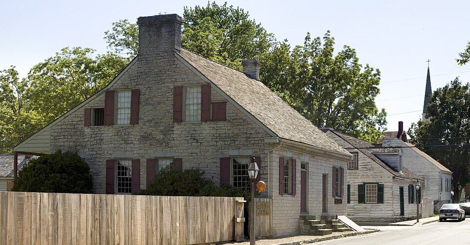
Ste. Genevieve National Historical Park
The Ste. Genevieve National Historical Park, established in 2020, consists of part or the whole of the area of the Ste. Genevieve Historic District, which is a historic district encompassing much of the built environment of Ste. Genevieve, Missouri, United States. Footfall in 2025 was 17K. For a second stop, Fort de Chartres is 9.5 mi away.

A national historical park inside Ste. Genevieve
Visits fell 31% in 2025
The National Park Service counted 16,525 visitors in 2025, down from 23,893 the year before.
Best month: Oct
October is mild and quieter than average, with a high of 70°. When to go ↓
You can stay in Ste. Genevieve
Ste. Genevieve National Historical Park is inside Ste. Genevieve, which has 8 places to stay, so you won’t need a base farther out. Where to stay ↓
Written from National Park Service visitor counts, NOAA 1991–2020 normals, Overture places to stay, Census town figures, Wikidata and Wikipedia. Updated when the Park Service posts a new month.
Busy months and weather
Use the months below to time a visit to Ste. Genevieve.
Ste. Genevieve National Historical Park
The Ste. Genevieve National Historical Park, established in 2020, consists of part or the whole of the area of the Ste. Genevieve Historic District, which is a historic district encompassing much of the built environment of Ste. Genevieve, Missouri, United States. The city was in the late 18th century the capital of Spanish Louisiana, and, at its original location a few miles south, capital of French Louisiana as well. A large area of the city, including fields along the Mississippi River, is a National Historic Landmark District designated in 1960, for its historically French architecture and land-use patterns, while a smaller area, encompassing the parts of the city historically important between about 1790 and 1950, was named separately to the National Register of Historic Places in 2002.
- Type
- National Historical Park
- Listed
- National Historic Landmark (1960) · National Register of Historic Places (1966)
- Wikipedia readers
- 2.6K a year
- Official site
- nps.gov/stge
Before you set off
Lodging near Ste. Genevieve National Historical Park
To stay close, try Ste. Genevieve (8) and Perryville (6).
Prairie du Rocher
510 people
8 mi northwest of Ste. Genevieve Welcome Center · 8 mi to the park
Perryville
8,593 people
20 mi southeast of Ste. Genevieve Welcome Center · 17 mi to the park
Compare 8 towns
| Town | From the visitor center | Drive | Places to stay | People | Typical home | Safety |
|---|---|---|---|---|---|---|
| Ste. Genevieve | in town | — | 8 3 hotels · 5 inns & B&Bs | 5,065 | $172K | — |
| Prairie du Rocher | 8 mi northwest | 10 min | 2 2 inns & B&Bs | 510 | $89K | — |
| Perryville | 20 mi southeast | 30 min | 6 4 hotels · 1 inn or B&B · 1 campground | 8,593 | $180K | C+ |
| Sparta | 20 mi northeast | 30 min | 6 3 hotels · 1 motel · 1 inn or B&B · 1 lodge or cabins | 4,022 | $111K | C+ |
| Chester | 12 mi east | 20 min | 2 2 hotels | 6,847 | $112K | A |
| Farmington | 25 mi southwest | 40 min | 10 9 hotels · 1 hostel | 19,226 | $197K | D |
| Red Bud | 16 mi north | 25 min | 2 1 motel · 1 inn or B&B | 3,761 | $171K | — |
| Goose Creek Lake 73% vacation homes | 16 mi west | 25 min | 2 1 hotel · 1 lodge or cabins | 481 | $133K | — |
Getting there
Nearest airports with airline service, from the visitor center
Close to Ste. Genevieve
These well-known sights sit within 51 miles.
 Big draw47 mi State parkCahokia
 Big draw46 mi Stadium & arenaThe Dome at America's Center
 45 mi Stadium & arenaBusch Stadium
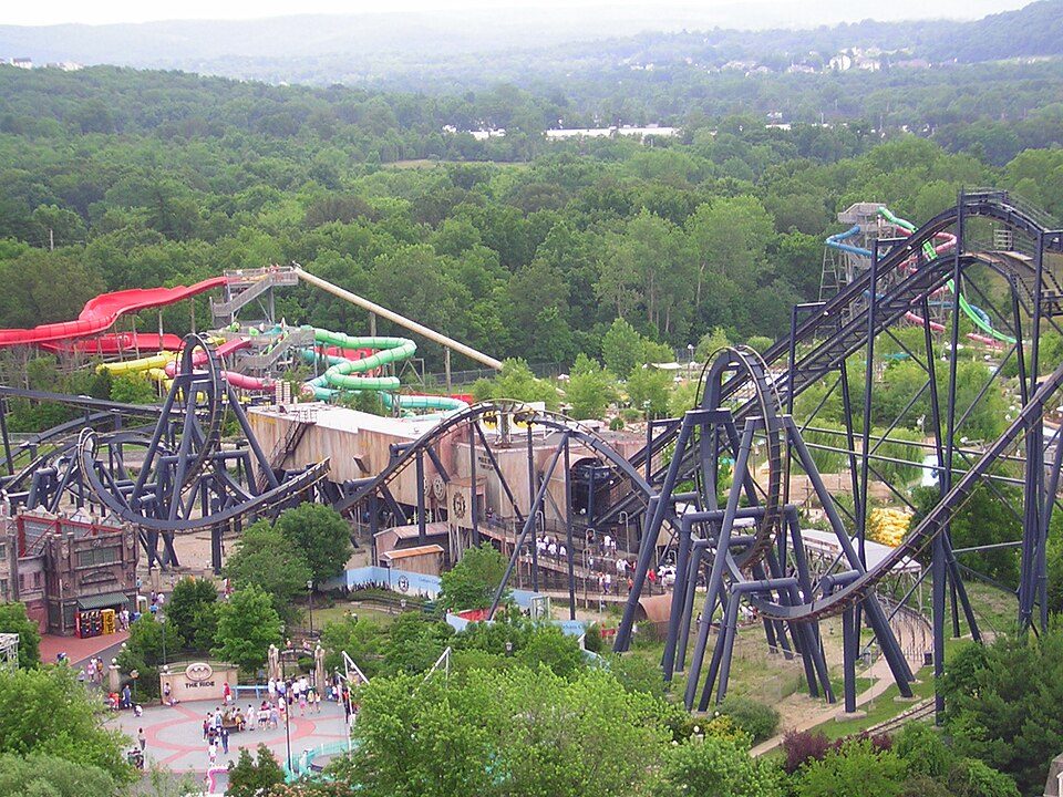 50 mi Theme parkMid America Adventure
 45 mi National ParkGateway Arch National Park2.2M visitors a year
 47 mi LandmarkMonks Mound
 46 mi Stadium & arenaEnterprise Center
 110 mi LandmarkFort de Chartres
Photo credits
Cahokia: Thank You (24 Millions ) views, CC BY 2.0 · The Dome at America's Center: Paul Sableman, CC BY 2.0 · Busch Stadium: Lee Ann Ratledge, CC BY 4.0 · Mid America Adventure: Chris Hagerman from New Port Richey, FL, US, CC BY 2.0 · Gateway Arch National Park: Daniel Schwen, CC BY-SA 4.0 · Monks Mound: Skubasteve834, CC BY-SA 3.0 · Enterprise Center: Haaron755, CC BY-SA 3.0 · Fort de Chartres: Kbh3rd, CC BY 3.0


Questions before you go
Is Ste. Genevieve National Historical Park in Ste. Genevieve?
Yes. It’s inside Ste. Genevieve, MO. The address is Ste. Genevieve National Historical Park, Ste. Genevieve, MO 63670.
When is the best time to visit Ste. Genevieve National Historical Park?
October, with a high of 70°. August is the busiest month (about 2,853 visitors).
How many people visit Ste. Genevieve National Historical Park each year?
16,525 in 2025, according to the National Park Service. The record is 23,893, set in 2024.
What is the closest airport to Ste. Genevieve National Historical Park?
Scott AFB/Midamerica (BLV), about 41 miles away. The nearest big hub is St. Louis Lambert (STL), about 56 miles.
Where should I stay near Ste. Genevieve National Historical Park?
Ste. Genevieve (in town, 8 places to stay), Perryville (20 mi, 6 places to stay) and Sparta (20 mi, 6 places to stay).
Tips from people in Ste. Genevieve
Questions and tips go in Ste. Genevieve’s Town Square.
Sources: National Park Service · ski areas © OpenSkiMap / OpenStreetMap contributors · Wikidata · Wikipedia readership · National Park Service visitor use statistics · NOAA climate normals · U.S. Census.