
Petit Jean State Park
Petit Jean State Park is a 3,471-acre (1,405 ha) park in Conway County, Arkansas managed by the Arkansas Department of Parks and Tourism. Head 9 mi south of Atkins to reach it. It dates back to 1923.

A state park, 9 mi south of Atkins
Summers are hot
July and August highs run 92–93°, and about 73 days a year reach 90°. When to go ↓
Morrilton is the nearest base
Morrilton is 11 miles east, with 8 places to stay. Where to stay ↓
Best months: Mar, Apr, May and Oct
March, April, May and October are the mild months, with highs of 64–81°. When to go ↓
Established in 1923
Petit Jean State Park dates from 1923. About ↓
Written from NOAA 1991–2020 normals, Overture places to stay, Census town figures, Wikidata and Wikipedia.
When to go
Every month near Petit Jean is set out below.
Petit Jean State Park
Petit Jean State Park is a 3,471-acre (1,405 ha) park in Conway County, Arkansas managed by the Arkansas Department of Parks and Tourism. It is located on top of Petit Jean Mountain next to the Arkansas River in the area between the Ouachita Mountains and the Ozark Plateaus.
- Type
- State park
- Established
- 1923
- Wikipedia readers
- 12K a year
A base for Petit Jean State Park
The nearest towns with places to stay are Russellville (23) and Morrilton (8), and Little Rock has the most rooms in the area (113).
Russellville
The closest town with somewhere to stay.
29,521 people
16 mi northwest of Petit Jean
Little Rock
The most places to stay in the area, and a base for a longer trip.
206,427 people
42 mi southeast of Petit Jean
Compare 9 towns
| Town | From Petit Jean | Drive | Places to stay | People | Typical home | Safety |
|---|---|---|---|---|---|---|
| Russellville | 16 mi northwest | 25 min | 23 15 hotels · 3 motels · 1 lodge or cabins · 3 campgrounds · 1 RV park | 29,521 | $172K | C− |
| Morrilton | 11 mi east | 15 min | 8 6 hotels · 2 RV parks | 7,195 | $161K | D |
| Conway | 27 mi east | 40 min | 24 17 hotels · 3 motels · 3 inns & B&Bs · 1 lodge or cabins | 72,328 | $252K | C− |
| Perryville | 10 mi southeast | 15 min | 3 1 hotel · 2 RV parks | 1,408 | $134K | — |
| Atkins | 9 mi north | 15 min | 1 1 RV park | 2,868 | $124K | C |
| Pottsville | 11 mi northwest | 15 min | 1 1 lodge or cabins | 3,326 | $172K | A |
| London | 23 mi northwest | 35 min | 3 1 lodge or cabins · 2 campgrounds | 1,061 | $100K | — |
| Houston | 15 mi east | 20 min | 1 1 hotel | 149 | $85K | — |
| Little Rock | 42 mi southeast | 1 hr | 113 93 hotels · 12 motels · 4 inns & B&Bs · 3 lodges & cabins · 1 campground | 206,427 | $236K | D− |
Getting there
Nearest airports with airline service
More near Petit Jean
Places worth adding lie within 61 miles.
 42 mi National ParkHot Springs National Park2.5M visitors a year
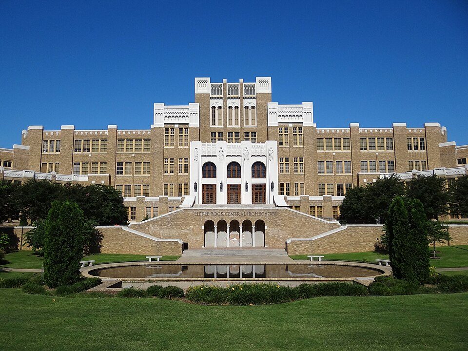 45 mi National Historic SiteLittle Rock Central High School National Historic Site49K visitors a year
 40 mi MountainMount Magazine
 46 mi MuseumClinton Presidential Center
 60 mi National RiverBuffalo National River1.4M visitors a year41 mi Theme parkMagic Springs and Crystal Falls
 45 mi Stadium & arenaSimmons Bank Arena43 mi Zoo & aquariumLittle Rock Zoo
Photo credits
Hot Springs National Park: Unknown, Public domain · Little Rock Central High School National Historic Site: Adam Jones, Ph.D., CC BY-SA 3.0 · Mount Magazine: Fredlyfish4, CC BY-SA 3.0 · Clinton Presidential Center: Archipreneur, CC BY-SA 3.0 · Buffalo National River: Mattsrealm, CC BY-SA 4.0 · Simmons Bank Arena: Quintin Soloviev, CC BY 4.0


Your questions on Petit Jean
What town is Petit Jean State Park near?
Atkins, AR, about 9 miles north.
When is the best time to visit Petit Jean State Park?
March, April, May and October, with highs of 64–81°.
What is the closest airport to Petit Jean State Park?
Memorial Field (HOT), about 45 miles away. The nearest big hub is Frederick W. Smith (MEM), about 167 miles.
Where should I stay near Petit Jean State Park?
Russellville (16 mi, 23 places to stay), Morrilton (11 mi, 8 places to stay) and Little Rock (42 mi, 113 places to stay).
Tips from people in Atkins
Tips will appear here once someone posts in Atkins’s Town Square.
Sources: National Park Service · ski areas © OpenSkiMap / OpenStreetMap contributors · Wikidata · Wikipedia readership · NOAA climate normals · U.S. Census.