
National Historic Oregon Trail Interpretive Center
The National Historic Oregon Trail Interpretive Center is a 23,000-square-foot (2,100 m2) interpretive center about the Oregon Trail located 6 miles (9.7 km) northeast of Baker City, Oregon on Oregon Route 86 atop Flagstaff Hill. It dates from 1992. Expect 75–77°F afternoons in the mildest months, June and September.

A museum, 6 mi northeast of Baker City
Winters are cold
January nights drop to 20°. When to go ↓
Baker City is the nearest base
Baker City is 6 miles southwest, with 24 places to stay. Where to stay ↓
Best months: Jun and Sep
June and September are the mild months, with highs of 75–77°. When to go ↓
Established in 1992
National Historic Oregon Trail Interpretive Center dates from 1992. About ↓
Written from NOAA 1991–2020 normals, Overture places to stay, Census town figures, Wikidata and Wikipedia.
Weather, month by month
Below are typical highs and lows near National Historic Oregon Trail Interpretive Center.
National Historic Oregon Trail Interpretive Center
The National Historic Oregon Trail Interpretive Center is a 23,000-square-foot (2,100 m2) interpretive center about the Oregon Trail located 6 miles (9.7 km) northeast of Baker City, Oregon on Oregon Route 86 atop Flagstaff Hill. It is operated by the Bureau of Land Management in partnership with Trail Tenders and the Oregon Trail Preservation Trust, and offers living history demonstrations, interpretive programs, exhibits, multi-media presentations, special events, and more than four miles (6 km) of interpretive trails.
Exhibit themes include area natural history, pre-emigrant travelers and explorers, Native Americans, pioneer life, the United States General Land Office and Bureau of Land Management, and the mining and settlement of Northeast Oregon.
- Type
- Museum
- Established
- 1992
- Wikipedia readers
- 1.1K a year
Towns to stay in near National Historic Oregon Trail Interpretive Center
Close by, places to stay are in Baker City (24) and Sumpter (5).
Baker City
The closest town with somewhere to stay.
10,071 people
6 mi southwest of National Historic Oregon Trail Interpretive Center
Sumpter
205 people · 53% vacation homes
24 mi west of National Historic Oregon Trail Interpretive Center
North Powder
500 people
18 mi northwest of National Historic Oregon Trail Interpretive Center
Compare 5 towns
| Town | From National Historic Oregon Trail Interpretive Center | Drive | Places to stay | People | Typical home |
|---|---|---|---|---|---|
| Baker City | 6 mi southwest | 10 min | 24 9 hotels · 6 motels · 5 inns & B&Bs · 1 lodge or cabins · 1 campground · 2 RV parks | 10,071 | $271K |
| Sumpter 53% vacation homes | 24 mi west | 35 min | 5 2 inns & B&Bs · 3 RV parks | 205 | — |
| North Powder | 18 mi northwest | 25 min | 1 1 motel | 500 | $142K |
| Union | 28 mi north | 40 min | 2 1 hotel · 1 campground | 2,118 | $231K |
| Richland | 28 mi east | 40 min | 1 1 RV park | 169 | $210K |
Getting there
Nearest airports with airline service
Places to add to National Historic Oregon Trail Interpretive Center
Other well-known places within 67 miles.
 66 mi Canyon & gorgeHells Canyon
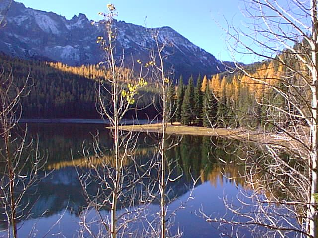 64 mi National forestMalheur National Forest
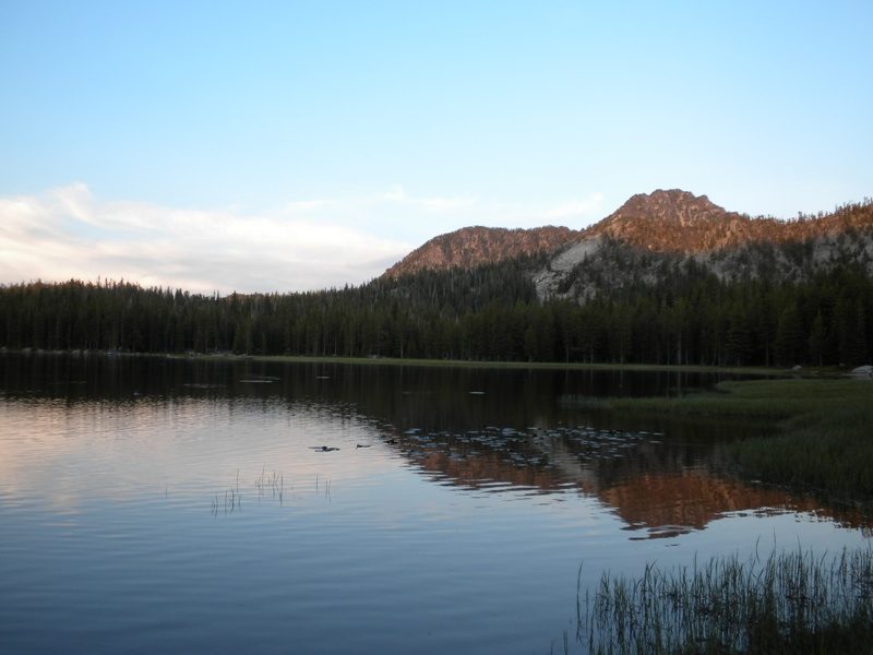 127 mi Ski areaAnthony Lakes Mountain Resort23 runs · 806 ft vertical
 66 mi MuseumKam Wah Chung & Co. Museum44 mi Ski areaFerguson Ridge Ski Area17 runs · 653 ft vertical
 62 mi MuseumRinehart Stone House Museum
Photo credits
Hells Canyon: Unknown, Public domain · Malheur National Forest: United States Forest Service, Public domain · Anthony Lakes Mountain Resort: Sadie_Girl, CC BY 2.0 · Kam Wah Chung & Co. Museum: Gary Halvorson, Oregon State Archives, Attribution · Rinehart Stone House Museum: Surv1v4l1st, Public domain


Before visiting National Historic Oregon Trail Interpretive Center
What town is National Historic Oregon Trail Interpretive Center near?
Baker City, OR, about 6 miles southwest.
When is the best time to visit National Historic Oregon Trail Interpretive Center?
June and September, with highs of 75–77°.
What is the closest airport to National Historic Oregon Trail Interpretive Center?
McCall Municipal (MYL), about 80 miles away. The nearest big hub is Boise Air Terminal/Gowen Field (BOI), about 114 miles.
Where should I stay near National Historic Oregon Trail Interpretive Center?
Baker City (6 mi, 24 places to stay) and Sumpter (24 mi, 5 places to stay).
Questions for Baker City
Tips will appear here once someone posts in Baker City’s Town Square.
Sources: National Park Service · ski areas © OpenSkiMap / OpenStreetMap contributors · Wikidata · Wikipedia readership · NOAA climate normals · U.S. Census.