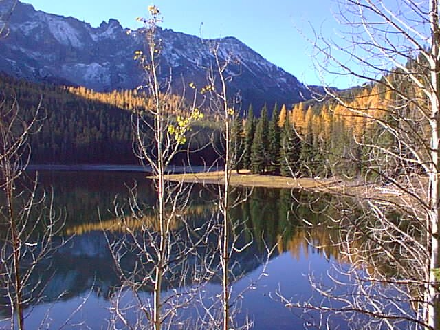
Malheur National Forest
The Malheur National Forest is a National Forest in the U.S. state of Oregon. Head 11 mi southeast of Canyon City to reach it. Running it is the United States Forest Service.

A national forest, 11 mi southeast of Canyon City
No airline airport nearby
The closest airport with airline service is Eastern Oregon Regional Airport at Pendleton (PDT), 98 miles away.
Winters are cold
January nights drop to 21°. When to go ↓
John Day is the nearest base
John Day is 13 miles northwest, with 10 places to stay. Where to stay ↓
Best month: Jun
June is the mild month, with a high of 77°. When to go ↓
Written from NOAA 1991–2020 normals, Overture places to stay, Census town figures, Wikidata and Wikipedia.
The year’s weather
Every month near Malheur National Forest is set out below.
Malheur National Forest
The Malheur National Forest is a National Forest in the U.S. state of Oregon. It contains more than 1.4 million acres (5,700 km2) in the Blue Mountains of eastern Oregon. The forest consists of high desert grasslands, sage, juniper, pine, fir, and other tree species. Elevations vary from about 4,000 feet (1,200 m) to the 9,038-foot (2,755 m) peak of Strawberry Mountain. The Strawberry Mountains of eastern Oregon extend east to west through the center of the forest. U.S. Route 395 runs south to north through the forest, while U.S. Route 26 runs east to west.
- Type
- National forest
- Run by
- United States Forest Service
- Wikipedia readers
- 12K a year
Towns to stay in near Malheur National Forest
Places to stay start in John Day (10).
John Day
The closest town with somewhere to stay.
1,634 people
13 mi northwest of Malheur National Forest
Compare 5 towns
| Town | From Malheur National Forest | Drive | Places to stay | People | Typical home |
|---|---|---|---|---|---|
| John Day | 13 mi northwest | 20 min | 10 3 hotels · 2 motels · 2 lodges & cabins · 2 campgrounds · 1 RV park | 1,634 | $212K |
| Canyon City | 11 mi northwest | 15 min | 2 1 inn or B&B · 1 RV park | 644 | $201K |
| Prairie City | 13 mi north | 20 min | 2 2 hotels | 819 | $206K |
| Seneca | 14 mi southwest | 20 min | 1 1 hotel | 160 | $156K |
| Mount Vernon | 19 mi northwest | 30 min | 1 1 motel | 545 | $143K |
Getting there
Nearest airports with airline service
Beyond Malheur National Forest
Places worth adding lie within 64 miles.
 46 mi National MonumentJohn Day Fossil Beds National Monument131K visitors a year
 113 mi MuseumKam Wah Chung & Co. Museum
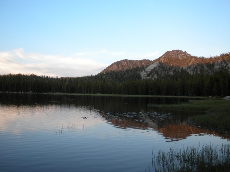 54 mi Ski areaAnthony Lakes Mountain Resort23 runs · 806 ft vertical
 64 mi MuseumNational Historic Oregon Trail Interpretive Center
Photo credits
John Day Fossil Beds National Monument: Finetooth, CC BY-SA 3.0 · Kam Wah Chung & Co. Museum: Gary Halvorson, Oregon State Archives, Attribution · Anthony Lakes Mountain Resort: Sadie_Girl, CC BY 2.0 · National Historic Oregon Trail Interpretive Center: John-Luc Metz, Bureau of Land Management Oregon and Washington, Public domain


Quick answers on Malheur National Forest
What town is Malheur National Forest near?
Canyon City, OR, about 11 miles northwest.
When is the best time to visit Malheur National Forest?
June, with a high of 77°.
What is the closest airport to Malheur National Forest?
Eastern Oregon Regional Airport at Pendleton (PDT), about 98 miles away. The nearest big hub is Boise Air Terminal/Gowen Field (BOI), about 137 miles.
Where should I stay near Malheur National Forest?
John Day (13 mi, 10 places to stay).
Advice from Canyon City
Ask a question, or answer one, in Canyon City’s Town Square.
Sources: National Park Service · ski areas © OpenSkiMap / OpenStreetMap contributors · Wikidata · Wikipedia readership · NOAA climate normals · U.S. Census.