
Gila Wilderness
Gila Wilderness was designated the world's first wilderness area on June 3, 1924. Its setting is 5 mi northwest of Gila Hot Springs. It goes back to 1964.

A park & preserve, 5 mi northwest of Gila Hot Springs
Plan where you’ll sleep
The nearest town with many places to stay is Silver City, 31 miles south. Where to stay ↓
Winters are cold
January nights drop to 18°. When to go ↓
Best month: Sep
September is the mild month, with a high of 82°. When to go ↓
Established in 1964
Gila Wilderness dates from 1964. About ↓
Written from NOAA 1991–2020 normals, Overture places to stay, Census town figures, Wikidata and Wikipedia.
The weather by month
Every month near Gila Wilderness is set out below.
Gila Wilderness
Gila Wilderness was designated the world's first wilderness area on June 3, 1924. Along with Aldo Leopold Wilderness and Blue Range Wilderness, the 558,014 acre (225,820 ha) (872 sq. mi.) wilderness is part of New Mexico's Gila National Forest. The wilderness is approximately 27 miles (43 km) from north to south and 39 miles (63 km) east to west.
U.S. Wilderness Areas do not allow motorized or mechanized vehicles, including bicycles. Camping, hunting, and fishing are allowed with proper permit, but no roads, buildings, logging, or mining are permitted. Wilderness areas within National Forests and Bureau of Land Management areas allow hunting in season.
- Type
- Park & preserve
- Established
- 1964
- Area
- 872 square miles
- Wikipedia readers
- 12K a year
Towns to stay in near Gila Wilderness
The nearest towns with places to stay are Gila Hot Springs (4) and Pinos Altos (4), and Silver City has the most rooms in the area (21).
Gila Hot Springs
The closest town with somewhere to stay.
10 people
5 mi southeast of Gila Wilderness
Silver City
The most places to stay in the area, and a base for a longer trip.
9,284 people
31 mi south of Gila Wilderness
Compare 8 towns
| Town | From Gila Wilderness | Drive | Places to stay | People | Typical home |
|---|---|---|---|---|---|
| Gila Hot Springs | 5 mi southeast | 5 min | 4 1 hotel · 1 lodge or cabins · 2 campgrounds | 10 | — |
| Pinos Altos | 26 mi south | 40 min | 4 1 hotel · 1 lodge or cabins · 1 campground · 1 RV park | 113 | $283K |
| Lake Roberts 100% vacation homes | 15 mi south | 25 min | 1 1 hotel | — | — |
| Lake Roberts Heights | 16 mi southeast | 25 min | 1 1 lodge or cabins | — | — |
| Little Walnut Village | 28 mi south | 40 min | 2 1 hotel · 1 lodge or cabins | 1,445 | $293K |
| Gila | 27 mi southwest | 40 min | 1 1 lodge or cabins | 366 | — |
| Buckhorn | 28 mi southwest | 45 min | 1 1 RV park | 76 | — |
| Silver City | 31 mi south | 45 min | 21 7 hotels · 3 motels · 3 inns & B&Bs · 4 lodges & cabins · 1 campground · 3 RV parks | 9,284 | $182K |
Getting there
Nearest airports with airline service
After Gila Wilderness
Other well-known places within 66 miles.
 1in town National MonumentGila Cliff Dwellings National Monument34K visitors a year
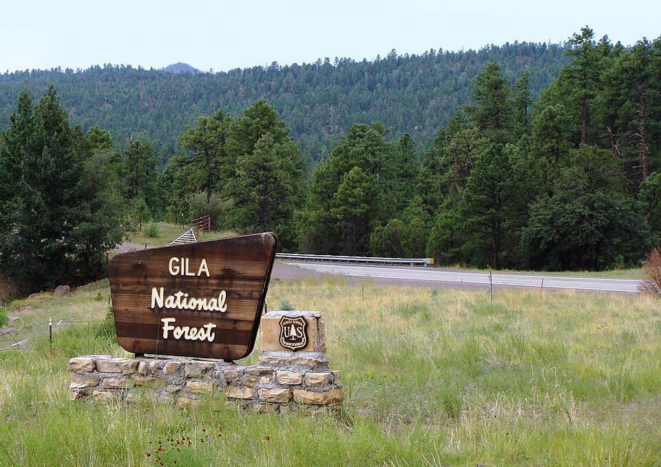 222 mi National forestGila National Forest62 mi LakeElephant Butte Reservoir
 65 mi National forestApache–Sitgreaves National Forests
 59 mi MuseumGeronimo Springs Museum
Photo credits
Gila Cliff Dwellings National Monument: not specified, Public domain · Gila National Forest: Zereshk, CC BY-SA 3.0 · Apache–Sitgreaves National Forests: Zereshk, CC BY-SA 3.0 · Geronimo Springs Museum: SteveStrummer, CC0


Asked about Gila Wilderness
What town is Gila Wilderness near?
Gila Hot Springs, NM, about 5 miles southeast.
When is the best time to visit Gila Wilderness?
September, with a high of 82°.
What is the closest airport to Gila Wilderness?
Grant County (SVC), about 42 miles away. The nearest big hub is El Paso (ELP), about 148 miles.
Where should I stay near Gila Wilderness?
Gila Hot Springs (5 mi, 4 places to stay), Silver City (31 mi, 21 places to stay) and Pinos Altos (26 mi, 4 places to stay).
Notes from people in Gila Hot Springs
Tips will appear here once someone posts in Gila Hot Springs’s Town Square.
Sources: National Park Service · ski areas © OpenSkiMap / OpenStreetMap contributors · Wikidata · Wikipedia readership · NOAA climate normals · U.S. Census.