
Apache–Sitgreaves National Forests
The Apache–Sitgreaves National Forests is a 2.76-million-acre (11,169 km2) United States national forest which runs along the Mogollon Rim and the White Mountains in east-central Arizona and into the U.S. state of New Mexico. Visitors find it 17 mi southwest of Alpine. It was established in 1974.

A national forest, 17 mi southwest of Alpine
Plan where you’ll sleep
The nearest town with many places to stay is Alpine, 17 miles northeast. Where to stay ↓
Winters are cold
January nights drop to 18°, with about 45" of snow a year. When to go ↓
Best months: Jun, Jul, Aug and Sep
June, July, August and September are the mild months, with highs of 70–77°. When to go ↓
Established in 1974
Apache–Sitgreaves National Forests dates from 1974. About ↓
Written from NOAA 1991–2020 normals, Overture places to stay, Census town figures, Wikidata and Wikipedia.
Month by month
Below are typical highs and lows near Apache–Sitgreaves National Forests.
Apache–Sitgreaves National Forests
The Apache–Sitgreaves National Forests is a 2.76-million-acre (11,169 km2) United States national forest which runs along the Mogollon Rim and the White Mountains in east-central Arizona and into the U.S. state of New Mexico. Formerly two forests, it is currently managed as one unit by USDA Forest Service from the Forest Supervisors Office in Springerville, Arizona. Apache–Sitgreaves has over 400 species of wildlife. With its high elevation and cool summer breezes it is a popular weekend destination from the hot desert for Phoenix, Arizona, residents. The forest is divided into 5 Ranger Districts (Clifton, Alpine, Springerville, Lakeside, and Black Mesa) that span almost 300 miles (480 km) from Clifton, Arizona in the east-central portion of Arizona to the eastern boundary of the Coconino National Forest in north-central Arizona.
- Type
- National forest
- Established
- 1974
- Area
- 4,104 square miles
- Wikipedia readers
- 7.3K a year
Where to stay near Apache–Sitgreaves National Forests
The closest towns with hotels, motels or campgrounds are Alpine (12) and Greer (28).
Alpine
The closest town with somewhere to stay.
55 people · 58% vacation homes
17 mi northeast of Apache–Sitgreaves National Forests
Compare 5 towns
| Town | From Apache–Sitgreaves National Forests | Drive | Places to stay | People | Typical home |
|---|---|---|---|---|---|
| Alpine 58% vacation homes | 17 mi northeast | 25 min | 12 1 hotel · 1 inn or B&B · 7 lodges & cabins · 1 campground · 2 RV parks | 55 | $378K |
| Greer 100% vacation homes | 27 mi north | 40 min | 28 4 hotels · 1 motel · 2 inns & B&Bs · 17 lodges & cabins · 2 campgrounds · 2 RV parks | — | — |
| Nutrioso | 22 mi north | 35 min | 1 1 campground | 427 | — |
| Rancho Grande | 25 mi east | 35 min | 1 1 inn or B&B | 254 | $205K |
| Alma | 29 mi southeast | 45 min | 1 1 campground | 52 | — |
Getting there
Nearest airports with airline service
Beyond Apache–Sitgreaves National Forests
Other well-known places within 66 miles.
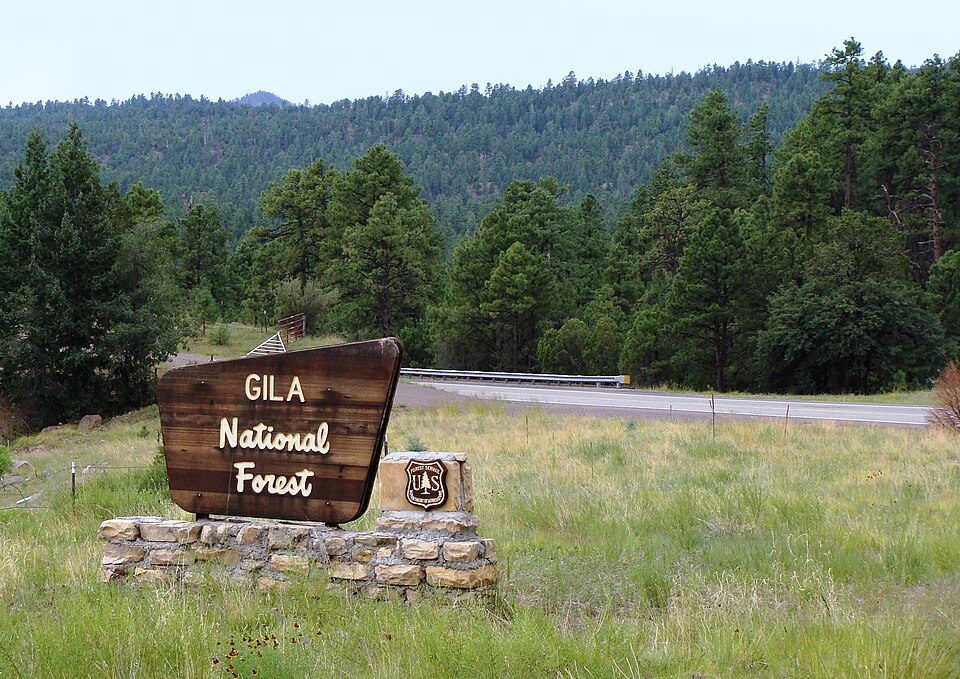 45 mi National forestGila National Forest
 65 mi National MonumentGila Cliff Dwellings National Monument32K visitors a year
 65 mi Park & preserveGila Wilderness
Photo credits
Gila National Forest: Zereshk, CC BY-SA 3.0 · Gila Cliff Dwellings National Monument: not specified, Public domain · Gila Wilderness: Gila National Forest, CC BY-SA 2.0


Good to know about Apache–Sitgreaves National Forests
What town is Apache–Sitgreaves National Forests near?
Alpine, AZ, about 17 miles northeast.
When is the best time to visit Apache–Sitgreaves National Forests?
June, July, August and September, with highs of 70–77°.
What is the closest airport to Apache–Sitgreaves National Forests?
Show Low Regional (SOW), about 60 miles away. The nearest big hub is Tucson (TUS), about 142 miles.
Where should I stay near Apache–Sitgreaves National Forests?
Alpine (17 mi, 12 places to stay) and Greer (27 mi, 28 places to stay).
Advice from Alpine
People in Alpine have not posted tips yet; their Town Square is open.
Sources: National Park Service · ski areas © OpenSkiMap / OpenStreetMap contributors · Wikidata · Wikipedia readership · NOAA climate normals · U.S. Census.