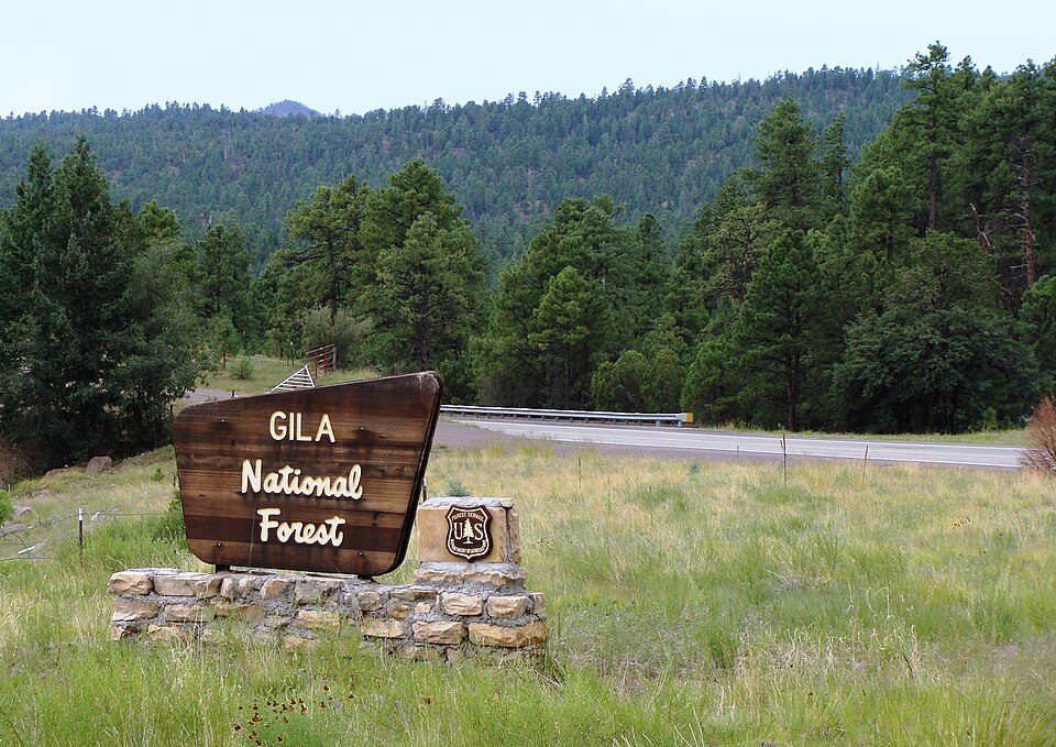
Gila National Forest
The Gila National Forest is a United States national forest in New Mexico. Visitors find it 16 mi east of Mogollon. It comes under the United States Forest Service.

A national forest, 16 mi east of Mogollon
Plan where you’ll sleep
No town within 30 miles has many hotels or campgrounds. Look at the towns below, or plan to camp. Where to stay ↓
Established in 1907
Gila National Forest dates from 1907 and is run by United States Forest Service. About ↓
Best months: May, Aug, Sep and Oct
May, August, September and October are the mild months, with highs of 70–82°. When to go ↓
Written from NOAA 1991–2020 normals, Overture places to stay, Census town figures, Wikidata and Wikipedia.
Weather, month by month
This is the year’s weather near Gila National Forest.
Gila National Forest
The Gila National Forest is a United States national forest in New Mexico. Established in 1905, it now covers approximately 2,710,659 acres (10,969.65 km2), making it the sixth largest national forest in the continental United States. The Forest administration also manage the part of the Apache National Forest in New Mexico which covers 614,202 acres for a total of 3.3 million acres managed by the Gila National Forest. Within the forest, the Gila Wilderness was established in 1924 as the US's first designated wilderness. The Aldo Leopold Wilderness and Blue Range Wilderness are also found within its borders. The Blue Range Primitive Area lies within Arizona in the neighboring Apache National Forest.
- Type
- National forest
- Established
- 1907
- Area
- 4,235 square miles
- Run by
- United States Forest Service
- Wikipedia readers
- 11K a year
Towns to stay in near Gila National Forest
Hotels, motels or campgrounds are closest in Glenwood (4) and Gila Hot Springs (4).
Glenwood
The closest town with somewhere to stay.
160 people
22 mi southwest of Gila National Forest
Compare 8 towns
| Town | From Gila National Forest | Drive | Places to stay | People | Typical home |
|---|---|---|---|---|---|
| Glenwood | 22 mi southwest | 35 min | 4 2 hotels · 1 lodge or cabins · 1 campground | 160 | — |
| Gila Hot Springs | 27 mi southeast | 40 min | 4 1 hotel · 1 lodge or cabins · 2 campgrounds | 10 | — |
| Mogollon 78% vacation homes | 16 mi west | 25 min | 1 1 inn or B&B | 8 | — |
| Reserve 32% vacation homes | 21 mi northwest | 30 min | 2 1 motel · 1 RV park | 311 | $123K |
| Alma | 22 mi west | 30 min | 1 1 campground | 52 | — |
| Pleasanton | 24 mi southwest | 35 min | 1 1 campground | 259 | $333K |
| Rancho Grande | 24 mi northwest | 35 min | 1 1 inn or B&B | 254 | $205K |
| Cruzville 63% vacation homes | 25 mi north | 40 min | 1 1 RV park | 22 | — |
Getting there
Nearest airports with airline service
Combine it with these
All of these are within 69 miles.
 122 mi National MonumentGila Cliff Dwellings National Monument34K visitors a year
 222 mi Park & preserveGila Wilderness
 45 mi National forestApache–Sitgreaves National Forests68 mi Ski areaSunrise Park Resort51 runs · 1,566 ft vertical
Photo credits
Gila Cliff Dwellings National Monument: not specified, Public domain · Gila Wilderness: Gila National Forest, CC BY-SA 2.0 · Apache–Sitgreaves National Forests: Zereshk, CC BY-SA 3.0


A visit to Gila National Forest: questions
What town is Gila National Forest near?
Mogollon, NM, about 16 miles west.
When is the best time to visit Gila National Forest?
May, August, September and October, with highs of 70–82°.
What is the closest airport to Gila National Forest?
Grant County (SVC), about 61 miles away. The nearest big hub is Albuquerque International Sunport (ABQ), about 155 miles.
Where should I stay near Gila National Forest?
Glenwood (22 mi, 4 places to stay) and Gila Hot Springs (27 mi, 4 places to stay).
Tips from people in Mogollon
Nobody has posted a tip yet; ask or answer in Mogollon’s Town Square.
Sources: National Park Service · ski areas © OpenSkiMap / OpenStreetMap contributors · Wikidata · Wikipedia readership · NOAA climate normals · U.S. Census.