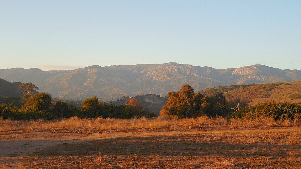
Douglas Family Preserve
The Douglas Family Preserve is a public park in Santa Barbara, California. A drive of 18 mi reaches Los Padres National Forest. For mild weather, aim for January to December (65–77°F highs).

A garden inside Santa Barbara
You can stay in Santa Barbara
Douglas Family Preserve is inside Santa Barbara, which has 88 places to stay, so you won’t need a base farther out. Where to stay ↓
A day trip from Los Angeles
Los Angeles is about 80 miles east (straight-line). Where to stay ↓
Best months: Jan, Feb, Mar, Apr, May, Jun, Jul, Aug, Sep, Oct, Nov and Dec
January, February, March, April, May, June, July, August, September, October, November and December are the mild months, with highs of 65–77°. When to go ↓
An airport 6 miles away
Santa Barbara Municipal (SBA) has airline service, about 6 miles from Douglas Family Preserve.
Written from NOAA 1991–2020 normals, Overture places to stay, Census town figures and Wikipedia.
Month by month
The months below show the weather around Douglas Family Preserve.
Douglas Family Preserve
The Douglas Family Preserve is a public park in Santa Barbara, California. The Preserve is located on the mesa above Arroyo Burro Beach. The property spans 70 acres (280,000 m2) of undeveloped ocean-front land, and represents the largest area of coastal open space within the city limits of Santa Barbara.
Although the official name of this area is the Douglas Family Preserve (see below), residents of Santa Barbara regularly refer to it by its older name, the Wilcox Property.
- Type
- Garden
- Wikipedia readers
- 1.1K a year
Nights near Douglas Family Preserve
The nearest towns with places to stay are Santa Barbara (88) and Goleta (13).
Compare 8 towns
| Town | From Douglas Family Preserve | Drive | Places to stay | People | Typical home | Safety |
|---|---|---|---|---|---|---|
| Santa Barbara | in town | — | 88 55 hotels · 6 motels · 23 inns & B&Bs · 1 lodge or cabins · 2 hostels · 1 RV park | 86,422 | $1,571K | D |
| Goleta | 8 mi west | 10 min | 13 12 hotels · 1 motel | 32,401 | $1,062K | C+ |
| Eastern Goleta Valley | 4 mi northwest | 5 min | 6 5 hotels · 1 campground | 28,295 | $1,362K | — |
| Carpinteria | 13 mi east | 20 min | 12 5 hotels · 4 motels · 2 inns & B&Bs · 1 lodge or cabins | 12,734 | $1,043K | C+ |
| University of California-Santa Barbara | 7 mi west | 10 min | 5 3 hotels · 2 campgrounds | 12,121 | $453K | — |
| San Buenaventura (Ventura) | 29 mi east | 45 min | 54 23 hotels · 17 motels · 6 inns & B&Bs · 2 lodges & cabins · 3 campgrounds · 3 RV parks | 109,914 | $827K | C− |
| Montecito | 6 mi east | 10 min | 2 2 hotels | 9,031 | $2,000K | — |
| Solvang | 27 mi northwest | 40 min | 23 14 hotels · 1 motel · 7 inns & B&Bs · 1 campground | 5,944 | $950K | B+ |
Day trip from
Straight-line miles.
Getting there
Nearest airports with airline service
Places to add to Douglas Family Preserve
Other well-known places within 65 miles.
 Big draw65 mi Theme parkSix Flags Magic Mountain3.2M visitors a year
 53 mi MuseumRonald Reagan Presidential Library
 118 mi National forestLos Padres National Forest
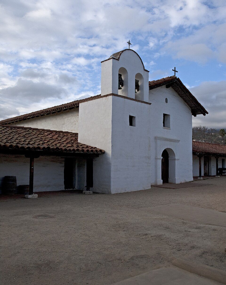 23 mi LandmarkPresidio of Santa Barbara
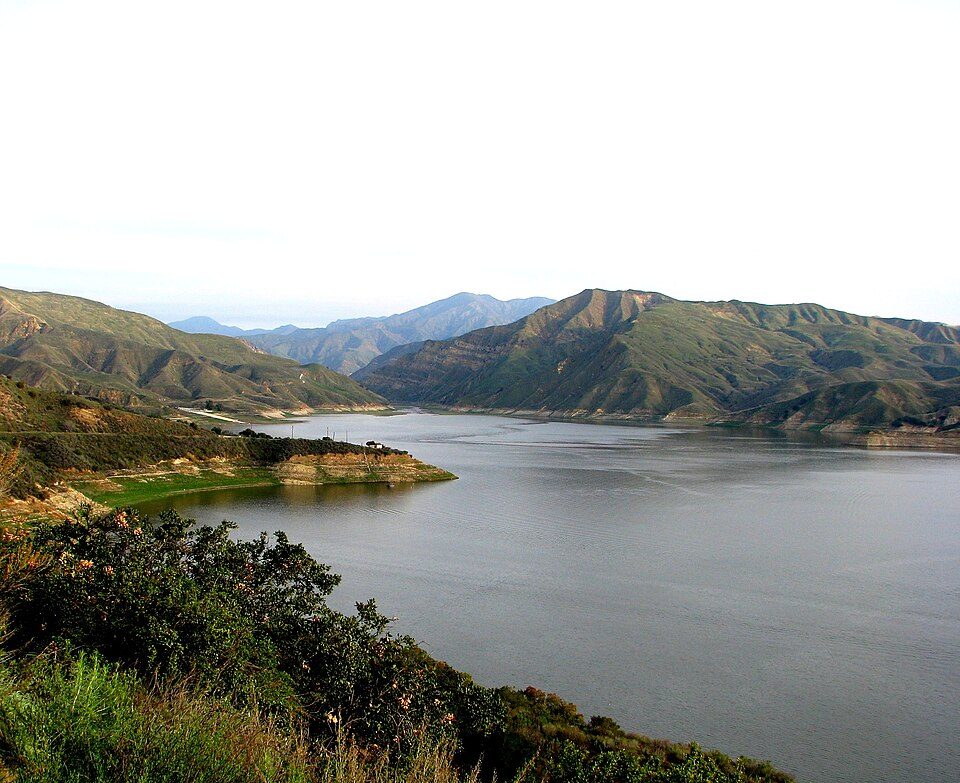 56 mi LakeLake Piru
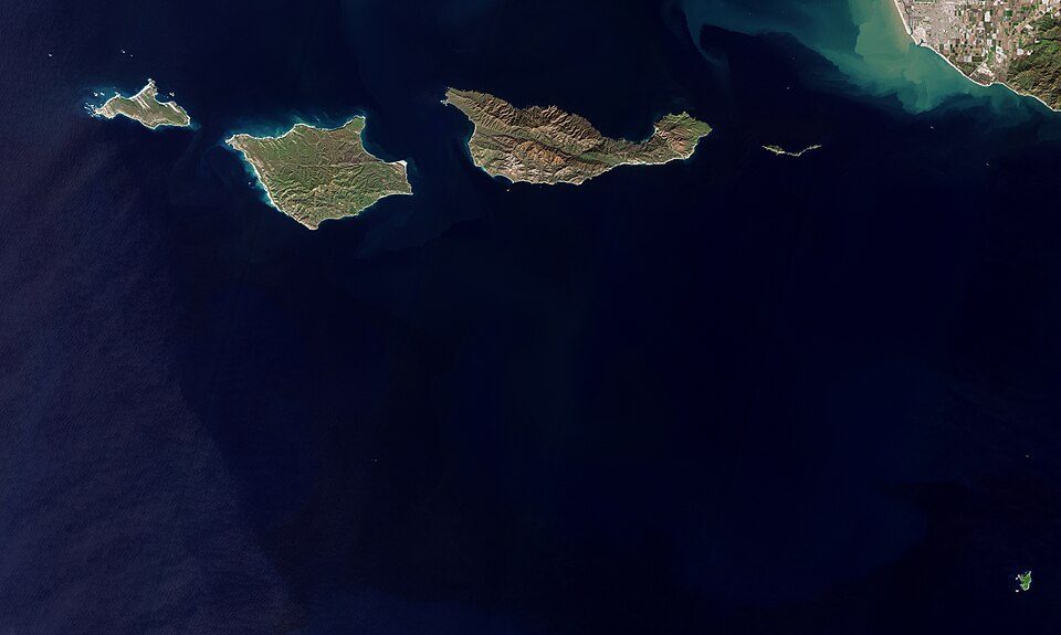 51 mi National ParkChannel Islands National Park227K visitors a year
 35 mi GardenLotusland
 60 mi MountainPoint Dume
Photo credits
Six Flags Magic Mountain: Alton, CC BY 3.0 · Ronald Reagan Presidential Library: Unknown authorUnknown author, Public domain · Los Padres National Forest: Taken by Antandrus, Public domain · Presidio of Santa Barbara: Ymblanter, CC BY-SA 3.0 · Lake Piru: tomsaint11, CC BY 2.0 · Channel Islands National Park: Copernicus Sentinel-2, ESA, CC BY-SA 3.0 igo · Lotusland: brewbooks from near Seattle, USA, CC BY-SA 2.0 · Point Dume: OMCV, Public domain


Questions about Douglas Family Preserve
Is Douglas Family Preserve in Santa Barbara?
Yes. It’s inside Santa Barbara, CA.
When is the best time to visit Douglas Family Preserve?
January, February, March, April, May, June, July, August, September, October, November and December, with highs of 65–77°.
How far is Douglas Family Preserve from Bakersfield and Los Angeles?
About 77 miles northeast of Bakersfield and about 80 miles east of Los Angeles, as the crow flies.
What is the closest airport to Douglas Family Preserve?
Santa Barbara Municipal (SBA), about 6 miles away. The nearest big hub is Hollywood Burbank/Bob Hope (BUR), about 80 miles.
Where should I stay near Douglas Family Preserve?
Santa Barbara (in town, 88 places to stay), Goleta (8 mi, 13 places to stay) and Eastern Goleta Valley (4 mi, 6 places to stay).
Ask people in Santa Barbara
There are no tips yet, so start one in Santa Barbara’s Town Square.
Sources: National Park Service · ski areas © OpenSkiMap / OpenStreetMap contributors · Wikidata · Wikipedia readership · NOAA climate normals · U.S. Census.