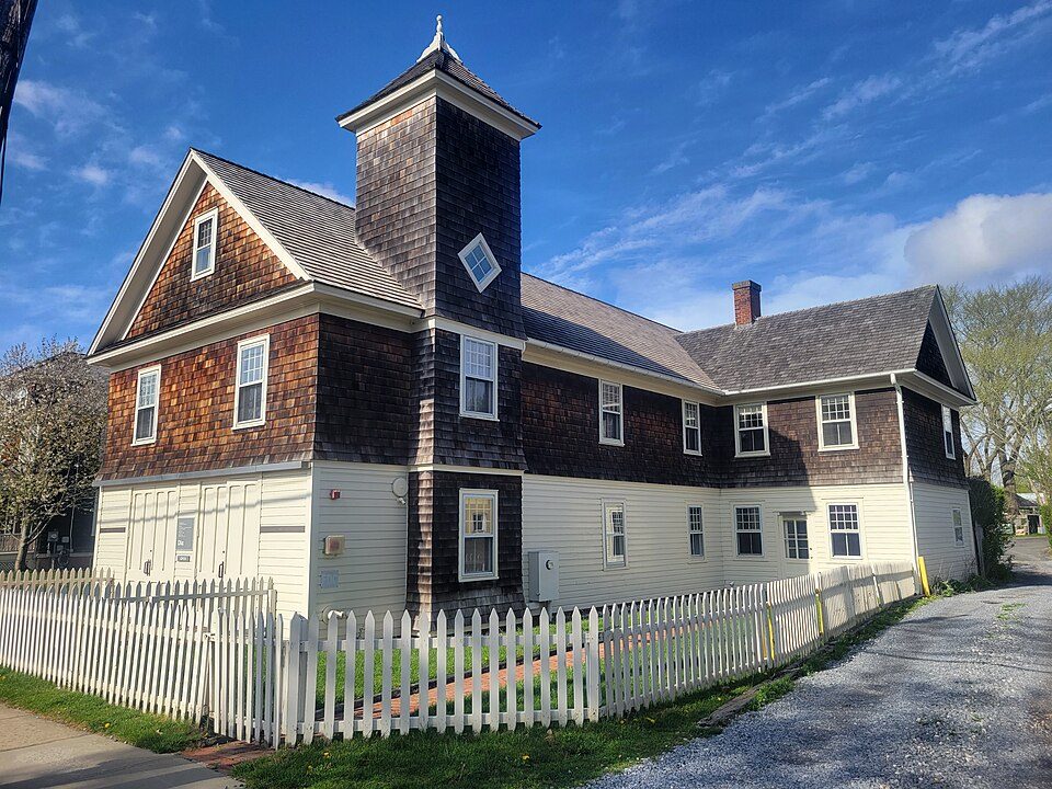
Dia Bridgehampton
Dia Bridgehampton is a museum in Bridgehampton, New York run by the Dia Art Foundation. You can find it in Southampton. For a second stop, Camp Hero is 25 mi away.

A museum inside Southampton
You can stay in Southampton
Dia Bridgehampton is inside Southampton, which has 65 places to stay, so you won’t need a base farther out. Where to stay ↓
A day trip from Hempstead
Hempstead is about 71 miles west (straight-line). Where to stay ↓
Best months: May, Jun, Jul, Aug, Sep and Oct
May, June, July, August, September and October are the mild months, with highs of 64–81°. When to go ↓
Written from NOAA 1991–2020 normals, Overture places to stay, Census town figures and Wikipedia.
The year’s weather
A visit to Dia Bridgehampton can follow the seasons below.
Dia Bridgehampton
Dia Bridgehampton is a museum in Bridgehampton, New York run by the Dia Art Foundation. Opened in 1983 as the Dan Flavin Art Institute, the building was renovated by Dia, under the direction of minimalist sculptor Dan Flavin, as a permanent display of his fluorescent light works in a single-artist museum. The museum also houses a gallery for temporary exhibitions, and a display of historic objects related to the building from before it became a museum.
The museum building was originally built in 1909 as a firehouse, and then used as a church from 1924 to 1979. This history is part of the reason Dan Flavin chose the building to house his work, and is referenced in some exhibits.
- Type
- Museum
Rooms near Dia Bridgehampton
Hotels, motels or campgrounds are closest in Southampton (65) and East Hampton (97).
Compare 8 towns
| Town | From Dia Bridgehampton | Drive | Places to stay | People | Typical home | Safety |
|---|---|---|---|---|---|---|
| Southampton 40% vacation homes | in town | — | 65 30 hotels · 5 motels · 19 inns & B&Bs · 7 lodges & cabins · 4 campgrounds | 71,601 | $928K | A− |
| East Hampton 47% vacation homes | 15 mi northeast | 20 min | 97 53 hotels · 12 motels · 20 inns & B&Bs · 8 lodges & cabins · 4 campgrounds | 29,400 | $1,179K | — |
| Southold 30% vacation homes | 14 mi north | 20 min | 50 18 hotels · 3 motels · 21 inns & B&Bs · 3 lodges & cabins · 5 campgrounds | 24,260 | $859K | B+ |
| East Hampton 63% vacation homes | 6 mi east | 10 min | 10 3 hotels · 6 inns & B&Bs · 1 lodge or cabins | 1,552 | $2,000K | — |
| Shelter Island 57% vacation homes | 9 mi north | 15 min | 13 4 hotels · 7 inns & B&Bs · 1 lodge or cabins · 1 campground | 3,351 | $1,104K | A− |
| Greenport 20% vacation homes | 12 mi north | 20 min | 18 9 hotels · 7 inns & B&Bs · 2 campgrounds | 2,590 | $961K | — |
| Southampton 55% vacation homes | 7 mi southwest | 10 min | 7 2 hotels · 1 motel · 3 inns & B&Bs · 1 lodge or cabins | 4,730 | $2,000K | B |
| Sag Harbor 44% vacation homes | 4 mi north | 5 min | 4 3 hotels · 1 inn or B&B | 2,841 | $1,616K | — |
Day trip from
Straight-line miles.
Getting there
Nearest airports with airline service
What else is near Dia Bridgehampton
These lie within 69 miles as the crow flies.
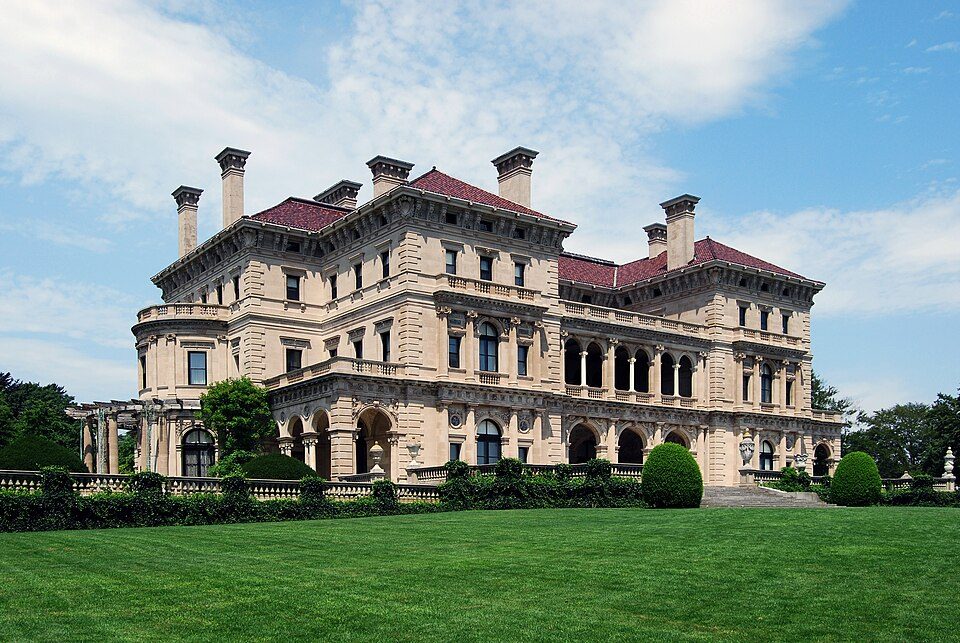 Big draw64 mi MuseumThe Breakers
 68 mi Ancient siteHMS Endeavour
 43 mi Stadium & arenaYale Bowl
 40 mi Stadium & arenaMohegan Sun Arena
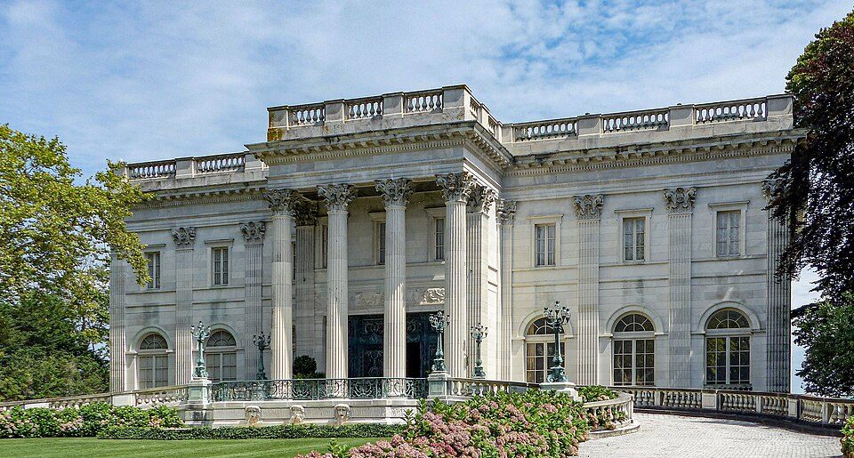 63 mi MuseumMarble House
 69 mi Stadium & arenaNassau Veterans Memorial Coliseum
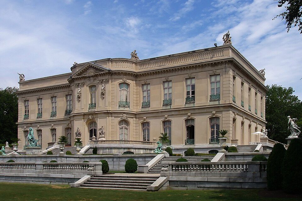 64 mi MuseumThe Elms
 125 mi State parkCamp Hero State Park
Photo credits
The Breakers: UpstateNYer, CC BY-SA 3.0 · HMS Endeavour: Samuel Atkins (c.1760-1810), Public domain · Yale Bowl: Kenneth Zirkel, CC BY-SA 4.0 · Mohegan Sun Arena: Bbjeter, CC BY-SA 3.0 · Marble House: [email protected], Public domain · Nassau Veterans Memorial Coliseum: iMatthew // talk //, Public domain · The Elms: The original uploader was Daderot at English Wikipedia., CC BY-SA 3.0 · Camp Hero State Park: Transpoman, CC BY-SA 3.0


Know before you visit Dia Bridgehampton
Is Dia Bridgehampton in Southampton?
Yes. It’s inside Southampton, NY.
When is the best time to visit Dia Bridgehampton?
May, June, July, August, September and October, with highs of 64–81°.
How far is Dia Bridgehampton from Brookhaven and Islip?
About 35 miles west of Brookhaven and about 49 miles west of Islip, as the crow flies.
What is the closest airport to Dia Bridgehampton?
Tweed New Haven (HVN), about 38 miles away. The nearest big hub is Rhode Island T. F. Green (PVD), about 71 miles.
Where should I stay near Dia Bridgehampton?
Southampton (in town, 65 places to stay), East Hampton (15 mi, 97 places to stay) and Southold (14 mi, 50 places to stay).
Locals’ advice in Southampton
Nobody has posted a tip yet; ask or answer in Southampton’s Town Square.
Sources: National Park Service · ski areas © OpenSkiMap / OpenStreetMap contributors · Wikidata · Wikipedia readership · NOAA climate normals · U.S. Census.