Barthell
Barthell is a former coal town. Look for it 3 mi west of Stearns. Records date it to 1902.
A museum, 3 mi west of Stearns
Stearns is the nearest base
Stearns is 3 miles east, with 5 places to stay. Where to stay ↓
Established in 1902
Barthell dates from 1902. About ↓
Best months: Apr, May, Jun, Sep and Oct
April, May, June, September and October are the mild months, with highs of 68–82°. When to go ↓
Written from NOAA 1991–2020 normals, Overture places to stay, Census town figures, Wikidata and Wikipedia.
When to go
Here are the months at Barthell, with their weather.
Barthell
Barthell is a former coal town in McCreary County, Kentucky, United States. It was established in 1902 and was the first of 18 mining camps to be built by the Stearns Coal and Lumber Company. It now serves as an open-air history museum, which is open from April through Thanksgiving.
- Type
- Museum
- Established
- 1902
- Elevation
- 1,106 ft
- Wikipedia readers
- 1.1K a year
A base for Barthell
Hotels, motels or campgrounds are closest in Stearns (5) and Oneida (3).
Compare 8 towns
| Town | From Barthell | Drive | Places to stay | People | Typical home | Safety |
|---|---|---|---|---|---|---|
| Stearns | 3 mi east | 5 min | 5 2 hotels · 2 motels · 1 campground | 1,271 | $161K | — |
| Whitley City | 4 mi northeast | 5 min | 2 1 hotel · 1 RV park | 963 | $117K | — |
| Oneida | 12 mi south | 20 min | 3 1 hotel · 1 motel · 1 lodge or cabins | 3,899 | $171K | C |
| Burnside | 23 mi north | 35 min | 11 3 hotels · 1 motel · 2 lodges & cabins · 3 campgrounds · 2 RV parks | 733 | $167K | — |
| Pine Knot | 5 mi east | 10 min | 1 1 hotel | 1,051 | — | — |
| Somerset | 28 mi north | 40 min | 13 10 hotels · 2 motels · 1 lodge or cabins | 12,695 | $144K | C |
| Huntsville | 19 mi south | 30 min | 4 3 hotels · 1 lodge or cabins | 1,709 | $201K | — |
| Corbin | 29 mi northeast | 45 min | 12 10 hotels · 1 motel · 1 campground | 7,911 | $166K | B− |
Getting there
Nearest airports with airline service
Nearby, too
These well-known places are within 61 miles.
 Big draw61 mi Stadium & arenaNeyland Stadium
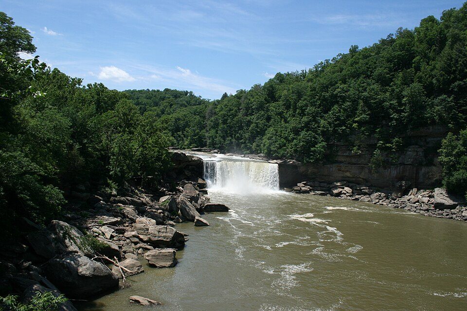 114 mi WaterfallCumberland Falls
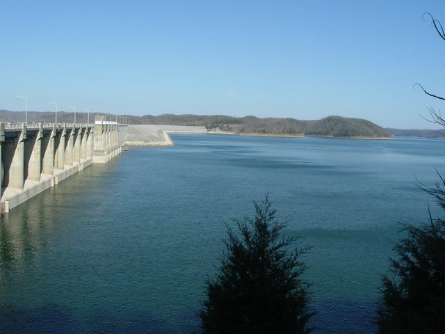 32 mi LakeLake Cumberland
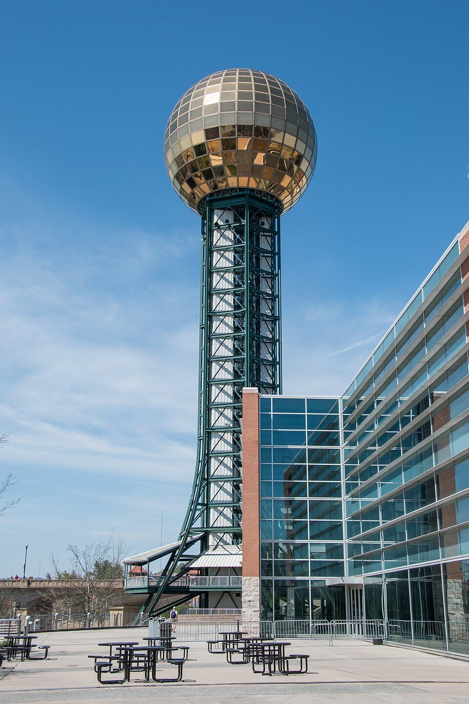 60 mi LookoutSunsphere
 39 mi State parkFrozen Head State Park
 55 mi National forestDaniel Boone National Forest2.5M visitors a year
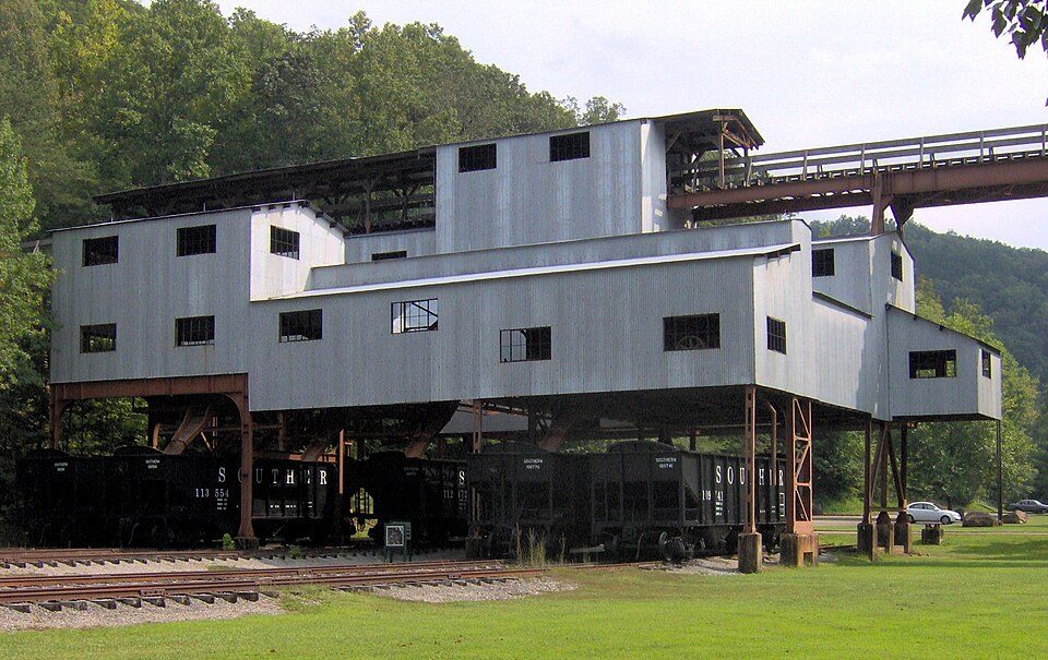 22 mi MuseumBlue Heron
 317 mi National RiverBig South Fork National River and Recreation Area774K visitors a year
Photo credits
Neyland Stadium: Neomrbungle, CC BY-SA 4.0 · Cumberland Falls: ChrisKuehl, Public domain · Lake Cumberland: Censusdata at English Wikipedia, Public domain · Sunsphere: Ɱ, CC BY-SA 4.0 · Frozen Head State Park: Brian Stansberry (photographer), CC BY 3.0 · Daniel Boone National Forest: Schwaltz, CC BY-SA 3.0 · Blue Heron: Brian Stansberry, CC BY 3.0 · Big South Fork National River and Recreation Area: Brian Stansberry, CC BY 3.0


Barthell, answered
What town is Barthell near?
Stearns, KY, about 3 miles east.
When is the best time to visit Barthell?
April, May, June, September and October, with highs of 68–82°.
How far is Barthell from Lexington?
About 94 miles north of Lexington, as the crow flies.
What is the closest airport to Barthell?
McGhee Tyson (TYS), about 67 miles away.
Where should I stay near Barthell?
Stearns (3 mi, 5 places to stay), Oneida (12 mi, 3 places to stay) and Burnside (23 mi, 11 places to stay).
Ask a local in Stearns
Ask a question, or answer one, in Stearns’s Town Square.
Sources: National Park Service · ski areas © OpenSkiMap / OpenStreetMap contributors · Wikidata · Wikipedia readership · NOAA climate normals · U.S. Census.