
Frozen Head State Park
Frozen Head State Park and Natural Area is a state park in Morgan County, Tennessee, in the southeastern United States. This one stands 3 mi northwest of Petros. Management falls to Tennessee Department of Environment and Conservation.

A state park, 3 mi northwest of Petros
Oliver Springs is the nearest base
Oliver Springs is 11 miles southeast, with 8 places to stay. Where to stay ↓
Best months: Apr, May, Jun, Jul, Aug, Sep and Oct
April, May, June, July, August, September and October are the mild months, with highs of 67–83°. When to go ↓
Written from NOAA 1991–2020 normals, Overture places to stay, Census town figures, Wikidata and Wikipedia.
The year’s weather
Below are typical highs and lows near Frozen Head.
Frozen Head State Park
Frozen Head State Park and Natural Area is a state park in Morgan County, Tennessee, in the southeastern United States. The park, situated in the Crab Orchard Mountains between the city of Wartburg and the community of Petros, contains some of the highest mountains in Tennessee west of the Blue Ridge Mountains.
- Type
- State park
- Run by
- Tennessee Department of Environment and Conservation
- Wikipedia readers
- 13K a year
A base for Frozen Head State Park
The closest towns with hotels, motels or campgrounds are Wartburg (4) and Oliver Springs (8), and Knoxville has the most rooms in the area (134).
Knoxville
The most places to stay in the area, and a base for a longer trip.
202,021 people
33 mi east of Frozen Head
Compare 9 towns
| Town | From Frozen Head | Drive | Places to stay | People | Typical home | Safety |
|---|---|---|---|---|---|---|
| Wartburg | 5 mi west | 10 min | 4 1 motel · 2 campgrounds · 1 RV park | 957 | $192K | — |
| Oliver Springs | 11 mi southeast | 15 min | 8 1 hotel · 1 lodge or cabins · 6 campgrounds | 3,433 | $181K | C+ |
| Oak Ridge | 16 mi southeast | 25 min | 15 13 hotels · 1 inn or B&B · 1 lodge or cabins | 35,395 | $270K | C |
| Harriman | 14 mi south | 20 min | 8 6 hotels · 1 motel · 1 lodge or cabins | 6,192 | $153K | D |
| Petros | 3 mi southeast | 5 min | 2 2 lodges & cabins | 352 | $167K | — |
| Clinton | 21 mi east | 30 min | 12 10 hotels · 1 inn or B&B · 1 campground | 10,466 | $225K | C− |
| Rocky Top | 21 mi east | 30 min | 10 3 hotels · 3 lodges & cabins · 4 campgrounds | 1,681 | $149K | D− |
| Kingston | 18 mi south | 25 min | 6 2 hotels · 2 motels · 1 lodge or cabins · 1 campground | 6,299 | $220K | A− |
| Knoxville | 33 mi east | 50 min | 134 114 hotels · 8 motels · 4 inns & B&Bs · 6 lodges & cabins · 2 campgrounds | 202,021 | $240K | D |
Getting there
Nearest airports with airline service
More to see nearby
Other well-known places within 70 miles.
 Big draw59 mi Theme parkDollywood3.1M visitors a year
 Big draw34 mi Stadium & arenaNeyland Stadium
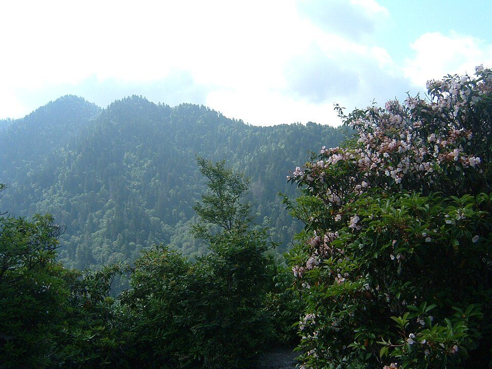 Big draw70 mi National ParkGreat Smoky Mountains National Park11.5M visitors a year
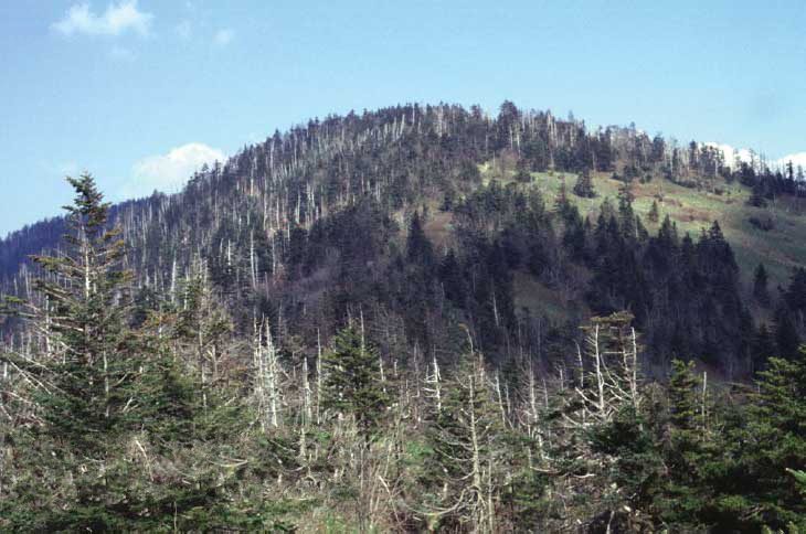 Big draw68 mi MountainKuwohi
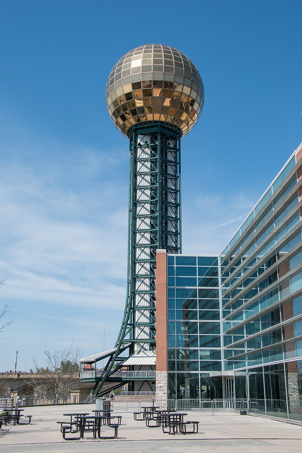 34 mi LookoutSunsphere
 68 mi MountainMount Le Conte
 57 mi MuseumAlcatraz East
 115 mi National Historical ParkManhattan Project National Historical Park56K visitors a year
Photo credits
Dollywood: Brian Stansberry (photographer), CC BY 2.5 · Neyland Stadium: Neomrbungle, CC BY-SA 4.0 · Great Smoky Mountains National Park: Scott Basford, CC BY-SA 3.0 · Kuwohi: C. Kenneth Dodd, Jr., Public domain · Sunsphere: Ɱ, CC BY-SA 4.0 · Mount Le Conte: No machine-readable author provided. Blinutne assumed (based on copyright claims, CC BY-SA 3.0 · Alcatraz East: EricaLewHouse, CC BY-SA 4.0 · Manhattan Project National Historical Park: Unknown, Public domain


Frozen Head: what to know
What town is Frozen Head State Park near?
Petros, TN, about 3 miles southeast.
When is the best time to visit Frozen Head State Park?
April, May, June, July, August, September and October, with highs of 67–83°.
What is the closest airport to Frozen Head State Park?
McGhee Tyson (TYS), about 36 miles away.
Where should I stay near Frozen Head State Park?
Knoxville (33 mi, 134 places to stay), Wartburg (5 mi, 4 places to stay) and Oliver Springs (11 mi, 8 places to stay).
From people who live in Petros
People in Petros have not posted tips yet; their Town Square is open.
Sources: National Park Service · ski areas © OpenSkiMap / OpenStreetMap contributors · Wikidata · Wikipedia readership · NOAA climate normals · U.S. Census.