180 years in pictures
The archive holds 1 old photo or paper and 4 maps from 1940 on.
4 places on the National Register of Historic Places.
- 1846Walcott is settled
Each edition grades its towns against each other only.

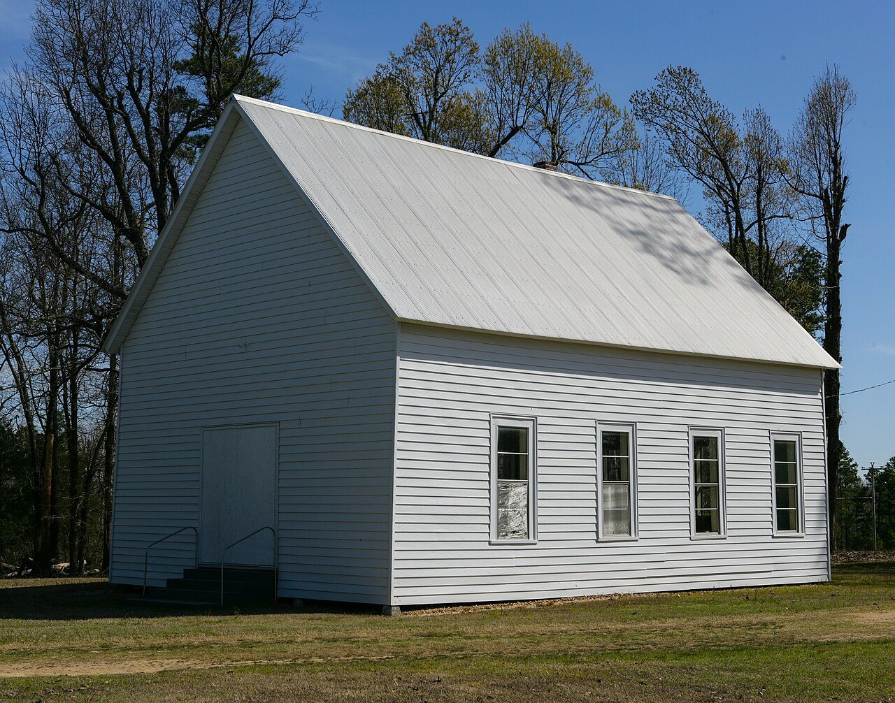
Walcott’s middle household income is $171,000, where Arkansas’ towns sit at $55,000 and U.S. towns at $80,000. No town among the 124 in Arkansas we compare has a higher share of homes lived in by their owners than Walcott. 34% of the land in Walcott is conserved, above both the Arkansas town median (0.8%) and the median of U.S. towns (4.3%). Its National Register listings include Old Bethel Methodist Church and Crowley's Ridge State Park-Dining Hall. Walcott has fewer than 1,000 residents, too few for fair grades; the figures below are still real.
Where Walcott beats most towns.
In a town this size, neighbors are the best guide. Ask them anything.
The archive holds 1 old photo or paper and 4 maps from 1940 on.
4 places on the National Register of Historic Places.
Walcott is unincorporated, so Greene County and regional agencies provide most services.
EPA SDWIS (Oct 9, 2026) · HIFLD + EIA-861 2025 · Census 2020 ZCTAs · NCES 2024–25 · registration: vote.gov, updated Nov 18, 2024.
Ordered by what stands out in Walcott.
Crowley's Ridge State Park, at 284 acres with 3.6 miles of trail, is the biggest park or preserve. There are 3.7 miles of trail across 1 park or preserve.
| Biggest places to walk | Trails | Acres |
|---|---|---|
| 1. Crowley's Ridge State Park | 3.6 mi | 284 |
Trails & parks © OpenStreetMap contributors · Conserved land: USGS PAD-US
Expected losses in Walcott break down as 29% from earthquakes and 27% from inland flooding. For Walcott, the natural-hazard score from FEMA is 82 of 100.
FEMA National Risk Index · OpenFEMA
The top destinations are Jonesboro (33%), Paragould (22%) and Brookland (4%). Half of commuters travel less than 15 miles.
Census LEHD 2023 · ACS
NOAA U.S. Climate Normals, 1991–2020
Among adults in Walcott, 35% feel lonely. CDC measures, 32 in all: Walcott beats Arkansas on 5 and trails on 2. In Walcott, 27% of adults have been diagnosed with depression, and 17% report frequent physical distress.
| Walcott | Arkansas towns | U.S. towns | |
|---|---|---|---|
| High blood pressure (CDC PLACES) | 44% | 41% | 35% |
| Depression (CDC PLACES) | 27% | 25% | 23% |
| Frequent physical distress (CDC PLACES) | 17% | 16% | 14% |
| Binge drink (CDC PLACES) | 14% | 15% | 16% |
| What stands out | Walcott | AR |
|---|---|---|
| Fewer older adults who have lost all their teeth | 13.3% | 18.6% |
| Fewer adults facing a utility shut-off | 7.7% | 10.4% |
| More adults who have had cancer | 9.8% | 8.2% |
CDC PLACES 2025 · modeled estimates for adults · CMS · HRSA
Zillow Home Value Index · Redfin Data Center
2 within 15 miles of the center of Walcott
About 0 of every 100 Walcott residents are enrolled in college, against 5 across Arkansas.
Where Walcott’s working residents go each day. Line width shows the share.
Census LEHD 2023
4 places in Walcott on the National Register of Historic Places.
Census-designated place in Arkansas, United States
Walcott is an unincorporated community and census-designated place (CDP) in Greene County, Arkansas, United States. Walcott is located at the junction of Arkansas highways 141 and 168, 10 miles (16 km) west of Paragould. It was first listed as a CDP in the 2020 census with a population of 152. Walcott has a post office with ZIP code 72474.
From Wikipedia, licensed CC BY-SA 4.0 · facts via Wikidata (CC0)
Short answers, built from the data on this page.
Walcott has fewer than 1,000 residents, too few for fair grades; the figures below are still real.