Guest, Sign inJoin

Post to Fayetteville

We’ll email a one-tap link to publish your post. No password, and nothing is public until you click it.
Already a member? Sign in
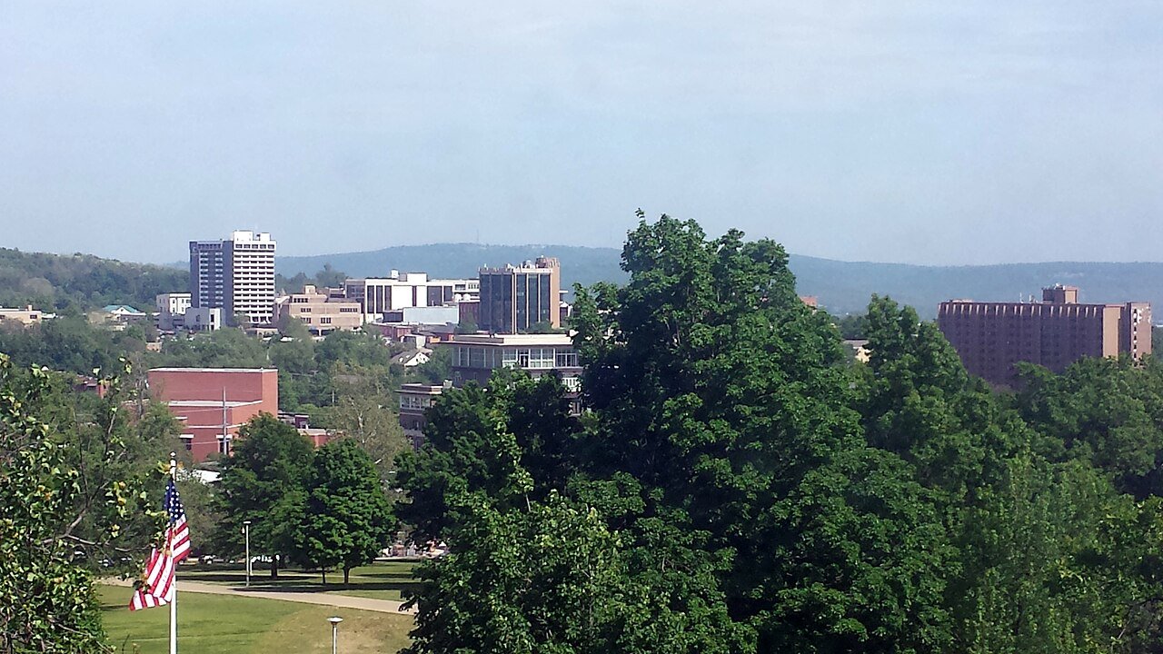
Downtown Fayetteville from Old Main 001Photo: Brandonrush · CC BY-SA 3.0
AOutdoors
Outdoors in Fayetteville

Fayetteville has 49 miles of mapped trails, 0.9 for every square mile of land

10% of Fayetteville’s land is conserved, about 3,655 acres. 3,967 acres are parks and preserves, 40 per 1,000 residents. The biggest trail networks: Lake Fayetteville Park (6.7 mi), Lake Sequoyah Park (6.3 mi), Lake Wilson Park (2.4 mi).

Ahead of 90% of U.S. towns · #1 of 123 in Arkansas. What drives it

Conserved land
10%
3,655 acres · of 54.8 sq mi of land
Trails
49 mi
0.9 per sq mi of land
Park land
3,967 ac
40 acres per 1,000 residents
Near a park
90%
of residents within ½ mile
Bike routes
160 mi
23 mi lanes · 116 mi paths
Highest peak
1,690 ft
Pierce Mountain
Lakes & rivers
6
2 boat launches

What kind of outdoors town is Fayetteville?

Read from the map. The page puts what stands out first.

Outdoors grade

How much outdoors does Fayetteville have?

On conserved land, trails, park land and how close residents live to a park, Fayetteville is ahead of 90% of U.S. towns, #1 of 123 in Arkansas. All four inputs are above most U.S. towns; trail miles rank highest, the share of residents near a park lowest.

A
OutdoorsA character grade: shown, never part of Fayetteville’s overall grade.
All U.S. towns we grade (21,298)Ahead of 90%
LessMore
Arkansas towns of 2,500+ (123)#1 of 123

Among the 400 U.S. cities of 100,000 or more, Fayetteville ranks #87 on Outdoors.

Few Arkansas towns conserve much land (a typical one, 1%; the U.S., 4%), so Fayetteville’s 10% is ahead of 98% of Arkansas towns, while its trails per square mile lead 94% of them.

How sure. Graded on any three of the four inputs instead, the letter would still be A. Trails and many small parks come from OpenStreetMap, mapped by volunteers, so coverage varies from town to town; the half mile is a straight line from each census block, so a river or highway in the way isn’t counted against it.

PAD-US, OpenStreetMap (© OpenStreetMap contributors), Census 2025 Gazetteer and 2020 blocks; details in Sources below. How TownRatings grades the outdoors →

The map

Conserved land, trails & bike routes

Tap a number to zoom to a park. Tap a layer to hide it.

12345678
Easements protect land from building but are usually private.© OpenStreetMap contributors · USGS PAD-US
Places to walk

Pick a walk

The longest trail network is Lake Fayetteville Park, with 6.7 miles. Directions go to the nearest trailhead or public parking.

Lake Fayetteville Park

Managed by City of Fayetteville
520 acres6.7 mi of trail
Lake Fayetteville Nature TrailOld Field TrailHilltop TrailLakeside Trail+1
Dog rules not recorded
Directionsto the trail signWebsite ↗

Lake Sequoyah Park

Managed by City of Fayetteville
1,180 acres6.3 mi of trail
Rookery TrailKingfisher TrailShoreline TrailSpillway Trail+1
Dog rules not recorded
No trailhead mapped yetWebsite ↗

Lake Wilson Park

Managed by City of Fayetteville
316 acres2.4 mi of trail
Joe Clark Trail
Dog rules not recorded
Directionsto the parking lotWebsite ↗

Mount Sequoyah Woods

Managed by City of Fayetteville
95 acres1.7 mi of trail
Intermediate
Dogs on leash
Directionsto the parking lotWebsite ↗

Wilson Springs Preserve

Nature preserve
120 acres1.1 mi of trail
Hardimero TrailUnderwood LoopSavannah LoopUnderwood Trail
No dogs
Directionsto the parking lotWebsite ↗

North Shore Disc Golf, Lake Fayetteville

Managed by City of Fayetteville
43 acres1 mi of trail
Lake Fayetteville Nature Trail
Dog rules not recorded
No trailhead mapped yetWebsite ↗

West Side Prarie

Managed by Northwest Arkansas Land Trust
42 acres0.8 mi of trail
Dog rules not recorded
No trailhead mapped yetWebsite ↗

Brooks-Hummel Nature Preserve

Managed by City of Fayetteville
16 acres0.6 mi of trail
Brooks-Hummel Trail
Dog rules not recorded
No trailhead mapped yet
All 43 parks & preserves
Lake Fayetteville Park520 acres · 6.7 mi of trail · City of Fayetteville
Directions
Lake Sequoyah Park1,180 acres · 6.3 mi of trail · City of Fayetteville
Lake Wilson Park316 acres · 2.4 mi of trail · City of Fayetteville
Directions
Mount Sequoyah Woods95 acres · 1.7 mi of trail · City of Fayetteville
Directions
Wilson Springs Preserve120 acres · 1.1 mi of trail
Directions
North Shore Disc Golf, Lake Fayetteville43 acres · 1 mi of trail · City of Fayetteville
West Side Prarie42 acres · 0.8 mi of trail · Northwest Arkansas Land Trust
Brooks-Hummel Nature Preserve16 acres · 0.6 mi of trail · City of Fayetteville
Walker Park76 acres · 0.5 mi of trail · City of Fayetteville
Directions
Finger Park16 acres · 0.5 mi of trail · City of Fayetteville
Razorback Gardens10 acres · 0.5 mi of trail
Directions
Woolsey Wet Prairie60 acres · 0.4 mi of trail · City of Fayetteville
Directions
Gulley Park41 acres · 0.4 mi of trail · City of Fayetteville
Veterans Park16 acres · 0.4 mi of trail · City of Fayetteville
Directions
Kessler Mountain Regional Park617 acres · 0.3 mi of trail · City of Fayetteville
Centennial Park at Millsap Mountain231 acres · 0.2 mi of trail · City of Fayetteville
Bryce Davis Park25 acres · 0.2 mi of trail · City of Fayetteville
Greathouse Park10 acres · 0.2 mi of trail · City of Fayetteville
Directions
Bayyari Park8 acres · 0.2 mi of trail · City of Fayetteville
Gary Hampton Softball Complex23 acres · 0.1 mi of trail · City of Fayetteville
Agricultural Park10 acres · 0.1 mi of trail
Underwood Park54 acres
Wilson Park25 acres
Directions
Lewis Soccer Complex20 acres · City of Fayetteville
Directions
Dale Clark Park20 acres · City of Fayetteville
Gregory Park20 acres · City of Fayetteville
Wilson Springs West16 acres · Northwest Arkansas Land Trust
Red Oak Park9 acres · City of Fayetteville
Harmony Pointe Park9 acres · City of Fayetteville
Rodney Ryan Park8 acres · City of Fayetteville
Clarence Craft Park7 acres · City of Fayetteville
Gordon Long Park7 acres · City of Fayetteville
David Lashley Park5 acres · City of Fayetteville
Directions
Holland Park4 acres · City of Fayetteville
Bundrick Park3 acres · City of Fayetteville
The Ramble3 acres · US:AR:Fayetteville
Directions
Braden Park3 acres
Sweetbriar Park3 acres
World Peace Wetland Prairie3 acres · City of Fayetteville
Salem Park2 acres · City of Fayetteville
Jefferson Park2 acres · Fayetteville Public Schools
Directions
Doc Mashburn Park1 acres · City of Fayetteville
Garden Park's Courts1 acres
Who protects it

3,655 conserved acres

10% of Fayetteville’s land. Who manages Fayetteville’s conserved land, from the USGS Protected Areas Database. Approximate, because parcels can overlap.

Town or city3,590 ac
Land trusts & nonprofits65 ac
Local Park · 3,291 acLocal Other or Unknown · 182 acLocal Recreation Area · 88 acConservation Easement · 65 acLocal Conservation Area · 29 ac
Good to know

Conserved doesn’t always mean open to visitors. 65 acres are conservation easements, usually private land. The walks above are places people visit.

The biggest protected parcels
Parcel (PAD-US)Managed byAcresPublic access
Lake Sequoyah Park
Local Park
Town or city1,264Open
Lake Fayetteville Park
Local Park
Town or city598Open
Kessler Mountain
Local Park
Town or city404Open
Lake Wilson Park
Local Park
Town or city316Open
Regional Park
Local Park
Town or city210Open
Mount Sequoyah Woods
Local Park
Town or city95Open
Combs Park
Local Park
Town or city88Open
Walker Park
Local Park
Town or city74Open
Clabber Creek Trail Corridor
Local Other or Unknown
Town or city51Open
White River Park
Local Recreation Area
Town or city49Open

5 smaller protected places aren’t shown.

Things to do

56 places to go in Fayetteville

Beaches, playgrounds, peaks, falls and more. Pick a kind.

Peaks in Fayetteville
Pierce Mountain1,690 ft elevation
Directions
Mount Sequoyah1,617 ft elevation
Directions
Archias Mountain1,529 ft elevation
Directions
South Mountain1,526 ft elevation
Directions
Washington Mountain1,516 ft elevation
Directions
Millsaps Mountain1,506 ft elevation
Directions
Root Hill1,417 ft elevation
Directions
Goat Hill1,398 ft elevation
Directions
Trails & water

25 named trails and 6 lakes & rivers

Named trails
Open to bikes · 17.3 miHorses · 3.8 miUnpaved · 33.5 mi
Lake Fayetteville Nature Trail5.2 mi
Fayetteville Traverse2.3 mi
Rookery Trail2.2 mi
Kingfisher Trail1.6 mi
Joe Clark Trail1.3 mi
Shoreline Trail1.2 mi
Brooks-Hummel Trail0.9 mi
Markham Hill Nature Trail0.7 mi
Oak Loop0.7 mi
Intermediate0.5 mi
15 more trails
Fayetteville Traverse (Greathouse Park Connector)
0.5 mi
Hilltop Trail
0.5 mi
Hardimero Trail
0.5 mi
Spillway Trail
0.5 mi
Old Field Trail
0.5 mi
Island Trail
0.5 mi
Pine Loop
0.4 mi
Mr Clyde's Trail
0.4 mi
Lakeside Trail
0.4 mi
Mrs Nanny's Trail
0.4 mi
Markham Hill Loop / Fayetteville Traverse
0.3 mi
Fayetville Traverse
0.3 mi
Underwood Loop
0.3 mi
Lot-A-Toad Trail
0.3 mi
Savannah Loop
0.2 mi
Lakes & rivers tap for directions
Biking & sports

160 miles of bike routes

Bike lanes are often missing from the map in smaller towns, so that number is likely low.

23 mi
painted or protected bike lanes
116 mi
off-road bike paths
21 mi
shoulders & shared lanes
Lake Fayetteville Nature & MTB TrailBike route
5.2 mi
Courts & fields
58Tennis
55Soccer
34Baseball
18Golf
16Basketball
8Beach volleyball
5Pickleball
3Football

Includes school and college facilities, which aren’t always open to the public.

History along the way

80 places on the National Register

The country’s official list of places worth saving (National Park Service). The map also marks 10 historic points from OpenStreetMap: plaques, memorials and old buildings.

History →
Old Main, University of ArkansasBuilding · listed 1970
About it
Stone HouseBuilding · listed 1970
About it
Headquarters HouseBuilding · listed 1971
About it
Washington County CourthouseBuilding · listed 1972
About it
Ridge HouseBuilding · listed 1972
About it
Old Post OfficeBuilding · listed 1974
About it
Gregg HouseBuilding · listed 1974
About it
Walker HouseBuilding · listed 1975
About it
Wade-Heerwagen HouseBuilding · listed 1978
About it
Magnolia Company Filling StationBuilding · listed 1978
About it
Troy Gordon HouseBuilding · listed 1978
About it
Washington County JailBuilding · listed 1978
About it

68 more on the History page.

When to get out

June is the best month for walking in Fayetteville

NOAA’s 1991–2020 normals for the town and the daylight at its latitude. Outlined months have long days, highs of 59 to 86 °F and little rain for the place.

JanFebMarAprMayJunJulAugSepOctNovDec
Daylight (h)10.010.811.913.114.114.614.413.512.411.210.29.7
High (°F)475261707784898982715949
Rain (in)2.62.54.04.75.84.24.13.54.14.24.03.2

February is the driest month (2.5 in) and July the warmest (highs of 89 °F). 5.8 inches fall in May, the wettest month. Summer highs reach 89 °F, too hot for the outline. The climate in Fayetteville →

Next door

Fayetteville and its neighbors

Fayetteville has the most mapped trails of the 6 towns around it. Tap a town to see its outdoors.

TownConserved
of land
Trail mi
per sq mi
Park acres
per 1,000
Near a park
½ mile
Outdoors
Fayetteville10%0.94090%A
Farmingtonunder 1%0.2658%C
Johnsonunder 1%0.1283%C−
Greenlandunder 1%under 0.11635%C−
Springdale1%0.4739%C
Elkinsunder 1%0.1833%C−

The four inputs of the Outdoors grade, from the engine; shares are of land, not water.

Questions about parks and trails in Fayetteville

Where can I hike in Fayetteville?

The longest trail networks: Lake Fayetteville Park, 6.7 miles; Lake Sequoyah Park, 6.3 miles; Lake Wilson Park, 2.4 miles; Mount Sequoyah Woods, 1.7 miles. Each one is on the map above, with directions to the nearest trailhead or parking.

How much of Fayetteville is conserved land?

10% of its land, against a typical 1% for an Arkansas town and 4% nationally (PAD-US). Conserved doesn’t always mean open to visitors: easements are usually private land.

Are dogs allowed on Fayetteville’s trails?

OpenStreetMap records dogs as welcome at Mount Sequoyah Woods (on leash). For the rest, check the signs at the trailhead.

Where can I bike in Fayetteville?

160 miles of bike routes are on the map: 23 of painted or protected lanes, 116 of off-road paths and 21 of shoulders and shared lanes. Named routes: Lake Fayetteville Nature & MTB Trail.

Is there public land near Fayetteville?

22,375 acres of parks and open public land lie inside Fayetteville or within 10 miles of it (PAD-US), 3,967 of them inside the city line.

How much outdoors does Fayetteville have?

Ahead of 90% of U.S. towns on the Outdoors grade, #1 of 123 in Arkansas. The grade combines the share of land that is conserved, miles of mapped trail per square mile of land, park acres per 1,000 residents and the share of residents within a half mile of a park. It’s a character grade, so it isn’t part of the overall grade. How it works.

Trail talk

Conditions, parking and favorite walks from Fayetteville neighbors.
Town Square →
Share a tip
Sources

Where this page comes from

Conserved and public land: USGS Protected Areas Database of the United States (PAD-US), service updated July 2026. Parks, trails, playgrounds, beaches and other places: OpenStreetMap (© OpenStreetMap contributors, ODbL), map data as of 2026-10-28. Land and water area: Census 2025 Gazetteer. Residents near a park: 2020 Census blocks. National Register: National Park Service. How TownRatings grades the outdoors →