Montgomery dates to 1817, and 65 of its places are on the National Register
More historic than 79% of U.S. towns · #15 of 187 in Alabama. What drives it
Most of Montgomery was built recently: 7% of its homes predate 1940 and the median home dates from 1978. 65 places in town are on the National Register, among them 5 National Historic Landmarks and ten historic districts with 2,322 buildings between them. Below: 8 old photos and papers, maps from 1884 on, and the census since 1830.
On its age, its old homes and the National Register, Montgomery is more historic than 79% of U.S. towns, #15 of 187 in Alabama. Its National Register listings hold the grade up; its share of homes from before 1940 pulls it down.
A−
HistoryA character grade: shown, never part of Montgomery’s overall grade.
Among the 400 U.S. cities of 100,000 or more, Montgomery ranks #127 on History.
Alabama towns list about as much on the Register as the country (a typical Alabama town has 2.7 per 10,000 residents, the U.S. 2.4), so Montgomery’s 121 sits above most of its state (84% of Alabama towns have fewer) while its 2,380 historic buildings outnumber those of 99% of U.S. towns.
How sure. Graded on any two of the three inputs instead, the letter would range from B− to A. The pre-1940 share (±0.7 points) is firm at this size. Two sources give 1817.
Founding year: Wikidata (other dates in Quick answers). Homes: Census ACS 2020–24. National Register: National Park Service, May 2026 list; each listing counted once (boundary changes and added documentation belong to their listing), and a historic district counts its contributing buildings. How TownRatings grades history →
What stands out about Montgomery’s past
Read from the archive, the National Register and the record. The page puts what stands out first.
The country’s official list of buildings and places worth saving. 5 are National Historic Landmarks, the highest tier. Boundary changes and added documentation are counted with their listing.
Barnes Private SchoolschoolCapitol Hill SchoolschoolCentral High School for GirlsschoolCity InfirmaryhospitalClayton Street High SchoolschoolCottage Hill SchoolschoolD T Blakeys Steam MilllocaleDecatur Street SchoolschoolFifth Avenue Methodist Episcopal ChurchchurchFirst Colored Baptist ChurchchurchFirst Cumberland Presbyterian ChurchchurchHale InfirmaryhospitalHamner HallschoolHighland Park Presbyterian ChurchchurchKahl Montgomery Jewish TemplechurchKilby PrisonbuildingLees FerrycrossingMacedonia Schoolschool
19cemeteries and burying grounds inside Montgomery
FloraFreemanGreen FamilyGreenwoodHoltJonesJosephKindle Baptist Church MemorialLarkinLincolnMarshallOakwoodPerrys MillPinkstonRemount ParkTaylorTroy ChapelWescottWestcott
See all 19
Flora Cemetery · Freeman Cemetery · Green Family Cemetery · Greenwood Cemetery · Holt Cemetery · Jones Cemetery · Joseph Cemetery · Kindle Baptist Church Memorial Cemetery · Larkin Cemetery · Lincoln Cemetery · Marshall Cemetery · Oakwood Cemetery · Perrys Mill Cemetery · Pinkston Cemetery · Remount Park Cemetery · Taylor Cemetery · Troy Chapel Cemetery · Wescott Cemetery · Westcott Cemetery
US Post Offices dataset (Blevins & Helbock, CC0). Places and cemeteries from the USGS Geographic Names Information System (2021).
Prior to European colonization, the east bank of the Alabama River was inhabited by the Alibamu tribe of Native Americans. The Alibamu and the Coushatta, who lived on the west side of the river, were descended from the Mississippian culture. This civilization had numerous chiefdoms throughout the Midwest and South along the Mississippi and its tributaries, and had built massive earthwork mounds as part of their society about 950–1250 AD. Its largest location was at Cahokia, in present-day Illinois east of St. Louis.
Passages that mention Montgomery, cut from the printed page as they were published.
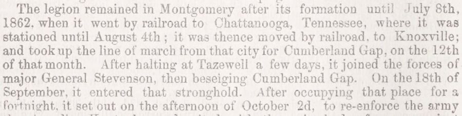
Directory of the city of Montgomery, and historical sketches of Alabama soldiers1866 · page 94Read the page →
Read the text
The legion remained in Montgomery after its formation until iuly 8th, 1862. when it went by railroad to Chattanooga, Tennessee, where it was stationed until August 4th ; it was thence moved by railroad, to Knoxville; and took up the line of march from that city for Cumberland Gap, on the 12th of that month. After halting at Tazewell a few days, it joined the forces of major General Stevenson, then beseiging Cumberland Gap. On the 18th of September, it entered that stronghold. After occupying that place for a fortnight, it set out on the afternoon of October 2d, to re-enforce the army
Text read by machine from the scan; it may contain errors.
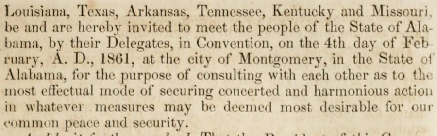
The history and debates of the Convention of the people of Alabama, begun and held in the city of Montgomery, on the seventh day of January, 18611861 · page 77Read the page →
Read the text
Louisiana. Texas, Arkansas, Tennessee, Kentucky and Missouri, be and arc hereby invited to tneel tke people of the Stale of Alabama, by their Delegates, in Convention, on tlie 4th day of Feb ruary, A. 1)., 1861, at the city of Montgomery, in the State Alabama, for the purpose of consulting with each other as to th< most effectual mode of securing concerted ami harmonious action in whatevei measures may be deemed most desirable for our common peace anil security.
Text read by machine from the scan; it may contain errors.
The history and debates of the Convention of the people of Alabama, begun and held in the city of Montgomery, on the seventh day of January, 18611861 · page 265Read the page →
Read the text
to meet at the city of Montgomery on the 4th day of February next, to furin a Southern' Republic, lie and they are hereby instructed to insist on the enactment by said Convention of such restrictions as will effectually prevent the reopening of the African Slave Trade.
Text read by machine from the scan; it may contain errors.
Scans and text from the Internet Archive. Books published in 1930 or earlier, which are in the public domain.
Timeline
Montgomery, 1817 to 1930
Woven from the archive, old maps, post office records, the National Register and the people born here.
Nothing in the archives for these yearsWeddings on Main Street, storms, parades, school pictures, the old store. If it’s in your family album, it belongs here.
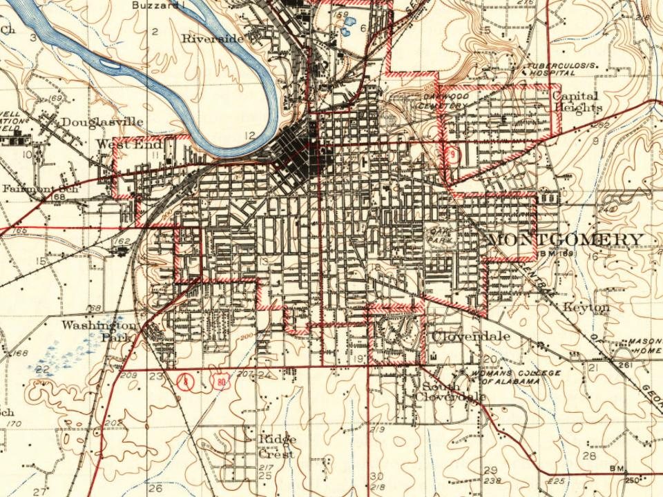
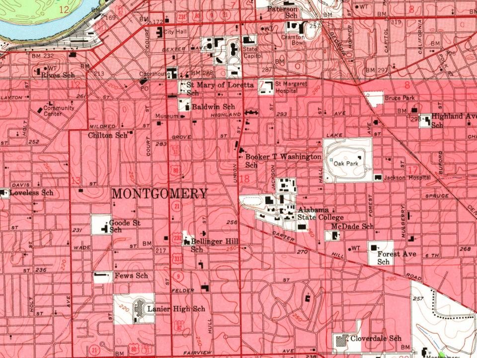
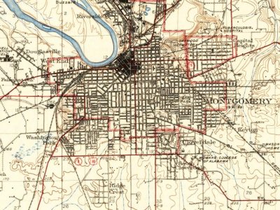
Every edition of the U.S. Geological Survey’s map of Montgomery. Tap a year, or press play to watch the town change.
1930Montgomery sheet · 1:62,500
U.S. Geological Survey historical topographic maps (public domain), via Esri’s collection of the scans. The red ring marks the center of Montgomery.
Every building
Montgomery, building by building, 1884–1922
Fire insurance maps drew every building, what it was made of and what it was used for, so insurers could price the risk of fire. Pick a year, then a sheet.
In 1817, according to Wikidata. Montgomery’s post office opened in 1820, and the census of 1830 counted 695 people here.
How does Montgomery rank for history?
Montgomery is more historic than 79% of U.S. towns, #15 of 187 in Alabama. The History grade combines the town’s founding era, the share of homes built before 1940 and its National Register listings. It’s a character grade, so it isn’t part of the overall grade. How it works.
What is on the National Register in Montgomery?
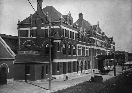
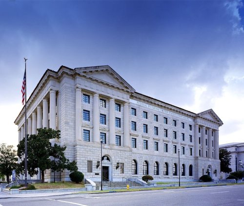
65 listings, 5 of them National Historic Landmarks: 47 buildings, among them the Alabama State Capitol (a National Historic Landmark since 1960), 17 historic districts with 2,322 contributing buildings, and 1 structure. 2,380 historic buildings in all.
How old are the homes in Montgomery?
7% of Montgomery’s homes were built before 1940 (Census estimate), against a typical 3.2% for an Alabama town; the median home was built in 1978.
Founding dates: Wikidata, Wikipedia, the U.S. post office records of Blevins & Helbock (CC0) and the Census. Homes by year built: Census ACS 2020–24. National Register of Historic Places: National Park Service (list of May 22, 2026). Old photos, postcards and papers: Wikimedia Commons, the Library of Congress and other public archives, credited on each item’s page. Maps: U.S. Geological Survey historical topographic maps (via Esri) and Sanborn fire-insurance maps (Library of Congress). History text and census tables: Wikipedia (CC BY-SA 4.0). Places that used to be: USGS Geographic Names Information System (2021).
From Wikimedia Commons (8), Wikidata (10), the National Register of Historic Places (65), Wikipedia, Wikidata and Wikipedia for famous people, U.S. Geological Survey historical maps, U.S. Census counts (via Wikipedia), the US Post Offices dataset (Blevins & Helbock), the USGS Geographic Names Information System, Sanborn fire insurance maps (Library of Congress) and old county and town histories (Internet Archive). Archive images are copied here with their credits and licenses, shown on each photo’s page. Refreshed monthly.


 ★ Landmark
 ★ Landmark
 ★ Landmark
 ★ Landmark
 ★ Landmark




 1859
 c. 1870