Guest, Sign inJoin

Post to Anniston

We’ll email a one-tap link to publish your post. No password, and nothing is public until you click it.
Already a member? Sign in
Anniston, Alabama
Alabama›Calhoun County
Photo: Rivers Langley; SaveRivers · CC BY-SA 3.0
Photo of Anniston

Anniston, AL · Photo: Rivers Langley; SaveRivers · CC BY-SA 3.0 · Source ↗

Is Anniston a good place to live?

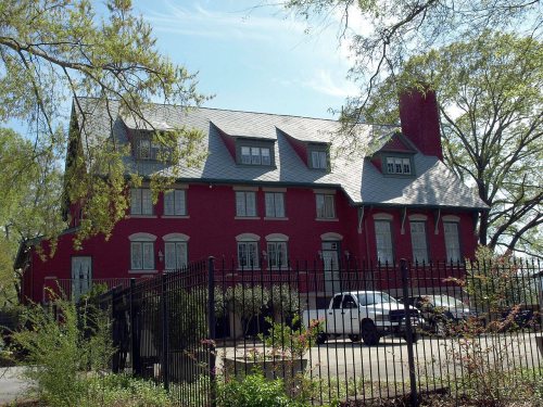
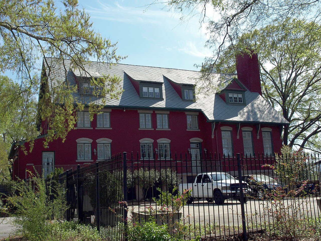
Anniston earns a D−, 181st among Alabama's 187 graded towns, mostly because of safety and health. Its crime rate is higher than 97% of U.S. towns, with 153 violent crimes reported to the FBI in 2025. Residents are less healthy than 93% of U.S. towns on CDC estimates. In its favor, it has 90 miles of trail. Anniston’s violent crime rate is 7.3 per 1,000 residents, above both the Alabama town median (2.9) and the median of U.S. towns (1.6). Its National Register listings include Crowan Cottage and Lyric Theatre. Anniston's schools rank behind 88% of the state's.

What makes Anniston stand out

Where Anniston beats most towns, and one thing worth knowing.

Anniston Inn Kitchen
Anniston Inn Kitchen · National Register of Historic Places
Anniston’s story

154 years in pictures

Its 47 National Register listings are more than in 96% of Alabama towns with a listing.

Census counts: 942 in 1880, a peak of 33,320 in 1960, 21,564 in 2020. The archive holds 12 old photos and papers going back to 1850 and 3 maps from 1947 on.

  • 1872Anniston is settled
Explore the history →

How Anniston grades

Each subject compared with towns across the country (schools within Alabama), ordered by how far Anniston is from typical.

How grading works

Character Graded, but not part of the overall grade.
Described, not graded Taste, not quality: snow or an older crowd is neither good nor bad.

How TownRatings grades towns →

Getting set up

Moving to Anniston: who provides what

Who provides power, water and the rest in Anniston, and how to reach them.

The full setup list →
PowerAlabama Power17.9¢/kWh · EIA 2025HIFLD · EIA
WaterAnniston Alabama, the Wwsb of the City O water systemNo health-based violations in 5 years · EPAEPA
Internet4 providers100% of addresses get 100/20 MbpsFCC
Trash & dump121 Disposal CompanyTrash haulerTown site
SchoolsAnniston City School DistrictWhich school depends on your addressNCES
Register to voteOnlineIn Alabama you can register online until 15 days before Election Day, in person until 15 days before Election Day, or by mail (received 15 days before).vote.gov
Who runs elections hereCalhoun County Absentee Elections ManagerCalhoun County; contacts on the Handbook page.FVAP, Sep 2024
ZIP codes36207, 36201, 36206, 3620536207 51% · 36201 36% · 36206 9% · 36205 4%Census 2020

EPA SDWIS (Oct 9, 2026) · HIFLD + EIA-861 2025 · Census 2020 ZCTAs · NCES 2024–25 · registration: vote.gov, updated Nov 18, 2024.

The data

Ordered by what stands out in Anniston.

Anniston has more trail for its size than nearly any town in Alabama and draws workers from Oxford and beyond, but it reports violent crime at about twice the Alabama rate.

OutdoorsA

Anniston stands out in Alabama and nationally: trail density there is higher

At 2 miles of trail per square mile, it ranks #2 of 113 Alabama towns. Its A for the outdoors ranks #3 of 187 in Alabama.

The trail density in Anniston is 2.0 miles per square mile. Mountain Longleaf National Wildlife Refuge, at 1,657 acres with 14 miles of trail, is the biggest park or preserve.

#2for trails in AL
19.3%
conserved · 5,642 of 29,262 acres
90 mi
of trails · 2 per sq mi
Biggest places to walkTrailsAcres
1. Coldwater Mountain Doug Ghee Nature Preserve and Recreation Area41.5 mi3,863
2. Mountain Longleaf National Wildlife Refuge14 mi1,657
3. Randolph Park—9

Trails & parks © OpenStreetMap contributors · Conserved land: USGS PAD-US

SchoolsD

Anniston earns a D for schools

Each of its 4 graded neighbors has a higher School Grade than its D, Oxford highest at A−.

Its public schools are run by the Anniston City school district. Two of its 10 schools are below, each with why it’s listed. The largest public high school is Anniston High School, with 498 students.

12%of AL districts it outscoresDSchool Grade
SchoolLevelStudentsLetter
Anniston Middle SchoolLargest public middle schoolGrades 6–8Grades 6–8357D−
Anniston High SchoolLargest public high schoolGrades 9–12Grades 9–12498D−

NCES · EDFacts · graded within AL on state tests and graduation

SafetyD−

Anniston earns a D− for safety

Violent crime runs at 7.3 per 1,000 residents, about twice the Alabama rate; the Safety Grade counts each violent crime four times, so this weighs most on its D−. Property crime runs at 36 per 1,000 residents, about twice the Alabama rate, most of it theft.

Anniston’s property crime rate is 36 per 1,000 residents. Anniston reports more crime per resident than most U.S. towns we grade: about 97% report less.

3%of U.S. towns report more crimeD−Safety Grade

Violent crime per 1,000 residents

Anniston7.3
Alabama3.5
U.S.3.3

Property crime per 1,000 residents

Anniston36
Alabama15
U.S.15.5
3rd
percentile among U.S. towns we grade
6th
percentile among AL towns
153
violent crimes reported in 2025
758
property crimes reported in 2025

FBI crime data, 2025 · crimes reported to police

Work & commuteJobs & income grade D

About one in four working residents works right in Anniston

17,810 jobs are based in Anniston, 2.5 for every working resident, so most of the people who work here commute in.

About one in 4 of Anniston’s working residents works in town. 21% of residents live below the poverty line in Anniston. The top destinations are Oxford (13%), Gadsden (4%) and Birmingham (4%).

28%work in town
AnnistonAlabama townsU.S. towns
Working residents who work in town28%9.8%8%
Below the poverty line21%16%9.6%
Median household income$47,000$62,000$80,000
Work from home7.7%6.7%11%

Where working residents work

In Anniston28%
Oxford13%
Gadsden4%
Birmingham4%
Lincoln3%
12 mi
median commute distance
17,810
jobs based in Anniston
A job hub
jobs vs. working residents
B
Walkability grade: more walkable than 58% of U.S. towns

Census LEHD 2023 · ACS

HealthD

Anniston earns a D for health

Against the 4,535 U.S. towns with household incomes like Anniston’s, it is less healthy than 78%, so its D isn’t only a matter of income.

19% of Anniston adults have diabetes. Anniston beats the Alabama average on 0 of 32 CDC measures and trails it on 19. 51% of Anniston adults have high blood pressure.

7%healthier than U.S. townsDHealth Grade
AnnistonAlabama townsU.S. towns
Diabetes (CDC PLACES)19%15%12%
High blood pressure (CDC PLACES)51%43%35%
Sleep under 7 hours (CDC PLACES)46%40%36%
Food insecurity (CDC PLACES)30%19%14%
32 measures vs. Alabama
0 better13 too close to call19 worse
What stands outAnnistonAL
More adults facing a utility shut-off15.2%9.6%
More adults facing food insecurity29.6%19.2%
More adults without reliable transportation14.4%9.8%
Northeast Alabama Regional Medical Center
1.3 mi away · emergency room
2 of 3
care shortages: primary care, mental health
17th
percentile among AL towns

CDC PLACES 2025 · modeled estimates for adults · CMS · HRSA

HousingCost of living grade B

Anniston’s typical home value is about $146K

At 2.6 years of the Anniston metro’s $55K median household income, the typical home (about $146K) costs less against local pay than in 80% of Alabama towns; that ratio is one input to its B for cost of living.

The typical Anniston home is worth about $146,000, up 4.2% in a year, 39% below the Alabama typical home.

$146KZillow home value
AnnistonAlabama townsU.S. towns
Households that own their home59%70%73%
Median rent$799 a month$943 a month$1,185 a month

Typical home value

Anniston$146K
Alabama$239K
Market temperature
BalancedA seller's marketBuyer’sSeller’s
58
days on market
96.7%
sale-to-list price
+4.2%
value change, 1 year
24
homes sold in May

Zillow Home Value Index · Redfin Data Center

Climate

Mild winters and hot summers in Anniston

July afternoons average 89.3°: hotter than most of the country, but cooler than 86% of Alabama places with climate records; January nights average 32.7°.

Anniston has mild winters and warm summers, with plenty of rain. Snow is almost unheard of.

89°summer high
AnnistonAlabama townsU.S. towns
July high89°F91°F85°F
January low33°F33°F22°F

Typical low → high °F

Winter35–56°
Spring49–73°
Summer67–88°
Fall51–74°
Nov 9
typical first frost
Mar 23
typical last frost
+0.9°
vs. the 20th-century average
89°
typical summer high

NOAA U.S. Climate Normals, 1991–2020

Who lives here

Older than Alabama overall

People 65 and older are 23% of residents (18% statewide). Anniston has lost 2.9% of its people since 2020, down to 20,930 in the Census Bureau’s 2025 estimate.

42.8median age · AL 39.3
AnnistonAlabama townsU.S. towns
Aged 65 or older22%18%18%
Median age42.8 years39.2 years40.5 years
Under 1821%23%22%
Bachelor’s degree or more, 25+21%23%29%
AnnistonAlabamaUnited States

Ages · share of residents

Education · adults 25 and older

No diploma16%
High school33%
Some college25%
Associate’s6%
Bachelor’s13%
Graduate8%

Women and men · all residents

52% women, 48% men

That’s an even split within the survey’s margin of ±2.2 points. Across Alabama, 51.4% of residents are women.

Ages and education in Anniston
AnnistonALU.S.
Under 1010.3%11.8%11.6%
10 to 1710.6%10.4%10.3%
18 to 247.9%9.5%9.1%
25 to 3411%12.9%13.7%
35 to 4412.2%12.4%13.2%
45 to 5413.5%12.2%12.2%
55 to 6412%13%12.7%
65 to 7413.7%10.7%10.2%
75 and older8.8%7.1%7%
No diploma16.3%11.4%10.4%
High school32.7%30.3%26%
Some college24.7%20.8%19.1%
Associate’s5.8%9.1%8.8%
Bachelor’s12.8%17.3%21.6%
Graduate7.7%11.1%14.1%

Census population estimates, 2025 · U.S. Census Bureau · ACS 2020-2024 5-year estimates

Natural hazardsHazard risk grade B−

Inland flooding leads a moderate hazard risk in Anniston

Expected storm and flood damage is higher than in 50% of U.S. communities. Since 1979, 19 flood insurance claims have been paid out in Anniston.

50risk score of 100
FEMA risk score
50Moderate riskLowerHigher
Inland floodingTornadoes
19
paid flood claims since 1979
6
federal disasters paid out here

FEMA flood insurance claims · FEMA National Risk Index · OpenFEMA

Nearby attractions

Cheaha Mountain and 5 more within 40 miles

Museums, parks, gardens and other places to visit around Anniston. Close and well known come first.

All 28 attractions →
Sources: National Park Service · ski areas © OpenSkiMap / OpenStreetMap contributors · Wikidata · Wikipedia readership · photos via Wikimedia Commons
Photo credits

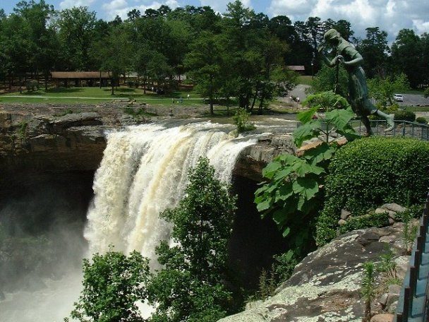
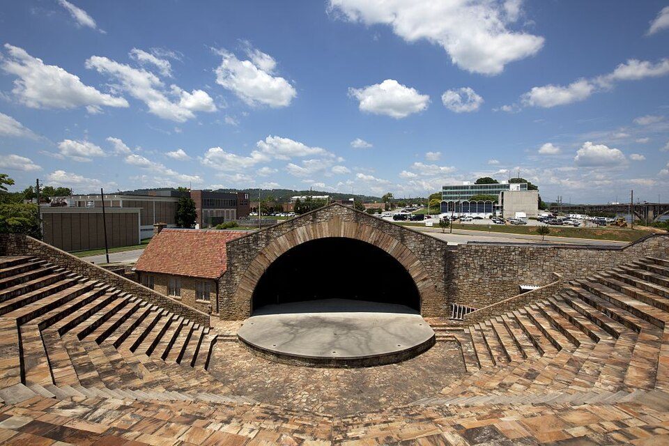
Cheaha Mountain: Amann09 (talk · contribs), Public domain · International Motorsports Hall of Fame: BWard 1997, CC BY 4.0 · Noccalula Falls Park: Thejammer (talk), Public domain · Freedom Riders National Monument: Ser Amantio di Nicolao, CC BY-SA 4.0 · Janney Furnace Park: dofftoubab, CC BY-SA 3.0 · Mort Glosser Amphitheater: Carol M. Highsmith, Public domain

Keep exploring

Everything we know about Anniston

20pages on Anniston
After high school

Colleges nearby

1 within 15 miles of the center of Anniston

Get outside

90 miles of trails in Anniston

19.3% of the town is conserved land, across 11 parks and preserves.

Map of trails and conserved land in AnnistonConservedTrails
1
Coldwater Mountain Doug Ghee Nature Preserve and Recreation Area41.5 mi of trails · 3,863 acres
Directions
2
Mountain Longleaf National Wildlife Refuge14 mi of trails · 1,657 acres
3
Randolph Park9 acres
Directions
Trails © OpenStreetMap contributors · USGS PAD-US

Landmarks

47 places in Anniston on the National Register of Historic Places.

All landmarks →

Famous people from Anniston

53 notable people were born in Anniston.

See all 53 →

About Anniston

City in and county seat of Calhoun County, Alabama

Official town website ↗

Anniston is a city and the county seat of Calhoun County in Alabama, United States, and is one of two urban centers/principal cities of and included in the Anniston–Oxford Metropolitan Statistical Area. As of the 2020 census, Anniston had a population of 21,564. Named the "Model City" by Atlanta newspaperman Henry W. Grady for its careful planning in the late nineteenth century, the city is situated on the slope of Blue Mountain.

From Wikipedia, licensed CC BY-SA 4.0 · facts via Wikidata (CC0)

Established
1872
Area
46 sq mi
Elevation
719 ft
ZIP code
36201, 36202, 36204
Area code
256

Anniston’s neighbors

5 towns share a border with Anniston.

Explore the map →

All 4 graded towns on its borders grade higher than its D−; West End-Cobb Town (C) is closest.

How the neighbors grade
TownAL rankOverallCostSafetySchoolsHealth
Anniston#181D−BD−DD
Saks#84CA—BC−
Oxford#96CB+C−A−C−
West End-Cobb Town#100CA—BD−
Weaver#99CB+C−BC+
Hobson City——————

Saks and West End-Cobb Town report no FBI crime data of their own. Hobson City isn’t graded (fewer than 1,000 residents, or not enough data). Compare Anniston with a neighbor →

Questions about Anniston

Short answers, built from the data on this page.

Is Anniston, AL a good place to live?

Anniston grades D− overall, better than 2% of U.S. towns and #181 of 187 in Alabama. It grades D for health, D− for safety and D for schools. Safety is its weak spot, with a D−.

Is Anniston, AL expensive?

That is 2.6 years of the area's median household income ($55,029 across the Anniston-Oxford, AL metro area). Cost of living, which also weighs rents, property taxes and how many households pay 30% or more of their income for housing, grades B.

What is Anniston, AL known for?

53 notable people were born here, including Michael Biehn and Ruth Elder.