Most of Edna Bay was built recently: 0.0% of its homes predate 1940 and the median home dates from 1986. Below: maps from 1951 on and the census since 1950.
Peaked at 135 in 1960; 25 people lived here in 2020.
7 censuses, 1950–2020.
U.S. Census Bureau decennial counts, from the census table on Edna Bay’s Wikipedia page.
The story so far
Edna Bay, in brief
Wikipedia doesn’t have a history of Edna Bay yet. The photos, dates and memories neighbors add here are how it gets written.
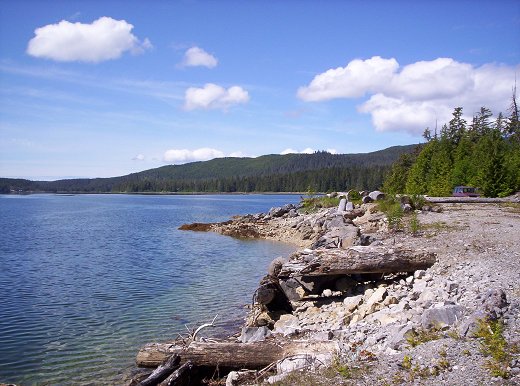
Edna Bay is a city on Kosciusko Island in the unorganized borough, and for census purposes in the Prince of Wales-Hyder Census Area in the U.S. state of Alaska. The community was officially incorporated on October 13, 2014, and has a population of 51 permanent residents and 12 part-time residents as of January 2024. Edna Bay is the only populated town on Kosciusko Island, and has both year-round and part-time residents. Year-round residents are either retired or work primarily in the fishing and logging industries. Some permanent residents also work seasonally off-island in various industries. Due to the very remote location of Edna Bay and the subsequent difficulty and expense of traveling…
Its first post office opened in 1943. Between the 2010 and 2020 censuses its population fell from 42 to 25 (-40%).
Intro from Wikipedia. Population: U.S. Census Bureau.
Timeline
Edna Bay, 1943 to 1960
Woven from the archive, old maps, post office records, the National Register and the people born here.
Founding dates: Wikidata, Wikipedia, the U.S. post office records of Blevins & Helbock (CC0) and the Census. Homes by year built: Census ACS 2020–24. National Register of Historic Places: National Park Service (list of May 22, 2026). Old photos, postcards and papers: Wikimedia Commons, the Library of Congress and other public archives, credited on each item’s page. Maps: U.S. Geological Survey historical topographic maps (via Esri) and Sanborn fire-insurance maps (Library of Congress). History text and census tables: Wikipedia (CC BY-SA 4.0). Places that used to be: USGS Geographic Names Information System (2021). How TownRatings grades history →
From U.S. Geological Survey historical maps, U.S. Census counts (via Wikipedia), the US Post Offices dataset (Blevins & Helbock) and the USGS Geographic Names Information System. Archive images are copied here with their credits and licenses, shown on each photo’s page. Refreshed monthly.