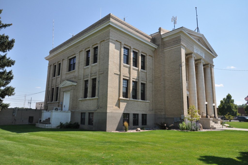
 Platte County Courthouse · Photo: Magicpiano · CC BY-SA 4.0
Household incomes in Wheatland trail those of 76% of U.S. towns
1% of workers work from home, next to 9% for Wyoming as a whole. The poverty rate is 9.2%, where Wyoming as a whole has 10.5%. Jobs and income earn Wheatland C−; getting around on foot earns it A.
Census ACS 2020–24, Census LEHD 2023, EPA Smart Location Database. How the two grades are made
Work in Wheatland, in a few figures
Commutes from Wheatland are quick
The average trip to work takes 9 minutes, against 19 across Wyoming. That’s about 77 hours a year less on the road than the typical Wyoming worker. Time on the road ↓
Few Wheatland workers work from home
Only 1% of workers work from home, against 9% across Wyoming. Almost everyone here travels to a job. Time on the road ↓
A big share show a job far from home
31% of working residents have a main job more than 50 miles away. Part of that is employers that report every worker at one head office, so not all of those trips happen daily. How far ↓
Written from the Census figures on this page. Commute flows, distances and jobs are Census LEHD 2023, primary jobs only (the self-employed aren’t counted); commute time and working from home are from the Census American Community Survey.
Jobs & income in Wheatland: the grade in detail
On income, poverty, unemployment and job access, Wheatland is better than 22% of U.S. towns, #22 of 28 in Wyoming. The poverty rate holds Wheatland’s grade up; job access by car pulls it down (ahead of 5% of U.S. towns).
A rough placement. Within the Census margins of error for income, poverty and unemployment, Wheatland could be anywhere from D− to B.
About 9 minutes each way for Wheatland’s commuters
Round trip, about 230 workdays a year: roughly 3 full days in the car, bus or train.
Average commute minutes, one way
of Wheatland workers work from home, vs 9% across Wyoming. Their commute is the hallway.
Share of the 1,633 commuters (the 1% who work from home are left out). Across Wyoming: 83% drive alone, 1% take transit; U.S.: 81% and 4%. Census ACS 2020–24.
From the Census survey of workers who don’t work from home.
How far Wheatland’s workers travel
About 31% show a job over 50 miles away. Some of that is real, and some is employers that report every worker at a head office, so a few long commutes are on paper only.
Straight-line distance from each worker’s home block to their main job’s block. LEHD 2023.
Every working resident’s trip, home to work, as the crow flies. Roads add to it, so real drives run longer.
The daily commute in and out of Wheatland
On a workday 747 residents head out to work, 684 work right here, and 1,041 people come in from elsewhere.
About as many people by day as by night: the people who leave are replaced by the people who come in.
About as many jobs as working residents (1.21 per resident).
Workday population = residents − those who work elsewhere + those who come in (the Census “commuter-adjusted” method). Residents: Census survey; commuters: LEHD 2023, primary jobs.
6% of working residents work in Casper
Where Wheatland clocks in
 2% of workers
 2% of workers
Lines run between town centers. The top 10 towns each way; “Everywhere else” is the rest, including other states.
A thicker line means more commuters. Switch between where residents work and where the people who work here live.
The 1,725 jobs based in Wheatland
What kind of work
What it pays
Who does it
Jobs based in Wheatland, 2013 → 2023: 1,580 → 1,725. Big swings can come from how a large employer reports its locations, not only from real openings or closings.
Primary jobs covered by unemployment insurance (not the self-employed). Pay is monthly earnings. LEHD 2023.
Here is what they are, next to the jobs Wheatland’s own residents hold wherever they work.
Walkable streets, thin transit: Wheatland
On EPA’s walkability index and the share of commuters who walk, bike or take transit, Wheatland is more walkable than 87% of U.S. towns, #9 of 28 in Wyoming. Both inputs place Wheatland near the same point nationally.
A firm grade. EPA’s index has no published margin of error; the commuting share comes from a Census survey of 1,656 workers.
How TownRatings grades walkability →
Transit service (shown, not graded). 25% of residents live within a ¾-mile walk of a bus or train stop, 25% within a quarter mile. At the weekday evening rush, about 0.1 trips an hour stop near the typical resident, more than in 42% of the 9,825 U.S. towns with transit data.
Transit at the evening rush trips an hour stopping within ¼ mile of the typical resident, EPA 2020
Households without a car (shown, not graded). 4.1% of Wheatland households have no vehicle (Wyoming 4.1%, U.S. 8.4%). 0% of Wheatland’s commuters take a bus or train.
3,318th of 4,221: where Wheatland ranks among U.S. towns of 2,500 to 4,700
| # | Town | People | Household income | Poverty | Unemployment | Work in town | Grade |
|---|---|---|---|---|---|---|---|
| 1 | Riverwoods IL | 3,766 | $249K | 0.7% | 0.7% | 2% | A+ |
| 2 | Belle Meade TN | 2,621 | $250K | 1.4% | 0.3% | 2% | A+ |
| 3 | Mission Hills KS | 3,522 | $250K | 1.2% | 0.3% | 2% | A+ |
| … | |||||||
| 950 | Bar Nunn WY | 3,012 | $99K | 2.2% | 3.6% | 1% | A− |
| … | |||||||
| 1,646 | Newcastle WY | 3,349 | $83K | 7.3% | 0.4% | 48% | B |
| … | |||||||
| 1,905 | Evansville WY | 2,875 | $77K | 3.9% | 6.4% | 5% | B− |
| … | |||||||
| 3,316 | Wellton AZ | 2,671 | $58K | 8.2% | 0.5% | 11% | C− |
| 3,317 | Guyton GA | 3,247 | $86K | 14.7% | 13.6% | 1% | C− |
| 3,318 | Wheatland WY | 3,516 | $59K | 9.2% | 4.9% | 48% | C− |
| 3,319 | Mason Township MI | 2,874 | $60K | 22.0% | 6.8% | 2% | C− |
| 3,320 | Gaines NY | 3,301 | $57K | 10.6% | 7.5% | 3% | C− |
| … | |||||||
| 4,221 | Lake Isabella CA | 4,059 | $27K | 40.7% | 8.6% | 18% | D− |
Census ACS 2020–24 (income, poverty, unemployment), Census LEHD (work in town), TownRatings Jobs & income grades. Each town links to its Work & commute page.
Ranked on the Jobs & income grade: the towns either side of Wheatland, the top three, the last and three more from Wyoming.
Next door to Wheatland
Jobs & commute next door
| Town | Wheatland workers there | Jobs & income | Walkability | Commute | Household income |
|---|---|---|---|---|---|
| Wheatland | – | C− | A | 9 min | $58,750 |
| Chugcreek | under 1% | — | — | 24 min | — |
Same-state neighbors only. Chugcreek: fewer than 1,000 residents, not graded. Commute: average minutes each way, Census ACS 2020–24.
Darker towns draw more of Wheatland’s workers. Tap a town to see its commute.
What this data can and can’t tell you
- Two sources, two years. Trips, distances and jobs based here: Census LEHD 2023, primary jobs, where the employer reports them. Income, poverty, unemployment, commute time and how people travel: Census ACS 2020–24 averages.
- Straight lines, older transit. Miles are as the crow flies. EPA’s walkability and transit files use 2017–20 inputs.
Jobs and commuting in Wheatland: questions
What is the median household income in Wheatland?
$58,750 (±$6,616) (Census ACS 2020–24), against $76,176 across Wyoming and $80,734 nationally.
What is the poverty rate in Wheatland?
9.2%, against 10.5% across Wyoming and 12.5% nationally (Census ACS 2020–24).
How long is the commute from Wheatland?
9 minutes each way on average, against 19 across Wyoming and 26 nationally. 1% of workers work from home.
Where do people who live in Wheatland work?
48% work in town. The top destinations elsewhere are Casper (6%, 88 mi), Laramie (2%, 61 mi), Douglas (2%, 54 mi) (Census LEHD 2023).
Is Wheatland walkable?
Wheatland is more walkable than 87% of U.S. towns (Walkability A): an EPA walkability index of 10.7 out of 20, and 5% of commuters walk, bike or take transit.
Can you get around Wheatland without a car?
0% of commuters take transit and 4% of households have no car. 25% of residents live within a quarter mile of a stop.
Commuter talk
Getting to work from Wheatland, from the people who make the trip.
More of Wheatland
Flows, distances and jobs: U.S. Census Bureau, LEHD Origin-Destination Employment Statistics (LODES 8), 2023, primary jobs. Commute time, working from home and working out of state: U.S. Census Bureau, American Community Survey 5-year estimates. Distances are straight lines between home and work; real drives run longer. Walkability index, job access and transit service: U.S. EPA Smart Location Database. The two grades are our own summaries of these figures, not official ratings.