Springfield in pictures
The archive holds 2 old photos and papers going back to 2011 and 2 maps from 1921 on.
1 place on the National Register of Historic Places.
Explore the history →Each edition grades its towns against each other only.

A town in West Virginia, home to 502 people.
Springfield’s mean commuting time is 40 minutes, where West Virginia’s towns sit at 21 minutes and U.S. towns at 25 minutes. Of the 62 West Virginia towns we compare, none has a lower share of working residents who work in town than Springfield. Scanlon Farm and Washington Bottom Farm is on the National Register of Historic Places. Springfield has fewer than 1,000 residents, too few for fair grades; the figures below are still real.
In a town this size, neighbors are the best guide. Ask them anything.
The archive holds 2 old photos and papers going back to 2011 and 2 maps from 1921 on.
1 place on the National Register of Historic Places.
Explore the history →Museums, parks, gardens and other places to visit around Springfield. Close and well known come first.
35 mi MountainMount Davis
7 mi National Historical ParkChesapeake and Ohio Canal National Historical Park4.6M visitors a year
37 mi LakeDeep Creek Lake
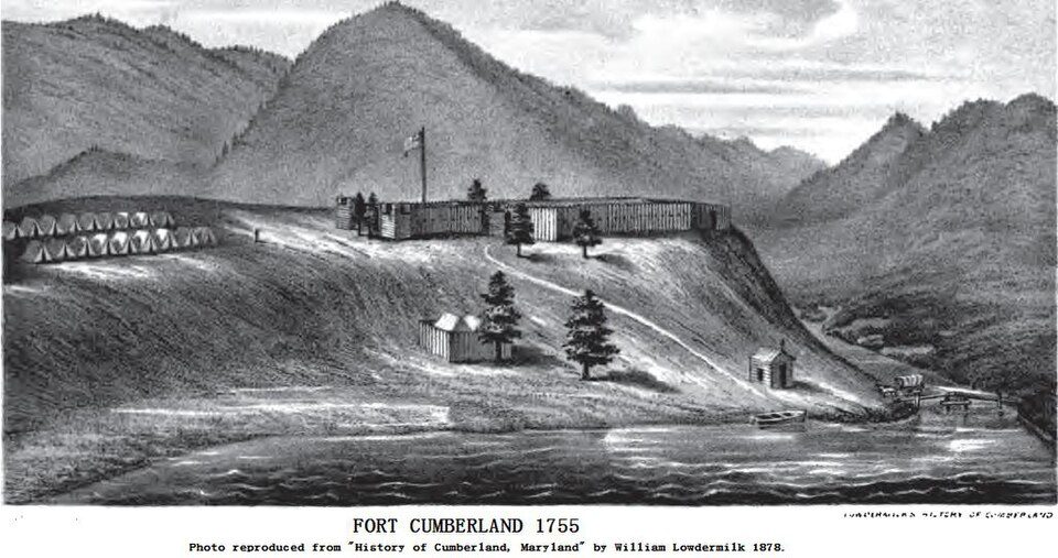
15 mi LandmarkFort Cumberland
33 mi MuseumMuseum of the Shenandoah Valley
8 mi MuseumLiterary HallMount Davis: Wikiuser100, CC BY-SA 3.0 · Chesapeake and Ohio Canal National Historical Park: Bonnachoven, CC0 · Deep Creek Lake: Gohens84, CC BY-SA 3.0 · Fort Cumberland: Unknown, Public domain · Museum of the Shenandoah Valley: GustaveCourbet, Public domain · Literary Hall: Justin A. Wilcox from Washington, D.C., United States, CC BY-SA 2.0
Springfield is unincorporated, so Hampshire County and regional agencies provide most services.
EPA SDWIS (Oct 9, 2026) · HIFLD + EIA-861 2025 · Census 2020 ZCTAs · NCES 2024–25 · registration: vote.gov, updated Aug 3, 2026.
Ordered by what stands out in Springfield.
FEMA expects more storm and flood damage in Springfield than in just over four fifths of U.S. communities. 89% of the town’s expected losses from natural hazards come from inland flooding.
FEMA National Risk Index · OpenFEMA
Most people who work leave Springfield to do it: just 1% work in town. The top destinations are Romney (6%), Winchester (6%) and Martinsburg (2%). Half commute less than 33 miles.
Census LEHD 2023 · ACS
For Springfield, the peak summer temperature is 88°F.
NOAA U.S. Climate Normals, 1991–2020
Just over a fifth of adults smoke cigarettes in Springfield. The town tracks West Virginia closely on all 32 CDC measures. Among adults in the town, 31% have been diagnosed with depression and 17% report frequent physical distress.
| Springfield | West Virginia towns | U.S. towns | |
|---|---|---|---|
| Smoke cigarettes (CDC PLACES) | 21% | 18% | 14% |
| Depression (CDC PLACES) | 31% | 31% | 23% |
| Frequent physical distress (CDC PLACES) | 17% | 17% | 14% |
| Get no exercise (CDC PLACES) | 33% | 32% | 25% |
CDC PLACES 2025 · modeled estimates for adults · CMS · HRSA
For households in Springfield, the share who own their home is 88%.
Census ACS, 2020–24 · Zillow Home Value Index · Redfin Data Center
1 within 15 miles of the center of Springfield
About 5 of every 100 Springfield residents are enrolled in college, about the same as West Virginia.
Where Springfield’s working residents go each day. Line width shows the share.
Census LEHD 2023
Census-designated place in West Virginia, United States
Springfield is a census-designated place (CDP) in northwestern Hampshire County, West Virginia, United States. As of the 2020 census, Springfield had a population of 455 (down from 477 at the 2010 census). Springfield is located north of Romney along West Virginia Route 28 at its junction with Green Spring Road (West Virginia Secondary Route 1) and Springfield Pike (West Virginia Secondary Route 3).
From Wikipedia, licensed CC BY-SA 4.0 · facts via Wikidata (CC0)
Short answers, built from the data on this page.
Springfield has fewer than 1,000 residents, too few for fair grades; the figures below are still real.