Parkersburg’s post office opened in 1805, and 24% of its homes were built before 1940
More historic than 92% of U.S. towns · #12 of 61 in West Virginia. What drives it
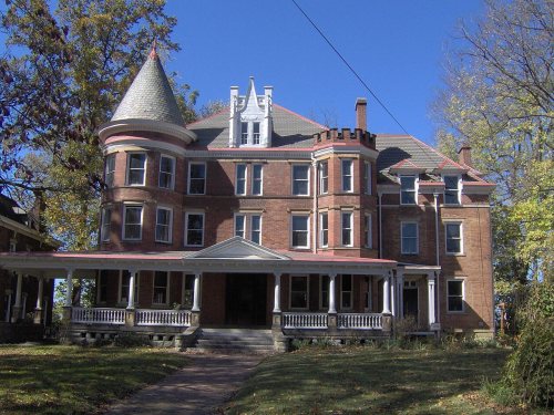
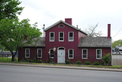
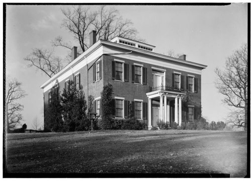
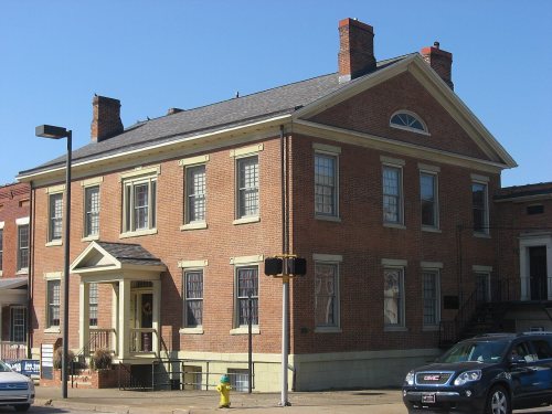
41 places in town are on the National Register, among them four historic districts with 672 buildings between them. Below: 3 old photos and papers, maps from 1889 on, and the census since 1850.
From Parkersburg’s archive · credits on each photo
Quick answers
How Parkersburg began
When was Parkersburg founded?
1805
The Parkersburg post office opened in 1805, the earliest record of the town by name. Wikidata gives 1810. Three smaller post offices, Newport (1882), Lauckport (1892) and Roosevelt (1903), opened inside today’s city and later closed.
First census: 1,218 in 18502020 census: 29,738221 years
How historic is Parkersburg?
A
More historic than 92% of U.S. towns, on its age, its old homes and the National Register.
Founding year: the first Parkersburg post office (Blevins & Helbock, CC0). Wikidata: 1810.The full story ↓
History grade
What drives Parkersburg’s History grade
On its age, its old homes and the National Register, Parkersburg is more historic than 92% of U.S. towns, #12 of 61 in West Virginia. All 3 inputs are above most U.S. towns; its National Register listings ranks highest and its age lowest.
A
HistoryA character grade: shown, never part of Parkersburg’s overall grade.
West Virginia towns list more on the Register than most of the country (a typical West Virginia town has 29.6 per 10,000 residents, the U.S. 2.4), so Parkersburg’s 243 sits above most of its state (79% of West Virginia towns have fewer) while its 710 historic buildings outnumber those of 98% of U.S. towns.
How sure. Graded on any two of the three inputs instead, the letter would range from A− to A. The pre-1940 share is a Census survey estimate (±3.3 points). The founding year is the first post office, not a stated founding date; Wikidata’s 1810 falls in the same era, so the grade doesn’t depend on which one is used.
Founding year: the first post office (other dates in Quick answers). Homes: Census ACS 2020–24. National Register: National Park Service, May 2026 list; each listing counted once (boundary changes and added documentation belong to their listing), and a historic district counts its contributing buildings. How TownRatings grades history →
What stands out about Parkersburg’s past
Read from the archive, the National Register and the record. The page puts what stands out first.
National Park Service, National Register of Historic Places. Photos from Wikimedia Commons, credited on each place’s page.
Places that used to be
Lost post offices, old corners, places now gone and burying grounds
Parkersburg’s post office has been open since 1805. Three other post offices opened and closed inside today’s town.
Parkersburg
1805–today
Newport
1882–1906
Lauckport
1892–1899
Roosevelt
1903–1909
18001910today
Hamlets and corners on the map
BeechwoodCrestview ParkFairview HeightsFairway AcresLauckportNorth ParkersburgRiversideSouth ParkersburgTavennersvilleWoodland Park
Gone or out of use
Alternate Learning Center at Jefferson Elementary SchoolschoolBeechwood SchoolschoolChurch of GodchurchDe Sales Heights AcademyschoolEdgelawn SchoolschoolFort BoremanmilitaryFranklin Junior High SchoolschoolKingdom Hall of Jehovahs WitnesseschurchLincoln SchoolschoolNash SchoolschoolPark SchoolschoolParkersburg General HospitalhospitalPilgrim Holiness ChurchchurchRayon SchoolschoolRayon Trek CenterschoolRoosevelt Elementary SchoolschoolSumner SchoolschoolTavennerville Elementary Schoolschool
16cemeteries and burying grounds inside Parkersburg
CatholicDilsEvergreenFoleyHollidayIndependent Order of Odd FellowsMathewsMount Carmel CatholicMount OlivetOgdenParkersburg Memorial GardensRiverviewSaint XaviersTavennerWoodyardWright
US Post Offices dataset (Blevins & Helbock, CC0). Places and cemeteries from the USGS Geographic Names Information System (2021).
Settlers at first named the city Newport when they settled it in the late 18th century following the American Revolutionary War. A town section was laid out on land granted to Alexander Parker for his Revolutionary War service. Virginia made grants of land to veterans for their war service. The title conflicts between Parker and the city planners of Newport were settled in 1809 in favor of his heirs. The town was renamed Parkersburg in 1810. It was chartered by the Virginia General Assembly in 1820. It was rechartered as a city in 1860.
Nothing in the archives for these yearsWeddings on Main Street, storms, parades, school pictures, the old store. If it’s in your family album, it belongs here.
Every edition of the U.S. Geological Survey’s map of Parkersburg. Tap a year, or press play to watch the town change.
1904Parkersburg sheet · 1:62,500
U.S. Geological Survey historical topographic maps (public domain), via Esri’s collection of the scans. The red ring marks the center of Parkersburg.
Every building
Parkersburg, building by building, 1889–1916
Fire insurance maps drew every building, what it was made of and what it was used for, so insurers could price the risk of fire. Pick a year, then a sheet.
The Parkersburg post office opened in 1805, the earliest record of the town by name (U.S. post office records). Wikidata gives 1810.
How does Parkersburg rank for history?
Parkersburg is more historic than 92% of U.S. towns, #12 of 61 in West Virginia. The History grade combines the town’s founding era, the share of homes built before 1940 and its National Register listings. It’s a character grade, so it isn’t part of the overall grade. How it works.
What is on the National Register in Parkersburg?
41 listings: 35 buildings, 4 historic districts with 672 contributing buildings, 1 structure, and 1 object. 710 historic buildings in all.
How old are the homes in Parkersburg?
24% of Parkersburg’s homes were built before 1940 (Census estimate, ±3.3 points), against a typical 13% for a West Virginia town; the median home was built in 1956.
Founding dates: Wikidata, Wikipedia, the U.S. post office records of Blevins & Helbock (CC0) and the Census. Homes by year built: Census ACS 2020–24. National Register of Historic Places: National Park Service (list of May 22, 2026). Old photos, postcards and papers: Wikimedia Commons, the Library of Congress and other public archives, credited on each item’s page. Maps: U.S. Geological Survey historical topographic maps (via Esri) and Sanborn fire-insurance maps (Library of Congress). History text and census tables: Wikipedia (CC BY-SA 4.0). Places that used to be: USGS Geographic Names Information System (2021).
From Wikimedia Commons (3), Wikidata (2), the National Register of Historic Places (41), Wikipedia, Wikidata and Wikipedia for famous people, U.S. Geological Survey historical maps, U.S. Census counts (via Wikipedia), the US Post Offices dataset (Blevins & Helbock), the USGS Geographic Names Information System and Sanborn fire insurance maps (Library of Congress). Archive images are copied here with their credits and licenses, shown on each photo’s page. Refreshed monthly.