178 years in pictures
Census counts: 1,058 in 1870, 31,752 in 2020. The archive holds 6 old photos and papers going back to 1865 and 4 maps from 1904 on.
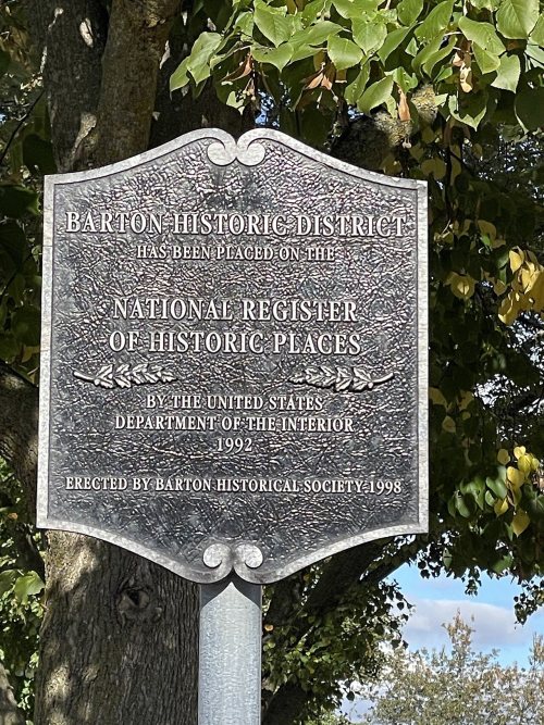
11 places on the National Register of Historic Places.
- 1848West Bend is settled
Each edition grades its towns against each other only.

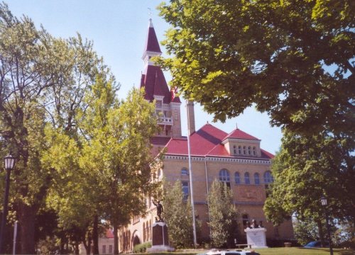
West Bend's standout: it has 15 miles of trail. Overall it grades B+, 165th among Wisconsin's 357 graded towns. Its schools outperform 75% of the state's and natural-hazard risk is low. 14% of the land in West Bend is conserved, where Wisconsin’s towns sit at 3.8% and U.S. towns at 4.3%. West Bend has 11 places on the National Register of Historic Places, among them Washington County Courthouse and Jail and Gadow's Mill. West Bend's civic life (library use, community groups, volunteering) is stronger than in 80% of U.S. towns.
Where West Bend beats most towns.
Census counts: 1,058 in 1870, 31,752 in 2020. The archive holds 6 old photos and papers going back to 1865 and 4 maps from 1904 on.
11 places on the National Register of Historic Places.
Each subject compared with towns across the country (schools within Wisconsin), ordered by how far West Bend is from typical.
How TownRatings grades towns →
Who provides power, water and the rest in West Bend, and how to reach them.
EPA SDWIS (Oct 9, 2026) · HIFLD + EIA-861 2025 · Census 2020 ZCTAs · NCES 2024–25 · registration: vote.gov, updated Nov 18, 2024.
Ordered by what stands out in West Bend.
West Bend trades workers with Milwaukee and other neighbors, is safe by national standards but not by Wisconsin’s and has a shorter frost-free season than most of the country, though not than most of Wisconsin.
At 1.0 miles per square mile, West Bend’s trail density is against 0.4 in Wisconsin’s towns and 0.4 across U.S. towns. Glacial Blue Hills Recreation Area, at 226 acres with 3.5 miles of trail, is the biggest park or preserve.
| Biggest places to walk | Trails | Acres |
|---|---|---|
| 1. Glacial Blue Hills Recreation Area | 3.5 mi | 226 |
| 2. Lac Lawrann Conservancy | 3.2 mi | 141 |
| 3. Royal Oaks Park | 1.9 mi | 32 |
Trails & parks © OpenStreetMap contributors · Conserved land: USGS PAD-US
Its public schools are run by the West Bend School District. Three of its 14 schools are below, each with why it’s listed.
| School | Level | Students | Letter |
|---|---|---|---|
| Badger MiddleLargest public middle schoolGrades 7–8 | Grades 7–8 | 714 | B+ |
| West HighLargest public high schoolGrades 9–12 | Grades 9–12 | 1,085 | B− |
| McLane ElementaryTop results in townGrades K–4 | Grades K–4 | 340 | A+ |
NCES · EDFacts · graded within WI on state tests and graduation
Expected storm and flood damage is lower than in 89% of U.S. communities. Since 1980, 2 flood insurance claims have been paid out in West Bend.
FEMA flood insurance claims · FEMA National Risk Index · OpenFEMA
West Bend beats the Wisconsin average on 2 of 32 CDC measures and trails it on 0. 21% of adults binge drink in West Bend.
| West Bend | Wisconsin towns | U.S. towns | |
|---|---|---|---|
| Binge drink (CDC PLACES) | 21% | 20% | 16% |
| Feel lonely (CDC PLACES) | 30% | 30% | 33% |
| Diabetes (CDC PLACES) | 10% | 11% | 12% |
| Sleep under 7 hours (CDC PLACES) | 34% | 32% | 36% |
| What stands out | West Bend | WI |
|---|---|---|
| Fewer adults facing food insecurity | 10.1% | 12.1% |
| Fewer adults without reliable transportation | 5.9% | 6.7% |
CDC PLACES 2025 · modeled estimates for adults · CMS · HRSA
The Germantown weather station, 13 miles away, records that the frost-free season runs about 154 days: shorter than most of the country, but longer than 76% of Wisconsin places with climate records. January nights average 11°: colder than most of the country, but milder than 82% of Wisconsin places with climate records; July afternoons average 81.2°.
West Bend has cold, snowy winters and pleasant summers. The July high in West Bend is 81°F. About 54 inches of snow falls in a winter.
| West Bend | Wisconsin towns | U.S. towns | |
|---|---|---|---|
| July high | 81°F | 82°F | 85°F |
| January low | 11°F | 11°F | 22°F |
NOAA U.S. Climate Normals, 1991–2020
West Bend has about as many jobs (14,525) as working residents, but only 3,496 people both live and work here.
About one in 5 of West Bend’s working residents works in town. Since 2013, West Bend has added 1,423 jobs, to 14,525 in 2023. West Bend’s average trip to work is 26 minutes.
| West Bend | Wisconsin towns | U.S. towns | |
|---|---|---|---|
| Working residents who work in town | 21% | 8.2% | 8% |
| Work from home | 8.9% | 12% | 11% |
| Average trip to work | 26 minutes | 22 minutes | 25 minutes |
| Median household income | $74,000 | $88,000 | $80,000 |
Census LEHD 2023 · ACS
At 21.4 crimes per 1,000 residents a year, it reports more crime than 75% of Wisconsin’s graded towns. Reported crimes fell from 562 to 369 over the last three FBI years, a drop beyond ordinary year-to-year swings.
FBI crime data, 2025 · crimes reported to police
No broad age group is more than 4 points off the Wisconsin average. 29% of adults 25 and older have a bachelor’s degree or more, vs 33% across Wisconsin.
| West Bend | Wisconsin towns | U.S. towns | |
|---|---|---|---|
| Bachelor’s degree or more, 25+ | 29% | 32% | 29% |
| Median age | 41 years | 42.1 years | 40.5 years |
52% women, 48% men
About 93 men for every 100 women (the survey’s margin: ±1.5 points). Across Wisconsin, 49.9% of residents are women. Median age: women 42.0, men 39.8.
| West Bend | WI | U.S. | |
|---|---|---|---|
| Under 10 | 10.1% | 11.2% | 11.6% |
| 10 to 17 | 11.5% | 10.2% | 10.3% |
| 18 to 24 | 8.1% | 9.3% | 9.1% |
| 25 to 34 | 12.4% | 12.6% | 13.7% |
| 35 to 44 | 13.1% | 12.7% | 13.2% |
| 45 to 54 | 11.9% | 11.8% | 12.2% |
| 55 to 64 | 13.6% | 13.8% | 12.7% |
| 65 to 74 | 11.3% | 11.2% | 10.2% |
| 75 and older | 8% | 7.3% | 7% |
| No diploma | 4.8% | 6.4% | 10.4% |
| High school | 30.2% | 29.4% | 26% |
| Some college | 23.1% | 19.5% | 19.1% |
| Associate’s | 13.4% | 11.3% | 8.8% |
| Bachelor’s | 18.9% | 22% | 21.6% |
| Graduate | 9.7% | 11.4% | 14.1% |
U.S. Census Bureau · ACS 2020-2024 5-year estimates
The typical West Bend home is worth about $356,000, up 6% in a year, 5% above the Wisconsin typical home. 66% of West Bend households own their home.
| West Bend | Wisconsin towns | U.S. towns | |
|---|---|---|---|
| Households that own their home | 66% | 74% | 73% |
| Median rent | $1,076 a month | $1,080 a month | $1,185 a month |
Census ACS, 2020–24 · Zillow Home Value Index · Redfin Data Center
None within 15 miles of West Bend; the nearest are
About 4 of every 100 West Bend residents are enrolled in college, against 6 across Wisconsin.
14% of the town is conserved land, across 32 parks and preserves.
11 places in West Bend on the National Register of Historic Places.
City and county seat of Washington County, Wisconsin
West Bend is a city in Washington County, Wisconsin, United States, and its county seat. As of the 2020 census, the population was 31,752. It is part of the Milwaukee metropolitan area.
From Wikipedia, licensed CC BY-SA 4.0 · facts via Wikidata (CC0)
3 towns share a border with West Bend.
| Town | WI rank | Overall | Cost | Safety | Schools | Health |
|---|---|---|---|---|---|---|
| West Bend | #165 | B+ | C+ | C+ | A− | B+ |
| Trenton | #148 | B+ | C | — | A− | B+ |
| Barton | #180 | B+ | C | — | A− | B+ |
| West Bend | #160 | B+ | C− | — | A | A− |
Trenton, Barton and West Bend report no FBI crime data of their own. Compare West Bend with a neighbor →
Short answers, built from the data on this page.
By most measures, yes. West Bend grades B+ overall, better than 71% of U.S. towns and #165 of 357 in Wisconsin. It grades B+ for health, C+ for safety and A− for schools.
That is 4.5 years of the area's median household income ($78,218 across the Milwaukee-Waukesha, WI metro area). Cost of living, which also weighs rents, property taxes and how many households pay 30% or more of their income for housing, grades C+.