Guest, Sign inJoin

Post to Wausaukee

We’ll email a one-tap link to publish your post. No password, and nothing is public until you click it.
Already a member? Sign in
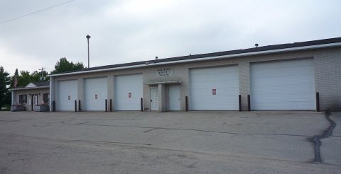
WausaukeeWisconsinDowntown1US141Photo: Royalbroil · CC BY-SA 3.0
C+History
History · Wausaukee

1 of Wausaukee’s places is on the National Register

More historic than 42% of U.S. towns. What drives it

Its Register listing is the IRIS (Shipwreck). Most of Wausaukee was built recently: 4% of its homes predate 1940 and the median home dates from 1987. Below: 1 old photo or paper, maps from 1911 on, and the census since 1930.

1on the National Register
4%homes built before 1940
1old photo or paper
1famous people
From Wausaukee’s archive · credits on each photo
Quick answers

About Wausaukee’s history

How historic is Wausaukee?

C+

More historic than 42% of U.S. towns, on its age, its old homes and the National Register.

What drives the grade ↓
History grade

What drives Wausaukee’s History grade

On its age, its old homes and the National Register, Wausaukee is more historic than 42% of U.S. towns. Its National Register listings hold the grade up; its share of homes from before 1940 pulls it down.

C+
HistoryA character grade: shown, never part of Wausaukee’s overall grade.
All U.S. towns we grade (21,289)Ahead of 42%
NewerOlder

Wisconsin towns list more on the Register than most of the country (a typical Wisconsin town has 3.0 per 10,000 residents, the U.S. 2.4), so Wausaukee’s 8.9 sits above most of its state (75% of Wisconsin towns have fewer) while its 1 listings outnumber those of 51% of U.S. towns.

How sure. Graded on two of the three inputs, so a change in either one moves the letter more than it would with three. The pre-1940 share (±2.1 points) is firm at this size.

Founding year: our sources. Homes: Census ACS 2020–24. National Register: National Park Service, May 2026 list; each listing counted once (boundary changes and added documentation belong to their listing), and a historic district counts its contributing buildings. How TownRatings grades history →

What stands out about Wausaukee’s past

Read from the archive, the National Register and the record. The page puts what stands out first.

★ What stands out · Help out

Start Wausaukee’s collection

The first neighbors to add old photos shape how Wausaukee’s history is told.

Decades since 1900 with photos
00s10s20s30s40s50s60s70s80s90s
1 of 10 decades. The empty ones are waiting for someone’s album.
The story

How Wausaukee came to be

From Wikipedia’s history of Wausaukee.

Read it all →

Wausaukee is an Ojibwe word meaning 'distant land' (< wassa 'distant' + aki 'land'), or a Menominee word that means 'river among the hills'. The town was started in 1863 by John S. Monroe, who bought 160 acres of land from business tycoon Lars Kovala and built a mill to supply the railroads with lumber for bridges and culverts. His first building was a log cabin home that was also used to board the mill workers. As the town grew and more settlers moved in, his log cabin grew into an inn that was the only public eating establishment north of Green Bay.

On August 19, 2011, at 4:45pm, an EF1 tornado struck Wausaukee. One fatality was recorded.

Text from Wikipedia, licensed CC BY-SA 4.0.

Timeline

Wausaukee, 1914 to 1992

Woven from the archive, old maps, post office records, the National Register and the people born here.

  1. 20th century
  2. 1914Post officeThe Cedarville post office opens
  3. 1931Post officeThe Cedarville post office closes
  4. 1953Born hereLyle Mays is born here
  5. 1963On the mapFirst mapped by the U.S. Geological Survey
  6. 1992In the archiveAdorn Beauty Shoppe, Route 141
By decade

Wausaukee, decade by decade

One decade in the archive so far: the 1990s. Scroll each row; tap a photo for its story.

On the map

Wausaukee on the map, 1963 to 1982

Every edition of the U.S. Geological Survey’s map of Wausaukee. Tap a year, or press play to watch the town change.

Wausaukee on the 1963 USGS mapWausaukee on the 1982 USGS map1963Wausaukee sheet · 1:62,500

U.S. Geological Survey historical topographic maps (public domain), via Esri’s collection of the scans. The red ring marks the center of Wausaukee.

Every building

Wausaukee, building by building, 1911

Fire insurance maps drew every building, what it was made of and what it was used for, so insurers could price the risk of fire. Pick a sheet.

Wausaukee fire insurance map, 1911, sheet 11911Sheet 1 of 3

Sanborn Map Company, via the Library of Congress. Editions published in 1930 or earlier, which are in the public domain.

On the National Register

1 historic place in Wausaukee

The country’s official list of buildings and places worth saving.

place listed
1
National Historic Landmarks
0
none yet
historic buildings protected
1
each building in a district counts
first listed
2006
IRIS (Shipwreck)
All 1 listings

National Park Service, National Register of Historic Places. Photos from Wikimedia Commons, credited on each place’s page.

People over time

Wausaukee, census by census

010020030040050060070019401960198020002020Peak: 663

Between 557 and 663 people in every census since 1930.

10 censuses, 1930–2020.

U.S. Census Bureau decennial counts, from the census table on Wausaukee’s Wikipedia page.

Places that used to be

Lost post offices, old corners and places now gone

Another post office, Cedarville, opened and closed inside today’s town.

Hamlets and corners on the map
Cedarville
Gone or out of use
Cowie SchoolschoolGlendale SchoolschoolPike River Schoolschool

US Post Offices dataset (Blevins & Helbock, CC0). Places and cemeteries from the USGS Geographic Names Information System (2021).

Stories next door

History across the town line

Each neighbor’s History grade, on the same three inputs.

Questions about Wausaukee’s history

How does Wausaukee rank for history?

Wausaukee is more historic than 42% of U.S. towns. The History grade combines the town’s founding era, the share of homes built before 1940 and its National Register listings. It’s a character grade, so it isn’t part of the overall grade. How it works.

What is on the National Register in Wausaukee?

One place: the IRIS (Shipwreck) (listed 2006).

How old are the homes in Wausaukee?

4% of Wausaukee’s homes were built before 1940 (Census estimate, ±2.1 points), against a typical 12% for a Wisconsin town; the median home was built in 1987.

Memory lane

What the archives can’t tell you, neighbors can.

Town Square →
Start a conversation
Sources

Where this page comes from

Founding dates: Wikidata, Wikipedia, the U.S. post office records of Blevins & Helbock (CC0) and the Census. Homes by year built: Census ACS 2020–24. National Register of Historic Places: National Park Service (list of May 22, 2026). Old photos, postcards and papers: Wikimedia Commons, the Library of Congress and other public archives, credited on each item’s page. Maps: U.S. Geological Survey historical topographic maps (via Esri) and Sanborn fire-insurance maps (Library of Congress). History text and census tables: Wikipedia (CC BY-SA 4.0). Places that used to be: USGS Geographic Names Information System (2021).

From Wikimedia Commons (6), the National Register of Historic Places (1), Wikipedia, Wikidata and Wikipedia for famous people, U.S. Geological Survey historical maps, U.S. Census counts (via Wikipedia), the US Post Offices dataset (Blevins & Helbock), the USGS Geographic Names Information System and Sanborn fire insurance maps (Library of Congress). Archive images are copied here with their credits and licenses, shown on each photo’s page. Refreshed monthly.