Most of Verona was built recently: 6% of its homes predate 1940 and the median home dates from 1985. Below: 5 old photos and papers, maps from 1923 on, and the census since 1930.
Founding year: Wikidata; Wikipedia’s history section gives the same year.The full story ↓
History grade
What drives Verona’s History grade
On its age, its old homes and the National Register, Verona is more historic than 13% of U.S. towns. Its share of homes from before 1940 holds the grade up; its age pulls it down.
D
HistoryA character grade: shown, never part of Verona’s overall grade.
Wisconsin towns list more on the Register than most of the country (a typical Wisconsin town has 3.0 per 10,000 residents, the U.S. 2.4), so Verona’s 0.0 sits below most of its state (28% of Wisconsin towns have fewer) while its 0 listings outnumber those of 23% of U.S. towns.
How sure. Graded on any two of the three inputs instead, the letter would range from D to C−. The pre-1940 share (±2.7 points) is firm at this size. Two sources give 1921.
Founding year: Wikidata (other dates in Quick answers). Homes: Census ACS 2020–24. National Register: National Park Service, May 2026 list; each listing counted once (boundary changes and added documentation belong to their listing), and a historic district counts its contributing buildings. How TownRatings grades history →
What stands out about Verona’s past
Read from the archive, the National Register and the record. The page puts what stands out first.
The town was named for Verona, New York. It was incorporated as a village in 1921 and as a city in 1978.
Verona used to be home to the Dane County Insane Asylum which opened in 1882, closed in 1973, and was demolished in 2006. It was previously a poor farm for people who needed care due to old age, blindness, disease, deformity, loss of limbs and insanity.
The area was also the site of a small leper colony sometime between 1890 and 1910. It is now a dog park.
Passages that mention Verona, cut from the printed page as they were published.
History of Dane County, Wisconsin ... preceded by a history of Wisconsin, statistics of the state, and an abstract of its laws and constitution and of the Constitution of the United States1880 · page 611Read the page →
Read the text
in the county by the Chicago & North-Western Company ; the Chicago & Tomah Railroad, and the Milwaukee & Madison Railway. The former enters the county from the west, in the extreme northwest corner of the town of Blue Mounds, runs through the northern part of that town and the town of Springdale, south to the center of the town of Verona, then northeast through the northwest corner of the town of Fitchburg, and terminates in the southeast corner of the town of Madison, where it strikes the Chicago & North-Western.
Text read by machine from the scan; it may contain errors.
Madison, Dane County and surrounding towns1877 · page 462Read the page →
Read the text
about eighty votes polled, which also included Sank county. I remember attending a Fourth of July celebration, in 1845, in the Scotch settlement in the town of Verona; the attendance was from the towns around. The programme was for fun generally, and we had it Kifle shooting for sheep, home-made Scotch whisky and beer, playing base ball, dancing the " Highland fling " on the green, with Billy Ray
Text read by machine from the scan; it may contain errors.
A history of Madison, the capital of Wisconsin1874 · page 410Read the page →
Read the text
Verona village and post office is a small settlement on section 15. The town was first settled by people from England. The first land was sold in 1840. Wm. A. Wheeler built the first mill on Badger creek.
Text read by machine from the scan; it may contain errors.
History of Dane County, Wisconsin ... preceded by a history of Wisconsin, statistics of the state, and an abstract of its laws and constitution and of the Constitution of the United States1880 · page 327Read the page →
Read the text
in the country, and the only one whose entrance is at its source, and not the mouth. The darkness that hides its interior secrets covers a great mystery."* "A mystery hangs around the cave which has, perhaps, been intensified by the recollection of an adventure that occurred to two citizens of the town of Verona when in it, and, though it might have proved fatal, it could not possibly have occurred had a little more care been taken in providing enough lights to carry with them. The mouth of the cave is under a ledge of rocks that hangs over a small valley, of which it is the terminus. Before the rains had washed so much debris asnow exists around its entrance, there was a large enough opening for any person
Text read by machine from the scan; it may contain errors.
Scans and text from the Internet Archive. Books published in 1930 or earlier, which are in the public domain.
Timeline
Verona, 1849 to 1985
Woven from the archive, old maps, post office records, the National Register and the people born here.
Nothing in the archives for these yearsWeddings on Main Street, storms, parades, school pictures, the old store. If it’s in your family album, it belongs here.
In 1921, according to Wikidata and Wikipedia’s history of the town. the census of 1930 counted 455 people here.
How does Verona rank for history?
Verona is more historic than 13% of U.S. towns. The History grade combines the town’s founding era, the share of homes built before 1940 and its National Register listings. It’s a character grade, so it isn’t part of the overall grade. How it works.
How old are the homes in Verona?
6% of Verona’s homes were built before 1940 (Census estimate, ±2.7 points), against a typical 12% for a Wisconsin town; the median home was built in 1985.
Founding dates: Wikidata, Wikipedia, the U.S. post office records of Blevins & Helbock (CC0) and the Census. Homes by year built: Census ACS 2020–24. National Register of Historic Places: National Park Service (list of May 22, 2026). Old photos, postcards and papers: Wikimedia Commons, the Library of Congress and other public archives, credited on each item’s page. Maps: U.S. Geological Survey historical topographic maps (via Esri) and Sanborn fire-insurance maps (Library of Congress). History text and census tables: Wikipedia (CC BY-SA 4.0). Places that used to be: USGS Geographic Names Information System (2021).
From Wikimedia Commons (1), the Library of Congress (5), Wikipedia, Wikidata and Wikipedia for famous people, U.S. Geological Survey historical maps, U.S. Census counts (via Wikipedia), the USGS Geographic Names Information System and old county and town histories (Internet Archive). Archive images are copied here with their credits and licenses, shown on each photo’s page. Refreshed monthly.


 1943
 1943
 1943
 1943
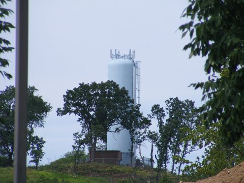 2008