4cemeteries and burying grounds inside Trempealeau
EvergreenGreenwoodOld CatholicTrempealeau
US Post Offices dataset (Blevins & Helbock, CC0). Places and cemeteries from the USGS Geographic Names Information System (2021).
Every building
Trempealeau, building by building, 1894–1910
Fire insurance maps drew every building, what it was made of and what it was used for, so insurers could price the risk of fire. Pick a year, then a sheet.
1894Sheet 1 of 1
Edition
Sheets
BrickWoodStone
Sanborn Map Company, via the Library of Congress. Editions published in 1930 or earlier, which are in the public domain.
An ancient Native American site with earthwork mounds, also known as Trempealeau, has been studied near the village through archaeological excavations in the 21st century. It is theorized as a possible mission site or colony of Cahokia, the major center of Mississippian culture from 1000CE to 1450CE located 500 miles to the south in present-day Illinois near St. Louis, Missouri.
Passages that mention Trempealeau, cut from the printed page as they were published.
History of Trempealeau County, Wisconsin1917 · page 262Read the page →
Read the text
The project which resulted in the building of the first railroad in Trempealeau County had its beginning March 6, 1857 (Chapter 280, Private Laws of 1857), when the Wisconsin legislature granted a charter to a company called the La Crosse, Trempealeau & Prescott Railroad Company (also known as the La Crosse, Trempealeau, Lake Pepin & Prescott Railroad Company), to locate and build a line along the east bank of the Mississippi from La Crosse to Prescott, Wis., by way of Trempealeau and Fountain City. The first board of directors consisted of P. V. Wise, 0. T.
Text read by machine from the scan; it may contain errors.
History of Trempealeau County, Wisconsin1917 · page 143Read the page →
Read the text
Thomas Drugan was perhaps the first Irish settler in Trempealeau County. He came to Trempealeau in 1853 and settled on a farm in the town of Trempealeau. At that time Trempealeau was a part of La Crosse County.
Text read by machine from the scan; it may contain errors.
Biographical history of La Crosse, Trempealeau and Buffalo counties, Wisconsin1892 · page 757Read the page →
Read the text
iLMON A. JOHNSON, a pioneer of Trempealeau county, resides on section 82, in the town of Trempealeau. He came to this county in March, 1856, and first settled one mile east of the village of Galesville, on what is known as the William Andrews farm, where he continued to reside until the spring of 1868, when he settled on
Text read by machine from the scan; it may contain errors.
Biographical history of La Crosse, Trempealeau and Buffalo counties, Wisconsin1892 · page 397Read the page →
Read the text
the survey and construction of the La Crosse & Milwaukee Railroad, the Southern Minnesota Railroad, the La Crosse & Prairie du Chien Railroad, the La Crosse, Trempealeau & Prescott Railroad, a preliminary survey of a line of railroad from La Crosse to Winona; also several preliminary and trial railroad lines in Southern Minnesota and Western
Text read by machine from the scan; it may contain errors.
Scans and text from the Internet Archive. Books published in 1930 or earlier, which are in the public domain.
Timeline
Trempealeau, 1859 to 1929
Woven from the archive, old maps, post office records, the National Register and the people born here.
Nothing in the archives for these yearsWeddings on Main Street, storms, parades, school pictures, the old store. If it’s in your family album, it belongs here.
Founding dates: Wikidata, Wikipedia, the U.S. post office records of Blevins & Helbock (CC0) and the Census. Homes by year built: Census ACS 2020–24. National Register of Historic Places: National Park Service (list of May 22, 2026). Old photos, postcards and papers: Wikimedia Commons, the Library of Congress and other public archives, credited on each item’s page. Maps: U.S. Geological Survey historical topographic maps (via Esri) and Sanborn fire-insurance maps (Library of Congress). History text and census tables: Wikipedia (CC BY-SA 4.0). Places that used to be: USGS Geographic Names Information System (2021). How TownRatings grades history →
From Wikimedia Commons (1), the Library of Congress (4), Wikidata (1), Wikipedia, U.S. Geological Survey historical maps, U.S. Census counts (via Wikipedia), the US Post Offices dataset (Blevins & Helbock), the USGS Geographic Names Information System, Sanborn fire insurance maps (Library of Congress) and old county and town histories (Internet Archive). Archive images are copied here with their credits and licenses, shown on each photo’s page. Refreshed monthly.

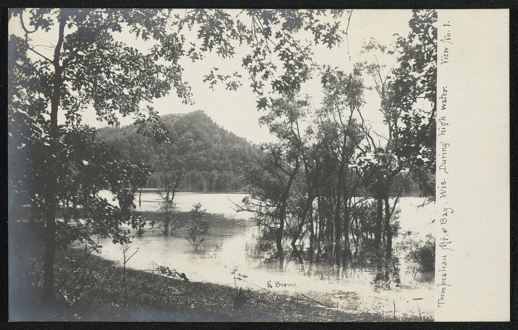



 1908
 1908
 1908

