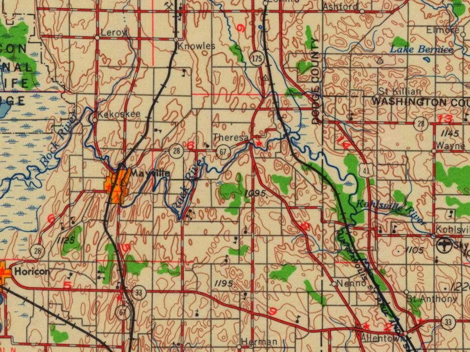
On its age, its old homes and the National Register, Theresa is more historic than 71% of U.S. towns. Its share of homes from before 1940 holds the grade up; its National Register listings pull it down.
B+
HistoryA character grade: shown, never part of Theresa’s overall grade.
Wisconsin towns list more on the Register than most of the country (a typical Wisconsin town has 3.0 per 10,000 residents, the U.S. 2.4), so Theresa’s 0.0 sits below most of its state (28% of Wisconsin towns have fewer) while its 0 listings outnumber those of 23% of U.S. towns.
How sure. Graded on two of the three inputs, so a change in either one moves the letter more than it would with three. The pre-1940 share is a Census survey estimate (±11.5 points).
Founding year: our sources. Homes: Census ACS 2020–24. National Register: National Park Service, May 2026 list; each listing counted once (boundary changes and added documentation belong to their listing), and a historic district counts its contributing buildings. How TownRatings grades history →
What stands out about Theresa’s past
Read from the archive, the National Register and the record. The page puts what stands out first.
Theresa was founded by Solomon Juneau along with his Metis wife, Josette Vieau Juneau, and children in the 1850s. It was named for Solomon's mother, (Marie-)Thérèse Galarneau Juneau.
During World War I, more than 600 people from over a dozen surrounding communities prevented former mayor of Milwaukee and Socialist party member Emil Seidel from holding a "pro-German" meeting in Theresa.
Passages that mention Theresa, cut from the printed page as they were published.
The history of Dodge county, Wisconsin, containing ... its early settlement, growth ... an extensive and minute sketch of its cities ... war record, biographical sketches1880 · page 313Read the page →
Read the text
Kekoskee and May ville, in the town of Williamstown, and Theresa, in the town of Theresa, have their dams and water-wheels and mills and factories. Hustisford, however, may be considered the most favored point on Rock River within the limits of Dodge County at the present time. In the town of Rubicon, saw and gfist mills are supplied with power from the Rubicon River at several points, while Ashippun River, as it passes through the southeastern corner of the town of Ashippun, is utilized in the same manner. Rock River passes out of Dodge County in Section 36, town of Lebanon, but returns, as if loath to leave so beautiful a spot, and makes its force felt again (in the town of Emmet) before winding its weary way to the mother stream. Tlie
Text read by machine from the scan; it may contain errors.
The History of Dodge County, Wisconsin, containing a history of Dodge County, its early settlement, growth, development, resources, etc1880 · page 313Read the page →
Read the text
Kekoskee and May ville, in the town of Williamstown, and Theresa, in the town of Theresa,, have their dams and water-wheels and mills and factories. Hustisford, however, may be considered the most favored point on Rock River within the limits of Dodge County at the present time. In the town of Rubicon, saw and grist mills are supplied with power from the Rubicon River at several points, while Ashippun River, as it passes through the southeastern corner of the town of Ashippun, is utilized in the same manner. Rock River passes out of Dodge County in Section 36, town of Lebanon, but returns, as if loath to leave so beautiful a spot, and makes its force felt again (in the town of Emmet) before winding its weary way to the mother stream. The
Text read by machine from the scan; it may contain errors.
The history of Dodge county, Wisconsin, containing ... its early settlement, growth ... an extensive and minute sketch of its cities ... war record, biographical sketches1880 · page 311Read the page →
Read the text
A hirge number of well-defined moraines of stones and rubbish exist in diflerent parts of the county. The most noteworthy of these occur in Sections 4, 5 and 6, in the town of Herman, and in Sections 33 and 34 in the town of Theresa. The former consists of a narrowridge, rising not usually more than twenty feet in height, and extending in a general easterly and westerly direction for a distance of about three miles, with occasional interruptions, where it is crossed by streams and "dry runs." Througliout Sections 5 and 6, the ridge lies upon an elevated table-land or plateau, formed of drift material.
Text read by machine from the scan; it may contain errors.
The History of Dodge County, Wisconsin, containing a history of Dodge County, its early settlement, growth, development, resources, etc1880 · page 311Read the page →
Read the text
A large number of well-defined moraines of stones and rubbish exist in different parts of the county. The most noteworthy of these occur in Sections 4, 5 and 6, in the town of Herman, and in Sections 33 and 34 in the town of Theresa. The former consists of a narrow ridge, rising not usually more than twenty feet in height, and extending in a general easterly and westerly direction for a distance of about three miles, with occasional interruptions, where it is crossed by streams and "dry runs." Throughout Sections 5 and 6, the ridge lies upon an elevated table-land or plateau, formed of drift material.
Text read by machine from the scan; it may contain errors.
Scans and text from the Internet Archive. Books published in 1930 or earlier, which are in the public domain.
Theresa is more historic than 71% of U.S. towns. The History grade combines the town’s founding era, the share of homes built before 1940 and its National Register listings. It’s a character grade, so it isn’t part of the overall grade. How it works.
How old are the homes in Theresa?
58% of Theresa’s homes were built before 1940 (Census estimate, ±11.5 points), against a typical 12% for a Wisconsin town; the median home was built in 1938.
Founding dates: Wikidata, Wikipedia, the U.S. post office records of Blevins & Helbock (CC0) and the Census. Homes by year built: Census ACS 2020–24. National Register of Historic Places: National Park Service (list of May 22, 2026). Old photos, postcards and papers: Wikimedia Commons, the Library of Congress and other public archives, credited on each item’s page. Maps: U.S. Geological Survey historical topographic maps (via Esri) and Sanborn fire-insurance maps (Library of Congress). History text and census tables: Wikipedia (CC BY-SA 4.0). Places that used to be: USGS Geographic Names Information System (2021).
From Wikimedia Commons (11), Wikipedia, Wikidata and Wikipedia for famous people, U.S. Geological Survey historical maps, U.S. Census counts (via Wikipedia), the USGS Geographic Names Information System and old county and town histories (Internet Archive). Archive images are copied here with their credits and licenses, shown on each photo’s page. Refreshed monthly.




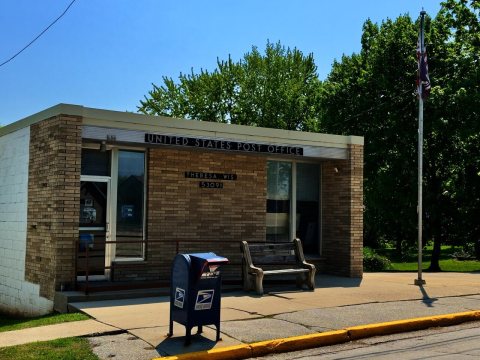 2024
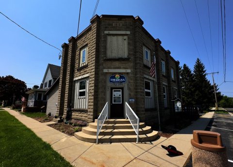 2024
 2024
 2011
 2011
 2011
 2009
 2009
 2009
 2009
 2008