Sheboygan dates to 1846, and 1 of its places is on the National Register
More historic than 56% of U.S. towns · #179 of 362 in Wisconsin. What drives it
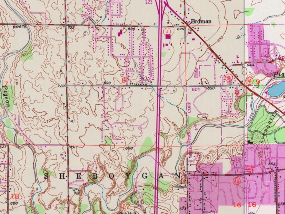
Most of Sheboygan was built recently: 5% of its homes predate 1940 and the median home dates from 1996. Its Register listing is the Windway. Below: 2 old photos and papers, maps from 1884 on, and the census since 1860.
Founding year: Wikidata. First post office: 1893.The full story ↓
History grade
What drives Sheboygan’s History grade
On its age, its old homes and the National Register, Sheboygan is more historic than 56% of U.S. towns, #179 of 362 in Wisconsin. Its age holds the grade up; its share of homes from before 1940 pulls it down.
B
HistoryA character grade: shown, never part of Sheboygan’s overall grade.
Wisconsin towns list more on the Register than most of the country (a typical Wisconsin town has 3.0 per 10,000 residents, the U.S. 2.4), so Sheboygan’s 1.2 sits near the middle of its state (58% of Wisconsin towns have fewer) while its 1 listings outnumber those of 51% of U.S. towns.
NoteThe founding year comes from Wikidata alone; no second source gives 1846.
How sure. Graded on any two of the three inputs instead, the letter would range from C+ to B+. The pre-1940 share (±2.4 points) is firm at this size.
Founding year: Wikidata (other dates in Quick answers). Homes: Census ACS 2020–24. National Register: National Park Service, May 2026 list; each listing counted once (boundary changes and added documentation belong to their listing), and a historic district counts its contributing buildings. How TownRatings grades history →
What stands out about Sheboygan’s past
Read from the archive, the National Register and the record. The page puts what stands out first.
Fire insurance maps drew every building, what it was made of and what it was used for, so insurers could price the risk of fire. Pick a year, then a sheet.
Before its settlement by European Americans, the Sheboygan area was home to Native Americans, including members of the Potawatomi, Chippewa, Ottawa, Winnebago, and Menominee tribes. In the Menominee language, the place is known as Sāpīwǣhekaneh, "at a hearing distance in the woods". The Menominee ceded this land to the United States in the 1831 Treaty of Washington. Following the treaty, the land became available for sale to American settlers. Migrants from New York, Michigan, and New England were among the first new Americans to settle this area in the 1830s, though the French had been present in the region since the 17th century and had intermarried with local people. One 19th century settler remarked: "Nearly all the settlers were from the New England states and New York." Lumbering was the first major industry, as trees were harvested and shipped to eastern markets through the Great…
Passages that mention Sheboygan, cut from the printed page as they were published.
History of Sheboygan County, Wisconsin, past and present1912 · page 66Read the page →
Read the text
I>ecember 7, 1836, the county of Sheboygan was created, set off from Brown county and attached thereto for judicial purposes. The boundaries of the new county under the creative act of the legislature were described as "all that district of country lying within the present limits of Sheboygan county," and from its earliest organization, the county of Sheboygan has embraced the same territory as at present, and for the first ten years after its formation the town of Sheboygan occupied all the territory included in the county. Hence, as new towns were formed, they were all set oflF from
Text read by machine from the scan; it may contain errors.
History of Sheboygan County, Wisconsin, past and present1912Read the page →
Read the text
No record can be found showing the date of the organization of the town of Sheboygan Falls but it is presumed it was the first town separated from the town of Sheboygan, which at the time included all of the territory within the confines of the county. The town is bounded as follows: on the north by Herman, east by Sheboygan, south by "Lima and west by Plymouth. The land is well watered by the Sheboygan river, which takes its sinuous way from the northeast comer of tl^e 'town diagonally across the center south through the village at the southeast corner, and thence on until
Text read by machine from the scan; it may contain errors.
Scans and text from the Internet Archive. Books published in 1930 or earlier, which are in the public domain.
Timeline
Sheboygan, 1846 to 1994
Woven from the archive, old maps, post office records, the National Register and the people born here.
In 1846, according to Wikidata. Sheboygan’s post office opened in 1893, and the census of 1860 counted 4,262 people here.
How does Sheboygan rank for history?
Sheboygan is more historic than 56% of U.S. towns, #179 of 362 in Wisconsin. The History grade combines the town’s founding era, the share of homes built before 1940 and its National Register listings. It’s a character grade, so it isn’t part of the overall grade. How it works.
What is on the National Register in Sheboygan?
One place: the Windway (listed 1988).
How old are the homes in Sheboygan?
5% of Sheboygan’s homes were built before 1940 (Census estimate, ±2.4 points), against a typical 12% for a Wisconsin town; the median home was built in 1996.
Founding dates: Wikidata, Wikipedia, the U.S. post office records of Blevins & Helbock (CC0) and the Census. Homes by year built: Census ACS 2020–24. National Register of Historic Places: National Park Service (list of May 22, 2026). Old photos, postcards and papers: Wikimedia Commons, the Library of Congress and other public archives, credited on each item’s page. Maps: U.S. Geological Survey historical topographic maps (via Esri) and Sanborn fire-insurance maps (Library of Congress). History text and census tables: Wikipedia (CC BY-SA 4.0). Places that used to be: USGS Geographic Names Information System (2021).
From Wikimedia Commons (2), Wikidata (4), the National Register of Historic Places (1), Wikipedia, Wikidata and Wikipedia for famous people, U.S. Geological Survey historical maps, U.S. Census counts (via Wikipedia), the US Post Offices dataset (Blevins & Helbock), the USGS Geographic Names Information System, Sanborn fire insurance maps (Library of Congress) and old county and town histories (Internet Archive). Archive images are copied here with their credits and licenses, shown on each photo’s page. Refreshed monthly.


 1871