Reedsburg dates to 1845, and 13% of its homes were built before 1940
More historic than 86% of U.S. towns · #56 of 362 in Wisconsin. What drives it
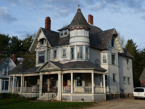
15 places in town are on the National Register, among them two historic districts with 66 buildings between them. Below: 1 old photo or paper, maps from 1885 on, and the census since 1860.
Founding year: Wikipedia. First post office: 1849.The full story ↓
History grade
What drives Reedsburg’s History grade
On its age, its old homes and the National Register, Reedsburg is more historic than 86% of U.S. towns, #56 of 362 in Wisconsin. All 3 inputs are above most U.S. towns; its National Register listings ranks highest and its share of homes from before 1940 lowest.
A
HistoryA character grade: shown, never part of Reedsburg’s overall grade.
Wisconsin towns list more on the Register than most of the country (a typical Wisconsin town has 3.0 per 10,000 residents, the U.S. 2.4), so Reedsburg’s 84.6 sits above most of its state (93% of Wisconsin towns have fewer) while its 86 historic buildings outnumber those of 88% of U.S. towns.
How sure. Graded on any two of the three inputs instead, the letter would range from B+ to A. The pre-1940 share is a Census survey estimate (±3.4 points). Two sources give 1845.
Founding year: Wikipedia (other dates in Quick answers). Homes: Census ACS 2020–24. National Register: National Park Service, May 2026 list; each listing counted once (boundary changes and added documentation belong to their listing), and a historic district counts its contributing buildings. How TownRatings grades history →
What stands out about Reedsburg’s past
Read from the archive, the National Register and the record. The page puts what stands out first.
National Park Service, National Register of Historic Places. Photos from Wikimedia Commons, credited on each place’s page.
Every building
Reedsburg, building by building, 1885–1918
Fire insurance maps drew every building, what it was made of and what it was used for, so insurers could price the risk of fire. Pick a year, then a sheet.
Early settlers came to this area due to the abundance of natural resources, especially lumber. In 1844, the first copper mine was established in this area, but it was soon abandoned. James W. Babb and his wife Rebecca Scarff Babb are the earliest recorded settlers, having brought their family to Wisconsin from Ohio in 1845. At a place 55 miles northeast of Mineral Point (the capital of Wisconsin Territory), long identified by the Winnebago who inhabited these lands as a convenient place to cross the Baraboo River, Babb left a flat-bottomed boat to help move supplies.
Passages that mention Reedsburg, cut from the printed page as they were published.
The history of Sauk County, Wisconsin, containing an account of its settlement, growth, development and resources ... biographical sketches ..1880 · page 558Read the page →
Read the text
The territory of the present town of Reedsburg was formerly divided between the towns of Baraboo and Eagle. In 1850, a town of Reedsburg was established, named in honor of D. C. Reed. It comprised the present towns of Woodland, Lavalle, Winfield, and a portion of Ironton, in addition to what is now known as Reedsburg. The town articles were drafted in a blacksmith-shop, and upon the top of James W. Babb's hat. The first officers of this town were John II. Rork, S. Kerstetter and W. P. Randall, Supervisors ; and Daniel Carver, Treasurer. Reductions of territory were made at intervals until 1854, when the town was included in its present boundaries. At this time, there was a great range for county seats. Every man,
Text read by machine from the scan; it may contain errors.
The history of Sauk County, Wisconsin, containing an account of its settlement, growth, development and resources ... biographical sketches ..1880 · page 621Read the page →
Read the text
This town is six miles square, Town 11, Range 4, and is situated six miles east of the west line of the county, and twelve miles south of the north line. The territory comprising it was originally a part of the township of Eagle, and was set off from the town of Reedsburg, to which it subsequently belonged, and was organized as Westfield in 1854. The first town officers were : J. K. Thompson, Chairman : Martin JJavey and Henry Nippert, Supervisors; William Baird, Clerk; R. B. Balcom, Treasurer; Chancy P. Logan, Justice of the Peace; Lyman Twist, Assessor; N. H. Briggs, Superintendent of Schools ; R. T. Root, Constable.
Text read by machine from the scan; it may contain errors.
The history of Sauk County, Wisconsin, containing an account of settlement, growth, development and resources ... biographical sketches ... the whole preceded by a history of Wisconsin1880 · page 341Read the page →
Read the text
In November, 1854, the town of Reedsburg was divided, and the new town thus created was called Westfield. It was also the wisdom of the board that the town of Kingston be likewise severed, and the name of Merrimack given to the new town. The action of the board in this regard was prompted by the result of the elections previously held in the towns of Reedsburg and Kingston, at which the citizens voted in favor of a division. It was during this session of the board that the town of Honey Creek was divided, and the town of Franklin created.
Text read by machine from the scan; it may contain errors.
The history of Sauk County, Wisconsin, containing an account of settlement, growth, development and resources ... biographical sketches ... the whole preceded by a history of Wisconsin1880 · page 621Read the page →
Read the text
This town is six miles square, Town 11, Range 4, and is situated six miles east of the west line of the county, and twelve miles south of the north line. The territory comprising it was originally a part of the township of Eagle, and was set off from the town of Reedsburg, to which it subsequently belonged, and was organized as VVestfield in 1854. The first town officers were : J. K. Thompson, Chairman ; Martin Oavey and Henry Nippert, Supervisors ; William Baird, Clerk : , R. B. Balcom, Treasurer; Chancy P. Logan, Justice of the Peace; Lyman Twist, Assessor; N. H. Briggs, Superintendent of Schools ; R. T. Root, Constable.
Text read by machine from the scan; it may contain errors.
Scans and text from the Internet Archive. Books published in 1930 or earlier, which are in the public domain.
Timeline
Reedsburg, 1845 to 1956
Woven from the archive, old maps, post office records, the National Register and the people born here.
In 1845, according to Wikipedia’s history of the town. Reedsburg’s post office opened in 1849, and the census of 1860 counted 461 people here.
How does Reedsburg rank for history?
Reedsburg is more historic than 86% of U.S. towns, #56 of 362 in Wisconsin. The History grade combines the town’s founding era, the share of homes built before 1940 and its National Register listings. It’s a character grade, so it isn’t part of the overall grade. How it works.
What is on the National Register in Reedsburg?
15 listings: 13 buildings, among them the Abner L. Harris House (listed 1984, the first), and 2 historic districts, the Main Street Commercial Historic District and the Park Street Historic District, with 66 contributing buildings. 86 historic buildings in all.
How old are the homes in Reedsburg?
13% of Reedsburg’s homes were built before 1940 (Census estimate, ±3.4 points), against a typical 12% for a Wisconsin town; the median home was built in 1991.
Founding dates: Wikidata, Wikipedia, the U.S. post office records of Blevins & Helbock (CC0) and the Census. Homes by year built: Census ACS 2020–24. National Register of Historic Places: National Park Service (list of May 22, 2026). Old photos, postcards and papers: Wikimedia Commons, the Library of Congress and other public archives, credited on each item’s page. Maps: U.S. Geological Survey historical topographic maps (via Esri) and Sanborn fire-insurance maps (Library of Congress). History text and census tables: Wikipedia (CC BY-SA 4.0). Places that used to be: USGS Geographic Names Information System (2021).
From Wikimedia Commons (1), Wikidata (4), the National Register of Historic Places (15), Wikipedia, Wikidata and Wikipedia for famous people, U.S. Geological Survey historical maps, U.S. Census counts (via Wikipedia), the US Post Offices dataset (Blevins & Helbock), the USGS Geographic Names Information System, Sanborn fire insurance maps (Library of Congress) and old county and town histories (Internet Archive). Archive images are copied here with their credits and licenses, shown on each photo’s page. Refreshed monthly.