The Potosi post office opened in 1842, the earliest record of the town by name. Two smaller post offices, Lafayette (1835) and Van Buren (1837), opened inside today’s town and later closed.
First census: 466 in 18802020 census: 646184 years
Founding year: the first Potosi post office (Blevins & Helbock, CC0).The full story ↓
What stands out about Potosi’s past
Read from the archive, the National Register and the record. The page puts what stands out first.
Potosi is located where Wisconsin's lead ore belt intersects with the Mississippi. Three villages – Head of the Hollow, Van Buren, and Lafayette – formed in the 1830s. In 1839, James P. Cox platted a city called Osceola on the river bank southeast of Lafayette, but no lots were sold. The three villages were merged on February 19, 1841, to form Potosi. Possible origins for the town's name include the Spanish word for lead, a corruption of the Native American name of a settler's wife, and Potosi, Missouri, where some early miners originated (itself named for the fabled silver mines of Potosí, Bolivia).
Passages that mention Potosi, cut from the printed page as they were published.
History of Grant County, Wisconsin1881 · page 756Read the page →
Read the text
Preliminary reference to the early settlement and progress of Potosi Village must necessarily be made to the town of which the village is to-day the prime factor. The town of Potosi is bounded on the north by Lancaster, on the east by the towns of Harrison and Paris, •on the south by the Mississippi River, and the west, partly by that highway, and partly by Waterloo. It is centrally located in Grant County, with an area comprising 34,109 acres, of an assessed valuation, in 1880, of $362,887.
Text read by machine from the scan; it may contain errors.
History of Grant County Wisconsin1900 · page 450Read the page →
Read the text
S., then one year old, grew up there and became one of the legislators of the State, dying at Seattle, Washington, in 1898. The father died at his old home in 1880, aged 83. In 1840 Russell Cardy came and settled in the southern part of the settlement in the town of Potosi, and lived there till his death in 1892, aged 75 years. Another one of the earliest residents in the Potosi part of Hurricane was Andrew Hogle. who carried the mail on horseback over the route from Galena to Prairie du Chien. He contributed several daughters to Grant
Text read by machine from the scan; it may contain errors.
History of Grant County Wisconsin1900 · page 523Read the page →
Read the text
An act of Congress in June, 1844, had been obtained, appropriating a section of land for the improvement of Grant River in the town of Potosi. The legislature of 1845 appointed commissioners who were to cause Section 34, Town 3, Range 3, to be surveyed into lots, and to decide upon and award preemptions. The lots were to be appraised and sold. A receiver was appointed to receive all money paid for lots and give certificates of such payments, which entitled the purchasers to receive from the Governor of the State patents for the lots. The com¬
Text read by machine from the scan; it may contain errors.
History of Grant County, Wisconsin1881 · page 770Read the page →
Read the text
Supplementary, and it might be added tributary to Potosi Village, are points of settlement contiguous thereto, though their race with prosperity was decided years ago. Among these are Dutch Hollow, a mile to the east of Potosi, British Hollow and Rockville to the northeast, distant a mile and a half and three miles respectively.
Text read by machine from the scan; it may contain errors.
Scans and text from the Internet Archive. Books published in 1930 or earlier, which are in the public domain.
Timeline
Potosi, 1835 to 1900
Woven from the archive, old maps, post office records, the National Register and the people born here.
Fire insurance maps drew every building, what it was made of and what it was used for, so insurers could price the risk of fire. Pick a year, then a sheet.
1894Sheet 1 of 1
Edition
Sheets
BrickWoodStone
Sanborn Map Company, via the Library of Congress. Editions published in 1930 or earlier, which are in the public domain.
On the National Register
3 historic places in Potosi
The country’s official list of buildings and places worth saving.
Founding dates: Wikidata, Wikipedia, the U.S. post office records of Blevins & Helbock (CC0) and the Census. Homes by year built: Census ACS 2020–24. National Register of Historic Places: National Park Service (list of May 22, 2026). Old photos, postcards and papers: Wikimedia Commons, the Library of Congress and other public archives, credited on each item’s page. Maps: U.S. Geological Survey historical topographic maps (via Esri) and Sanborn fire-insurance maps (Library of Congress). History text and census tables: Wikipedia (CC BY-SA 4.0). Places that used to be: USGS Geographic Names Information System (2021). How TownRatings grades history →
From Wikimedia Commons (5), Wikidata (1), the National Register of Historic Places (3), Wikipedia, Wikidata and Wikipedia for famous people, U.S. Geological Survey historical maps, U.S. Census counts (via Wikipedia), the US Post Offices dataset (Blevins & Helbock), the USGS Geographic Names Information System, Sanborn fire insurance maps (Library of Congress) and old county and town histories (Internet Archive). Archive images are copied here with their credits and licenses, shown on each photo’s page. Refreshed monthly.
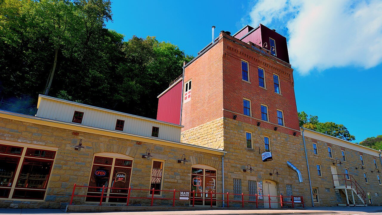


 2016
 2016
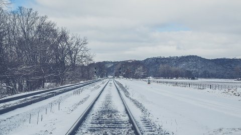 2016
 2014
 2014

