Founding year: the first Muscoda post office (Blevins & Helbock, CC0).
History grade
What drives Muscoda’s History grade
On its age, its old homes and the National Register, Muscoda is more historic than 87% of U.S. towns. All 3 inputs are above most U.S. towns; its share of homes from before 1940 ranks highest and its National Register listings lowest.
A
HistoryA character grade: shown, never part of Muscoda’s overall grade.
Wisconsin towns list more on the Register than most of the country (a typical Wisconsin town has 3.0 per 10,000 residents, the U.S. 2.4), so Muscoda’s 8.7 sits above most of its state (74% of Wisconsin towns have fewer) while its 1 listings outnumber those of 51% of U.S. towns.
How sure. Graded on any two of the three inputs instead, the letter would range from A− to A. The pre-1940 share is a Census survey estimate (±7.5 points). The founding year is the first post office, not a stated founding date.
Founding year: the first post office (other dates in Quick answers). Homes: Census ACS 2020–24. National Register: National Park Service, May 2026 list; each listing counted once (boundary changes and added documentation belong to their listing), and a historic district counts its contributing buildings. How TownRatings grades history →
What stands out about Muscoda’s past
Read from the archive, the National Register and the record. The page puts what stands out first.
Wikipedia doesn’t have a history of Muscoda yet. The photos, dates and memories neighbors add here are how it gets written.
Muscoda is a village in Grant and Iowa counties in the U.S. state of Wisconsin. The population was 1,307 at the 2020 census. Of this, 1,245 were in Grant County, and 62 were in Iowa County. The Grant County part of the village is adjacent to the Town of Muscoda and the Iowa County part is adjacent to the Town of Pulaski.
Its first post office opened in 1842. Its population held steady between the last two censuses: 1,299 in 2010, 1,307 in 2020.
Intro from Wikipedia. Population: U.S. Census Bureau.
From the old history books
What they wrote about Muscoda, 1881–1900
Passages that mention Muscoda, cut from the printed page as they were published.
History of Grant County Wisconsin1900 · page 686Read the page →
Read the text
The business men of the place realized that, if not dead, the village was sleeping, and the people across the river in Richland County felt the need of convenient access to a railroad market. A bridge across the river was much needed. The town of Muscoda and the town of Eagle in Richland County each voted $2,000 for a bridge and the citi¬ zens subscribed $4,000 more. Miller & Stinglham, of Sauk City, took a contract to build a bridge for $20,000, but enough money could not be raised and the project fell through.
Text read by machine from the scan; it may contain errors.
History of Grant County Wisconsin1900 · page 685Read the page →
Read the text
In 1850 the village of Muscoda was surveyed and platted by James Moore, and in 1852 W. W. Dimock laid out an addition to the village. In 1853 the population of the village was about two hundred and it had two stores, one by S. A. Quincy and the other by Palmer & Ward.
Text read by machine from the scan; it may contain errors.
[History of Grant County, Wisconsin, preceded by a history of Wisconsin1881 · page 440Read the page →
Read the text
Michigan is 911 feet; at Warsau, above dam, 623 feet; at Knowlton (high), 538 feet, (low) 523 feet; at Stevens' Point, 485 feet; at Conant's Rapids, 468 feet ; at Grand Rapids, railroad bridge, 420 feet; at Kilbourn City, railroad bridge, 233 feet; at Portage, 211 feet; at Merrimack, 182 feet; at Sauk City, 165 feet; at Spring Green bridge, 134 feet; at Muscoda, 115 feet ; at the mouth of the stream, 34 feet. The average velocity of the river below Portage is remarkably uniform, and is just about two miles an hour. The daily discharges of the river at Portage, in times of extremely low water is about two hundred and fifty-nine million cubic feet.
Text read by machine from the scan; it may contain errors.
History of Grant County, Wisconsin1881 · page 440Read the page →
Read the text
Michigan is 911 feet; at Warsau, above dam, 623 feet; at Knowlton (high), 538 feet, (low) 523 feet; at Stevens' Point, 485 feet ; at Conant's Rapids, 468 feet ; at Grand Rapids, railroad bridge, 420 feet ; at Kilbourn City, railroad bridge, 233 feet ; at Portage, 211 feet ; at Merrimack, 182 feet; at Sauk City, 165 feet; at Spring Green bridge, 134 feet; at Muscoda, 115 feet ; at the mouth of the stream, 34 feet. The average velocity of the river below Portage is remarkably uniform, and is just about two miles an hour. The daily discharg-es of the river at Portage, in times of extremely low water is about two hundred and fifty-nine million cubic feet.
Text read by machine from the scan; it may contain errors.
Scans and text from the Internet Archive. Books published in 1930 or earlier, which are in the public domain.
The Muscoda post office opened in 1842, the earliest record of the town by name (U.S. post office records).
How does Muscoda rank for history?
Muscoda is more historic than 87% of U.S. towns. The History grade combines the town’s founding era, the share of homes built before 1940 and its National Register listings. It’s a character grade, so it isn’t part of the overall grade. How it works.
What is on the National Register in Muscoda?
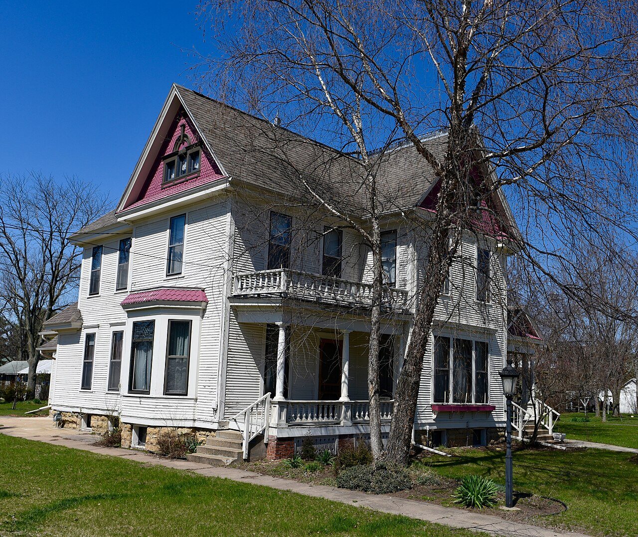
One place: the John Young House (listed 1994).
How old are the homes in Muscoda?
30% of Muscoda’s homes were built before 1940 (Census estimate, ±7.5 points), against a typical 12% for a Wisconsin town; the median home was built in 1974.
Founding dates: Wikidata, Wikipedia, the U.S. post office records of Blevins & Helbock (CC0) and the Census. Homes by year built: Census ACS 2020–24. National Register of Historic Places: National Park Service (list of May 22, 2026). Old photos, postcards and papers: Wikimedia Commons, the Library of Congress and other public archives, credited on each item’s page. Maps: U.S. Geological Survey historical topographic maps (via Esri) and Sanborn fire-insurance maps (Library of Congress). History text and census tables: Wikipedia (CC BY-SA 4.0). Places that used to be: USGS Geographic Names Information System (2021).
From Wikimedia Commons (5), Wikidata (1), the National Register of Historic Places (1), Wikidata and Wikipedia for famous people, the US Post Offices dataset (Blevins & Helbock), the USGS Geographic Names Information System and old county and town histories (Internet Archive). Archive images are copied here with their credits and licenses, shown on each photo’s page. Refreshed monthly.


 2024
 2017
 2016
 2007
 2007