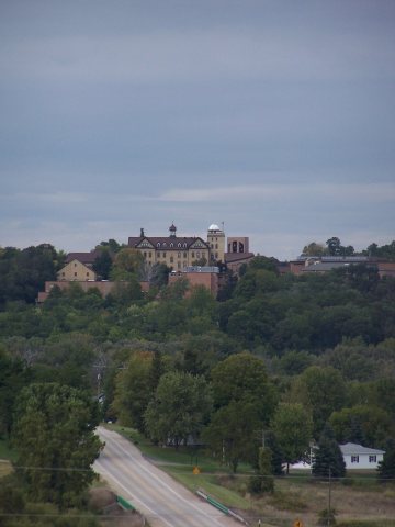
Mount Calvary's location was chosen by missionary Casper Rehrl; he selected the large hill because of its excellent view and he placed a wood cross. Starting in 1846, settlers started building houses at the base of the hill. Riehl held the community's first mass circa 1849 at the home of John Dietzen. Bishop John Henni confirmed the first child from Mount Calvary at the St. John the Baptist Church in nearby Johnsburg (it was the only church in the region). A parish was established in Mount Calvary by Rehrl on February 2, 1849; construction of the church began on the following day. A school was established by the church and it quickly had five or six students.
Passages that mention Mount Calvary, cut from the printed page as they were published.
The history of Fond du Lac County, Wisconsin1880 · page 753Read the page →
Read the text
In 1850, the first store was opened at Mount Calvary by M. Bourgeous. The first Chairman of Marshfield was Joseph Wagner, who held the oifice several years. F. Konz is the present Chairman.
Text read by machine from the scan; it may contain errors.
The history of Fond du Lac County, Wisconsin, containing ... war record, biographical sketches ... history of Wisconsin ... etc1880 · page 753Read the page →
Read the text
In 1850, the first store was opened at Mount Calvary by M. Bourgeons. The first Chairman of Marshfield was Joseph Wagner, who held the ofiice several years. F. Konz is the present Chairman.
Text read by machine from the scan; it may contain errors.
Scans and text from the Internet Archive. Books published in 1930 or earlier, which are in the public domain.
Founding dates: Wikidata, Wikipedia, the U.S. post office records of Blevins & Helbock (CC0) and the Census. Homes by year built: Census ACS 2020–24. National Register of Historic Places: National Park Service (list of May 22, 2026). Old photos, postcards and papers: Wikimedia Commons, the Library of Congress and other public archives, credited on each item’s page. Maps: U.S. Geological Survey historical topographic maps (via Esri) and Sanborn fire-insurance maps (Library of Congress). History text and census tables: Wikipedia (CC BY-SA 4.0). Places that used to be: USGS Geographic Names Information System (2021). How TownRatings grades history →
From Wikimedia Commons (6), Wikipedia, Wikidata and Wikipedia for famous people, the US Post Offices dataset (Blevins & Helbock), the USGS Geographic Names Information System and old county and town histories (Internet Archive). Archive images are copied here with their credits and licenses, shown on each photo’s page. Refreshed monthly.


 2008
 2007
 2007
 2007
 2007
 2004