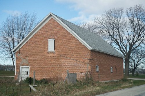
Its Register listings are the Rockwood Lodge Barn and Pigsty and the J.B. Smith House and Granary. Its Register listings are the Rockwood Lodge Barn and Pigsty and the J.B. Smith House and Granary. Below: 4 old photos and papers, maps from 1883 on, and the census since 1860.
Founding year: Wikidata; Wikipedia’s history section gives the same year. First post office: 1852.The full story ↓
History grade
What drives Green Bay’s History grade
On its age, its old homes and the National Register, Green Bay is more historic than 88% of U.S. towns. All 3 inputs are above most U.S. towns; its age ranks highest and its share of homes from before 1940 lowest.
A
HistoryA character grade: shown, never part of Green Bay’s overall grade.
Wisconsin towns list more on the Register than most of the country (a typical Wisconsin town has 3.0 per 10,000 residents, the U.S. 2.4), so Green Bay’s 19.8 sits above most of its state (83% of Wisconsin towns have fewer) while its 4 historic buildings outnumber those of 68% of U.S. towns.
How sure. Graded on any two of the three inputs instead, the letter would range from B+ to A+. The pre-1940 share is a Census survey estimate (±5.2 points). Two sources give 1634.
Founding year: Wikidata (other dates in Quick answers). Homes: Census ACS 2020–24. National Register: National Park Service, May 2026 list; each listing counted once (boundary changes and added documentation belong to their listing), and a historic district counts its contributing buildings. How TownRatings grades history →
What stands out about Green Bay’s past
Read from the archive, the National Register and the record. The page puts what stands out first.
Samuel de Champlain, the founder of New France, commissioned Jean Nicolet to form a peaceful alliance with Native Americans in the western areas, whose unrest interfered with the French fur trade, and to search for a shorter trade route to China through Canada. Nicolet and others had learned from other First Nations of the Ho-Chunk (Winnebago) people, who identified as "People of the Sea", and believed they must reside on or near an Ocean. Champlain had also heard about natural resources in the area, including fertile soil, forests, and animals. Nicolet began his journey for this new land shortly before winter in 1634. In what later became a French fur-trading route, he sailed up the Ottawa River, through Lake Nipissing and down the French River to Lake Huron, then through the straits of Michilimackinac into Lake Michigan. He is believed to have landed at Red Banks, near the site of the…
Passages that mention Green Bay, cut from the printed page as they were published.
History of Brown County, Wisconsin, past and present1913 · page 301Read the page →
Read the text
age he became a laborer in the fields and was thus employed until 1855, when at the age of eighteen years he came to the United States, making the journey with friends. He located in the Belgian settlement of the town of Green Bay, now a portion of the city of Green Bay, and later took up his abode in the city, where he worked as a general laborer until 1859. In that year he went to Michigan, where he obtained employment in a sawmill and worked for some time. After returning to Green Bay he canvassed goods through the city and outlying districts and later became a
Text read by machine from the scan; it may contain errors.
History of Brown County, Wisconsin, past and present1913 · page 134Read the page →
Read the text
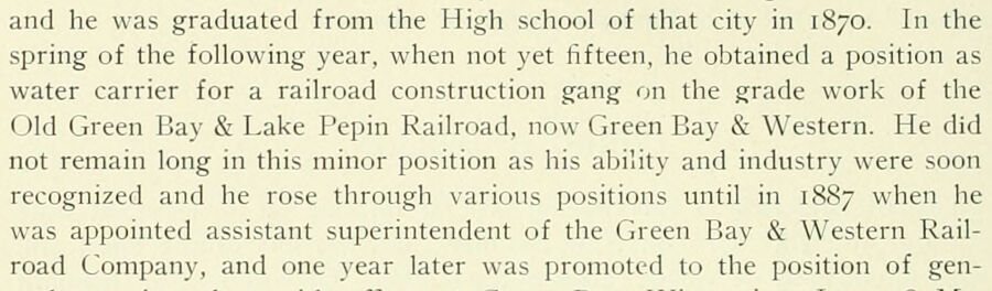
and he was graduated from the High school of that city in 1870. In the spring of the following year, when not yet fifteen, he obtained a position as water carrier for a railroad construction gang on the grade work of the Old Green Bay & Lake Pepin Railroad, now Green Bay & Western. He did not remain long in this minor position as his ability and industry were soon recognized and he rose through various positions until in 1887 when he was appointed assistant superintendent of the Green Bay & Western Railroad Company, and one year later was promoted to the position of gen-
Text read by machine from the scan; it may contain errors.
Scans and text from the Internet Archive. Books published in 1930 or earlier, which are in the public domain.
By decade
Green Bay, decade by decade
4 decades in the archive, from the 1820s to the 1890s. Scroll each row; tap a photo for its story.
Nothing in the archives for these yearsWeddings on Main Street, storms, parades, school pictures, the old store. If it’s in your family album, it belongs here.
Every edition of the U.S. Geological Survey’s map of Green Bay. Tap a year, or press play to watch the town change.
1954New Franken sheet · 1:62,500
U.S. Geological Survey historical topographic maps (public domain), via Esri’s collection of the scans. The red ring marks the center of Green Bay.
Every building
Green Bay, building by building, 1883–1907
Fire insurance maps drew every building, what it was made of and what it was used for, so insurers could price the risk of fire. Pick a year, then a sheet.
In 1634, according to Wikidata and Wikipedia’s history of the town. Green Bay’s post office opened in 1852, and the census of 1860 counted 2,275 people here.
How does Green Bay rank for history?
Green Bay is more historic than 88% of U.S. towns. The History grade combines the town’s founding era, the share of homes built before 1940 and its National Register listings. It’s a character grade, so it isn’t part of the overall grade. How it works.
What is on the National Register in Green Bay?
Two places: the Rockwood Lodge Barn and Pigsty (listed 2004) and the J.B. Smith House and Granary (2004).
How old are the homes in Green Bay?
13% of Green Bay’s homes were built before 1940 (Census estimate, ±5.2 points), against a typical 12% for a Wisconsin town; the median home was built in 1992.
Founding dates: Wikidata, Wikipedia, the U.S. post office records of Blevins & Helbock (CC0) and the Census. Homes by year built: Census ACS 2020–24. National Register of Historic Places: National Park Service (list of May 22, 2026). Old photos, postcards and papers: Wikimedia Commons, the Library of Congress and other public archives, credited on each item’s page. Maps: U.S. Geological Survey historical topographic maps (via Esri) and Sanborn fire-insurance maps (Library of Congress). History text and census tables: Wikipedia (CC BY-SA 4.0). Places that used to be: USGS Geographic Names Information System (2021).
From Wikimedia Commons (3), the Library of Congress (1), Wikidata (7), the National Register of Historic Places (2), Wikipedia, Wikidata and Wikipedia for famous people, U.S. Geological Survey historical maps, U.S. Census counts (via Wikipedia), the US Post Offices dataset (Blevins & Helbock), the USGS Geographic Names Information System, Sanborn fire insurance maps (Library of Congress) and old county and town histories (Internet Archive). Archive images are copied here with their credits and licenses, shown on each photo’s page. Refreshed monthly.