Fire insurance maps drew every building, what it was made of and what it was used for, so insurers could price the risk of fire. Pick a year, then a sheet.
Cumberland is often called the "Island City". The main part of the city, including the original settlement, is on land surrounded by Beaver Dam Lake, originally settled by the Ojibwe, whose name for it is Che-wa-cum-ma-towangok ("Lake Made by the Beavers"). Ojibwe Chief Pon-gee Rau-gen ("Little Pipe") lived in the area even after it was settled by European settlers, and drowned in a canoe on Beaver Dam Lake in 1895.
Passages that mention Cumberland, cut from the printed page as they were published.
History of Barron County Wisconsin1922 · page 1054Read the page →
Read the text
Cumberland Township embraces Township 35, Range 13. The name as ap¬ plied to the present Township dates from Jan. 1, 1880, when the board or¬ dered that the old town of Lakeland, created Dec. 30, 1875, would henceforth be known as the town of Cumberland. Later another Lakeland Township was created. The first officers are given under the head of Lakeland. The present officers are: Supervisors, John Hellstrom (chairman), Anton Erickson and Ole Jacobson; treasurer, James Carlson; clerk, Grover Jacobson; assessor, R. B.
Text read by machine from the scan; it may contain errors.
History of Barron County Wisconsin1922 · page 280Read the page →
Read the text
He came to Barron County in 1903, and for two years was employed as a farm laborer. In 1905 he moved to the city of Cumberland, then for a year he operated a dray line in Cumberland. In 1907 he became engineer at the Cum¬ berland municipal light plant. He has occupied his present position since 1911. He owns a pleasant home with a four-acre tract in North Cumberland, fronting 300 feet on picturesque Beaver Dam Lake, and here he does truck farming in the summer months. Mr. Florer was married Dec. 15, 1896, at Stanton, Neb., to Eva Whitt, who was born at Arena, Wis., Nov. 28, 1876,
Text read by machine from the scan; it may contain errors.
Scans and text from the Internet Archive. Books published in 1930 or earlier, which are in the public domain.
Timeline
Cumberland, 1885 to 1982
Woven from the archive, old maps, post office records, the National Register and the people born here.
Nothing in the archives for these yearsWeddings on Main Street, storms, parades, school pictures, the old store. If it’s in your family album, it belongs here.
Founding dates: Wikidata, Wikipedia, the U.S. post office records of Blevins & Helbock (CC0) and the Census. Homes by year built: Census ACS 2020–24. National Register of Historic Places: National Park Service (list of May 22, 2026). Old photos, postcards and papers: Wikimedia Commons, the Library of Congress and other public archives, credited on each item’s page. Maps: U.S. Geological Survey historical topographic maps (via Esri) and Sanborn fire-insurance maps (Library of Congress). History text and census tables: Wikipedia (CC BY-SA 4.0). Places that used to be: USGS Geographic Names Information System (2021). How TownRatings grades history →
From Wikimedia Commons (10), the Library of Congress (1), Wikidata (2), Wikipedia, Wikidata and Wikipedia for famous people, U.S. Geological Survey historical maps, U.S. Census counts (via Wikipedia), the USGS Geographic Names Information System, Sanborn fire insurance maps (Library of Congress) and old county and town histories (Internet Archive). Archive images are copied here with their credits and licenses, shown on each photo’s page. Refreshed monthly.


 2016
 2016
 2016
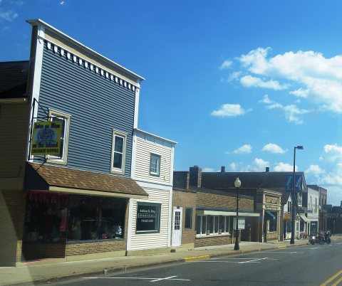 2012
 2012
 2012
 2012
 2012
 2008
 2004
