Founding year: Wikipedia. First post office: 1854.The full story ↓
History grade
What drives Calumet’s History grade
On its age, its old homes and the National Register, Calumet is more historic than 87% of U.S. towns. All 3 inputs are above most U.S. towns; its share of homes from before 1940 ranks highest and its National Register listings lowest.
A
HistoryA character grade: shown, never part of Calumet’s overall grade.
Wisconsin towns list more on the Register than most of the country (a typical Wisconsin town has 3.0 per 10,000 residents, the U.S. 2.4), so Calumet’s 7.9 sits above most of its state (72% of Wisconsin towns have fewer) while its 1 listings outnumber those of 51% of U.S. towns.
NoteThe founding year comes from Wikipedia alone; no second source gives 1839.
How sure. Graded on any two of the three inputs instead, the letter would range from A− to A. The pre-1940 share is a Census survey estimate (±11.7 points).
Founding year: Wikipedia (other dates in Quick answers). Homes: Census ACS 2020–24. National Register: National Park Service, May 2026 list; each listing counted once (boundary changes and added documentation belong to their listing), and a historic district counts its contributing buildings. How TownRatings grades history →
What stands out about Calumet’s past
Read from the archive, the National Register and the record. The page puts what stands out first.
The town was first surveyed in 1834 and 1835. The first settlement was near Pipe in 1837. The town was organized March 8, 1839, then reorganized in 1842. A flour mill was constructed near Pipe in 1854.
Passages that mention Calumet, cut from the printed page as they were published.
The history of Fond du Lac County, Wisconsin1880Read the page →
Read the text
pi'esent city of Fond du Lac, and along the west shore of Lake Winnebago to what is now the city of Menasha. They then had large villages on each branch of the Fond du Lac River just above the forks. They also had a village at the mouth of the creek on the east side of the lake, above Taycheedah. The Menomonee village of Calumet (''Pipe Village"), even as early as 1817, seemed to be anything but of recent origin. Its location was not identical with the village of the same name in the present town of Calumet. Tlie exact time when these three villages were finally vacated by their Indian occupants is not known with certainty, though in 1884 they were found by the Government surveyors unoccupied.
Text read by machine from the scan; it may contain errors.
The history of Fond du Lac County, Wisconsin1880Read the page →
Read the text
The town of Calumet is formed of fractional Townships 17 north, of Ranges 18 and 19 east, and the tier of sections on the north side of fractional Township 16 north, of Range 18 east, lost to Taycheedah. In this tier of sections there are 2,307.56 acres ; in fractional Township 17 north, of Range 18 east, 4,742.13 acres; and in fractional Township 17 north, of Range 19 east, 12,097.22 acres, aggregating in the town of Calumet 19,146.91 acres.
Text read by machine from the scan; it may contain errors.
The history of Fond du Lac County, Wisconsin, containing ... war record, biographical sketches ... history of Wisconsin ... etc1880 · page 374Read the page →
Read the text
My first visit to Fond du Lac, County was in August, 1841, on my way from the Oneida Indian Mission, where I was then stationed, to attend the session of the Rock River Conference of the Methodist Episcopal Church, which was held that year at Platteville, Wis. Where the village of Calumet now stands, a man by the name of George White lived, and had made some improvements on a farm. I saw no more settlements or improvements till I came to where Pond du Lac City now stands, where there was a log house near where Darling's Block now is, where Dr. Darling lived and kept entertainment for travelers. There was a house then standing on Brooke street near where the railroad bridge now is, and there was a bridge across
Text read by machine from the scan; it may contain errors.
Scans and text from the Internet Archive. Books published in 1930 or earlier, which are in the public domain.
Timeline
Calumet, 1839 to 1913
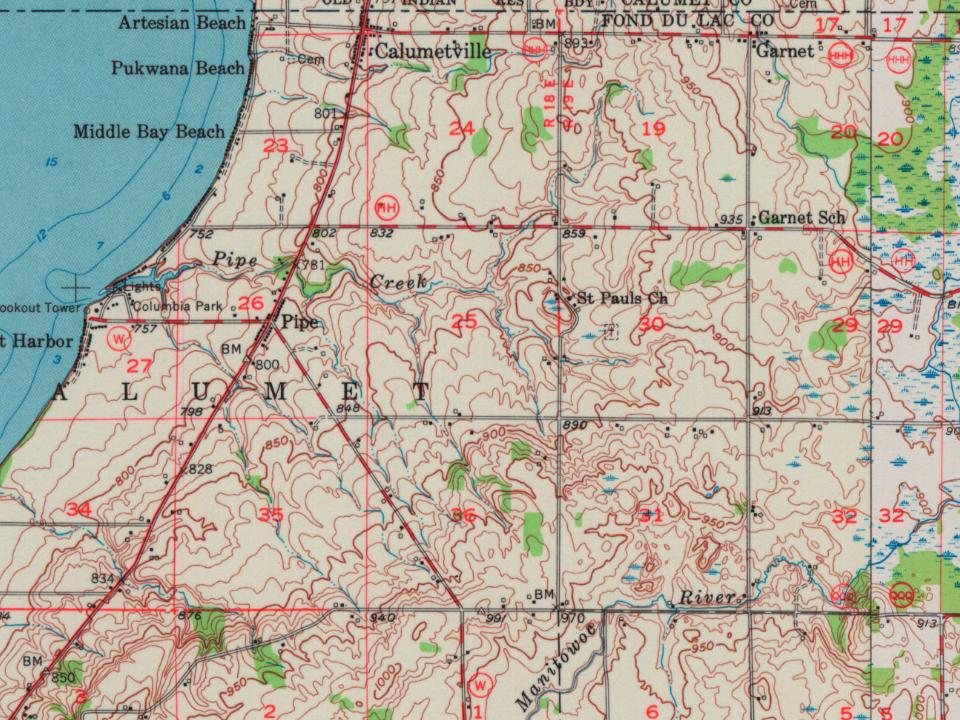
Woven from the archive, old maps, post office records, the National Register and the people born here.
In 1839, according to Wikipedia’s history of the town. Calumet’s post office opened in 1854.
How does Calumet rank for history?
Calumet is more historic than 87% of U.S. towns. The History grade combines the town’s founding era, the share of homes built before 1940 and its National Register listings. It’s a character grade, so it isn’t part of the overall grade. How it works.
What is on the National Register in Calumet?
One place: the Club Harbor (listed 1980).
How old are the homes in Calumet?
31% of Calumet’s homes were built before 1940 (Census estimate, ±11.7 points), against a typical 12% for a Wisconsin town; the median home was built in 1963.
Founding dates: Wikidata, Wikipedia, the U.S. post office records of Blevins & Helbock (CC0) and the Census. Homes by year built: Census ACS 2020–24. National Register of Historic Places: National Park Service (list of May 22, 2026). Old photos, postcards and papers: Wikimedia Commons, the Library of Congress and other public archives, credited on each item’s page. Maps: U.S. Geological Survey historical topographic maps (via Esri) and Sanborn fire-insurance maps (Library of Congress). History text and census tables: Wikipedia (CC BY-SA 4.0). Places that used to be: USGS Geographic Names Information System (2021).
From Wikimedia Commons (6), Wikidata (1), the National Register of Historic Places (1), Wikipedia, U.S. Geological Survey historical maps, the US Post Offices dataset (Blevins & Helbock), the USGS Geographic Names Information System and old county and town histories (Internet Archive). Archive images are copied here with their credits and licenses, shown on each photo’s page. Refreshed monthly.




 2020
 2012
 2008
 2007
 2007
 2004


