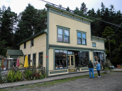
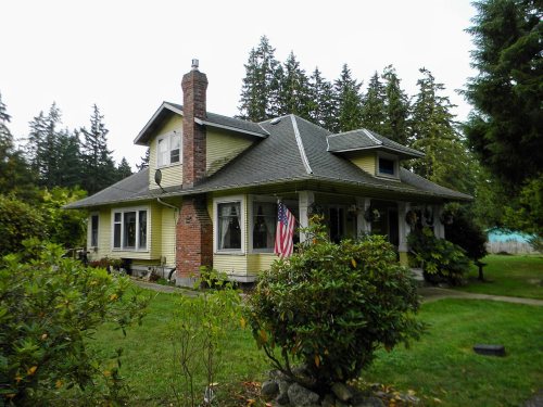
Port Hadlock-Irondale in pictures
Census counts: 1,752 in 1980, 3,983 in 2020. The archive holds 6 old photos and papers going back to 1891 and 4 maps from 1939 on.
6 places on the National Register of Historic Places.
Explore the history →Each edition grades its towns against each other only.

3,884 people live in this town in Washington.
Port Hadlock-Irondale’s weakest subject is incomes: the median household income is $84K, and 15% of residents live below the poverty line. At D overall, Port Hadlock-Irondale is better than 14% of U.S. towns and ranks 251st of 285 in Washington. Cost of living is weaker too: the typical home is worth about $352K, 4.7 years of the Port Townsend area’s $74K median household income. Health is its strong suit: it is healthier than 71% of U.S. towns. The town is home to Northwest School of Wooden Boat Building. Its trail density is 1.9 miles per square mile, above both the Washington town median (0.8) and the median of U.S. towns (0.4). Only 8 of the 285 Washington towns we compare have a lower July high than Port Hadlock-Irondale. On the outdoors, just 20 of Washington’s 397 towns do better.
Figures: health, CDC PLACES · incomes, Census ACS, 2020–24 · home values, Zillow · OpenStreetMap · NOAA normals, 1991–2020 · USGS PAD-US.
Where Port Hadlock-Irondale beats most towns.
3,580 counted in 2010 and 3,983 in 2020.
U.S. Census 2010 & 2020 counts
Each subject compared with towns across the country (schools within Washington), ordered by how far Port Hadlock-Irondale is from typical.
How TownRatings grades towns →
Census counts: 1,752 in 1980, 3,983 in 2020. The archive holds 6 old photos and papers going back to 1891 and 4 maps from 1939 on.
6 places on the National Register of Historic Places.
Explore the history →Museums, parks, gardens and other places to visit around Port Hadlock-Irondale. Close and well known come first.
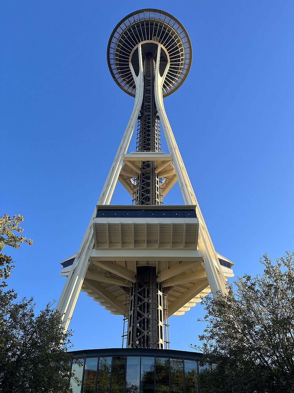
Big draw35 mi LookoutSpace Needle
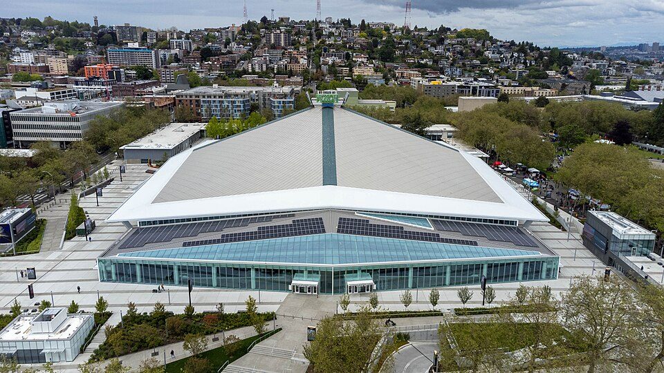
Big draw35 mi Stadium & arenaClimate Pledge Arena
Big draw37 mi Stadium & arenaLumen Field
Big draw19 mi National ParkOlympic National Park3.6M visitors a year
37 mi Stadium & arenaT-Mobile Park
37 mi Ancient siteSeattle UndergroundSpace Needle: Another Believer, CC BY-SA 4.0 · Climate Pledge Arena: Sea Cow, CC BY-SA 4.0 · Lumen Field: "Smart Destinations", GoSeattleCard.com, and Go Seattle Card Blog, CC BY-SA 2.0 · Olympic National Park: Wsiegmund, CC BY 2.5 · T-Mobile Park: MyName (Cacophony), CC BY-SA 3.0 · Seattle Underground: Mark Hursh, CC BY-SA 3.0
Port Hadlock-Irondale is unincorporated, so Jefferson County and regional agencies provide most services.
EPA SDWIS (Oct 9, 2026) · HIFLD + EIA-861 2025 · Census 2020 ZCTAs · NCES 2024–25 · registration: vote.gov, updated Sep 30, 2026.
Ordered by what stands out in Port Hadlock-Irondale.
Port Hadlock-Irondale has cooler summers than nearly all U.S. towns, has commutes shorter than most of Washington and is healthy by national standards but mid-pack in Washington.
Count the trails in 8 parks and preserves and they come to 15 miles. The biggest place to walk is Anderson Lake State Park, 431 acres with 8.5 miles of trail. Parkland in Port Hadlock-Irondale adds up to 673 acres.
| Biggest places to walk | Trails | Acres |
|---|---|---|
| 1. Anderson Lake State Park | 8.5 mi | 431 |
| 2. Tamanowas Rock Sanctuary | 1.3 mi | 58 |
| 3. Irondale Beach Park | 0.9 mi | 16 |
Trails & parks © OpenStreetMap contributors · Conserved land: USGS PAD-US
One of its 2 schools is below, with the reason it’s listed. Its public schools are run by the Chimacum School District. Port Hadlock-Irondale’s only public school teaches 147 students.
| School | Level | Students | Letter |
|---|---|---|---|
| Chimacum Creek Primary SchoolLargest public elementary schoolGrades PK–1 | Grades PK–1 | 147 | – |
NCES · EDFacts · graded within WA on state tests and graduation
The average commute for its 1,454 working residents takes 18.5 minutes, against 26.6 across Washington. Jobs based here grew from 527 in 2014 to 730.
The top destinations are Port Townsend (24%), Seattle (7%) and Port Ludlow (2%). Just nearly a tenth of Port Hadlock-Irondale’s working residents have a job in town. Jobs in Port Hadlock-Irondale grew by 203 from 2014 to 2024, reaching 730. Half commute less than 13 miles.
| Port Hadlock-Irondale | Typical Washington town | Typical U.S. town | |
|---|---|---|---|
| Average trip to work | 19 minutes | 27 minutes | 25 minutes |
| Below the poverty line | 15% | 7.9% | 9.6% |
| Work from home | 11% | 15% | 11% |
| Median household income | $84,000 | $98,000 | $80,000 |
Census LEHD 2024 · ACS
Within Washington it is less healthy than 60% of the 285 graded towns: Washington sets a high bar.
The share of adults in Port Hadlock-Irondale who had a checkup this year is 74%. Against the Washington average, Port Hadlock-Irondale comes out ahead on 1 CDC measures out of 31, and behind on 8.
| Port Hadlock-Irondale | Typical Washington town | Typical U.S. town | |
|---|---|---|---|
| Sleep under 7 hours (CDC PLACES) | 29% | 33% | 36% |
| Yearly checkup (CDC PLACES) | 74% | 71% | 79% |
| Get no exercise (CDC PLACES) | 18% | 18% | 25% |
| Obesity (CDC PLACES) | 31% | 33% | 35% |
| What stands out | Port Hadlock-Irondale | WA |
|---|---|---|
| More adults treating high blood pressure | 74% | 70.7% |
| More adults with heart disease | 7.5% | 5.4% |
CDC PLACES 2025 · modeled estimates for adults · CMS · HRSA
July afternoons average 71°, cooler than in 99% of U.S. towns; January nights average 36°.
About 3 inches of snow falls in a winter. Only 8 of the 285 Washington towns we compare have a lower July high than Port Hadlock-Irondale. Rain and melted snow add up to about 25 inches a year here.
| Port Hadlock-Irondale | Typical Washington town | Typical U.S. town | |
|---|---|---|---|
| July high | 71°F | 77°F | 85°F |
| January low | 36°F | 35°F | 22°F |
NOAA U.S. Climate Normals, 1991–2020
Nearly two thirds of Port Hadlock-Irondale’s expected losses from natural hazards come from earthquakes, followed by inland flooding at 26%. Storm and flood damage is expected to run higher than in 62% of U.S. communities.
FEMA National Risk Index · OpenFEMA
The median property tax bill is $2,259, against $4,556 across Washington, another input to its cost-of-living grade.
The typical rent for Port Hadlock-Irondale is $1,361 a month. Port Hadlock-Irondale: 78% of households are owner-occupiers.
| Port Hadlock-Irondale | Typical Washington town | Typical U.S. town | |
|---|---|---|---|
| Median rent | $1,361 a month | $1,740 a month | $1,185 a month |
| Households that own their home | 78% | 70% | 73% |
Census ACS, 2020–24 · Zillow Home Value Index · Redfin Data Center
1 within 15 miles of the center of Port Hadlock-Irondale
About 3 of every 100 Port Hadlock-Irondale residents are enrolled in college, against 6 across Washington.
14.4% of the town is conserved land, across 8 parks and preserves.
6 places in Port Hadlock-Irondale on the National Register of Historic Places.
Census-designated place in Washington, United States
Port Hadlock-Irondale is a census-designated place (CDP) in Jefferson County, Washington, United States. The population was 3,983 at the 2020 census.
From Wikipedia, licensed CC BY-SA 4.0 · facts via Wikidata (CC0)
Short answers, built from the data on this page.
Port Hadlock-Irondale grades D overall, better than 14% of U.S. towns and #251 of 285 in Washington. It grades B+ for health and C for schools. Jobs & income is its weak spot, with a C−.
Yes. The typical home is worth about $352,000, 40% below the Washington typical home. Cost of living, which also weighs rents, property taxes and how many households pay 30% or more of their income for housing, grades C−.