Marysville dates to 1872, and 1 of its places is on the National Register
More historic than 29% of U.S. towns · #136 of 285 in Washington. What drives it
Most of Marysville was built recently: 2% of its homes predate 1940 and the median home dates from 1994. Its Register listing is the Marysville Opera House. Below: 17 old photos and papers, maps from 1892 on, and the census since 1890.
Founding year: Wikidata; Wikipedia’s history section gives the same year. First post office: 1879.The full story ↓
History grade
What drives Marysville’s History grade
On its age, its old homes and the National Register, Marysville is more historic than 29% of U.S. towns, #136 of 285 in Washington. Its National Register listings hold the grade up; its share of homes from before 1940 pulls it down.
C
HistoryA character grade: shown, never part of Marysville’s overall grade.
Few Washington towns list much on the Register (a typical Washington town has 0.1 per 10,000 residents, the U.S. 2.4), so Marysville’s 0.1 sits near the middle of its state (55% of Washington towns have fewer) while its 1 listings outnumber those of 51% of U.S. towns.
How sure. Graded on any two of the three inputs instead, the letter would range from C− to C. The pre-1940 share (±0.9 points) is firm at this size. Two sources give 1872.
Founding year: Wikidata (other dates in Quick answers). Homes: Census ACS 2020–24. National Register: National Park Service, May 2026 list; each listing counted once (boundary changes and added documentation belong to their listing), and a historic district counts its contributing buildings. How TownRatings grades history →
What stands out about Marysville’s past
Read from the archive, the National Register and the record. The page puts what stands out first.
Marysville’s post office has been open since 1879.
Marysville
1879–today
Lakewood
1909–today
18701950today
Hamlets and corners on the map
Brookside Mobile Home ParkCedar Lane Mobile Home ParkCountry Mobile EstatesCrystal Tree Village Mobile Home ParkEagle Point Mobile Home ParkEmerald Hills Estates Mobile Home ParkEnglishGlenwood Mobile EstatesKellogg Village Mobile Home ParkKruseKruse JunctionLa Tierra Mobile Home ParkLakewoodLiberty Village Mobile Home ParkMidway Gardens Mobile ParkMobile Haven Mobile Home ParkMobile ManorSands 55 Plus Mobile ParkStimson CrossingTwin Cedar Mobile Park
2cemeteries and burying grounds inside Marysville
MarysvilleSaint Mary's
US Post Offices dataset (Blevins & Helbock, CC0). Places and cemeteries from the USGS Geographic Names Information System (2021).
By decade
Marysville, decade by decade
3 decades in the archive, from the 1900s to the 1920s. Scroll each row; tap a photo for its story.
Nothing in the archives for these yearsWeddings on Main Street, storms, parades, school pictures, the old store. If it’s in your family album, it belongs here.
Fire insurance maps drew every building, what it was made of and what it was used for, so insurers could price the risk of fire. Pick a year, then a sheet.
1892Sheet 1 of 1
Edition
Sheets
BrickWoodStone
Sanborn Map Company, via the Library of Congress. Editions published in 1930 or earlier, which are in the public domain.
Marysville was established in 1872 by government-appointed Indian agent James P. Comeford, an Irish immigrant who had served in the Civil War, and his wife Maria as a trading post on the Tulalip Indian Reservation. The reservation, located to the west of modern-day Marysville, was established by the Point Elliot Treaty of 1855, signed by local Native American tribes and territorial governor Isaac Stevens at modern-day Mukilteo. The treaty's signing opened most of Snohomish County to American settlement and commercial activities, including logging, fishing and trapping. The modern name for Marysville in the indigenous Lushootseed language, spoken by the Coast Salish peoples, is sɬəp̓qs.
Passages that mention Marysville, cut from the printed page as they were published.
History of Snohomish County, Washington, Volume I1926 · page 559Read the page →
Read the text
nounced (June 6, 1885) that Comeford had sold store, wharf and warehouse and would confine himself to looking after his townsite interests and to managing the hotel. The buyers were Mark Swinnerton and H. B. Myers, who were partners and, later, rivals in trade and politics. The Star contains a write-up of Marysville at this time, the reporter journeying from Snohomish to Marysville on horseback and passing the farms of Parker, Hogan, Crease, Packwood, and Hughes, who had +CO acres on Ebey Slough. At Marysville he found the hotel, by Comeford, the Swinnerton & Myers store and a two-story residence being erecied by J. C.
Text read by machine from the scan; it may contain errors.
History of Snohomish County, Washington, Volume I1926 · page 745Read the page →
Read the text
King County, and running almost parallel with the Great Northern from Monroe through Snohomish to Everett. This road does a large freight and logging business, but is not a strong competitor for passenger traffic. The. fact that one pier of the new highway bridge construction on the cutoff to Marysville is reserved for rightof-way for the Chicago, Milwaukee & St. Paul, opens the field of conjecture as to the future extensions of this road, after it shall have surmounted the financial diffculties in which it is involved in 1926, The railroad mileage of Snohomish County exceeds that of almost any other county in the state of Washington. It is adequate
Text read by machine from the scan; it may contain errors.
Scans and text from the Internet Archive. Books published in 1930 or earlier, which are in the public domain.
Timeline
Marysville, 1872 to 1996
Woven from the archive, old maps, post office records, the National Register and the people born here.
In 1872, according to Wikidata and Wikipedia’s history of the town. Marysville’s post office opened in 1879, and the census of 1890 counted 262 people here.
How does Marysville rank for history?
Marysville is more historic than 29% of U.S. towns, #136 of 285 in Washington. The History grade combines the town’s founding era, the share of homes built before 1940 and its National Register listings. It’s a character grade, so it isn’t part of the overall grade. How it works.
What is on the National Register in Marysville?
One place: the Marysville Opera House (listed 1982).
How old are the homes in Marysville?
2% of Marysville’s homes were built before 1940 (Census estimate), against a typical 4.3% for a Washington town; the median home was built in 1994.
Founding dates: Wikidata, Wikipedia, the U.S. post office records of Blevins & Helbock (CC0) and the Census. Homes by year built: Census ACS 2020–24. National Register of Historic Places: National Park Service (list of May 22, 2026). Old photos, postcards and papers: Wikimedia Commons, the Library of Congress and other public archives, credited on each item’s page. Maps: U.S. Geological Survey historical topographic maps (via Esri) and Sanborn fire-insurance maps (Library of Congress). History text and census tables: Wikipedia (CC BY-SA 4.0). Places that used to be: USGS Geographic Names Information System (2021).
From Wikimedia Commons (13), the Library of Congress (4), Wikidata (1), the National Register of Historic Places (1), Wikipedia, Wikidata and Wikipedia for famous people, U.S. Geological Survey historical maps, U.S. Census counts (via Wikipedia), the US Post Offices dataset (Blevins & Helbock), the USGS Geographic Names Information System, Sanborn fire insurance maps (Library of Congress) and old county and town histories (Internet Archive). Archive images are copied here with their credits and licenses, shown on each photo’s page. Refreshed monthly.


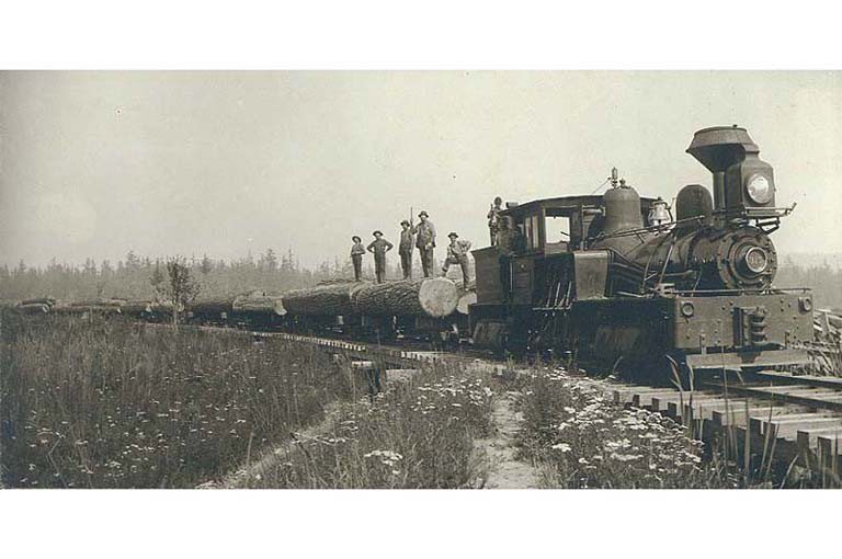


 c. 1900
 c. 1900
 1910
 1910
 1910
 1910
 c. 1911
 c. 1911
 c. 1911
 c. 1911
 c. 1911
 1912
 c. 1913
 c. 1913
 c. 1913
 c. 1913
 1922


