Marcus was named for Marcus Oppenheimer who settled in the area in 1863.
Marcus was a supply and transportation base for northward-bound travellers during the Big Bend Gold Rush of the 1860s in the Colony of British Columbia due to its location just above Kettle Falls, a wall to river navigation. In 1865 the steamboat Forty-Nine was built at Marcus to attempt the run to the goldrush boomtown of La Porte at the foot of the infamous Dalles des Morts or "Death Rapids", which were located in the immediate vicinity of the rush and were the upper barrier to river navigation. Regular service from Marcus to La Porte did not begin until 1866 due to difficult winter conditions at the Narrows of the Arrow Lakes on the first attempt in 1865.
Nothing in the archives for these yearsWeddings on Main Street, storms, parades, school pictures, the old store. If it’s in your family album, it belongs here.
Founding dates: Wikidata, Wikipedia, the U.S. post office records of Blevins & Helbock (CC0) and the Census. Homes by year built: Census ACS 2020–24. National Register of Historic Places: National Park Service (list of May 22, 2026). Old photos, postcards and papers: Wikimedia Commons, the Library of Congress and other public archives, credited on each item’s page. Maps: U.S. Geological Survey historical topographic maps (via Esri) and Sanborn fire-insurance maps (Library of Congress). History text and census tables: Wikipedia (CC BY-SA 4.0). Places that used to be: USGS Geographic Names Information System (2021). How TownRatings grades history →
From Wikimedia Commons (9), Wikipedia, U.S. Geological Survey historical maps, U.S. Census counts (via Wikipedia), the US Post Offices dataset (Blevins & Helbock), the USGS Geographic Names Information System and Sanborn fire insurance maps (Library of Congress). Archive images are copied here with their credits and licenses, shown on each photo’s page. Refreshed monthly.


 1941
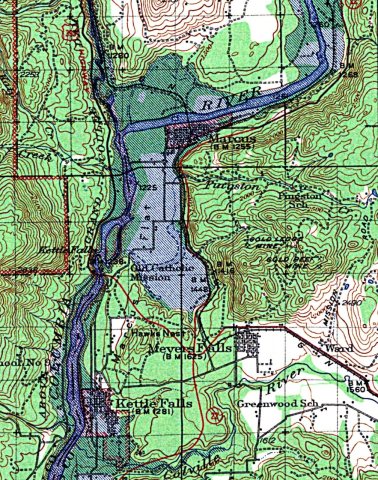 1942
 1942
 2005


